

Typhoon Tip
-
Posts
44,568 -
Joined
-
Last visited
Content Type
Profiles
Blogs
Forums
American Weather
Media Demo
Store
Gallery
Everything posted by Typhoon Tip
-
This isn't the same look at all. Something got into the works here to really change the complexion just enough. The impressive ridge signal, the one containing +20C 850 mb parcels embedded in 19C from MI to N. VT/ME? Gone, and all that. Monday through Wednesday has gotten shirked by these very recent trends - and it's in all guidance... An above normal period was always the higher confidence aspect - as is usually the case. Temperature is very fragile aspect to maintain in model handling. Throw in that we were asking them to do so from D9 ..meh. Even at 4 days out in time and space, it is ( say ) easier to ruin a 100 F, or even just 95 really, than it is to fumble around and miss a 12" snow event. So it looks like a middling heat wave at best, nested in a period of above normal temperatures. Could be 87-91. I don't even think the highest heat looks N anymore, not sure tho. The upshot is that there could be more TCU/ photogenic convection, because the "cap" of the ridging is weaker, less CIN when it's just above normal heights, and not an actually 'heat dome' - such that the models are leaning previously. I'm not sure it's warm all week frankly, btw. I could see this Wednesday at about 14z, a north-door or backdoor front does the old slamming screen doors with flags snapping in 28 kt NE gust drilling at first a refreshing ahh air mass. But three hours later, not so ahh. More like ew, 'what is it 49 F,' under an abyssal gray sky so slate its like staring into infinity. Meanwhile it's 94 NYC; but even there the BD cuts in, and probably terminates in southern NJ. That's like 6 or 7 isohypses compression aligning from N Ontario to NS. I'm not thinking we should trust any model to just hold that flow like that without sending a veritable p-wave off backdoor bomb blast all the way to Atlantic GA. EDIT: Actually using the Euro, I guess Monday still as a sneaking snipped of 850 layer/EML in there. Didn't see that, but seems to time wrong - 12z, the plume is escaping out of Maine.
-
Euro getting more aggressive with speeding up the polar jet, also, turning it more SE through the Canadia Maritimes mid week. It could be doing the amplitude aspect/bias it applies in that range however - we'll see if that has legs. It appears the model is outright locking an ambient suppression southwest of roughly BUF-NYC (~) by Wednesday, and won't let it return the rest of the way because of its setting up that ablating flow structure it retros/forces back SW. I'm not a big fan of terminating planetary wave events from the NE though - Looks like Sunday, Monday and Tuesday... 91, 93, 96 ... then 88 HFD to 74 LWM Wednesday on this run. Not sure I buy it just yet though. What would be more likely based on experience, is a BD interludes for a day ... then rolls out.
-
Yup - with Will on that one. The insurance company will supply that situation with all the legal they need, to recoup the money they have to give to you -
-
So y'allz are pre-occupied with a moral aspect of mask vs none. Relative to setting, my only concern is keeping the peace in a social circuitry that runs too hot in recent eras already. I don't agree with masks. I paragraphed that above. But I am willing to wear one to not be part of any triggers - those are two distinct motivations. I don't have much of a conflict personality I suppose... I tell ya what ..if science could get around to proving C-19 risk has fallen beneath the mask wearing risk factors -that would settle this debate immediately.
-
00z Euro has a Sonoran heat release, with kinetically charged 850 mb layer under an EML, all that, clearly charted and tracked back to origin. But the parcels are 20, maybe 20.5 C from the looks of it, and that may be 96 cap temp as most likely - but that's 00z for D5-7. I have noted in the past, the models tend to add ticks to the 850 in warm conveyors as outer mid ranges get nearer in time. This still looks to favor BTV- coastal NH as the heat axis, too. But we can make up for that with being 2 deg latitude more sun. When dealing with the upper edge, otherwise irrelevancies become more meaningful delimiters.
-
That's very difficult at 42.X latitude without assists. We can do it, but it's got to be perfect - perfection is an assist in that sense ha. But yeah, +22C at 850 mb, with down sloping and zero cirrus plumes timed ( like usual.) to steal 1.3% to keep in 98/75. That happened like twice in my life. 1975, and 2012 The reason why it is easier to do that out say, over the panhandle of Nebraska, is because the air is lighter for one. Adding that most locations that do that 100/75 are that crucially south and have 2 or even 4% more intense solar. Whatever the real percentage is, 1% from the sun is like a tsunamis of irradient power incoming, so a morning sounding 900 mb ( their surface equiv) of 24C over a corn field is a different set of initial conditions we don't find around here. But who needs 75 on the bottom. If it's 63 dp you can take the 96 to 102 and I dunno - at that far into the deep end of the heat it's hot under and over so it become irrelevant.
-
Brian or whomever knows, does the National Blend machine guidance also normalize/weight toward climatology out in time? I was poking around in NCEP's docs to find the tech but lost patience - I'm just curious because KFIT from the latest guidance is almost 19 over climate on days 6 and 7 ! TXN 57| 73 64| 80 61| 86 67| 92 68| 94 69| 94 67| 90 67 52 75 That's a helluva signal if they are pulling them down by climo and they're still towering like that.
-
Mm, yeah perhaps. You know, virtue signaling is a risk - because virtue is subjective? To those outside a given "ethical interpretation of propriety," that VS cozy euphemism becomes more like 'low-key gaslighting' - you know, guilt trip? - whether the mask wearer intends for that or not. I'm willing to bet, when the over-shadowing cloud of Pandemic awareness et al, eventually clears, that will brighten the dialogue about any ethical charge/responsibility, and then people will just view the mask wearer as an idiot. Fine - let 'em. That will back-draft a social stigma; and the wearers will give them up in some interminable amount of time from feeling that pressure. For the record, I think masks as silly. They were scientifically dubious all along as a significant deterrent for the spread of the virus - yes some, but enough to justify for what was more likely unhealthy for users? Mmm.. They are in and of themselves, unsanitary to the user, difficult to keep clean; and also adding another point of tedious hygiene requirement/stress. Frankly, folks either know this consciously, or just damn sense "something's not right" in wearing them all the time. To mention as a part of micro-management head-game. Yup, all this shit was actually prevalent and empirical, enough to objectively question risk, vs slowing a pathogen, in the sense of cost analysis there. It wouldn't shock me, in 10 years, some real science analysis of this practice may prove it detrimentally out-weighed the positive guesses on returns - how many times has time and history proven something like that? jesus. Lol, it's not hard to imagine some kind of/whatever mentality or predisposition about the damn things. If they do, the mere appearance of them as a 'virtue signal' touches that nerve - particularly if the virtue being signaled is some aspect they do not agree with - to put it nicely. I guess it's an interesting sociological experiment - not to toot my horn but I said that 15 months ago: this whole response culture to this Pandemic, we do because we can? Which by "virtue" of that course, being the first time in history the entire World unified around a common objective goal that didn't prospect unilateral war, is thus experimental. It's kind of a techno-sociological experiment. Perhaps an evolutionary necessity. Fascinating.
-
It's not - There's a stenchy sort of image mystique in saying 'I was up skiing Tuckermen's It's not absolute friend. - "probably conform" is another way of just saying "tend" to do so. It's an assessment, done at time of foot-in-the-door, particularly in situations when conforming isn't really costing anything. I don't think that processing is happening when one shows up to a setting thinking it's okay to saunter their way in with no intent to evaluated what is/was happening before they arrived. That's all. We are talking almost about common mores and behavior decency at that point. Gentile? And I think your missing the point on the virtue of not triggering others - maybe you just don't see that value. That's okay - we'll let that go. I will add IMHO the world is way loaded with triggers and stimulus - WOKE this and 'cancel culture' are all recreational outrage, etc, that go too far. Obviously racism and prejudice are bad - but these cultural modes won't work frankly. We have to educate, but not like showing people how to derive the Quadratic Formula, but to that kind of modality will come from ala mode spanning generations. That's what fixes that stuff - But that's another rabbit hole. We need more patience and gentility. Less stick of one's personal doctrine space. No one is that important and part of the decay of civility is actually defined by intolerance. I like William Shatner's recent aphorism .. something like, 'Take it easy - because in the end, none of this matters'
-
GFS model is relentless in its intent to undermine the spatial attributes of the next week's ridge, which concomitantly means it shortens the length of time of the anomaly, too. End result, middling warm up. This doesn't compare very well with the EPS, GEPs, nor the operational version of these ens familys, nor its own GEFs mean. Three run -cycles in a row, it has been definitively less amplified in both spatial and temporal aspects, comparing to these other guidance sources/methods, wrt to the entire over-arcing thematic pattern. It is likely to be less correct. I - personally - believe this is owing to that particular model's horrible and coherently bright and embarrassing bias to cumulatively lower heights on the polar side of any jet; usually gets noticeable around D4 at individual mid level vortex featrues, but grows out side of those to engulf the areal expanses between. Such that the entire region of the Ferrel cell - thanks Brian lol - can and usually does average some 6 to as much as 12 dam lower than all the other global numerical models and blends therein, sometimes as near in time as the far side of the mid range, day's 5-7. This does not lend to early detection of specifically, heat. It's good that the flagship America guidance rides the short-bus when it comes to detecting precisely and specifically N. Hemispheric summer seasonal heat - a crucial threat that is the most dire in a warm CC crisis - Good work! Was this on purpose? Was this deniers infiltrating the modeling offices - kidding Anyway, I may be over-stating it a little, but what it is doing since 12z run ( yesterday ) fits with that problem just too elaborately well to believe it. The operational Euro has it's quirks with other conserved curvature and amplitude out there too - but in this case, it fits so well with its EPS mean, and other cross-guidance techniques, it's like handling matter better. This looks like a planetary event. Basically, it's probably keyed into GWO/AAM passage and will thus swell and decay along that frequency - which probably takes 7 to 10 days to pass longitude. I also agree that before the end of that period, the tendency to establish/return a NW flow into Maritimes may levy a tax against New England with BDs stealing some time away as a possibility. Most likely after next Tuesday
-
Not yet. The GEFs mean is about par with the previous cycle. That IS the first model run where that particular blend was even, not more, than its previous - I mean it's gotta cap soon. We are not ultimately going to balloon heights to a step off altitude with the moon's orbit - lol... It'll probably max and bounce around run-to-run... Hotter than normalcy is still the higher confidence status for next week. The extremeness of it and whether there is qualitative 'big heat' embedded within that general ~ week of positive departures is still unknown.
-
Yeah I was more after droll humor with hand stuff - ... I'm sure there are circumstantial exceptions based on nuanced timing. Guy gets out of the shop, has 22 minute to drive 30 minutes or his kid's standing in the rain with no one left at the soccer field... - duh. But I'm aiming the rant specifically about adults with bad hygiene -
-
To each his own... ? I tend to evade confrontation as much as possible -then get pissed off and angry five days later and swear at the wall in the shower - LOL anyway, if something really important is on the line, I'll swell chest and stare down the assailing force - however, beyong our petty contrivances of indispensable dignity in reality most of us living, that is seldom necessary - just imho. 'sides, I think we're talking about about the same thing - in part - anyway. I more than less had, 'whatever the establishment wants' in mind. However, if I walk in...and the establishment has an 'up to the discretion of the person' policy in place, and everyone is wearing one, I'll probably do so just because I'm socially aware; because it is not hurting me to conform and be the bigger man for predicting how not to incense the 'asshole rube' ... With intelligence comes responsibility - if one is smart enough to detect triggers, it their responsibility not to flick them on.
-
Improvements in ceilings happening now. Interesting cloud pattern observing the morning hi res loops ( vis ). Had that standing wave effect look to it. But, that seems to be peeling away and I can see blue slots west and this is confirmed on sat now. probably ends up mostly sunny 2 to 6
-
Trade off. Biology evolved the sentience of infinite awareness, thus supplying the sentience - ironically - the knowledge of their absolute finality. It doesn't matter if humans beat the race of exhausting resources, or - just run fast enough to outpace the apocalypse wave that is unavoidable triggered by all this advancement ( catch -22isms) here on Earth. Because whether here, or there, or beyond 'there' ..one cannot cheat death - in either outcome the finality of the civility still takes place. I guess the idea is just to win more time.
-
You just keep your clean mask folded in a quick access pocket. If you walk into a joint, and obvious social cues flag needing to conform, if not ease in by 'virtue signaling,' why get into a row over it? Just don the f'n thing. It'll motivate you to conduct business and flee. Which is intrinsically better that way, anyway, because less packing people anywhere is obviously consistent with distancing. Which many of these measures, designed to slow the spread - not necessarily stop it - are still always valid. Be it masks, or distancing. Hand sanitizing. Not the masks, but heh, washing hands and distancing isn't a bad thing in world where new pathogens are increasingly more likely. Clean hands - I need to rant, cuz I see this everywhere. Clean that disgusting black scunge out from under your fingernails? I mean, these are folks washing their hands, yet there's black lines under their thumbnails. Adults, mind you. It's like there should have been social distancing, masks, hand sanitizers, mandatory closures, and, basic hygiene demo huts or something - I dunno. Teach these 45-year olds children how to wipe their f'n bums.
-
I forgot to actually look at the RH values/altitudes, yesterday -ha. I just assumed we'd be sunnier - oops. Ok, so partly sunny. Either way, turned heat back off. Windows open. Euro ensemble mean, and operational, flagging near/at historic heat early next week. Synoptically, the operational flat out supports Monday and or Tues at or above 97F, HFD to LWM to PWM. Still D6 so we wait, but it's a signal that's been " cooking" for days tho (ha). Spanning four consecutive runs, the EPS, GEFs and GEPs had increased the ridge in both the X and Y coordinates - i.e., wider and taller, another way to say hotter. The 0z continued that growth trend, now eclipsing 590 heights, centered roughly eastern OH to southern Jersey. Sorry y'all. I'm kind of a nerd about temperature extremes. When it comes to heat, love hate relationship. Hate living through them, but they are fascinating to watch get engineered in the models. - meantime, couple of beauts with some convection Thursday, getting increasingly humid. Saturday we transition. Which I wonder if 18 to 00z Thursday afternoon and evening, we may end up in a warm baroctropic wedge with decent helicity, while a right entrance wind max at 500 mb starts slicing into NW zones around 21z. That seems to be the gist of the layout from the higher res model types. If we can get a blue tinted hillside sunshine say 1- 5 pm, that might get interesting.
-
I mean. Nothing like a 22 temp bounce in light wind bathing in solar max heat - it’s gonna magnify that affect
-
tomorrow is going to be like stepping of an airplane, having left a cold corpse’s rectum, and landing instantly within paradise. Looking at the data if anything it should bust cool machine guidance 1 or 2 and probably be 81 around here ...with light wind and almost open sky
-
1930s did that. Not saying that's now - but there been research/reanalysis on that stretch of inferno summers and that aspect of a dry decadal land feedbacks lending
-
It's too early for folks to "take it seriously" Particular for dealing with temperature extreme -type siggy weather events, they are fragile. Get this to Wednesday's cycling of models, and this looks as impressive or even if trend continues - yeah, we'll probably start seeing a throttle in PSA. I mean, a cyclone is way more immovable in the charts than a either cold or hot waves? Think about it, we focus on details of the cyclone in the winter. Who gets what and how much, and those attributes do move around quite a bit, guidance to guidance, run time to run time, etc. But the cyclone, as an overall entity, is much harder to completely dissolve - unless it is the GFS model ( ) But the over arcing synopsis leading to delivering historic cold, or heat, mm. I mean you change one contributing crucial jet configuration and the air mass cuts back from the extremeness almost immediately. Probably because when we are pressing events against the ceiling of what Earth can do, the only other way is some form of destructive interference and on and so on. But the areal coverage of that synoptical heat is truly awesome. This may broil the Dakotas to the Lakes to NE/MA back through the lower OV to MV for days. To mention southern tier of the Canadian southern Provinces... I mean it could be 94 at the southern tip of JB, 97 at BTV and 95 at Boston at apex or something. If that happens ( and as I mentioning PF, if anything 2-m are tended a bit shy at this range for whatever reason notwithstandng ) then the grid may begin to waver some. There's been a lot of upgrades and improvements to the grid in the last 20 years. We have to consider that all those wind farms and solar parks do add quite a bit of back up to the system ... I mean on the order of 11% as of last look-up, but it may be more than than that by now. At some point that may also offset uneven load balancing.
-
A bit of bunner comment incoming but heh, my experience with Euro 2-m Ts, they tend to be under done in that range, relative to synoptics being handled. That look probably ends up verifying 1 to 2 ticks more aggravated in the 850, and the potential 2-m won't reflect until we're perhaps < 4 days. If this trend continues to unfold this way and goes on and verifies, I'd almost be surprised if KFIT stuck at 93 ... not with dem parametrics. That has a west wind Boston urban heat bum pointing and squeezing one off right at Logan look man -... 101.1 !
-
Wow, the Euro. Illustrates a 12z 850 mb temperature layout of +16 to 18C, all over Mi-N In and Oh, Ny, Pa and New England, both next Saturday Sunday. It's synopsis leading is still suggestive of over-the-top, but it's just getting so areal expansive in coverage that it really doesn't matter - it appears NYC-BOS-BTV is just 91 to 96 as the dice range - probably still weight the higher side, N. What's alarming - for lack of better adverb - is that this is getting more ominous as we get closer, and it's still a week away. The SFC pressure pattern layout is like that perfect bread baking 10 to 15 mph breeze that is utterly useless for ventilation, but perfect to make sure the atmosphere is a crucible to 800 mb level. That's the other thing,... those adiabats if that's right will be taller than 850 sigma. It's rare around here to get boundary layers that tall, but that starting to look like it can overcome the sea-level density stuff. The hints of that because there appears to be a lee side thermal trough kinking the isobars from SE NH to southern NJ. When was the last time we had a convincing hundo day ? D9, 21C 850 mb over BTV !
-
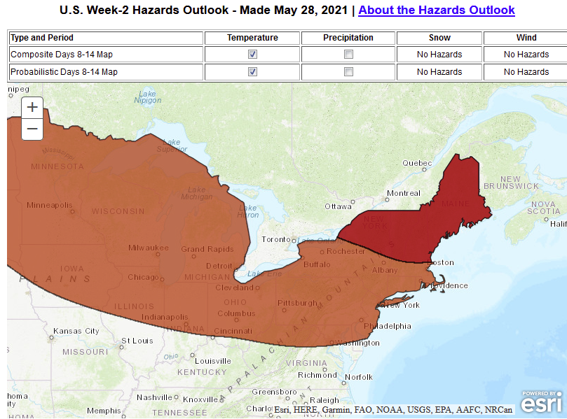
Fwiw, WPC's general D7-14 risk assessment is flagging moderate N, slight S, for excessive heat criteria. This matches our own consensus/obs that it may bleed 'over-top,' I would offer though some of the hottest weather from the N. Mid Atlantic to PWM, ME actually arrives on WNW to NW trajectories. Usually at the sacrifice of a stalled BD cold front blocking D.E.M from the party like Steve Roubel outside "Studio 54" circa 1979. just sayin' . If we don't, looks to me like roughly D5 to 12 might range 87 NYC ( with donkey nuts DPs ) to 96 BTV, where the DP is lower do to source/wind direction in the mid BL respectively. I also want to add that this is 'continental tucking' again - just a personal hypothesis of mine that an over active late spring polar jet tends to draw the continental/SW ejected air conveyor N-W of climo, and then there tends to be more S/SE DP into the Mid Atlantic to NYC. Boston is a wild card there - sort of hinted below with the southern edge of this speculation chart down to rt 2. I could see Boston with a 93/63 ( f'n hot enough!), while BTV puts up a 98/56; and neither of those extremes shows up until we are day 3-5 outlooks btw.
-
Buddy of mine has a 2nd home/cottage he's spend the last decade vitalizing, next to a lake outside of Fryeburg - across the way from the Steve King place I guess. He was saying that it's like the warm season is so short up there, the air mass becomes dense with a competition on any summer evening, between DP moisture vs mosquitoes. That blue tinted haze against the back drop is actually a fog of vampires. He joked they're like hummingbirds in size, too. So aggressive in fact that even while inside, they bob and probe relentlessing to a competing mat against the window screens. Basically, you can't be out side - there is no warm season in those interior woodland lake regions - there's just winter, then blood suck.


