

Typhoon Tip
-
Posts
44,567 -
Joined
-
Last visited
Content Type
Profiles
Blogs
Forums
American Weather
Media Demo
Store
Gallery
Everything posted by Typhoon Tip
-
I'm surprised this system is bullied along so robustly in these guidance to begin with .. It's a flat wave - yeah we know .. But, it's also being pulled up through a larger synoptic confluence at mid/U/A levels. The OV is the 'rejoining' axis of the southern stream with the northern stream. Yet this just has enough identity left after the fact ... (GFS and company) to get interesting after the fact. I've been on the fence with that. 1 .. models tend to see the mid range through a magnifying glass. Scoping out middling events as majors, minors and middling ...etc, has been a leitmotif of the global numerical models - particularly the GFS. This seemed to be a good candidate for that sort of gradual attenuation as the run cycles went by. Doesn't seem to be happening, however. Interesting... 2 .. maybe that's what the Euro's been after .. but there are two issues going on with that model for me. One, it thinks this is attenuating, but two, it is not handling the N stream/confluence and the particulars of the higher pressure up N the same way. Not sure why... just what the model behaviors been doing. Obviously, that is hugely instrumental in what ptype occurs where. 3 .. one aspect I like for QPF is that there is a staggered formation in the jet fields, where the 850 mb rides NE up and over the frontal interface, and underneath a 700 mb exit region from E NYS over SNE. Then, above that there is the 500 mb, a similar right exit region accelerating the field E, N of the 700 mb axis.. Finally, at 300 mb, there is whopper 150 to 175 kt right entrance/exit region jet blasting from ORD -CAR.. Basically that looks like this can produce a significant frontogenic banding/slantwise instability, and may be related to how the "robust" look I mentioned above is occurring. It's sort of an over-achiever because of these jet couplets.
-
There is no “reason” nor “rationale” “in the post below” ! One cannot believes an aspect to be true merely because they imagine and or want it’s veracity. When it’s concretely determined to be false … to persist in doing so is at a minimum determination IR-rational. Moreover it becomes an indictment of intelligence when one cannot connect with that reality Fine, then. Consider yourself humored along hence forth - with all the due respects and salutations commensurate to that social rank and recognition .. atta boy!
-
I mean you can look up the model verification scores for free - the NAVGEM is an UN -GOOD model... It's not designed for this type of land-based meteorology. It is used by the NAVY for NAVY purposes in the high seas and wave-guide. It's not only an UN -GOOD ( fact! ) model, it is also not even being used for the right reason when you attempt to employ it's solutions and then attempt to comparing. Jesus Christ. stop it. Unless you're mentally challenged and don't understand these turns of phrases, that's another story. If that's what's going one, we'll pat your head and tell ya your doing a great job -
-
18z GFS substantial correction south. actually ... this is a substantial ice storm threat for lower Missouri/southern IL up through the west OV as near as 96 hours ... speed things up in fast hemisphere friends... But, the arm of high pressure presses through Ontario and sorry,... long years of experience, that ends up with a boundary south of here. That's getting interesting... 120 hours we have overrunning pellet and cold rain streaking across the southern tier of NY into S VT and by later that evening we'll see what the entails here but I do NOT buy a polar boundary over recent snow pack, at climo cold time of year barely in the rear view mirror ...just hangin around southern NH ...no way! Not when pressure is rising through the mid range over/N of Montreal .. not happening Prolly should point out ...this next coverage is an entirely different type of system than this one. Not even the same synoptic ball park.
-
OBS/DISCO - The Historic James Blizzard of 2022
Typhoon Tip replied to TalcottWx's topic in New England
Yup just saw it on COD composite - nasty band man. Man snow as we say! -
OBS/DISCO - The Historic James Blizzard of 2022
Typhoon Tip replied to TalcottWx's topic in New England
So I just got back from the gym ... Holy hell!! Took almost 20 min to got 1.5 mi. Snow stepped up, while there, worst of the whole storm ( Ayer ).. We got est 3" in just a little over an hr, and it still snowing hard. I thought by rad trends and out of doors it was tapering off. Jesus Christ. 1/10th of mi vis stuff. Est now I got close to 10 or 11" out of this -
Yeah I guess I looked at the coarser product at PSU e-wall... heh... Looked like it suppressed the shit outta that.. which it did, but I guess it slipped a pass up the backside ..what was that an ANA?
-
OBS/DISCO - The Historic James Blizzard of 2022
Typhoon Tip replied to TalcottWx's topic in New England
Yup ...jives with my "estimate" too ( Ayer ) -
OBS/DISCO - The Historic James Blizzard of 2022
Typhoon Tip replied to TalcottWx's topic in New England
Uh...really. What are your sources? That doesn't jive with this: -
Well there you go ... Euro makes a step in the D8-11 direction. Can't run until you take a your first steps
-
Yup ... transition event. Tries to get mild but not impressed with the front side of the front's region for now. Then said front slips past - noooormally, that will be ahead of guidance when it comes to these weight polar high transits through SE Canada ..wedging under. Particularly, that kind set up will come SW down from Maine as coastal jet when the +PP lobes around the White's. Anyway, the cold air deepens and isn't going the other way... If there is a overrunning during cold air's gradual deepening, we'll go through some ptype axis ...
-
actually .. it's so suppressed it almost doesn't exist. The frontal passage has sped up in time over the recent days' worth of runs ..but whether there is any return flow right away that runs over it and creates something mixy and what not was also a newness to the Fri/Thur time frame. This Euro run doesn't so much establish enough of that and just keeps the whole thing as a cold front with a wave S. but christ... who knows. I think we need watch the D 8-11 range
-
It's an interesting system. It's what I like to call a maintenance event - it helps keep it cold but it isn't rooted in a pattern change that is going into cold(exit) from a milder(colder) regime. I don't know what that means - I have engagement fatigue and can't think straight. I'm just saying it sneaky in between the larger synoptic indicators. Tell you what..I'm gonna go look at the individual members of ens'
-
Ah yes ... it's always nicer to post-mortem our way out of an under-achiever ( relative to IMBY's of course - ), into another assurance for d-drip week, to keep us from crashing too hard. Haha... it's funny but true. I remember we use to talk about this up in the weather lab at UML back in college, how there's like a post-partum depression kinda of psycho babble after storms end. I mean you're in after glow but ... by the third day, that wears off and if you are looking at an anathemic pattern, that can be a bit of a withdraw likeness. But this GGEM solution just converted a thaw into an cold rain --> ice/mix --> snow ordeal ... Big too actually. You know regardless of whether that happens or not for IMBYs, where that does take place, that may last a full 24 hours to transition through that.
-
OBS/DISCO - The Historic James Blizzard of 2022
Typhoon Tip replied to TalcottWx's topic in New England
Ha.. you know when I see this... . I cannot help but wonder if the individual expectations are a wee bit too high going into these storms. I mean, NCEP apparently doesn't have any reservations in calling this blizzard conditions ...wtf are we peppering this obs thread with 'umimpressive' laments? What? do we have to have winter storm Mike Tyson punch us in the face with his giant snow fist - 'course, I've been kind of wondering about official office competency everywhere in western industrial civilities as of late but that's another rant. Anyway, I think this has turned into a meso salad - when that happens, the haves own 90% of the wealth and the rest work in their factories. -
OBS/DISCO - The Historic James Blizzard of 2022
Typhoon Tip replied to TalcottWx's topic in New England
I mean just being sorta whimsical but it's really kind of unfair? There are other storms of lore that did not require the kind of colonoscopy this thing apparently needed. And still ... it seems no one sniffed ( no pun intended ) out what may have been coup de gras factor: low level cold inhibition/BL resistance. I did not hear one AFD, not one TV met, nor read a post before hand where a single soul ( if you're out there ..with all due respects) warned that the reason the GFS was pearling out and stressing the low pressure structures so much, would be because of a sneaky arctic boundary displacing S of the south coast ... laying in an impenetrable wal - I can honestly say, I did not see that. I just assumed like ( apparently) everyone that this was chasing convection. The funny thing is...when I awoke this morning, the low was ( like I said) close to 38/72 something like that...and there was no convection anywhere around it... So, no it didn't chase shit - that's not what was going to happen and that was a poor model interpretation - I now feel strongly about. Not just me - everyone. So two ours later, the low's position leaped some 150 M ENE .. chasing convection that was not there to chase. No, that's it getting ground along the denser air mass interface is what that is. At the end of this...I will have clocked ...mm 10" ? I'm around 6 now, and it's milky out of window. Poor accumulation rates... We're pushing talcum powder around in 40 mph gusts. 16 F. I'd call it 1/4 mi vis, with about half that because of actual falling snow, and the other is cryo-dust. But 10" is a respectable snow storm. We just gotta allow ourselves to deflate from the loftier expectations, a resentful journey I know... But we'll eventually see that this was a successful and significant event anyway. And there's the IMBY shit too. I mean someone in the SE proobably has a more inspired sentiment. Remember when we joked the other day? - watch this break records, thus be historic, yet be utterly uninspired - who do we flip bird to LOL -
OBS/DISCO - The Historic James Blizzard of 2022
Typhoon Tip replied to TalcottWx's topic in New England
This cyclone event is unusually tilted backward from surface to mid levels ... That much is clearly exposed by balancing satellite and radar trends, against the current position of the surface low ...close to 40N/68W as of 1636Z (11:36 am). Also...as Will ( thank you ) posted soundings from KISP indicating the 500 mb wind is SSE ... west of that surface low, this thing is like one of those sloped tornadoes in the plains. Anyway... it's not a analog of that; just a metaphor. But you can sustain lift at all scales through a vertically stressed column as these kinds of small scale event (and today ) demonstrate. It's not normally how these works..some tilt yeah. But I suspect this is pushing this about as far as it really can - or one wonders... The other aspect I noticed ..I wonder if we've all neglected the age old rule about BL resistance when it comes to low pressure tracking. I think I see what happened ( or suspect as such ..). When we go back several surface analysis, we find that an arctic front passed S of the south coast prior to dawn. The low at that time was still around 71W/37 or so N ( or close to that - I didn't take precise look). Then, two hours later, ...there was an apparent center jump ENE pretty much parallel to the arctic front. Now as said, it's 40N by 67 W It's nasty outside... It's not inundating like those western solutions. The NAM has a bit of a NW bias with west Atlantic cyclone tracking of coastal storms. The 700 mb and 500 mb surfaces are clear, per radar and satellite, very displaced west of that WPC sfc analysis. These features in a less BL viscosity would like have pulled the surface center in tighter - - this was never destined to capture and stack, not given these now-cast observations. I mean with all this intense cold air flooding seaward, and that arctic undercut. This we're getting, it is a mid level snows storm falling through an arctic blast. I don't think I heard or read any statements related to this factor obtruding the low levels and (possibly causing ...) the surface low to displace so far SE as abruptly as it did right around 13Z ...seems that it "bumped" for lack of better word, off the arctic wall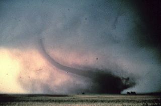
-
That's all that's left of the big early Feb warm up we saw 10 days ago, huh - Fast flow hemisphere: it can also give back in that sense ( maybe)
-
well ..that's what I had in mind when I said D6 ... there's a wave of low presser involved that passes either NW, over head, or underneath ( tho less likely the latter) around that day, but ..yeah, if the colder solutions were to pan out than the leading boundary would likely end up suppressing south of the PIT-BOS line, and that enters a question of overrunning/mix .. ice from NW to SE, out ahead of any such wave of low pressure. It's a messy look, I'll give you that. It's hard to pin point this last coastal storm? Try pinning down an icer from this range. pretty much can't be done. Only trend recognition
-
OBS/DISCO - The Historic James Blizzard of 2022
Typhoon Tip replied to TalcottWx's topic in New England
Why... 'cause he's a baseball celebrity? This culture's annoying sometimes - -
OBS/DISCO - The Historic James Blizzard of 2022
Typhoon Tip replied to TalcottWx's topic in New England
I wonder if this is maxing now... Oh, it'll be a fun exit and take hours to do so - no worries. But rad and sat depictions on whole are not improving nor decaying, sort of static ... it may have reached it's potency. Stars 2 am? ... there's going to be some brutal wind chills outside tonight. Like -15-like C with winds gusting still maxing 25mph -
This is the time range personally watching.. The aspect for D6/ overrunning is real. It's been trending E across the nation spanning 3.5 ( ~) run cycles across all guidance/means - obviously folks are onto to that so no need. But I'm interested in what happens after that - mentioned so at the end of the Jan thread ... D8-12 still looks so
-
It's actually been in trouble for 4 day worth or hemispheric trends .. .but, heh - right?
-
OBS/DISCO - The Historic James Blizzard of 2022
Typhoon Tip replied to TalcottWx's topic in New England
This is interesting ... WPC just did a new sfc plot/analysis and relocated the low due E of their previous fix some 200 mi - what? Suddely the GFS is the right model - yeah...right. there we go I guess -
OBS/DISCO - The Historic James Blizzard of 2022
Typhoon Tip replied to TalcottWx's topic in New England
Mm, this is starting to smell like a now-cast over-achiever, relative to the late model guidance shirking and pulling E solutions that is. ( not yelling at anyway lol...just sayn') granted the euro came back a bit at 18z yesterday. I haven't frankly seen any modeling since the early 00Z's and those were skim over looks... Now-casting is worth it on this bitch. But even the Euro was guilty of the dual node low, stressed cyclonic coherence scheme on a couple of runs - proverbial pin pricks in the glory balloon. Just when we almost had art ... Sometimes I wonder if there's a troll-mole planted in modeling sciences haha. But yeah..we've been onto the Meteorological oddity as not supporting the GFS - like solutions. Heh, it's one thing to cook up a bad idea once or twice along a storms story line, but to be adamantly unwavering and insistent even at 12 hrs ahead??!! That's a HUGE indictment - I'm sorry. We should note there have been hints of stalls.. moves toward doing so in the guidance from a couple days back, it was at least hinted. Looking at the well centralized deepening low due S of the eastern tip of L.I., and going forward through the synoptics.. I feel there is at least some chance these jet field could back some. There's always a bit of uncertainty when closing lows. We'll see if that happens.. It's a learning op on how cyclogenesis accuracy in proficiency ( and position and stressing evince problems ...), is critical piece to models getting things right. There are dynamic height falls associated to the low formation and the cloud/precipitation mechanics releasing rising air inducing height falls that feedback on trough structure, as the main S/W axis is nearing. Those feed-backs combined with and that is where the axis of the cut takes place... The models were showing the cut at 500 mb, ...way west of a low escaping east, and a 700 mb in between elevation low, skewed west. I mean you can "tilt" these aspect some .. we see that. But this was stressing believability to me. I said yesterday I wasn't buying it - I was resolute in being okay if proven wrong. Cool man. Bring it on. So we'll see where this goes..


