Typhoon Tip
Meteorologist-
Posts
43,840 -
Joined
-
Last visited
Content Type
Profiles
Blogs
Forums
American Weather
Media Demo
Store
Gallery
Everything posted by Typhoon Tip
-
hmm Euro looks like a band of significant ice along or just south of Rt 2...
-
Yeah, saw that... I almost wonder if that odd sfc placement ( wrt mid level forcing) may be a nod to more eventual coastal commitment - I've seen models do something like that, where they establish a 'correction vector' Interesting. Yeah, that's a zonk solution for like ALB though. They're probably getting a 6" hour with lightning strikes with that - wow. Also, the Euro trended colder here in the foreground from what I'm looking at... ? huh
-
Euro seems to be more phased like the GGEM with system #2, but too soon - that might end up in Buffalo. ...what the hell did they do, anyway -
-
Yeah... 10 days, 3 events... 30" piece of cake. Or piece of shit... depending - There isn't much difference timing-wise between the GGEM and GFS Otherwise, their respective 12z runs are almost identical. 10 days... 3 events... GFS has been succeeding all winter gashing hope in the heart for winter enthusiasts ... no need to elaborate there. GGEM has just enough more amplitude, and opts to align the storm track about 200 mile S or so. est.. Also, that second event has more N-stream phasing. The GFS bi-passes on that one and (what's new -) hurries the N/stream off the New England coast at ludicrous speed... Maybe that's right maybe that's wrong ? My guess is wrong, but whatever the result ...winter enthusiasts still get gashed again. Hard to knock such persistency.
-
In the meantime... 42 F in full sun after 48 hours of 30s in grunge is rather pleasant. Heh, with +2C at 850 ... full sun? In a month, we'd be 60F. I've seen it 62 F under 0C at 850 mb over a snow pack because of light wind warm sun angle super-adiabats. Soon as the sun kisses the tree line temp drops like a disgraced prom queen, sure ... But, days like this - this winter has been on life support all along, frankly, so you wonder if a rather over-performing nape season is in store. The numerical version of the teleconnectors are quite mild looking beyond next week... Yet, the depictions of all three ens cluster/means looks impressively wintry... These indicator methods are in conflict. Hmm... I'll tell you ( frankly...) the way this winter has gone preps one's perception to lean away from one of those portraits. Guess which one... heh. It's easy to imagine out there... this pattern change proven real but not that long, and not as amplified... starts folding toward an early spring. I'll be brutally honest, I would personally be quite happy with that. I'm not trying to rub this winter's shit show in or be "trollic" ...Just being objective about how the current and projected state of affairs are perceived, and based upon verification trends .. applied to guidance - and some measure of being bludgeoned over the head with it that CC modulation really gets harder to deny ... - from all these sources? Part of the 'quite happy' is perhaps more like acceptance setting one free.
-
It's not a bad interpretation, no. It's a 'smells like snow' rain along rt 2, with probably some stars on the windshield. Taking a closer look at the NAM ( for example...because it is one of the warmer 850 mb solutions as jbenedet points out..), the +2C I said was actually too warm. It's really closer to +1 with smaller meso holes punched through to 0C down as far as the Quabbin so... being at night, on January 19th, one could visualize that flopping over to wet cotton balls along this latitude. No bueno along the Pike... But yeah...as far as "accumulating" - heh
-
There may be some specific latitude consideration going on ... it's a finite scenario in that regards. Here along Rt 2... I would like to see more +PP correct into the front side of this. I don't see where the BL cold is coming from that is sufficient to offset a 850 mb thrust to +2C, in a season not providing a lot of faith that BLs can cool off and hold. But...looking at some higher resolution runs of the NAM, just over the border of VT/NH ...like almost collocated, it 0C there... But, they may also have a pesky warm layer in the bottom, too - not sure.. I think the best bet is modest height falls Friday morning with the collapsing column stuff. Man, what a tedious forecast this is -
-
Suppose this is all the reason for "needing to hear it elsewhere" The real problem with why-for the repetitive nature is because the users ( in general...no you or any particular member, per se - ) need faster entertainment out a focus that takes time to occur. In this case ... pattern change applied to the 20th through the end of the month, has been so basically 3 straight weeks ( more like 2, okay -). That is/was a constant. The ambition to see it happen, is not. In essence, some of the blame for that is on the user themselves ... perhaps in losing sight of having to wait a couple of weeks for an outlook to manifest in reality. They're some interpretation of can kicking here, that is out of line. The pattern changing/timing therein ...has not changed for this particular evolution, since it was ferreted out some 10 days ago or whenever that was... People need other hobbies, man. Tune in from time to time, then when/if the day arrives for the bigger entertainment/d-drip stuff, then engage more fully. But this reliance on this media for "substance" and fulfillment is ... only half comedic, frankly.
-
Yeah I don’t see Thursday as having a very high probability for positive return on snow south of New Hampshire Massachusetts border. Seems to me the only way we change this is to insert a little more front side +PP in Central Northern New England otherwise we probably have to wait for modest height falls on the backside of that mess. Might get into a burst of light snow Friday afternoon. ..This all seems pretty clear to me so I’m not gonna start a thread for this unless people want it. I’m not sure it’s really worth it for southern New England. However central northern New England it may be worth it for them - they are included in this forum lest we forget - right? ha ha ha
-
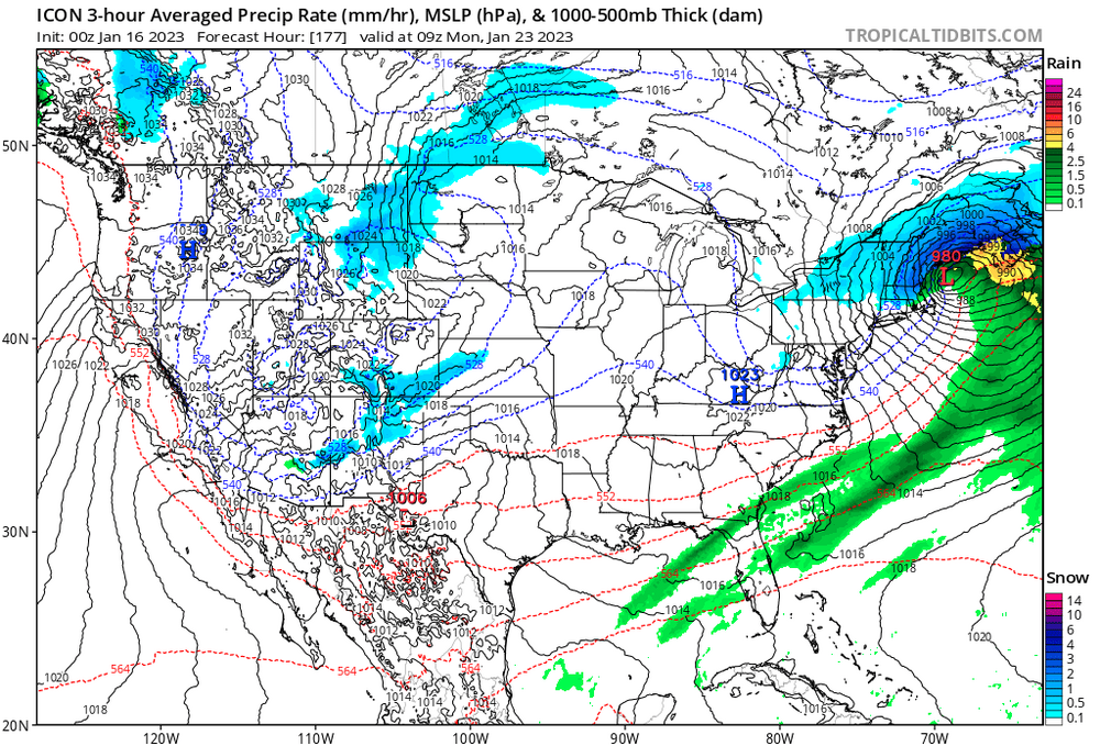
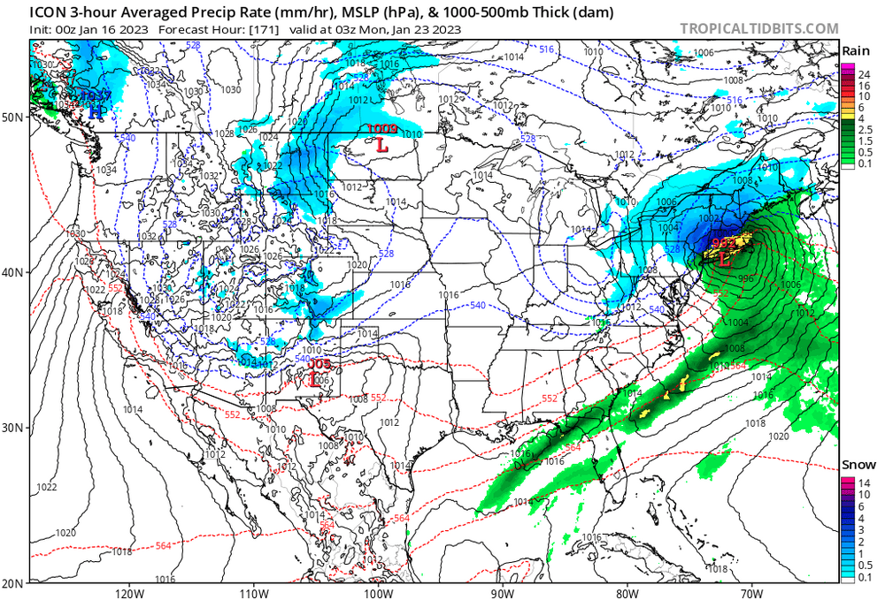
It appears the 23rd is more than less an inflection point. Fwiw, I keep noticing the 850 mb corrected significantly south passing that temporal entry, and then is in no hurry to go back... Some of the guidance had been trying to sell that lakes cutter/frontal passage as of a more coastal commitment but it is/was dubious against seasonal trends. That's been a kind of under-the-radar "model winter" persistence: coastal eye candy becomes a St Lawrence cruiser... We can argue a coastal doesn't fit the wave lengths on the front side of said change, anyway... I'm wondering what happens why out there. Because the 850 mb correction is coherent around the cross-guidance appeal just as well as the GFS. Some 25th..but yeah. However, they all have a ridge in the west, west biased ... in some cases, so far that it starts tugging the PNA down again. It's like a pattern that is sharing positive and negative index space without actually being neutral SD
-
What about us in here... haha.
-
hm ..does look improved.
-
-
The Euro's agreeing now with the GGEM/GFS re the 'quasi' norlun IVT lagging with persistent light snow on Friday. I suggest a thread... this specter has been coherent for enough runs. I told Will I'd do one by last night but I have other discussion obligation that took me off it. I'll put one up for moderate risk for (minor+moderate)/2 return
-
Well ...that explains the sleet contamination better than - but we both agree it's not likely right. Also, the BL ...the model does tend to saturate/wet-bulb higher than most other guidance in the mid range. I see this a lot with the GGEM ( and the only reason I bother to discuss is because the GGEM's been through some upgrades over the last 2 years and it has been showing somewhat improved performance...) where it places the rain/snow transition around -2 or -3 C at 850mb ... within a pounding CCB head. Nnnno
-
I realize your post was for dark humor/sarcasm but ... I took a look at the other synoptic metrics just for shits and giggles and that's basically impossible what it's doing there a few hours either side of 228. Vastly too warm relative to it's own guidance parametrics. The GGEM ( for the general audience) has a whopper warm BL bias in that range.
-
GFS is back to suggesting more snow Friday ...but the system evolution is also morphing. It's looking like a marginal BL event entry, with an isentropic burst over top overnight Thursday... cold rain and probably cat paws/sleety, but toward the end of that phase of things...there is an attempt to flash RT 2/S NH over to soaked cotton balls toward 12z Friday. Then,...there is more emphasis being placed on the trailing jet max during the day. The interior transitions, prolonging the event as a possible 9 or even 12 hours of persistent light snow.
-
that's your household ...? HOLY shit what a deliciously tedious hovel of One Flew Over The Cuckoo's Nest that's gotta be. So how many times a year does the local PD park at angles across the front lawn with their roofs lit up lol -
-
The 00Z EPS was an interesting trend. It's a tough sell though... it's tough to be abused for months and then drop that sentiment and be purely analytic/objective about regional chances ( got it ), but the EPS mean has significant number of members with a sub-index scale nuke. Those are tough to ferret out of any D7 range, let alone during a supposed pattern change period. Re the latter...the pattern is still destined to change, but to what? The bamboozle in this is that it doesn't appear to be changing toward one that is ideally useful to winter enthusiasts over the eastern continent. But as other's have rightfully pointed out...we can still do okay with cold loads into the Can shield, and a ridging depicted SE ... It's a matter of favoring storm typology - which, no surprise, a 00z EPS and 12z Euro *(yesterday) and 00z "ICAN'T" runs...sarcasm aside, might fit that kind of tapestry. I'm not willing to punt the 23rd, ... I only admit to it's low probability for positive return, and am willing to wait a bit.
-
-
yeah, hence "reasonable compromise" It was too robust with QPF, but it was also better continuity, consistently west of other guidance where that seemed to do okay. So we trade off in disappointing amounts for actually getting something/anything to happen in 2022-2023 Just my take - doesn't have to be the best version.
-
Looks like the Euro was the better fit... Somewhat better continuity, and layout of general 1.5 to 2.5" is a reasonable compromise between the unrealistic 4-6" ideas, and the relative no-show by some off-on other guidance types. Good win there For me personally ... this was a modest positive bust. I was on the fence about this thing even as the rad was activating on this yesterday, thinking a lot of the western edge/banding might have trouble getting down to the earth. Higher pwat in the area may have helped this facilitate better surface realization.
-
-
-
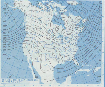
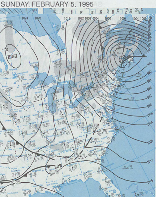
Heh...if it makes you feel any better ( probably not... ) that event had a fairly low probability for a positive return all along. That said, it's not sealed in fate just yet. That's still 4 or 5 days away. It's hard to maintain an objective vigil ... when there wasn't one to begin with hahaha.. No but, given the winter we've had, makes it sort of difficult to imagine anything working out really. It's been a little uncanny thus far? I wanna hammer it harder but I can't, not based upon decades of experiencing ups and downs. I remember a winter in the 1990s... right in the middle of a fantastic decade. 1994-1995. Man, that year stood out as numero uno sore butt year of all time... Until 2011-2012. But ...actually, both years had at least one decent event. The one in '94-'95 was a February 5 coastal bomb. Storm went from like 1004 mb to 970something in 10 minutes. It was too progressive to really be a big dawg, but there resulted 10 to 18" totals around the region, nonetheless. At peak strike, up at UML ... I recall est 1/16 mi vis snow/wind combo. It ended a remarkable streak of horrible luck though - in some senses, it was worse than this year, because first of all, that was the first snow of the season that really meant anything anywhere ... a bit later than our current plight at Jan 15. Secondly, much of the season the pattern was characterized as a 'low amplitude +PNA'. It looked from orbit like we should be doing better but nothing would ever break right. The persistent pattern just looked similar to this for 60 days prior to the coastal bomb... ...resulting in nothing... From orbit, that seems it shoulda been better. Not sure if it was warmer than normal ...I don't recall. I just remember the pattern looking similar to that above, unrelentingly too flat to actually do much of anything. Then this happened...


