

Typhoon Tip
-
Posts
43,850 -
Joined
-
Last visited
Content Type
Profiles
Blogs
Forums
American Weather
Media Demo
Store
Gallery
Everything posted by Typhoon Tip
-
no argument from me. this seemed evident by late August or September frankly.
-
I don't necessarily structure my outlooks around analog method/philosophies, buuuut ... the overnight ensemble means appear to be leaning more Jan 7 as opposed to the Jan 5 . You might recall yesterday the trend was the other way/we discussed it. Then we have these la la range runs occasionally creating black hole quasar storms near the 10-11-12 ... I think above all else, we're seeing some of the most elevated potential power we've seen in quite some time painted on the longer range model canvas' As the next cold loading into the continent is very prolific, and down to perhaps 50 N, meanwhile this maddening warm belt lingers along the ~ San Francisco to VA Beach latitude. Pretty much a baroclinic particle accelerator between it and said 50 N. ha. That's probably why anything the model physics generate beyond D10 is exceptionally intense - any cumulus cloud that wonders through ends up being an Andromeda Galaxy. sorry babbling
-
The cold loading into Canada ( particularly evidenced in the 00z GGEM and Euro operational runs) appears classic -EPO related. Couple of plumes up there to -30 C at 850 mb. The fact that it's not really coming south of the border? that appears related to the collapse of +PNA toward neutral or even going negative. The vastness of the PNA allows for less tightly constrained results. What we need to consider when juggling teleconnectors (particularly when they are in flux), is that there can be idiosyncratic anomalies relative to what is the canonical correlated/text book layout. Some -PNA's appear instrumental in driving 60 F to Chicago and eventually Boston, while others hit a cold wall and a stationary polar boundary aligns just S of that axis. Mixing/snows on one side, and a tornado event south. These variances occurring at the same numerical index values. The PNA domain is truly huge. It covers such a vast geometric area that events over the Pacific may ballast the total index into a negative value, while the eastern limb of the domain (over N/A) may actually be structured more like the positive mode. And vice versa.. Granted comparatively less likely. The D8-9-10 of the Euro and GGEM have some syrupy cold right down to the border of Lakes/NE with Canada. That's awful close for the deep mid range model performance to expect that it's impossible for that to come south.
-
Those stem-wound bombs have been recurring in both the GFS and Euro beyond 300 hours. ( not intending to lecture you here ...) It's likely a factor of background volatility in a potential saturated hemisphere, more so than having a "real" system. I think when there is this behavior in the guidance, there might be some value in monitoring the period in question as the time ranges shorten. The idea there being ... as the time nears and any real entities emerge, they may be doing so in said higher dynamics environment. Maybe D9 ? ... usually by 7 if the system in question is destined to be a humdinger it start to pin to the charts as run-to-run identity.
-
serious Q' where did you find this ?
-
I still have not seen a lot of evidence that this El Niño is strongly coupled to the hemisphere to be honest. … there are aspects that appear to be so but enough that don’t that I almost wonder if the former are just coincidences
-
Fwiw the 4-6th a bit more coherent in the 18z GEFS
-
Does look like a slow moving spring cold front doesn’t it ha ha
-
Kevin, I realize you’re just busting balls - or at least I hope you are… – but just in case, no one promised jack shit.
-
Put down the beer. It’s past your bedtime.
-
… Basically, the normally inconsolable crowd in here is downright apoplectic, and cannot be penetrated with any form of rational thinking
-
Would still be a false assessment approach
-
Pretty sure he was honoring Kevin
-
Kevin … isn’t it past your bedtime ?
-
As long as you guys are clear and square on the fact that the models can be right about the pattern change, and we may still not get snow. In other words, snow does not adjudicate whether the pattern change forecast’ was successful or not.
-
It might even be the same system in principal… It’s a similar time range, so it fits in the Rossby argument. The telecon spread isn’t in favor of a coastal storm during that timeframe but then again, the telecon spread could also change between now and then. But yeah, if you’re going with the tenor of the season, and that whole Stockholm syndrome of not being able to visualize any other reality ha ha ha then sure.
-
Not sure about the 12 Z but the 0Z last night… The GGEM and euro models both had plumes of -30+ C at 850 mb as far south as nearly lake superior at one time or another in those operational runs. I figured it was a nod to the negative EPO didn’t really think about it beyond that because while probably true about cold loading the details of where and when precise spatial layouts and all that is obviously unknown at this range. But yeah, get that to turn the corner and dip down and there you go.
-
Does NWS do reanalysis on those when they know the thermometers broken ? That’s so egregious and it’s been going on so long I mean how many of these fucking sites do they have like this where they’re sinking around and letting them go; when is it going to affect the 30 year climate totals ? I mean Jesus Christ
-
Yeah... yeah, this should cheer everyone up
-
Yeah, it's not abundantly clear these warm intrusions are settling downward out in time. Meanwhile, ... we may have a -AO going on over the course of the next 45 days from other factors forcing the domain; I'm sure we'll be reading tweet after tweet after tweet connecting the two without that downwelling
-
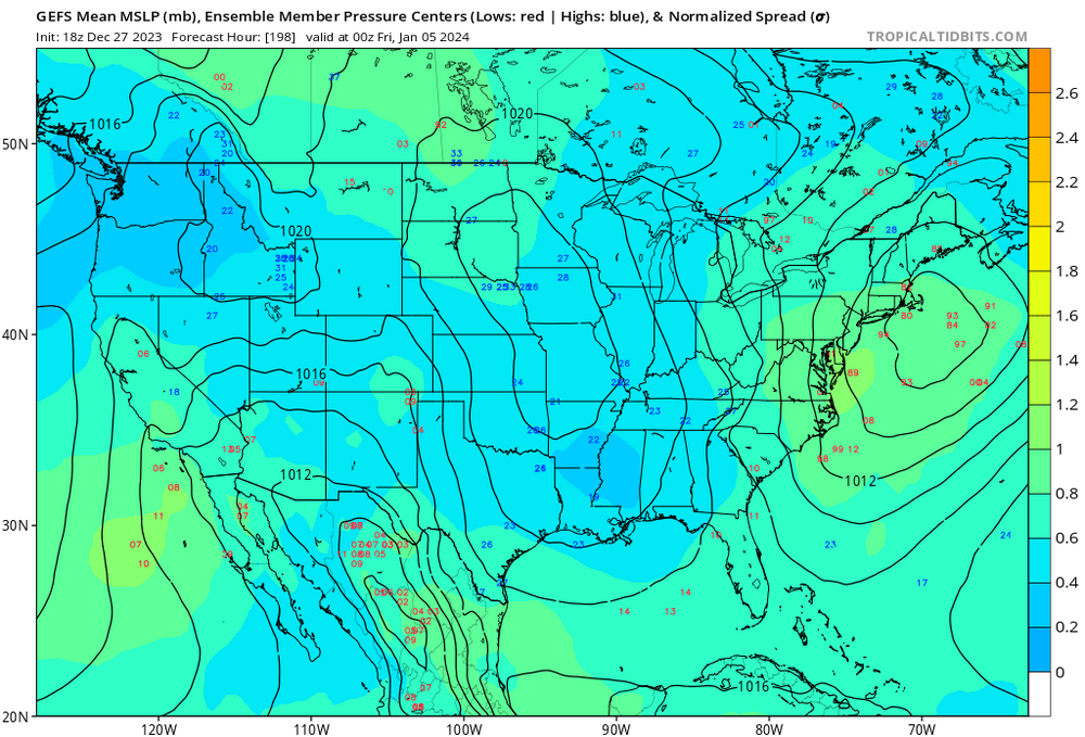
Yeah ...I saw that. But, the wave spacing is really close to the 4-6th, which is real enough and from what I see, has been +trend in recency. If this latter aspect were not in play, I'd be more inclined to lean - not that I'm exactly leaning to begin with. haha. Too early Typically when we get these sort of contention/spacing -related looks, the lead ends up winning the debate. that is, honestly, more old school model performance-wise. Still, I'm not sure if at 9 day ( Jan 5) lead, the models can't swap those out. We'll see. I like the whole period of time so -
-
You want them now... but in terms of OHC and SSTs and all that? The western Pacific climatology makes their season open ended compared to the Atlantic Basin. It does contract to the SW - similar to the Atlantic - but it doesn't really shut down. The other thing - and this is purely John speculation haha ... - the typhoon recurving seems to really be after the mode of the circulation from the Indian Ocean to the Date Line are already transmitting a change around the hemisphere. The typhoon occurs because of that. The circuitry there is that the TC latency inject plume enters the circulation and gives the R-wave signature a boost - typically in the EPO domain and the ridge benefits which then in turn helps the cold loading into N/A. LOL, why ... is there a typhoon recurving? haven't checked
-
Well, this has triggered me to check. Firstly, I prefer to keep a D9-13 "signal" pretty coarse. It's even less deterministically useful at a range of 9 days (Jesus) just trying to get the deep tropospheric signal to emerge. When signal are still attempting to emerge ... that seems backward in an operational sense. Confidence should improve in the emergence side, first ... then, along the way ..sure, increase evaluation efforts with those details. So yeah - I guess we have different approach. Having said that, the 850 mb thermal layout on the 4th in the EPS is ample cold enough. I realize that is not the BL but the BL temperature and hydrostatic thicknesses mean almost nothing in the midst of the solar min with any sufficiently strong system penetrating this particular layout - I'm just not seeing a warm BL problem given these initial conditions I checked the other ens systems and they're not significantly different. I'm done looking ( for now) for reasons/philosophy of approach I just described above. So, we'll see - Look, your post "timing" was pounced in character, as though going after snow enthusiasts? haha. Lord knows that is a lot of fun. But, I don't really give a fuck if it rains or snows at this range. I care about being right and having insight on periods of interest. Having said that, these critical level thermal field projections (above) centered mid way through the 4th -6th are encouraging considering everything that is substantive from this range.
-
Yes or no to this ... I'm not personally implicating snow. I'm saying there enhancing indication for a system there. I will add that BL problems is endemic to the majority of D8-13 range 'signals' since 2015 really.
-
It's always been about Dec 28 - Jan 7ish for me. The fact that we're seeing some "hopes" ( for lack of better word) during said period of time may be more academic, but getting those hopes to overcome destructive physics - It's always an interesting quandary to me how you can 'off-and-on' a storm appeal and then ultimately have it occur(not occur). It means there were back ground physics for both in play - what decides which rules out and which rules in, that is a fascination to me. anyway, yup - wouldn't be surprised if the 4th-6th because to add to your statement .. an aspect of that popularity is that it's been in +trend


