

Typhoon Tip
-
Posts
44,526 -
Joined
-
Last visited
Content Type
Profiles
Blogs
Forums
American Weather
Media Demo
Store
Gallery
Everything posted by Typhoon Tip
-
this might help elucidate the above facets ... https://www.cpc.ncep.noaa.gov/products/precip/CWlink/ir_anim_monthly.shtml loop that. you can see this hemispheric scale neggy uvm potential has stalled over the americas now on 45 days and gaining. this is directly related to suppression throughout the basin ( this may also be evidenced by mid and u/a thermal conditioning though i haven't checked ) normally, these regions of 'green' and 'brown' are propagating around the globe, as each passes through, tendencies for increased(decreased) tc genesis are observed. green is where tc enthusiasts wish to be. not shit stain brown. and, not shit stain brown not propagating - it doesn't mean we can't get events to unfold ... but 'explosions' of activity are a lot less likely. playing into a loaded deck
-
September vibes - Last 90s for some, 1st frost for others
Typhoon Tip replied to tamarack's topic in New England
yeah didn't explicitly mention that but the high parked over head is the actual idiosyncrasy i had in mind, which stops it from getting hot in the current model appeal it's alright for out doorsy stuff. by the way folks, lots of color, more so than just the typical 'sick maple,' dapples the distant groves around here. my big corner maple, healthy and stately, which i lovingly refer to as general sherman, is tinging orange a goodly 3 weeks ahead. i'm hypothesizing that the week of severe smoke we dimmed solar with for 10 days earlier last month might have triggered a bit of a green pigment pull-back if prematurely. these are healthy trees tinging around here, and i found that observation consistent along rt 2 and down 91 toward worcester over the weekend. -
was ruminating along these lines, myself, this morning while looking at this thing on satellite. a tc set up over no excuse ohc and slackening shear and no ri ? bit of supposition here, but it seems intuitive that rapid intensification behavior would be harder to come by when/if a tc is born out of some sort of tainted placenta. so we get stunted growth to torture the metaphor a little more - i'm pretty sure i know why this season's pulled the drain on tropical forecasting egos. though no attempt to take credit. for one, i don't give a fuck but for the other reason, i didn't see the standing wave/failed kelvin and mjo propagation phenomenon that's stalled the basin in a shit show for 45 days, either. hindsight 20/20 and all that. why those wave phenomenon [apparently] are slow and not allowing the basin to cycle back into a favorable hemispheric scaled uvm layout - i still suspect- is related to hc expansion causing a negative frequency modulation.
-
September vibes - Last 90s for some, 1st frost for others
Typhoon Tip replied to tamarack's topic in New England
historic heights with no 850s - at least per recent guidance. we'll see but it does seem there is this repetition to offset our warm patterns with idiosyncrasies. such that we never get out of control warmth here like other regions of the planet. i mean that has looked like one of those 'syngeristic heat bursts' setting up in the guidance, but nuances inside are stopping the heat from being realized. 565 dm hydrostatic hgts won't do it ... doesn't matter how high the non-hydrostatic hgts get. we'll still radiate at night and with low launch and tepid sun we're only recovering to 81 or 82 - not bad, but yet again ... leaving on the table. -
but they just explained it though ... ? all those working in concert and at varying amounts, produced a synergistic result. i'm personally above the 90th percentile confident in that. the problem with synergy is that it doesn't by mathematics have a linear cause - in other words, if one looks for the singular cause it is impossible to ever find it, because it does not exist. i get the appeal to find a silver bullet cause, but given the objective reality over the earth being a result of a complex polynomial of indirectly/co-mingling forces, anyway, it's pretty damning that all those factors also for constructively interfering complexity, led to the earth's temperature leap. you know ... if anything, it's more probable that we were behind; what took place was more like an uncapping of erstwhile suppressive effects - not the other way around. fascinating proposition, but perhaps any such erstwhile offset was only stopping the synergy product, perhaps only lending to observations looking more constrained.
-
Occasional Thoughts on Climate Change
Typhoon Tip replied to donsutherland1's topic in Climate Change
again ..another site where the record surpassed the penultimate by full degree unit(s). it's something when the previous several are mere decimals ... then a leap this large d(extreme) is going off all over the planet. probably the recent global temperature burst coming home to thermometers -
September vibes - Last 90s for some, 1st frost for others
Typhoon Tip replied to tamarack's topic in New England
hm impressive warm signaling continues ...extent of which tbd but 12z gfs over 594 dm ridge node parked over alb isn't very normal post 9/10s also have to wade thru model amplitude bias in the mid/ext ranges but the consistency in that direction has a lot of aggregated model runs at this point, too -
September vibes - Last 90s for some, 1st frost for others
Typhoon Tip replied to tamarack's topic in New England
okay just the 12z op euro and 18z gfs continuing trends ...that's approaching a historic signal out there. -
garbage solution
-
September vibes - Last 90s for some, 1st frost for others
Typhoon Tip replied to tamarack's topic in New England
-
September vibes - Last 90s for some, 1st frost for others
Typhoon Tip replied to tamarack's topic in New England
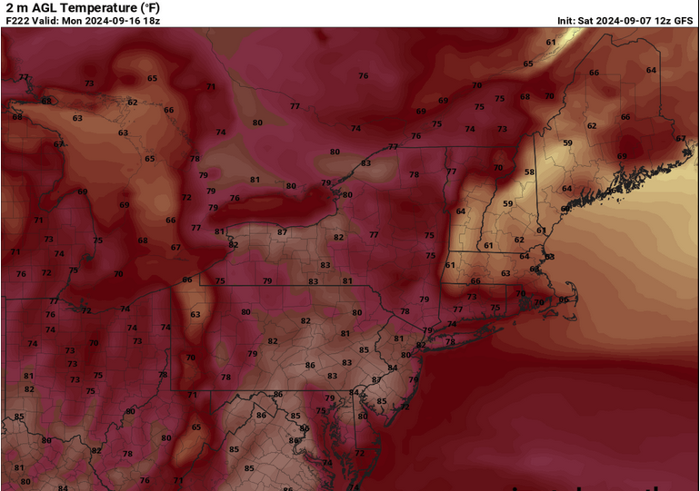
substantial bd on the euro late next weekend - been more and less on that model for a few cycles. agreed, warm pattern but we suffer for our circumstantial region and bd's preferential to 'warmer patterns' only difference between apr and sep is they don't have as much d(t) bite in the latter. sill ... 2 m's collapse from mid and upper 80s to low 60s course ... 7 days away and all - -
it's times like these that i wonder if the model's get exposed and they really do goose them toward climate. because the hemispheric scaled limitations that have ( and apparently continue to do so ...) been smothering activity don't appear to be alleviating in the latter mids ... yet they keep tryin and tryin to spin up mdr cumulus. the western gulf has legs if the fire hose shear were to slacken off.
-
September vibes - Last 90s for some, 1st frost for others
Typhoon Tip replied to tamarack's topic in New England
00z was better at 500 mb for heat signaling... 12z is about 5 dm shallower with dome node and also quicker to conjure up bullshit ( what's new with the gfs's magical grinding mechanics with that... ) to erode it down. it may not matter yeah yeah if the 800 mb and llv synoptics winds are remain favorable - just speaking to the standard metric. -
September vibes - Last 90s for some, 1st frost for others
Typhoon Tip replied to tamarack's topic in New England
might be the warmest 850 look leading this pattern change yet -
it starts in the asia dispersion/wpo
-
some are already aware but useful recap/nested links either way... https://phys.org/news/2024-09-earth-hottest-summer.html
-
I’m suspicious of the melt season lasting 10 or so days late.
-
what's perhaps most daunting of all about that svalbard location is that it's not like a freak low pulled a warm plume ... we're talkin' about a whole month average.
-
i'll give the guy credit. that's a humorous delivery there -
-
September vibes - Last 90s for some, 1st frost for others
Typhoon Tip replied to tamarack's topic in New England
probably a lot of 80s with unusual warm nights d6 to 11 solar's nearing the equinox. the lower troposphere is only marginal for 90 . if the modeling starts warming further then maybe we score a late 9 0 -
https://phys.org/news/2024-09-south-korea-highest-average-summer.html
-
It’s interesting that neither candidate’s addressed gun control - seems that of all travails society faces the imminent peril is clearly one devouring itself … seems worthy of at least a mention.
-
I mean what … it’s only been a couple o months since that last mass shooting
-
you know ... i admit to not taking the 00z nam very seriously. heh, why should i - but seeing it persist with the 06 and now 12, re a rapid book-end spin up tracking toward cape code, and the euro being more than less on board, i would think at least marine interests around the horn should be made aware. i'm sure that's happening - so maybe more for us lol it'll probably miss. nam may be both right about existing and wrong about where. but the point is, it's short term/now cast


