

Typhoon Tip
-
Posts
43,368 -
Joined
-
Last visited
Content Type
Profiles
Blogs
Forums
American Weather
Media Demo
Store
Gallery
Everything posted by Typhoon Tip
-
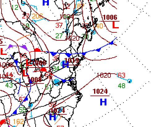
OT ...when I was young, the isobaric gradient on weather charts was always 1008, 1012, 1016. Whether displayed in weather books, or on the evening weather reports, that seemed to be a standard interval = 4mb. When did this change and why? I'm sure there's a "reason" that it is absolutely necessary (), but I wonder if it's "really" just because graphics tech is advanced enough to make for dramatic looking weather products for sale. What do I know. When I was young in this business ... I had a pretty good handle on wind just by the familiarization I had evolved over the year using the 4 mb differential. I'm sure I can adapt and probably should have by now but it's annoying when everything looks likes 50 mph rest state velocity wind must be carrying on.
-
Today is miserable ... no other way to cut it up. yuck -
-
Yeah honestly I wasn't looking at the 'trend' per se - as in comparing to a span of recent cycles. I was just looking at the 00z cross model comparison, and it immediately reminded my of what the GFS does in springs sometimes. I still would venture the GFS is too deep in general though.
-
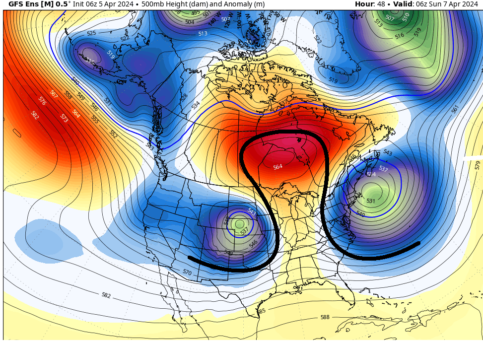
Typically the operational runs will be more amplified than their greater numbered ens means diluting the outlook - particularly further out in time. However, the operational GFS's 00z and 06z runs were excessive to me. It regresses the local hemisphere back an entire month or more, relative to climatology. I tend not to believe that. Something about the physics of present state of the ambient field on our side of the N. Hemisphere is constructively interfering with the GFS native tendency to have cold heights/bias, out in time. It's like the nursing staff forgot it's daily Thorazine dose and it went manic with it's native tendency. It may not be just the operational version, either. I compared the GEFs vs the EPS and GEPs and it's entire N. Hemisphere is eye-ball averaging some 10 dm colder overall compared to the former ens means once we get out to D9 ( 00z suite). Short version, the GEFs forecast system is systemically cold - perhaps too much so ... - and I am suspicious of that. I've seen the GFS do this pretty much every year since they started ensemble line pumping out new GFS model versions every year - a practice that began circa 2015. It tends to modulate the field toward a cold bias out in time, which of course consequentially might make it bad at modulating for spring warming. It just does this in the spring and puts out a series of charts like it gives up and runs back to Feb 20th
-
There's a warm signal in the east between roughly the 14th and 20th that the models, particularly the GFS ( which is normal for that tool's cold tendency in late mid and extended range - ) have been imagining innumerable ways in which to scrub it out of the synoptic outlooks in that time range.
-
We were picking up a buddy in Concord NH, then destined to N VT. That sort of limited our ability to choose routes and so there we were ... in the Notch, Canon on the left, the Lafayette sisters on the right, car fronts nearly tappin' car butts the entire 12 or whatever miles of bottle necked nimrod civil-engineering that is through there. Took us ~ 2 hr and 15 min to squeeze through but then 75 mph on the other side the rest of the way up. We made it in time, though. We were going to hit Lyndon State University/college but we were cutting it close; St Johnsbury area was well enough inside the totality region and would do just fine. Pulled off for a random meadow right around about 2:pm. 10 minutes later there were many cars pulled over with us. Small families here ... nerds with telescopic lens tech there. One dude had a welder's mask that looked just exactly like a Storm Trooper's helmet. The dimmer switch turning down became noticeable around 40% ... we all seemed to agree. It was subtle yet palpably, a "weird looking day light" permeated the ether of air and sky from that point onward. That's what really stood out, that eerie kind of sun light still shining. The air seemed to almost shimmer with a silvery translucence. My friend leans in, "It's like the sun shining on Mars" ...Around that point, ... nearing 60%, we noticed that sun on your face and arms, though still shining, delivered almost no discernible heat sensation. May as well have been as impersonal as a flashlight ... Slowly the dimming continued. Just then... nearing ~ 95% eclipse, we saw a remarkable sight. The shadow of the moon specifically darkening the SW-W horizon. The day was so fantastically lucky, too. For although it was entirely clear overhead and around the vicinity of the sky that hosted the enfeebling sun, a high layer of cirrus wisps existed just to the S. It betrayed a rather discrete edge where on one side, pale sun still lit the clouds, on other ... disappearing into that darkened deeper blue abyss. This line of shadow extended both above the clouds to space, and below in the air extending toward the ground. I wonder if we would have noticed this at all if not for those clouds enhancing that boundary. As we stood there amazed by that spectacle of like divine scale ... suddenly, the thumb and finger on the dimmer switch turned the dial the rest of the way all at once, and the pallid light was abruptly gone. The whole crowd erupts in cheering and applauding. It wasn't completely like night though. We were in totality, no doubt, but it was more apt to suggest it was like that 30 minutes passed sunset, the dim side of dusk on a summer evening. And yes it is true... the temperature crashed some 10 or 15 F. It was 64 on the dash when we rolled up. About 3 minutes after totality ended and the lights in the grand auditorium had risen like a minute past final curtain call, we spun tires to get the hell ahead of the traffic tsunamis going the other way... The dash thermometer was 49. Venus and other stars were visible in the navy blue-black sky surrounding the blackest black you can imagine, about the size of your thumb nail at arm's length. It was a black hole. Perfectly circular, demarcated by a fuzzy umbra of light emanating in all directions. The corona. I thought of a Quasar in the moment..heh. There was a tiny orange-red diamond of light, just a pin prick in size around the SE quadrant during totality - we later learned this may have been a Prominence, maybe even a CME underway. Just f'n wow man.
- 821 replies
-
- 10
-

-
67 glorious degrees made ever more ebullient by flawlessly unadulterated mid April sun intensity. Despite the fervor of all those syllables ( lol ), it's ultimately fake April warmth just the same, as the DP's are only 29 to 34 throughout the region. Inject any moisture at all into this air mass and it would slide back into the 44 F pit of despair. There's a BD being analyzed in the standard metric surface analysis at WPC ... With the high pressure lurking NW of Maine ... building ESE in time, it doesn't seem there is much of any reason to assume said BD doesn't eventually end up down in NJ somewhere. Question is when ... typically about 1:pm on a day like this given this synopsis below ...we'll be flirting with 70 F and then all the sudden ... 20 minutes later it's 49 F with flags pointed SW. But, it's still 59 in PSM which is bit unusual given the time of year/climo along with this below - their winds just came around to ENE though so reality's in the mail
-
Occasional Thoughts on Climate Change
Typhoon Tip replied to donsutherland1's topic in Climate Change
This missing mathematics in everyone's contribution to the present stream of dialogue is the deltas The d(CO2) since the Industrial Revolution has exceeded the positive rate of change since the paleo-antiquity. Many ...many millions of years. It is far more likely that the total manifold of the Earth system that become "climate" have not fully responded ... which makes events like last springs global sea and air spike, quite disconcerting. -
Oh. Indirectly related ...that maps seems a bit positive biased for around here. There's no snow on any yard or field. There's just these smaller piles skirting parking lots and what-not. I don't think those entrails are what this chart above is graphically presenting. Despite looking and sensibly appealing cold and gloomy that last 2 days since that event, we've very proficiently eradicated the 3 1/2 of dense sleet/snow mixture.
-
Here's the deal... we were plannin' on leaving early and headin' on up for the eclipse, replete with cooler and goggles not unlike the hundreds of thousands ( even millions) doing the same. This would make for a potentially shitty day out of a once in a lifetime experience. ... be that as it may... We have these strategies to avoid that part of the frustration - over crowded roads and stalled traffic that appears out to the horizon ..etc. Hopefully that works out. But there is a certain value in sticking here. My buddy's saying that if we get on one of the interstates and it's standing still we'll bale and just come back and do the 93% here and get a round of disc golf in. It's a hookie day from work and it's likely to be almost 70 F, with azure-cerulean blue skies horizon to horizon, with no wind and very low RH. Hmm if we get all the way up there, we'll miss out on that - that first day of the year like that is special. But it's likely to be in slush dump fields and muddy, and temperatures in the low 50s up along the path of totality.
-
Mid 60s tomorrow ... 70 possible over parking lots and sun lit back decks. what are you looking at that "looks like winter"
-
2044 is happening here? Oh ... you mean in general. My experience with attempting to buck demographics with sneaky lesser known routes and circuitous right and left turns that you think others aren't really accessing is that you end up actually worse - because it's far worse to be in grid lock alongthose podunk roads. With millions of people attempting to converge on N NY-NY-VT-N NH, the odds are overwhelmingly against you. The probability is there are thousands of people that thought the same thing you did and en masse, you're all packing those roads too. It doesn't work. I think my crew is planning on a disk golf round afterward. That will give 2 or 3 hours for the fudge to unpack.
-
Heh ... I disagree. I mean obviously this is just for subjective muse buuuut... it's a difference of mise-en-scène when you have the possibilities of an entire winter still before you. That month of late autumn is also been improving in wintry threat frequencies - owing to CC changing the circulation modes of the hemisphere, triggering seasonal 'pro-lapsing'. Counter-intuitive perhaps, but that causes cold incursions to increase at that time of year. It just doesn't last deeper into winters for a delicious popsicle headache bunch of reasons... Anyway, it may suck for him or her ... that's up to the individual. But if the reason it is sucking is because of uninspired drab weather? I don't see how either a subjective or objective observation makes that time year bad enough to put an "!" bang on the word suck - certainly not compared to a 47 f'um degrees with an endless hallway coming at us full of strata blocking warm sun, April. I get it that you can have fine stretches in Aprils ... however, that's like a abusive spouse syndrome. You may get these tender moments that keep you coming back ... ultimately for the back of the hand.
-
The operational model versions appear more pessimistic overall than their ensemble means ... I'm not sure that means they are wrong, however. The differences between them is the amount of blocking vs keeping the flow progressive. For ex, the GFS has what looks like a another -2 SD western -NAO. The GEFs mean however keeps the flow progressive through the NAO domain. GFS implies butt-bang weather. The GEFs would at least offer warm interludes. As spring/warm enthusiasts, obviously we don't want the operational GFS. We could say that it is an outlier compared to its ens mean ... etc therefore less likely to be correct. It's also true that at this time of year, with chaotic flow and shortening wave lengths, the overall predictive skill is just technologically limited... that too. However, we just had a pretty crazy -NAO, so the seasonal precedence is in place. That means if it happened once, it can certainly happen again. The other aspect is that we've been suffering this spring bullshit with New England being the only offset cool location out of the whole world, while everywhere else brags about global warming LOL. It's like we're the red-headed step child region. We have this tendency around here that is very real though, to never "feel" or sense our weather to be above normal, yet ... we're always resulting above normal. Relativity I suppose... We just aren't getting the big departures they're getting elsewhere. For whatever reason(s), we are above normal in a very uninspired/sneaky means; we are consummately limping to the finish line in last place in the warmer than normal race. We are currently -.5 and -2.2 at Hartford and Worcester so far through April 6. At least for the time being ... the averages actually are negative so far. But I wouldn't be surprised if these end up mirrored by the end of the month, yet we still carry on with our personal impressions of being red-headed ( lol )
-
Occasional Thoughts on Climate Change
Typhoon Tip replied to donsutherland1's topic in Climate Change
Need more research publications such as this ... https://phys.org/news/2024-04-electric-vehicles-lowering-bay-area.html ...to help dispel these Big Oil propaganda narratives that it cost too much this, or is shifting the problem that - all of which are of course by design, at great convenience to their economic outlook. ' So may as well just not do anything' -
i almost imagine after the next 100 years of only tepid success ... ultimately failing time constraining 'climate deadlines' later, and our seasons are so smeared at the boundaries it seems like it's trying to become one season. We average 56 to 62 in "cold" season, and summers are a putrid 81/79 daily torpid steam bath under rumbles like a rain forest...
-
here comes thursday, friday, shitterday, sunday ...
-
That'd be awesome... "What's cursive?" "You'll have to research, won't you." so in additional writing the paper in general, they gotta do that, too. And if they don't turn it in on Monday, they'll get the various corporal discipline tactics.
-
'wtf is cursive', right?
-
Occasional Thoughts on Climate Change
Typhoon Tip replied to donsutherland1's topic in Climate Change
Sea surface anomaly distributions are susceptible to local time-scale (vastly shorter than 'climate') wind stressing patterns. Those variances may redistribute (warm)(cool) either above or below the longer term baseline, but such interludes seldom represent the longer-termed systemic state. -
Classic omega pattern owing to spring tendency here
-
Cool ... looks like it was just updated, too
-
"Feel" ? I wonder if that is a subjective based reporting - like, population reported. So all the darker squares are like "23-and-me" genetically connected to the same lineage as Kevin in other words.
-
that was more likely something dietary that far away lol
-
mmm I'm on your side with this sentiment, but unfortunately ... it looks like it wants to claim this weekend, too. Sunday may get better ... at 4pm. heh.. I dunno. Maybe downslope flow will offset that cold anus whirling around the GOM? Monday is shockingly looking unobstructed skies ...i.e., clear, and has been that way for a week or more of modeling, in all sources. A true ironic rarity for the month of Asshole ... perhaps as rare a feet as an Eclipse.


