Typhoon Tip
Meteorologist-
Posts
43,774 -
Joined
-
Last visited
Content Type
Profiles
Blogs
Forums
American Weather
Media Demo
Store
Gallery
Everything posted by Typhoon Tip
-
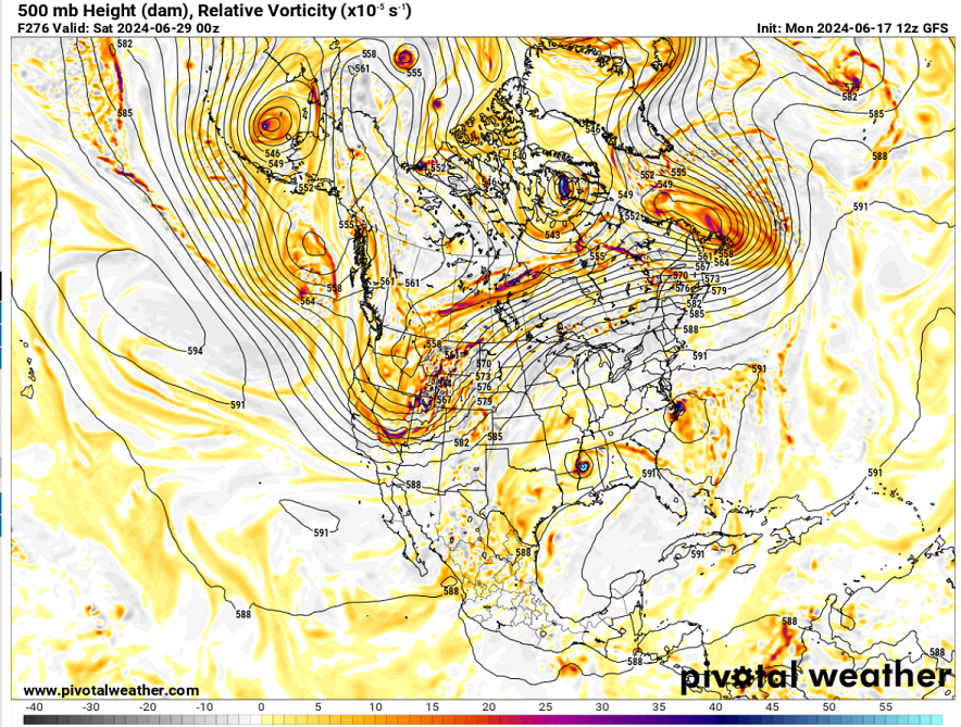
We'll likely recess this positive anomaly we're in ( the models appear too aggressive with fronts over the weekend but MCS activity may also get involved/obfuscate matters...) but the general -PNA scaffold remains in place, so this kind of signal in the operational GFS' extended has more relative merit. Feel higher than model climate confidence for eastern ridging - obviously less so for details.
-
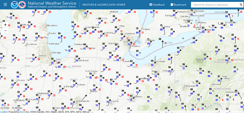
Hey Brian, looks like some mixing has commenced as DPS are more 70 to 73 across the southern Lakes and IN/OH. The NAM appears reasonable relative to hr 12z fwiw -
-
Tropical Storm Alberto--Mexico Landfall at 50mph/993mb
Typhoon Tip replied to WxWatcher007's topic in Tropical Headquarters
Home grower season, right on schedule. -
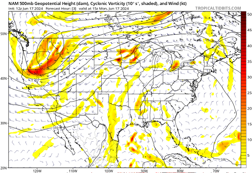
There's an element of discovery in every entry into a new pattern - which this is... The heights are evolving faster than the surface is catching up. If you look at 12z's initialization on this NAM run ( not saying anything that happens afterword has much value one way or the other ...) we are already over 582+ heights within a recognizable heat -related configuration. I've seen it be 98 like that. Again, the 850 mb is missing from this - or is yet to catch up... etc. Yet it's 75 at 11. Point is, this is coming in like a wall. Bursting forth is probably apropos. I don't think today, lagging as it appears to be, will be of much useful indication or offer much value in the area of "correcting" based on now-cast/present behavior biasing. I was noticing that the 850 mb rise from 13C at dawn to 16 or so by 21 Z... continuing to rise toward 18 or 19 Tues at dawm. We may even have a late high temperature today. Like we creep to 84 not realized until 5:30 pm ...then the lows tonight stay relatively elevated. It may be more like how tomorrow's behavior goes; telling us something about Wed. There's going to be some cumulative effect thereafter. Like the lows Wed night should be higher than the lows Tues night, even though by then...both overnights will be embedded in the same synoptic circumstance. That's just the battery charging from two days -worth of insolation vs just one... Thursday night could be quite impressive for that matter. We'll have to see how the DP advection fits into that. If we get a metalic 74DP in place under a 95 or 96 afternoon, that night may stay 80 in urban layouts.
-
This may be earn me some googly eye emoji's but ... you know, when it's 52 F on Sunday mornings with no snow on the ground and not particularly muddy, that is a terrific time to engage in outdoor sports. It's not hot. It's not cold. I've grown to appreciate the opportunities outside of home, too. Doesn't mean I don't want big winter expression. I still dork out for that too. But just sayn' ... activities like disc golf and tennis me and crew like to do doesn't get shut down that way.
-
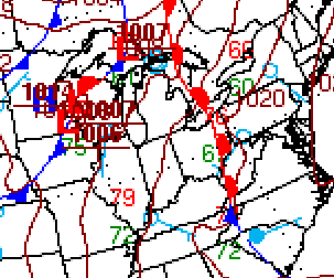
I was just looking around at obs and actual sfc features ( ha) I'm wondering if the NAM isn't as bad as we've been thinking. That warm front has 73 to 76 F DPs west, low to mid 60s east. We may see some drying from DVM associated with rising pig ridge heights... also if the wind can bend into more of a WNW direction..etc, but if the 850s mb is "only" 20C and we turn the air into a theta-e miasma, that would stymie down a Euro look. Actually, the MET has 97 at ASH on Wed so -
-
We'll get a snow chance between the 20th of October and December 3rd... lubing up the nostalgia no doubt. But ultimately a time span featuring whiplash variance between 'air smells like snow' (and actually can if there's a synoptic injection) then back to 83 F near or at records... Then, as the winter gradient ( hemispheric scale ) really sets up ...this will expose the butt banging that's become mid latitude winters ... dominated by strong mid level latitude height compression --> velocity saturation, which tends to limit blocking ... 43F winter results. Sometime in February, we start backing out of that regime by passing back through that autumn variance. This will last through April ... a time in which we'll have a couple of historic warm bursts chances, interceded by late season blocking that gives hope for an exit blue consolation storm. ---- That above characterization appears to have become the predominating Oct-Apr signal, regardless of any ENSO this or solar that, or blah blah-blah blah-blah ism we can articulately muster to explain why that winter will actually be winter. Because climate change is forcing this new paradigm (what ever it is...), subsuming the Rockwellian impression of what seasons mean.
-
Absorbed in the +D(hgt) suppression. Just my take ...
-
Noooo heat for you, ONE YEAR!
-
Ha ha... are you looking for the excitement and dystopia fun over the headline status? We have better luck with blizzards - although ... yeah, those seem to be a dying art form around here because you know, climate change is not real ( while makin' 'merica great agin' ) lol
-
We don't have the "edgy" 850 mb thermal inject into the ridge, that's why. That's been a concern from the get go in the modeling. The Euro did offer 22.5 on a couple of runs a couple of days ago, but has since been shirking 1/4 degree per run and as of last night's 00z it seems to have come back to the pack ... capping 20 or 21 C... That's not outrageous. It's perhaps unusual in and of its self to have non hydrostatic heights so high - I pointed this out that it's possibly historic for that metric alone, though quite unknowable. We've observed 24C waft over the region over the decades at one time or another, and every time that has happened, something interfered from fuller realization. In 2018, we had a magnificent ridge expression and only manufactured 20 or 21C in the 850s, too. The single day of near or at outrageous heat in 2011 July took place at < 590 non hydrostatic heights. Heights alone are not enough - we need the thermal seeding. Not that we're complaining.. heh. I mean, we really don't want 24 C at 850 mb injected into a 596+ dm heights, then worked over for 3 consecutive days of solar leading to aggregation. Think we can drain the concern for synergistic event at this point and go with high end seasonal heat wave.
-
Not sure if this has been mentioned yet, but there is a signal that heat may reload after perhaps a 2 to 3 day reprieve
-
Ah yes. 2011
-
I’m not sure where you’re located? But it was 75 to 78 common around the home sites here in northern Middlesex County Massachusetts. bit warmer than April and May climo , also considering what can typically happen in April and May around here in our climate. What happened today? Should have zero influence expectations later in the week. it’s kinda like the hot hand fallacy in Crapse
-
Contrasting ...the NAM. It has 96/73 at Lawrence between 18z and 21z on Wed afternoon , and that's supposedly the best mixed(ing) interval of the diurnal cycle. HFD is 93/72 ... How about the 2am temps along the Maine coastal plain Wednesday night? 85 at 2am NW of PWM is probably seldom seen up there I'm inclined to guess heh Anyway, in fairness, the NAM is typically under-mixed. Not sure it's the right model for seeing this sort of thing.
-
I'm also still at least a little concerned about the "synergistic" aspect. Those ilk of heat explosions that have been going off around the world with increased frequency over the last 20 years are typically preceded by environmental modeling doing similar super-imposing (constructively interfering ) larger scale parametrics .
-
Euro run appears to be the warmest of guidance 00z ( 12's are arriving now...) - I'm sure other's have noted this.. I've been off doing other stuff this weekend , but ... some other non traditional model types like the ICON and NOGAPS ...etc, have closed off the 600 dm heights briefly along the upper M/A on some recent cycles. The GFS at 06z also did so for the first time. There are two aspects to me in this ... whether we reach historic 2-meter verifications, those heights alone appear to noteworthy worthy of researching whether that specific metric approaches historic. Also, there is a chance that the multi day "integrated heat" may also be a cumulative type of record too. Those days are also not 'nicking' or barely making it into the VIP lounge... There'll likely be convincing solid blocks of time in consecutive hours where we're bangin HI's in a near or over dangerous range. Heat is a very fragile aspect. 4 out of 5 parameters may enter a period supporting 105 F but the 1 off put limits to 94. The trouble is ... at the ceiling temperatures, the only permutation there can be is less - that makes it hard ( or should ) for records to be broken, or just to push higher at all. 97/67 is a HI of 101 to 103.
-
Quick thought on this ... July 2010 saw a DPs dry out from somewhere around 70 all the way to the lower 50s between FIT-BED during the course of that afternoon where temperatures were near or over 100 before and after the DP advection took place. There's obviously other moving parts in the dynamics of the thing... I'm just pointing out that general rules can and do have exceptions yadda yadda What's the wind direction ? Curious. If this is WNW d-slope flow, we may see the in situ "dry line" advection take place.
-
That’s said. There’s still time for this to modulate. The GFS last two runs are showing a lot of continuity issues though.
-
Yeah, but unfortunately, today’s synoptics and what’s going on next week are unrelated. there’s a collateral index exchange going on all over the hemisphere, concurrently -whatever led to today and what’s going on today is prior to any of that taking place. The impending change appears to be harmonic. The result is a Rwave nadir situated around California and that’s sending a signal over Eastern North America, which is then being augmented further by a very positive NAO -
-
Rest my case … in my own inimitable way I was describing that bold as the potential is increasing here for the dreaded “ synergistic feedback” response and this thing being a bigger deal than these 2 m temperatures. It could be one of these scenarios where if anything the GFS 2-m are behind the ball meanwhile, we’re trying to argue why the others are too hot. But this being outside of model climatology …that’s another way of suggesting a situation that transcends/the same thing as the synergistic event. Interesting test Big story for next week continues to be likelihood of dangerous heat and humidity starting Tue and peaking Wed-Fri. Ensembles are in very good agreement on building strong upper ridge over eastern U.S. through most of next week which lends increasing confidence. In fact, 500 mb heights nearing 600 dm is something rarely seen in the Northeast and is a very strong signal for record heat. This aligns with EPS and NAEFS Situational Awareness Tables which show several parameters outside of model climatology relating to temperature, signaling potential for a highly unusual event.
-
I'll have to catch up on their reasoning but this appears axial too far NW aligned to me from what I've been seeing in the guidance, as well ... a-priori with how heat of this type will tend to effect the I-95 corridor given the total manifold of synoptics. Otherwise, I think this is experimental not ready for use. But I did have a conversation with an NWS director at the conference last June, whence I brought the synergistic heat phenomenon needs to be recognized as specific risk to civility..etc. She was in complete agreement and said that heat was an aspect they were working on improving. I think this product below is a great step (example).
-
Setting up training along the western end of the Pike ?
-
Occasional Thoughts on Climate Change
Typhoon Tip replied to donsutherland1's topic in Climate Change
https://phys.org/news/2024-06-antarctic-cold-shatter-global-late.html -
I did back down in the total list or synoptic metrics, though. The GFS did too. Could be a beginning of the 'deamplification' game when extended gets into mid range. Have to watch for that.


