

Windspeed
-
Posts
4,842 -
Joined
-
Last visited
Content Type
Profiles
Blogs
Forums
American Weather
Media Demo
Store
Gallery
Everything posted by Windspeed
-
 Super Typhoon Wutip was upgraded to Cat 5. No, not unusual to see those in the WPAC, but it's a first for February. In fact, this is the first classified Cat 5 ever in the northern hemisphere for the month. 28°C SSTs around the Marinas are still warm enough to support the intensity, but atmospheric favorability and outflow for this cyclone is textbook.
 -
That site is cancer on mobile. Full of spam and redirects.
-
Got an engagement and won't be able to post further warnings but it does look like things are picking up. Hopefully things don't digress into an outbreak and the discrete stuff transitions more linear swifly. Regardless, good luck to everyone. Here is the most recent warning on cell east of Philadelphia, MS, moving ENE:
-
Well-defined quasi-linear meso circulation on the strong line approaching MS/AL line moving north of Aberdeen, MS.
-
Discrete cells over central MS starting to get that look.
-
West of Booneville, MS:
-
First tornado warning of the event issued in Walker Co., Alabama:
-
TN valley heavy rain/flooding week of whenever
Windspeed replied to janetjanet998's topic in Tennessee Valley
Uptick QPF a bit further on the 00z. I hope this busts. -
HWRF has TC Gaja making landfall in India near Cat 4 intensity.
-
Thanks, Jeff! No need to remind when you are merely being informative about what to expect weather-wise while people are out exercising their right as citizens. Hopefully no severe variety storms or high wind impact events, and crap rain is all anybody has to deal with that day.
-
Yutu continues to buzzsaw along due west.
-
Yutu appears to be reintensifying. The ERC completed many hours ago and both microwave and visible imagery confirm a large and well-developed eyewall that continues to clear out. It is surrounded by a rather large CDO -- a big donut. Yutu may also not be done with land either. Some of the globals are flirting with Luzon. It is possible Yutu could even have a south of west motion for a time as heights may rebuild west under a lifting trough to the north. That trough was originally capturing Yutu, but that solution is losing recent model support.
-
Night time visible band uses moon light and some other remote sensing techniques. You can see the stadium shape of the eye down near the surface and lower level. The northern portion of Saipan may have missed the worst of the eyewall but it's still a guess at this point. The southern half may have got the worst. Clearly all of Tinian experienced full frontal and backside winds. I want to refrain from hyperbole, but there probably is catastrophic devestation for anything not built within the strictest of code. Image courtesy of CIMSS and William Straka and Scott Bachmeier: Use the direct link here if you want full resolution from CIMSS as the GIF is too large to post or is just will not animate correctly as posted to the forum.
-
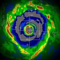
Very clean microwave during landfall. Distinct concentric features with an ERC in early stages. Two wind maxima were probably experienced in Tinian and Saipan with the larger outter band and insanely intense inner eyewall. Infared can be deceiving for exact path of the wall over those islands as well. The Himawari satellite is positioned at a plane of lower latitude and at an acute angle south of the typhoon. IR images reflect colder cloud tops that only start to resolve at the mid-to-upper level of the eye. You must account for the height of the eyewall cylinder down to the surface at that distance. A visible image with sunlight at the same angle will show the lower-level circulation, closer to the surface, at the bottom of the eyewall cylinder. It's frustrating we don't have observable radar for a US territory besides, but it is what it is. Luckily we did have the clean microwave scan at landfall. And perhaps the airport/military will have some closed network remote sensing before all hell broke lose; and hopefully some instrumentation survived for pressure distribution.
-
Yowza! I probably over use maximum potential even if there are cases where the environment isn't perfect. But in Yutu's case, it is definitely maxing out. Almost looks as insane as Haiyan. Almost... I am noticing a subtle bend back towards a more westward component in the extended loop. Not sure if that is merely short term, but hopefully that allows Yutu's intense core to miss Tinian/Saipan or any other population centers for that matter.
-
An issue for any vertical city is wind funneling. You may have 70 kt sustained at the airport, but in downtown with skyscrapers, off the bay, etc., wind will have greater effect and look more intense.
-
The GFS continues to be annoyingly overblown on intensity modeling. Jebi at 918 mb just off the coast while imbedded in strong SW mid level flow? No...
-
Updated track and intensity guidance for Jebi.
-
Be careful with use of that word imminent in describing an increased probability of a significant earthquake. Though there has been research that has tried to link small and prolonged seismic signals to tidal stresses, there has yet to be any substantial evidence correlating a single large seismic event based on the tidal influences and lower atmospheric surface pressures of a tropical cyclone. Simply put, there is yet no known mechanism to forecast failure of a fault based on a single weather event such as a tropical cyclone. The stresses of rock deformation, elastic and isostatic rebound are many factors exponentially greater on scale than to that of any atmospheric pressure influence by a single weather event. We also have too many examples of strong typhoons hitting Japan with little or negligible large seismic event observed. There is simply no evidence to support such a precursor, much less a prediction. However, Japan is always under threat of a strong seismic event simply due to the many active thrust faults there besides. So a threat is always high compared to other populated geographic locations regardless of what is occurring in the atmosphere. The same strong mid-level trough responsible for steering Jebi towards Honshu may also phase it. This will be a timing issue but I agree that Jebi has a good chance of being a significant strike. There may be mid-level shear impeding upon Jebi as it approaches landfall, but SSTs are still running 27-28°C off the coast there, so though I do expect quite a bit of weakening, it could still be packing 100+ kts. Could be a damaging event. Those folks are seasoned to handle it, however, though I am certainly not downplaying the threat.
-
JTWC now has Jebi classified a Super Typhoon at 140 kts.
-
The setup for early-to-mid May could be a volatile one for strong storms for the Mississippi and Tennessee Valley. Potent shortwaves enhanced by southwesterly jet out of Mexico, cooler than normal upper levels in May, advancing dry lines out of Texas, strong bulk shear, etc.; it only takes one of those surface lows to come in line to make for a memorable event. Yes, obviously not wanting to overhype so far in advance. Yes, it's Spring and there shall be storms with increasing juicy Gulf moisture as per the norm, but the atmosphere may very well be conducive for at least one strong Southern outbreak.

