mitchnick
-
Posts
28,729 -
Joined
Content Type
Profiles
Blogs
Forums
American Weather
Media Demo
Store
Gallery
Everything posted by mitchnick
-
On an unrelated note, new Wawa in Dover opens tomorrow. Hanover supposed to be before the end of the year. Yippee! Can't wait to be the first to try the bathrooms. It's an oldster thing, ya' know.
-
It does get harder as you get older, but I can still get used to it. My bigger issue is every time I hear the furnace goes on I cringe. Lol
-
Every time people mention MU I think of the pastor of my church. He started out a Met major at MU in the mid-2010's but ended up a political science major because of the math. By the time he graduated, he got the calling and ended up in the Seminary.
-
Things that are now...and the wacky Cfs2 sporadically, and often inexplicably, shows in the future. Often by itself. Lol
-
Cold
-
I know exactly what it's all about, hence why you cherry picked.
-
What I was questioning goes back to my original post about grabbing a forecast frame and comparing it to another later forecast like Bluewave did while disregarding an opposite result on the same run for a different period. Go back to my original post. I acknowledged the computers are flawed. My use of the word "bias" was in response to Bluewave's cherry pick...yes, cherry pick.
-
I'm sorry, I don't believe this model bias talk. If there was a proven bias, we would be hearing about it from all the Mets as the reason for their blown forecasts. Anyway, the models are run so many times a day, what runs are you going to use and how often do you check? And is this bias on all the models all the time or some of the models some of the time? It's a moving object that never stops. There's no doubt the models are flawed, but using 1 particular time on run vs another 1 particular time on a run to prove a point is cherry picking where I come from. Especially if you can take a different time on the same run and show the model has gotten colder. Frankly, I'm still trying to figure out the point of the exercise. I have my thoughts, of course.
-
Legalized gambling really. OK, I guess, as long as you know that going into it, but it's not for me. You're really trying to predict wx models and not the weather, because by the time the weather becomes certain, you've already lost or made your money.
-
We'll get the Euro monthly tomorrow if I'm not mistaken. I think it comes out on the 4th of the month these days??? So we'll have 1 more piece of guidance to fight over! Lol
-
Here's even a better example. 2 weeks ago, 11/18 forecast, for the week of 122-12/9 on top. Yesterday's forecast for the same week that's upon us so there's no question how close the prediction will be.

-
And from the same runs looking 2 weeks later, the weeklies did this. It happens all the time. Models are crap shoots. Lots of variations based on projected timing.
-
Orthopedic surgeons will have a banner 2025.
-
Or flatten the Appalachians.
-
Every location is different and I don't claim to know the various climos around PA, only mine. If I had to guess right now, I would say plus or minus 1-2 degrees from normal Dec-Feb average. So close enough to normal that most normal people won't notice. But considering how warm winters have been of late, my guess is the average person will feel it cold even if not technically BN. Snow is the bigger issue for most of us and, so far at least, I'm not getting a great feeling about that imby due to dryness and the insufferable warm/wet-dry/cold tendencies of a Niña or cold neutral. Maybe different away from me, idk. P.s. Of course, this could change, but I'm basing it on what I've seen so far. Feb or March could be our wild cards for the better.
-
Although signs point to a cooler/colder January, models are indicating a little BN precip. That could change, but that change could mean drier too. What a hobby.
-
And so are us snow weenies.
-
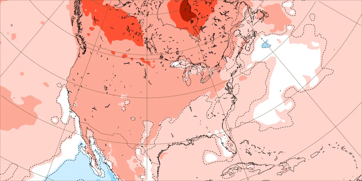
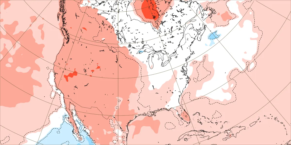
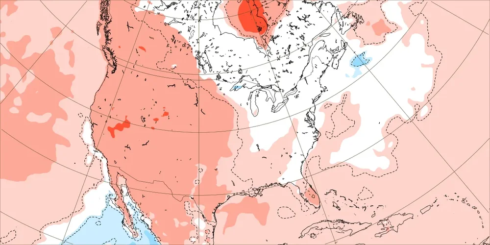
GEFS having a hard time making up it's mind in the long range between runs. End of the 12z run 850 anomalies on top and end of the 18z on the bottom. 500mb maps with similar looks.
-
Interesting how the Euro weeklies keep delaying the warmup in the east. Yesterday's run keeps the east BN or within the normal scale thru 1/6. The only AN is the week of 1/6-1/13, and only gets it into the lowest AN scale of +.5-1C. The good news being, if correct, that won't prohibited snow chances completely being so close to the climo minimum.
-
This Pic of 11/25 SSTA forecast from updated Cansips is for Larry.
-
December 2024 - Best look to an early December pattern in many a year!
mitchnick replied to FXWX's topic in New England
Here you go Jerry. Updated maps on TT. https://www.tropicaltidbits.com/analysis/models/?model=cansips®ion=us&pkg=z500a&runtime=2024120100&fh=0 -
100% on that. The ground was snow covered almost all of January. Then, February flipped warm mid month and March was around +5 at BWI. Maybe because I was younger in 76/77, but I found 93/94 to be even more brutal, though not as unrelenting as 76/77.
-
Not interested. I think BWI (mby at the time) had a lousy 12" or so that winter.
-
Coldest winter on record in the east will get you those numbers, but that was far from the norm. I walked 200' out onto the frozen Chesapeake Bay that winter in January, 1977 at Sandy Point State Park. The Chesapeake Bay never froze like that again.
-
December 2024 - Best look to an early December pattern in many a year!
mitchnick replied to FXWX's topic in New England
Helluva way to run a warmup on the Geps at the end of its run.