frostfern
-
Posts
2,267 -
Joined
-
Last visited
Content Type
Profiles
Blogs
Forums
American Weather
Media Demo
Store
Gallery
Everything posted by frostfern
-
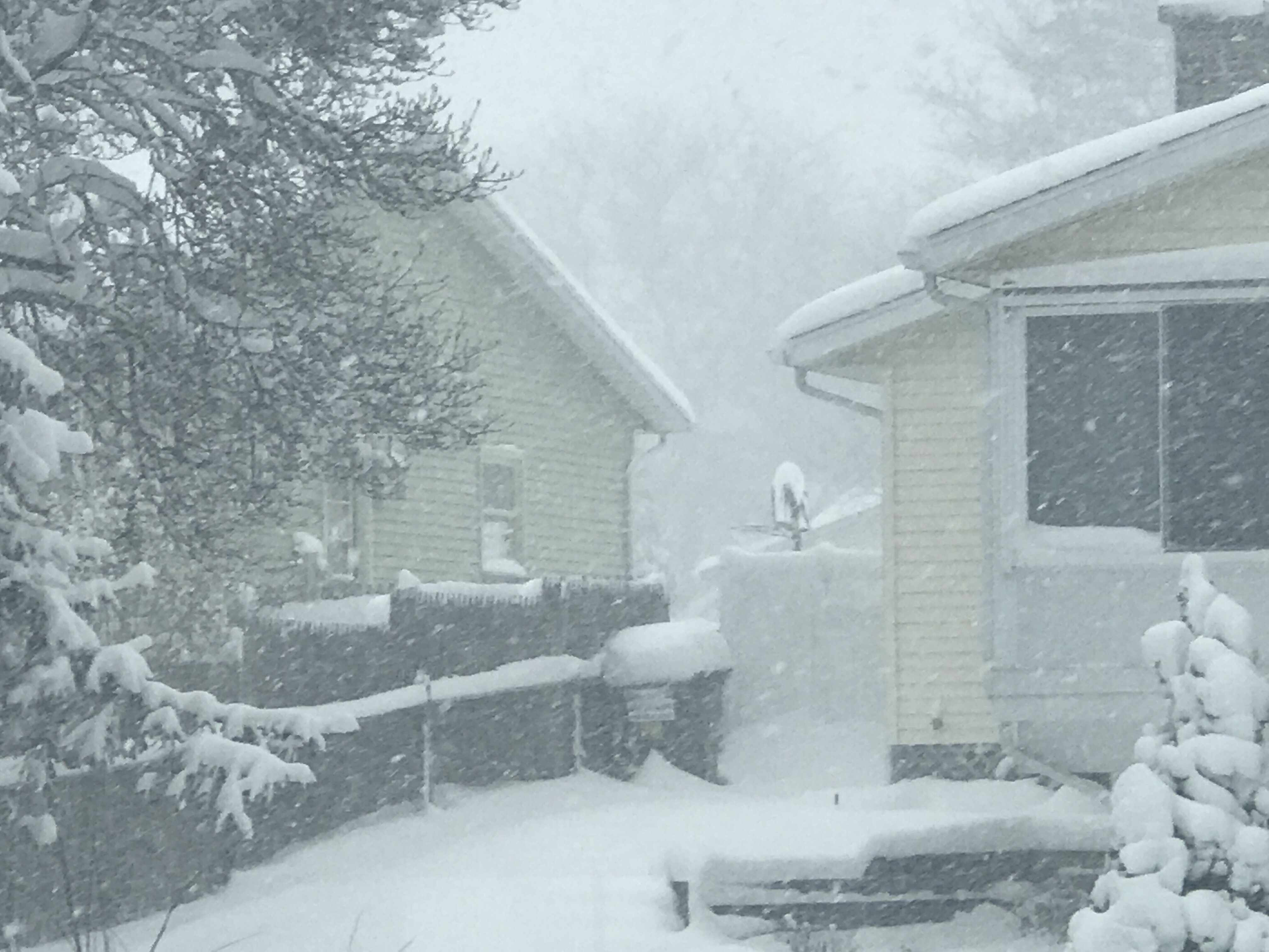
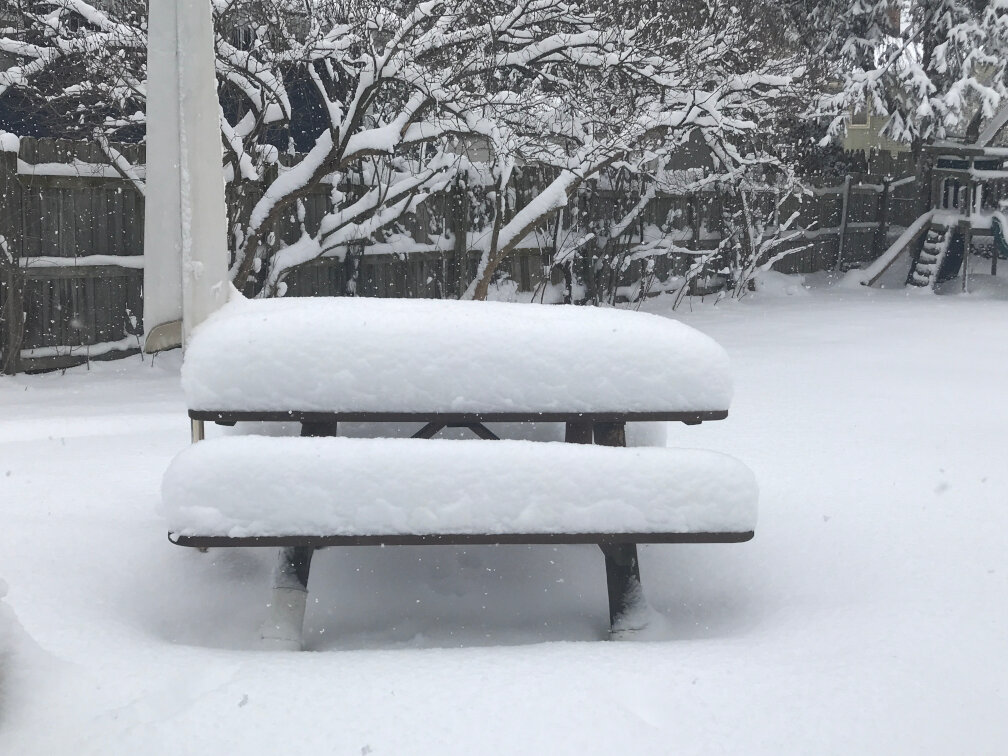
I'm calling it 13.5" here.
-
It should get there eventually. Probably Niles will be hit harder, but a good dominant band can carry inland a bit more even with winds slacking off. The sun just came out here briefly. Flakes totally stopped.
-
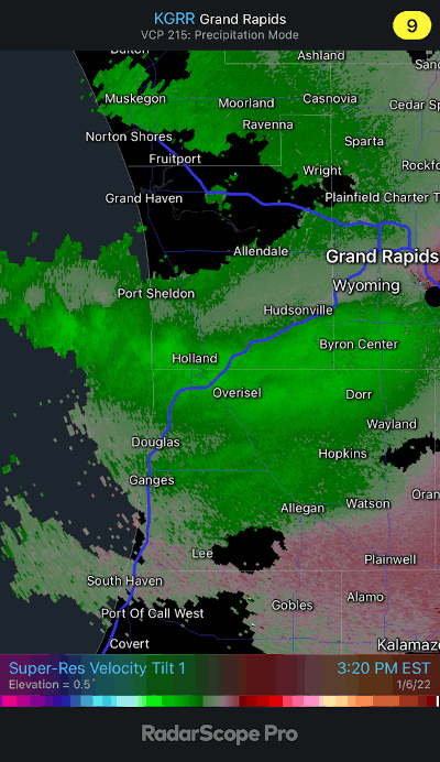
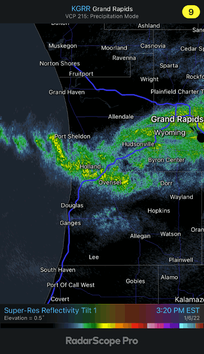
This band is full of mesovortices.
-
Snow hurricane going over Holland.
-
Other than this lake effect the synoptic pattern has been garbage lately. Unless you happen to like the warm sector gales in December.
-
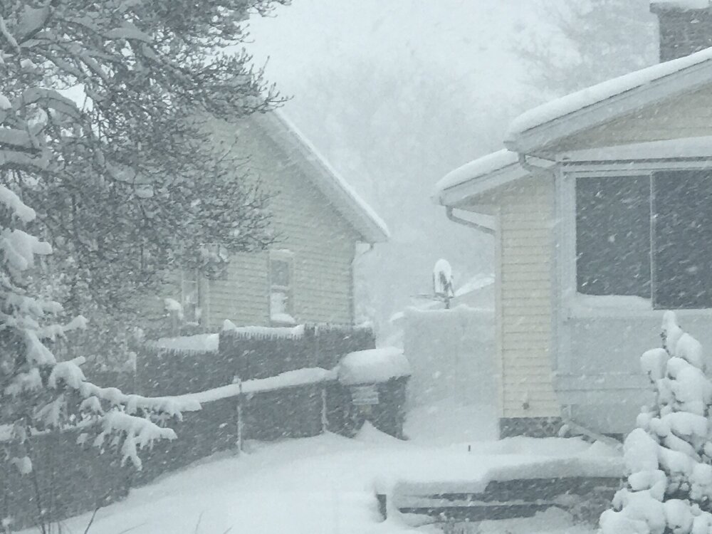
I think GRR is going to pass 14" for the storm total. The back edge is only a few miles to the north and creeping closer, but this current band is putting out a grand finale as it exits. 1-2" per hour rates. Big dendrites. Super high ratios.
-
Absolutely ripping again.
-
We had a couple weeks of decent snowpack last year in early February, but none of the events were bullseyes. It was all 4" events on the fringe of a 10"+ events missing south and east. They just added up because it was cold and didn't melt. Couldn't complain after a lousy December and January. Haven't had a LES event this good since 2014. 2014 was too good to be true though. It was like the late 1970s came back briefly.
-
Standard non-met weenie map trying to please everyone. Many nor'easters spells CAD west of Ohio Valley.
-
I wouldn't be surprised if any areas that manage to got clobbered in both the SW flow event yesterday and NW flow event today/tonight rack up some impressive 2 day totals. This is the best lake effect event in a LONG time here.
-
Closing in on a foot of depth and still ripping here in GRR. Feels good to be able to stop in and flex after such a long stretch of boring weather and covid hell.

-
Michigan moderate risk fail. Happy no power outages, but a big letdown. Not even any good lighting or rain.
-
The orientation isn't good for the derecho the CAMS were showing. zzzz....
-
It seems rare to get such widespread big totals in a midsummer month in Michigan. Usually it's just an isolated streak where a training event occurred. Widespread wetness seems much more likely in September, because that's when tropical systems are often involved.
-
I hope not. I was vaccinated in May. It seems like the low 70s dewpoints combined with wet ground and breezy conditions is doing it. The flowers are intense, but I also catch a whiff of swampy smell.
-
Anyone else notice how the air is unusually fragrant lately with all the humidity and rain? Both good smells and bad smells are really strong.
-
Where is my warm sector? Will be bummed if all this rain falls as boring stratiform shit.
-
Kalamazoo will probably have flooding if the current models play out, which is crazy considering how dry it was there only a little over a week ago.
-
It takes a few days. You probably see greening first happening in low areas where the water could pond. Sloping areas where the water ran off quickly are likely to stay brown. Same for places with little shade near hot pavement. Those are always the last to come back. That's the problem with downpours on top of dry soil. A bunch of the water runs off high areas before it has a chance to get deep into the soil. Gentle rains over several hours irrigate much more evenly.
-
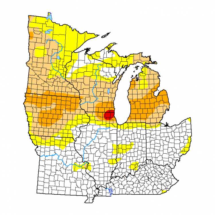
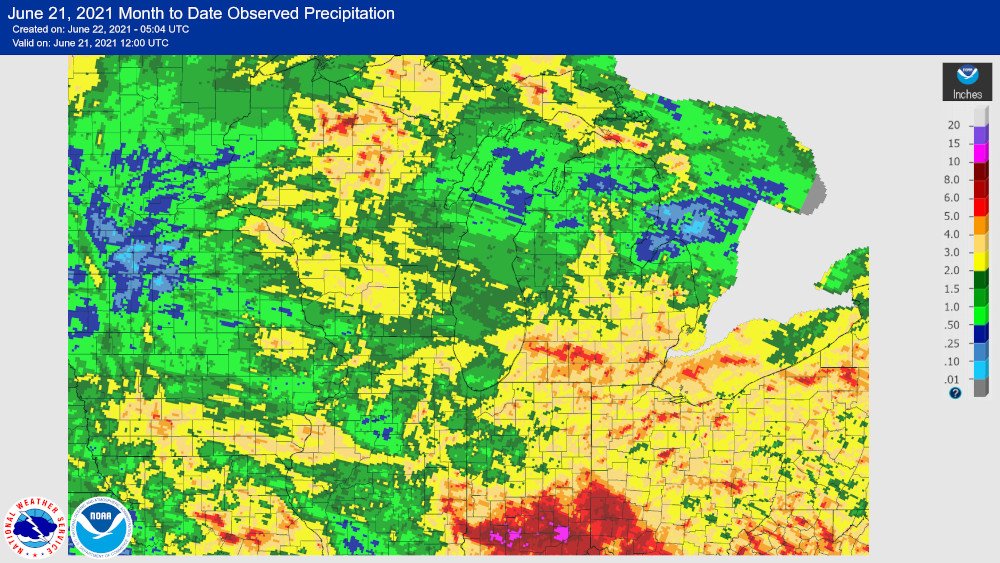
Overlying month-to-date precip on the drought map as of June 17, the biggest screw zones are north central Iowa, most of Minnesota, NW part of Lower Michigan as well as the Thumb area. At least the holes in Illinois and Indiana had rain earlier in the spring.
-
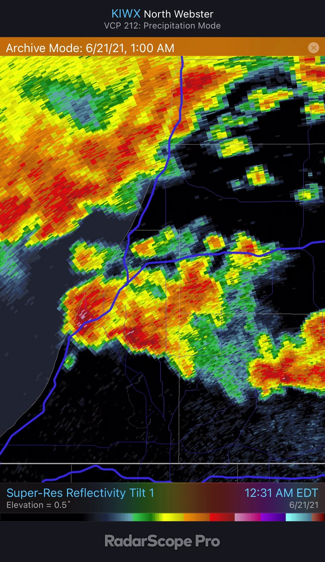
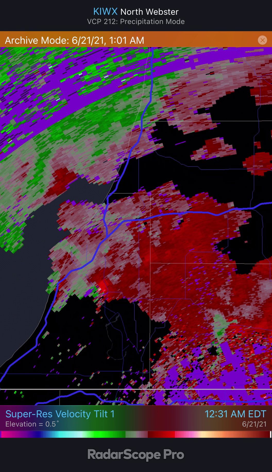
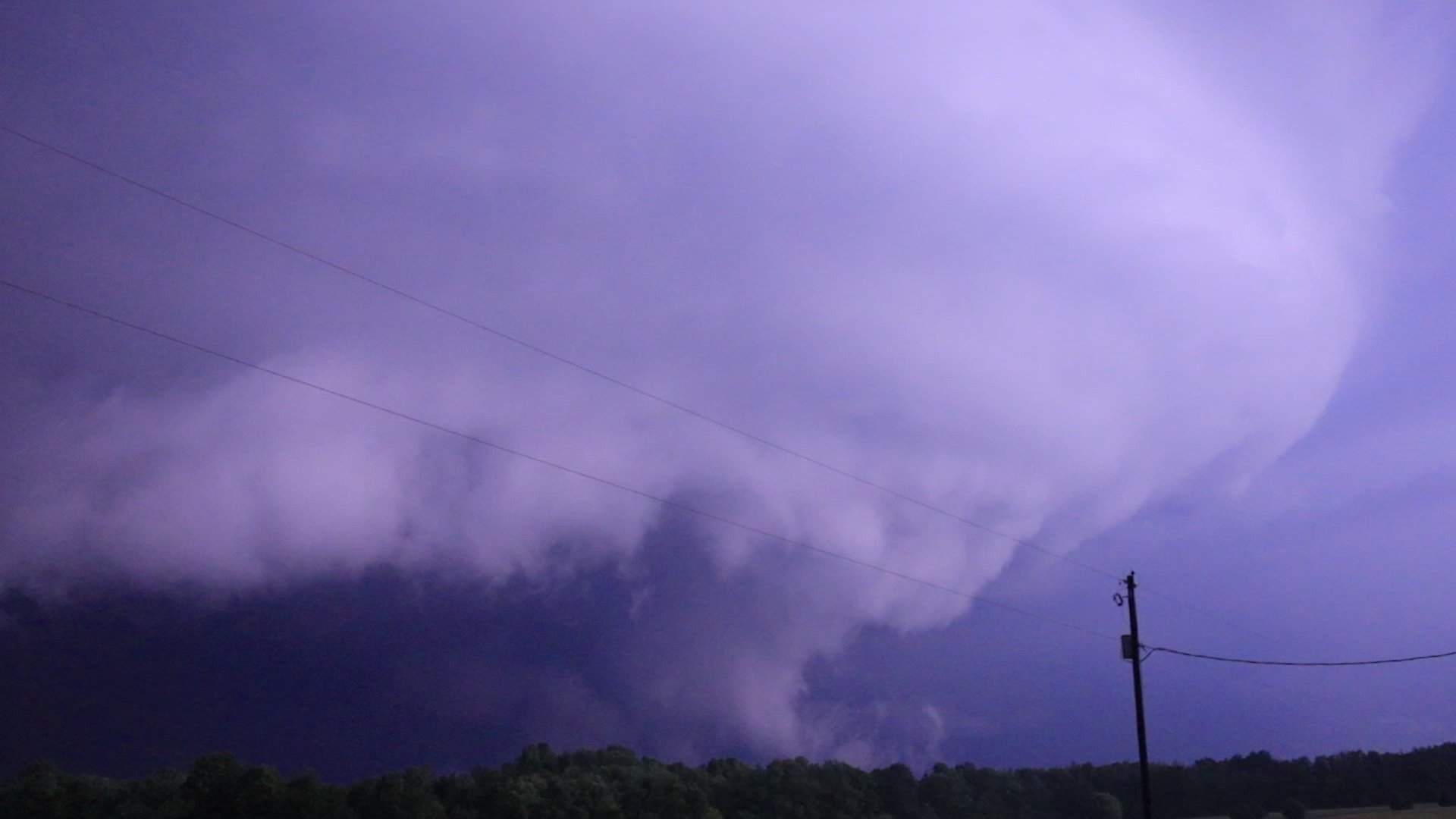
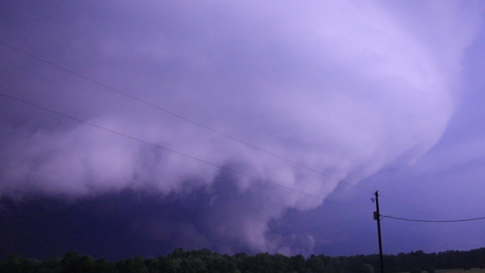
Here's the cell in I was looking at in Berrien county at 12:31 am. Definite hook and small couplet. One pixel is in the 65 mph range, away from KIWX. I don't know if this was ever confirmed as a tornado. If anything touched down it was extremely brief. The scud was ominously low to the ground but it was hard to tell if what I was looking at was the actual center of rotation, or if it was farther back. The scud I saw might have just been outflow from the cell farther west being lifted. The merging of the two cells disrupted whatever was trying to form at this moment. There was definitely decent rotation low to the ground right at that moment though. The internet will probably think the picture is a tornado, but it isn't really a funnel so I can't honestly claim I actually saw anything. The lightning wasn't frequent enough to pick up motion and it was too blinding. It can actually see it better on my camera than I could in person.


-
Yes. It was beneficial rain, just not a drought buster. It's annoying when you just miss the 2"+ totals twice. Kalamazoo is actually soggy now and doesn't need any more rain in the short term.
-
Found an even better frame of the nocturnal mothership near Eau Claire, Michigan. This cell got absorbed into the QLCS a little later. It was only a severe warning when I last looked. Don't know if it had a tornado warning at this point. The scud looked pretty ominous here but it's hard to gauge actual rotation at night.
-
Maybe some graupel showers with thunder to the north tomorrow. October climo in June.
-
LOL. Yes... really. Need to start a thread for June frost accumulations.