frostfern
-
Posts
2,267 -
Joined
-
Last visited
Content Type
Profiles
Blogs
Forums
American Weather
Media Demo
Store
Gallery
Everything posted by frostfern
-
I hope it can come a little farther north next time. Stratiform fringe stuff helps some, but the real downpours keep missing south.
-
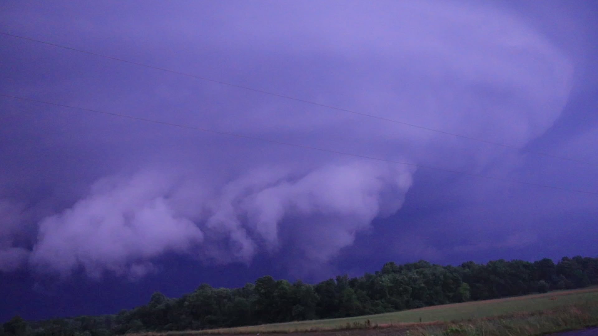
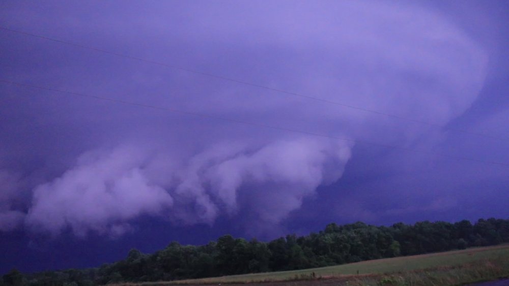
Here's a scuddy wall cloud with circular striations above. This was near Eau Claire, Michigan, just northeast of Berrien Springs. Not the best quality photo, but the best I could get at night. It's a frame extracted from video during a lightning flash. I just didn't have enough time to mess with setting up the tripod. It would have been a cool timelapse.
-
Remind me again of why I don't use facebook except to message friends and family.
-
Is he trying to be the Logan Paul of online weather geeks?
-
Yea. It was horrible for chasing. The evening stuff along I-30 in Indiana was a bunch of "pulse" supercells that were quickly collapsing in wet downbursts 20 minutes later, and also moving really fast. Not to mention the roads are terrible these days. If it wasn't lane closure induced traffic backups on the freeway, it was potholes on the country roads. Also ran into some roads that were just outright closed with no signed detour to follow. Lots of exits closed for construction too. It was pretty maddening. The one cell I had a nice view of out ahead of the QLCS had some cool structure if only it had not been during the night in an area with trees everywhere. I saw some good CGs though, some absolute bombs on camera. That alone made it worth it given how little lightning there has been this year IMBY so far.
-
I drove home right through the second QLCS. I had to slow down to 30 mph at one point on I-96 as I could only see about 50 feet in front of me and was scared of hydroplaning. I was so busy driving didn’t even see the tornado warnings. Just before that I was watching a scuddy supercell base out ahead of the line somewhere near Niles.
-
Yea. Im thinking the southerlies ahead of the MCV overriding the cold pool over southern lake michigan could trigger elevated convection that becomes surface based as it moves east.
-
Its plenty hot here in Niles even with clouds. No lack of instability. Its just a stubborn cap or something. Lack of cumulus.
-
Im waiting near Niles. Hoping activity perks up over the south end of Lake Michigan.
-
Hope there will be supercell potential ahead of the fast crapvection blob in SE Michigan. Its too early for Illinois and round 2 will probably be too late in the day and too far SW to be worth chasing for me.
-
The tail end of the complex in northern Indiana has good rotation.
-
A mesocyclone embedded in a messy QLCS with hail potential is ugly for chasing. If there are discrete supercells somewhere ahead of the line it might be okay. I'd think there will be better supercell structure potential farther west, even if no tornadoes. I just don't know far southwest the secondary outbreak will be. Having to go all the way to south central Iowa from GRR will be a taxing. At least the days are long.
-
The EML plume had a pretty stout cap last night that did screw-zone areas on the southern part of the risk area farther west. It seems like there was enough additional moisture surging up the MS valley by morning for the complex to finally overcome this warm zone and drop south.
-
I saw Kalamazoo got hit with a ton of lightning. Nice 5:30 am natural alarm clock. Didn't know there was wind as well. Storm was lame here. Only 0.5" rain.
-
In my personal subjective experience, "dryness" is more of a comfort factor when the air temperature is below your body/skin temperature... say 75-95 degrees. When it gets to be 100 or above it's unpleasant no matter how dry. A 90 degree day in Denver isn't horribly uncomfortable compared to the same in New Jersey... but neither are anywhere near 115 in Phoenix. High dews are an annoying thing when the temperature is in the 80s, but once you get into the 100s it's more of a choose your poison thing. You might get heat stroke faster if it's 105 with a 70 degree dewpoint, but if it's the same temp with a 40 degree dewpoint you dehydrate faster.
-
I just hope the wealth is shared north and east some.
-
Overnight MCS will make me happy if it can just hold together long enough for a morning CG show. I haven't seen a single CG this year.
-
Boo. I want rain/storms and I want Euro.
-
Cool. I could see the towers way low on the horizon from here on the west side of the state.
-
I will chase if anything good is possible.
-
It can happen if all the trees die and drop their leaves. That's where it'll be by August here if this bullshit pattern doesn't change.
-
Lake MI Shield prevails once again. Typical with a weak-ass afternoon cold front. What happened to warm fronts? Not even one this summer. It's the only way to get precip here in the lake shadow.
-
Screwzone here again. Need a warm front to bring rain. Cold fronts never do it with Lake Michigan suppression.
-
It won't happen in June for sure. Nothing significant this year except dryness and boringness.
-
It's better than nothing, but afternoon pulse stuff here isn't really cutting it. Areas outside the natural terrain/like-breeze convergence zones are repeatedly screwed out of rain despite random thunderheads nearby every day.