-
Posts
1,984 -
Joined
-
Last visited
Content Type
Profiles
Blogs
Forums
American Weather
Media Demo
Store
Gallery
Everything posted by frostfern
-
I'll take some to keep things lush. At least it's in the upper 50s as opposed to the upper 30s.
-

2023 Short/Medium Range Severe Weather Discussion
frostfern replied to Chicago Storm's topic in Lakes/Ohio Valley
Miss south stank season. -
If you pave a road, maintenance becomes more important. Everyone automatically starts driving faster and potholes in pavement are like 10 times more likely to cause sudden tire blowout.
-
Would be "mercy hole". The sun was actually poking through earlier. Now its back to cold and gray with a pathetic drizzle you can feel on your skin but can't really even see with the naked eye.
-
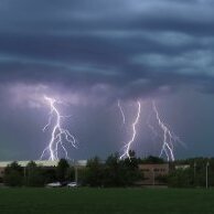
Spring storms in Michigan are often hidden by layers of frontal clouds. Summer is when you get the blossoming distant towers with clear conditions for miles around. I got video of a really good frequent IC display as a backbuilding complex slowly slid off to the S and SE in late August 2019. This was one of the best ones I have seen on this side of the state. https://youtu.be/YL4YWlq-bwg
-
Recent years there have been long t-storm droughts from mid-June into late July where everything gets brown. That annoying super-amplified plains ridge where every MCS just dives straight S from northern Minnesota into Illinois and the cold fronts all come through dry east of there. It the late spring season is a dud it often doesn’t get interesting again until August.
-
Its funny how “torch” can mean mid 50s and showers if it happens in a snow month. Only here.
-
The sun angle would do something for us if that dumb blocking upper low would stop slinging the turd weather south from the arctic.
-
Yea. Pretty much the same type of pattern that causes waterspouts causes lake-effect graupel showers here. The spring variety corn-snow seems to happen at colder temperatures and is a bit smaller in size from what I've noticed in this area. Strong afternoon sun turns a wet snow squall into a graupel shower. There's also a phenomenon called the Puget Sound Convergence Zone that sometimes causes graupel with thunder and lightning in the Seattle area. Landspout type tornadoes happen on rare occasions too. I think copious graupel is the most common with high elevation summer thunderstorms. I've been camping out west before where several inches of graupel accumulated during a thunderstorm.
- 512 replies
-
- 1
-

-
There was something in Kamchatka. Destructive ash fall, but it's a minor event climatologically. Mt. St. Helens had a very very small effect and this was quite a lot smaller than that. People don't realize the magnitude you need to have an actual impact.
- 512 replies
-
- 1
-

-
It's pretty common in the fall here with the first super cold 500mb low crossing Lake Michigan.
- 512 replies
-
- 1
-

-

Spring 2023 Medium/Long Range Discussion
frostfern replied to Chicago Storm's topic in Lakes/Ohio Valley
Chop 20 off that week and add +20 to this week I'd be happy. Annoying to go from low 80s to upper 30s. Rest of the month looks bleak. -
The heat index combos were pretty incredible during the July 1995 heatwave, but other July's have been quite a bit hotter overall. Don't quote me on it, but 1988 and 2012 had hotter July's I think. Even July 2018 was very warm, even though it didn't have any heat waves or daily records broken (maybe a high low or two). That was more just high humidity and a lack of good cold fronts.
-
That's crazy. Funny what can happen when the west wind is strong enough to shunt the marine layer offshore. There's quite a w-e gradient here. I'd actually be very happy with upper 50s and low 60s this time of year as that's what makes for a good flower season. Can't really complain, but prolonged summer-like temps always seems to screws things up here if it happens before early May. There's always that late freeze.
- 512 replies
-
- 1
-

-
It seems like black flies don't really take notice until you start to sweat. Like if you try to do landscaping or anything that requires hard sweaty work in the dirt they absolutely maul your head, like behind the ears, around the eyes, etc... Fleas and gnats are most annoying at night IMO. In places with no screens you try to read or use your laptop at night they see the light then come in and bite. They don't always bite, but sometimes just seeing them makes me start itching.
- 512 replies
-
- 1
-

-
Before the Morch, it used to seem like all those old records from the mid 20th century were impossible to beat. It's still hard to beat a lot of summer records though, despite a warming climate overall. Seems like it's harder to get the heat without the humidity these days. To really smash records you need a dry heat, more often than not. July 1995 did both heat and humidity, but that was about as unusual as Morch 2012.
-
Yea. Black flies are obnoxious. I react to them way more than mosquitos. Even if they only bite one tiny spot, the whole area will erupt in itchy hives. They go for the head and face way more than mosquitos too. I spent the spring in Vermont in my younger days. One warm day in May they all come out at once.
- 512 replies
-
- 1
-

-
27 degree 850s would equate to triple digits at sea level. The low level jet is pushing it east, but April sun angle isn't quite the same as June or July. It's a little harder to mix it all down.
- 512 replies
-
Funny having flood warnings and red flag warnings at the same time. It's windy but the dewpoint isn't as low as it could be. Conifers do torch pretty easily this time of year though, regardless of humidity.
- 512 replies
-
That must be incredibly heavy. It's like summer mountain snow at this point. What like 150" of powder all compressed down to 30"?
- 512 replies
-
The stable layer might be shallower some places due to where standing gravity waves set up. The supercell itself was cyclonic, so the anticyclonic tornado was probably displaced from the main mesocyclone. I think the reason elevated supercells don't usually produce tornadoes is the fact that the low pressure in the center lifts up the stable layer similar to how a hurricane storm surge lifts the water surface. This makes the inflow above the stable layer more sloped as opposed to the abrupt rising motion you get under a surface based mesocyclone. But if you have an anticyclonic circulation it's probably not directly in the center of the main mesocyclone. I recall the El Reno tornado of May 31, 2013 produced at least one anticyclonic tornado displaced quite a ways from the main tornado.
-
I would love to see a writeup on this.
-
30 day precip here is now around 8.0". Definitely excessive for a pre-leafout month. Wish some if this moisture could be saved for July when its almost always drying out around here.
-
The river here is the highest it's been since late April 2013. Thankfully it will have time to work its way down during the dry period coming up. A training MCS later in the month could bring the high water right back though. A 4-5" convective rain event on top of already wet conditions is what put things over the top in 2013.
-
Nice to have a sunny day finally. My lawn puddles are finally gone this afternoon, and daffodil tips are showing themselves many places.
- 512 replies
-
- 1
-


