luckyweather
-
Posts
637 -
Joined
-
Last visited
Content Type
Profiles
Blogs
Forums
American Weather
Media Demo
Store
Gallery
Everything posted by luckyweather
-
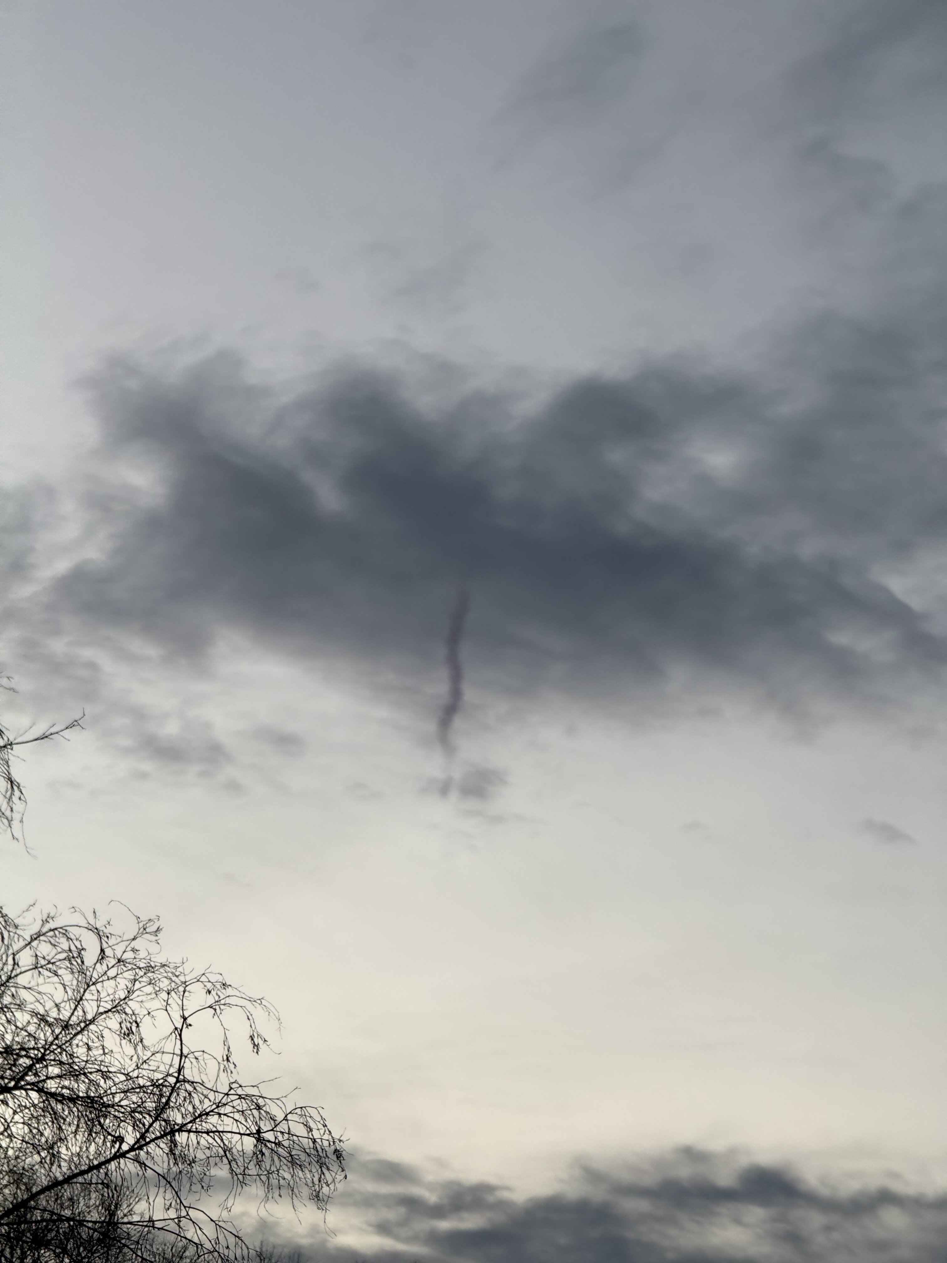
Smoke induced convection, new one for me.

-
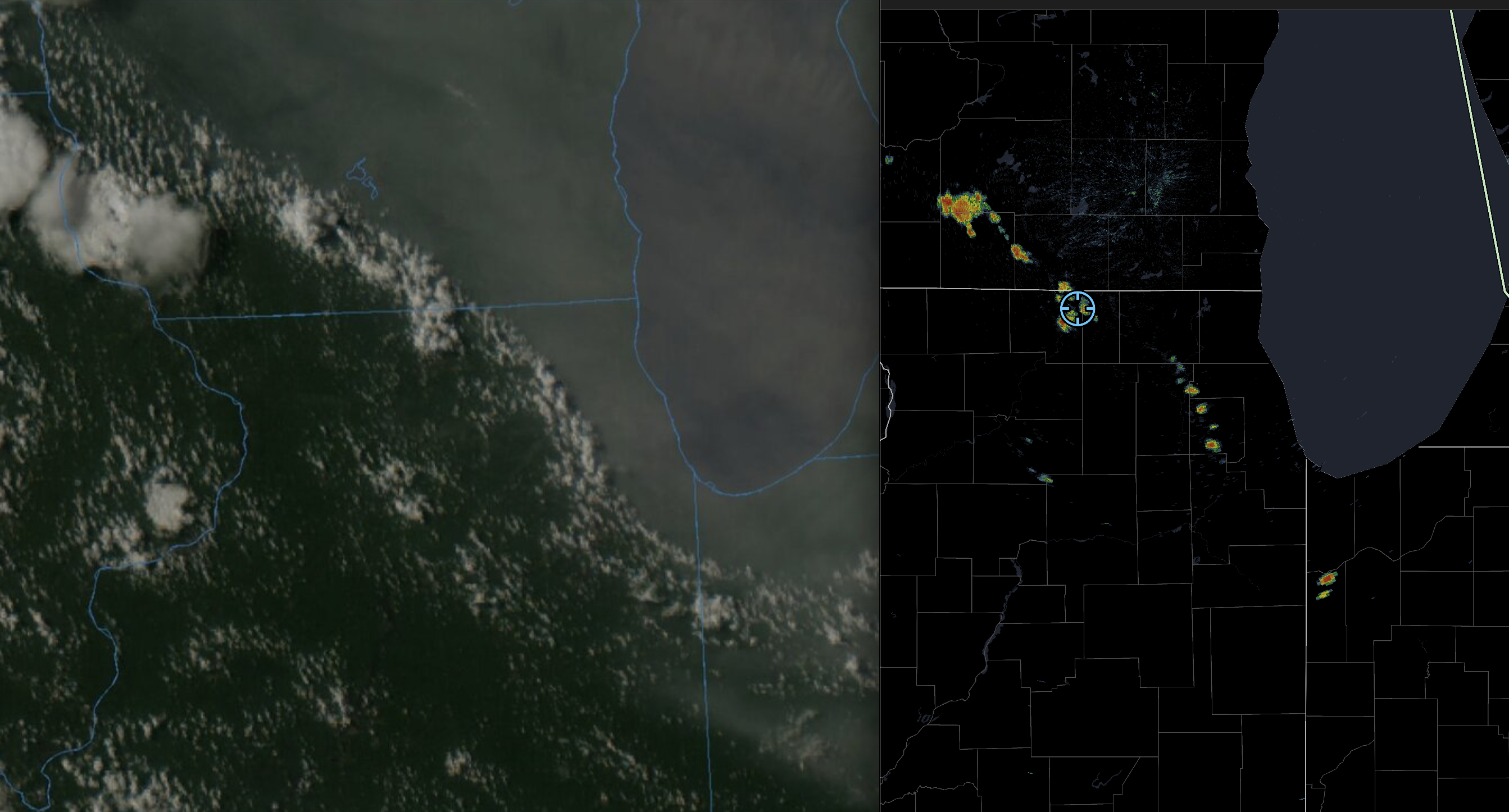
leading wind as the line approached ne of Rockford was pretty impressive. anemometer is busted so no substance to that other than “it was effin windy”. rotation south of Beloit, looks like it just got warned.
-
AL 2011 was 4 to 5 sigma, IL 2026 is 3.9 to 4 sigma. KS 08 was ~3 sigma and TX 15 was ~2 sigma. Your instinct was on point, AL11 is still the king, IL26 in 2nd place. there's still time lol
-
AL in 2011 with 146. “Padded” with 62 on April 27. KS in 2008 had 187. TX in 2015 had 244. Still a few outbreaks away from touching that in IL.
-
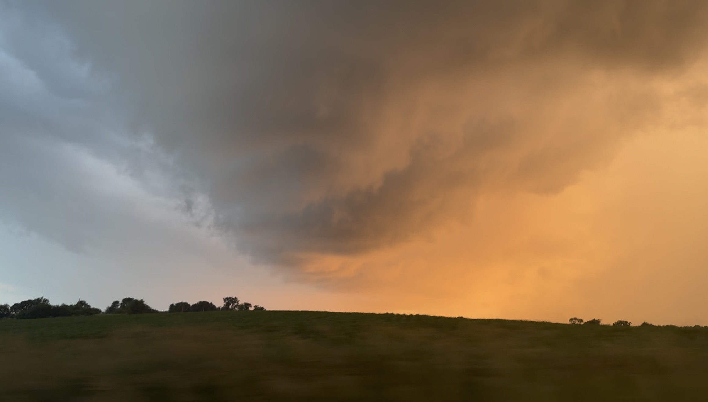
Still from video I took of the warned rotation in the notch in SE Rock County WI around a half hour ago, the greened up corn + the sunset made it majestic.

-
now ilx has it with Pana polygon
-
supposedly tog Palmer, IL outside of the Taylorsville, IL warning polygon.
-
92 stl 60 pia is just so wild to stare at in late June.
-
haven’t read this am’s and yet but yesterday pm lot afd ack’d this and basically said the strength of the low may aide in overcoming this
-
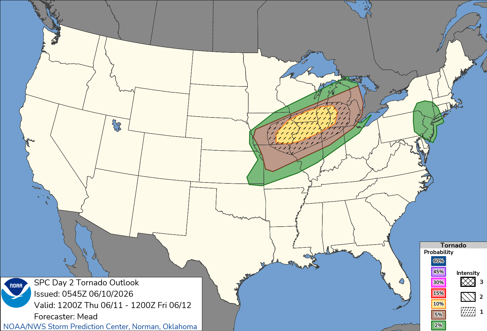
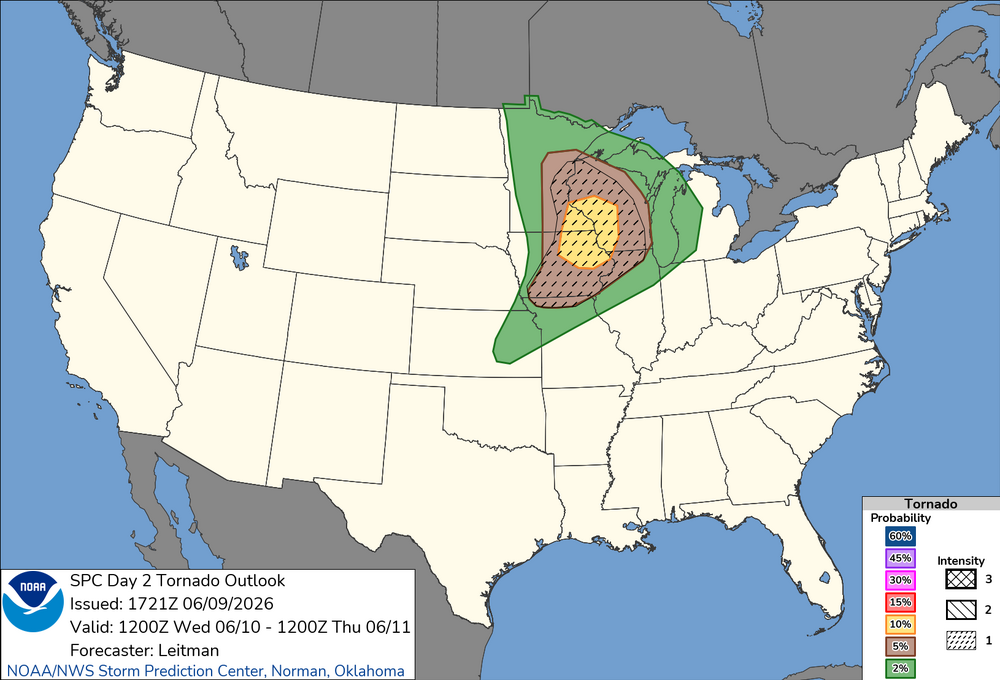
overnight d2
-
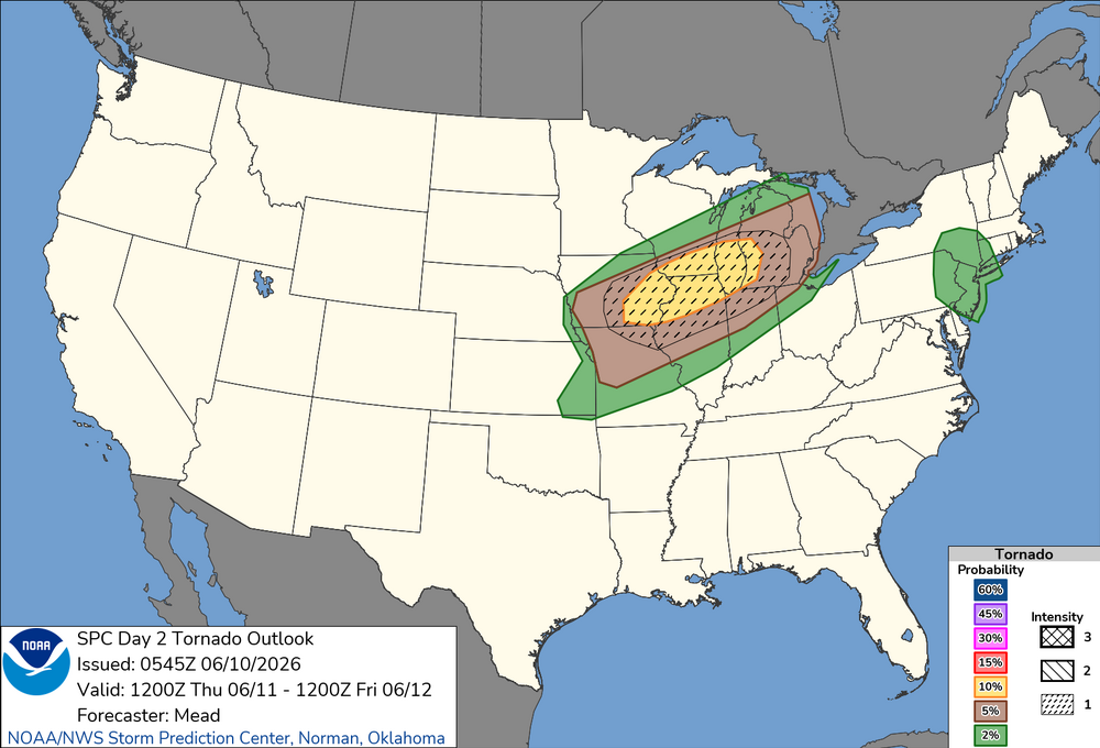
New D2 Tor Outlook. Seems like SW WI always gets the bullseye these days.
-
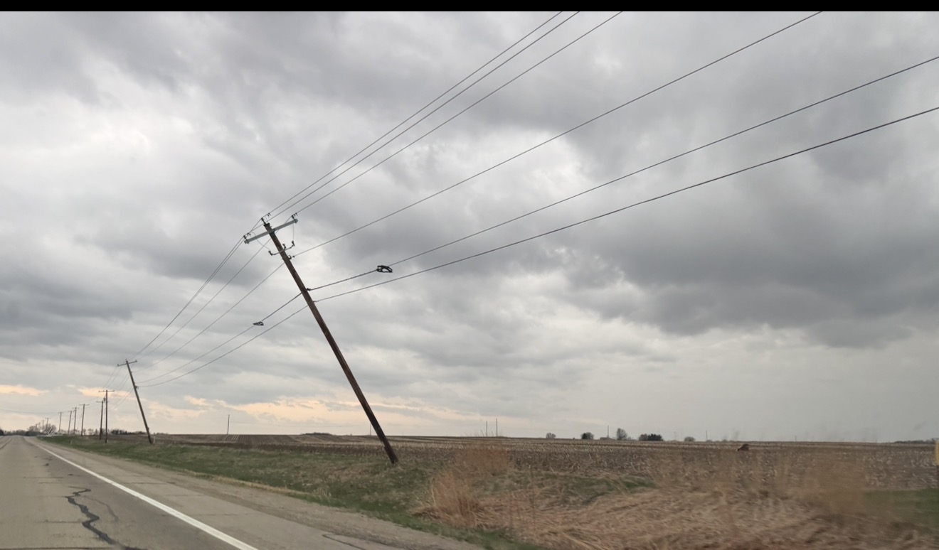
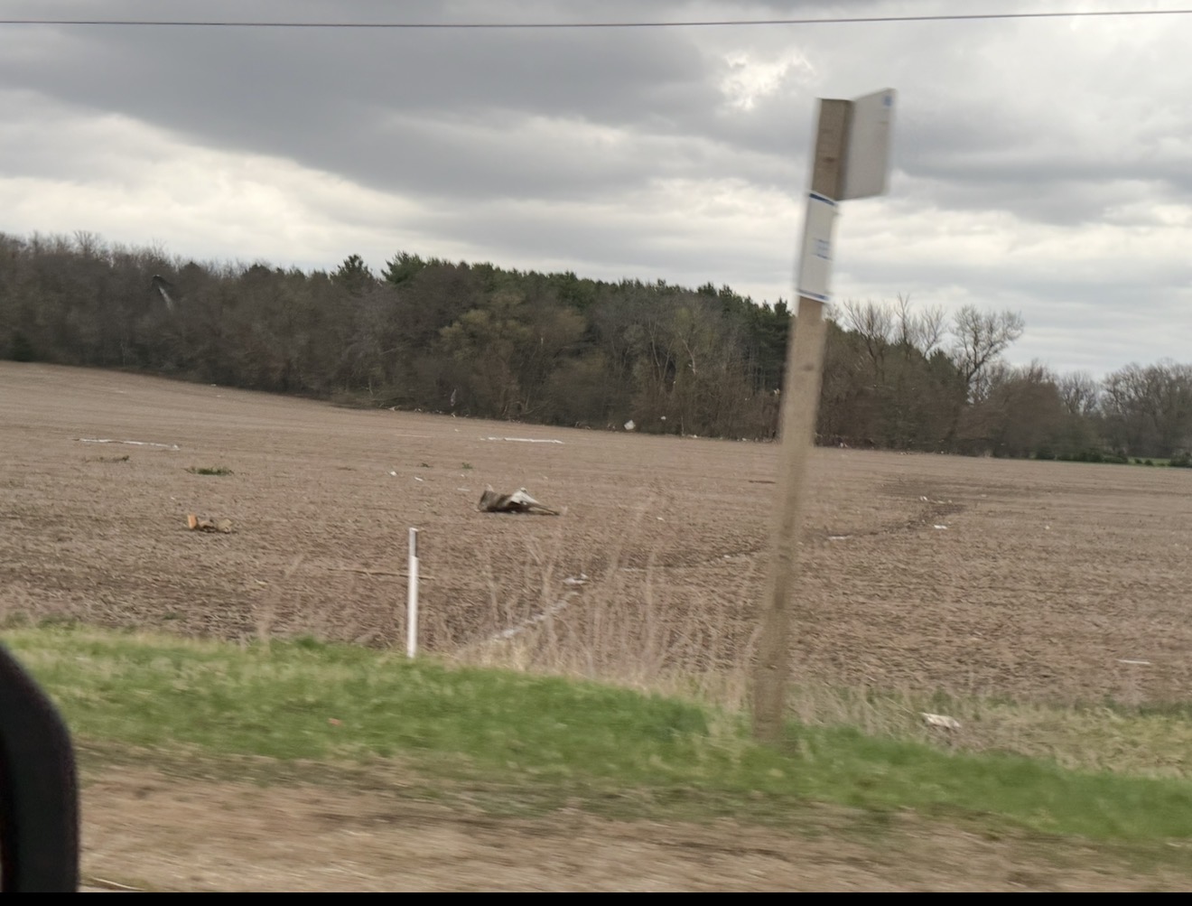
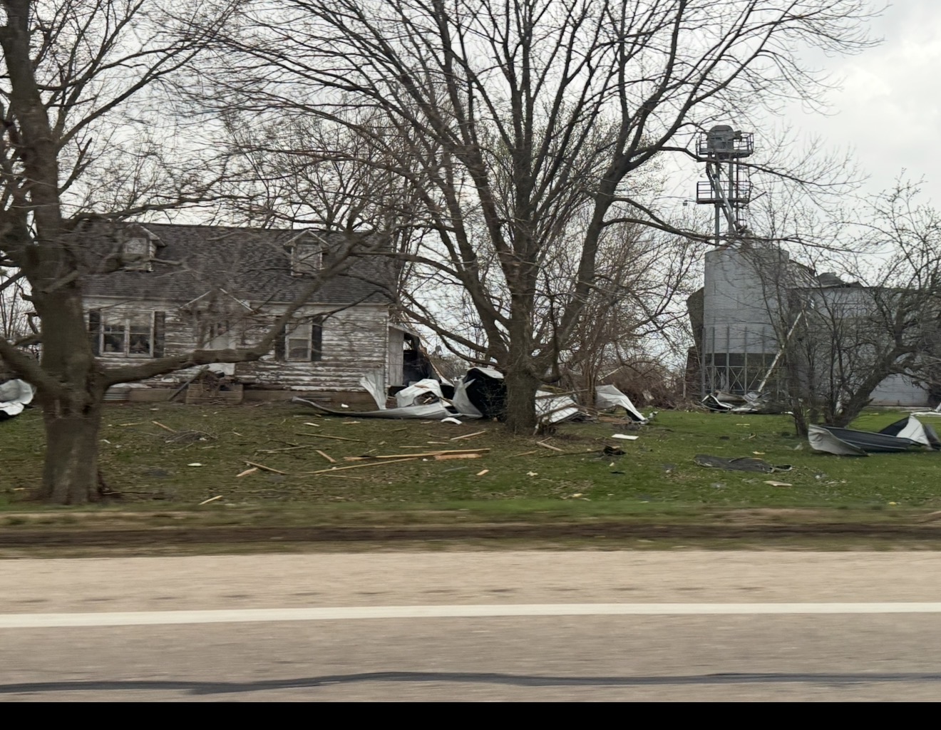
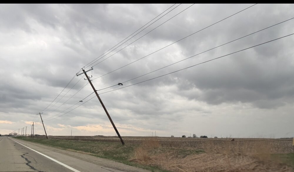
4th times the charm here between Roscoe and Rockton. All 4 roads in and out of my hood are closed, trees and power lines littering the roads. No power, no internet, partying like it’s 1899.
-
Damn man, close call there. Saw it hit from water tower webcam. Was legit. Looked like it was swallowing the town.
-
as of now if you target S. WI seems like platteville -> msn -> west bend is where I’d set up shop. probably platteville and watch development from there.
-
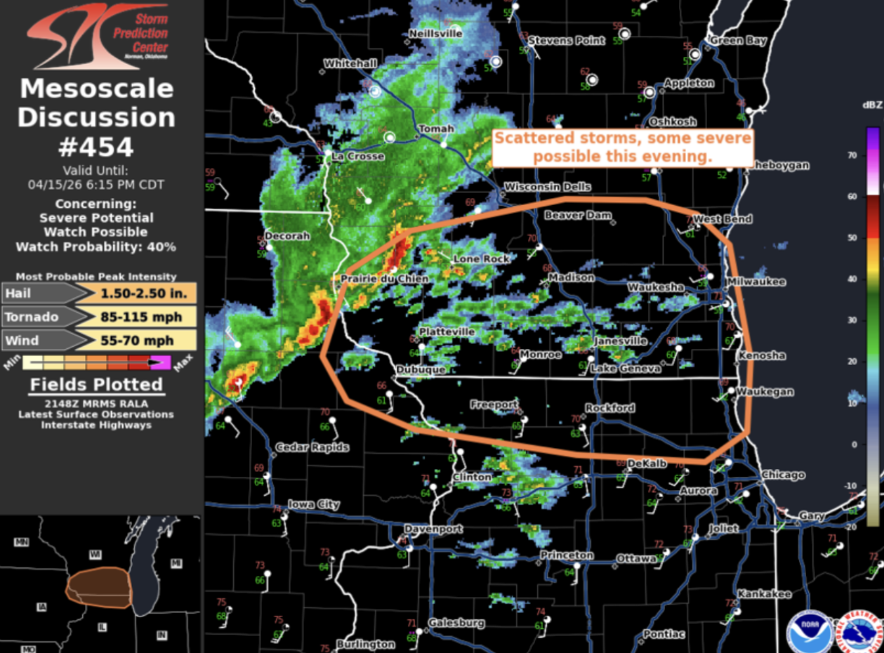
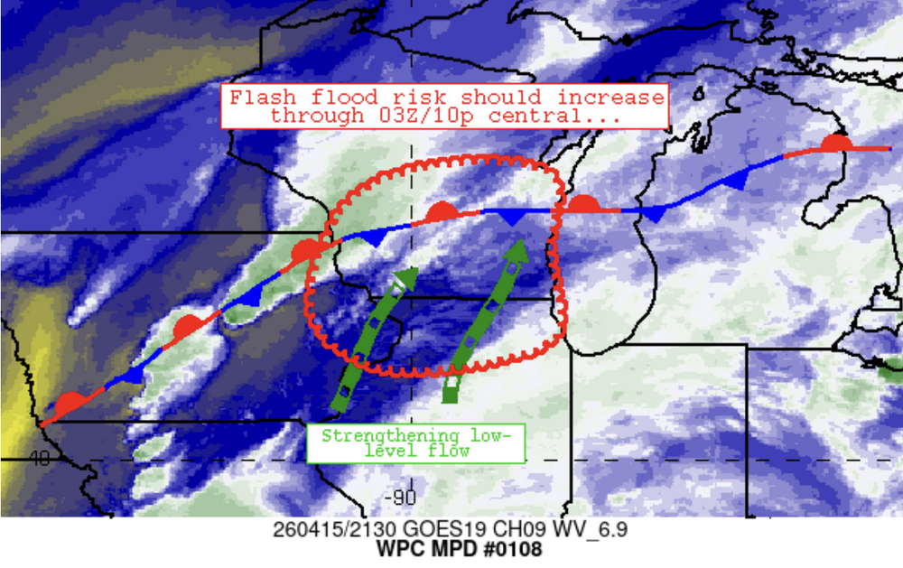
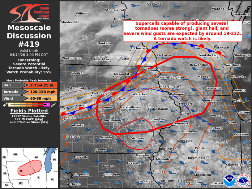
WPC md out for our leftovers tonight edit: maybe more than leftovers for the lucky. With adequate destabilization taking place, ongoing storms over northeast IA will likely continue eastward. These storms have shown some organization into linear segments and at least weak storm scale rotation already. Additional storm development (possibly more discrete) is likely ongoing across northern IL. With storm coverage expected to increase with time, a severe risk appears plausible. A WW may be needed.

-
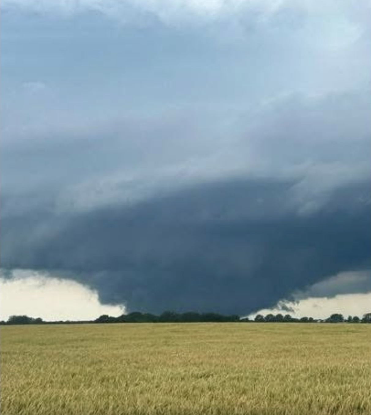
SE of Madison around 6:30 just after the first cell went through. I’m not 100% certain if this was from today’s cell or an earlier storm as there was a notable lack of water on the road.


-
DISCUSSION...The latest surface analysis depicts a quasi-stationary boundary extending from central/northern IA into southern/central WI, with an additional composite outflow boundary farther south from northeast IA into northern IL. Over the next few hours, continued diurnal heating of a moist air mass (upper 60s dewpoints) should erode remaining inhibition at the base a substantial EML, resulting in the development of strong surface-based buoyancy (upwards of 3000-3500 J/kg MLCAPE). As this occurs, initial thunderstorm development is expected across parts of central/eastern IA near the intersecting boundaries by around 19-22Z -- aided by a subtle frontal wave tracking eastward along the quasi-stationary boundary. The strongly unstable air mass coupled with 40-50 kt of effective shear will favor rapid thunderstorm organization/intensification into semi-discrete supercells and organized clusters. Initially, very large to giant hail (2-3+ inches in diameter) and severe wind gusts will be the main concern with potentially splitting supercells -- given a mostly straight hodograph. However, a south-southwesterly low-level jet will strengthen across the area later this afternoon into the evening and likely favor a transition to dominant right-moving supercells with a quickly increasing tornado risk. The strong buoyancy and 200-300+ m2/s2 effective SRH will support strong to intense tornadoes with any longer-lived supercells, along with a continued risk of giant hail and severe gusts. Eventually, thunderstorms may have a tendency of growing upscale into clusters with eastward extent, which will yield an increasing risk of damaging wind swaths.
-
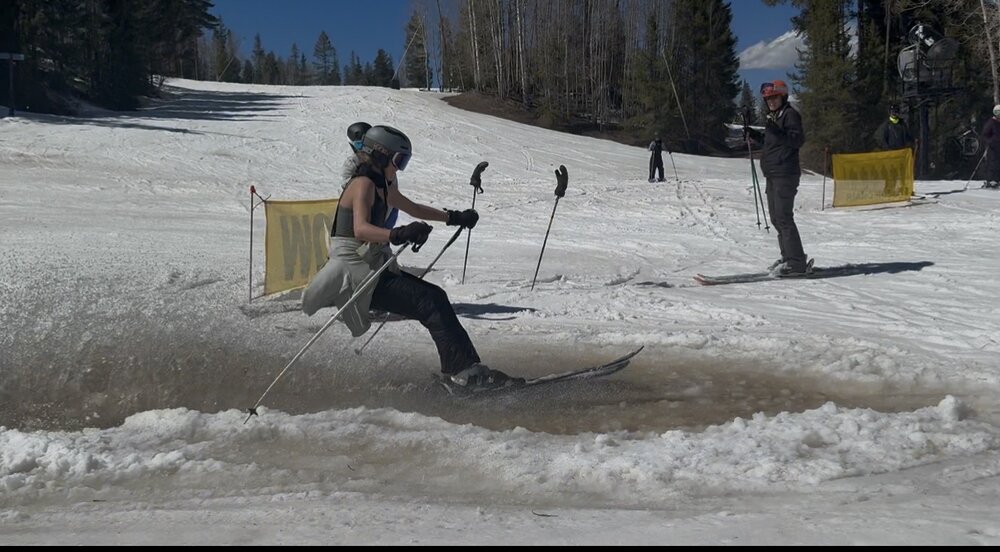
pretty brutal situation in Colorado, granite peak in WI has a substantially better base than the CO Rockies resorts. My kids were doing unsanctioned pond skimming in the random ponds that were forming all over Vail last week.
-
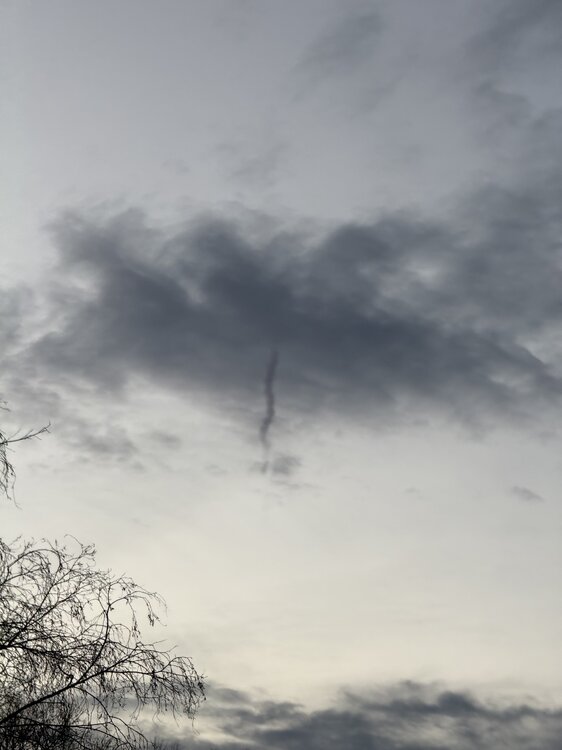
cold air funnel on my bike ride just now. surreal atmosphere, pockets of dense fog at ground level, would ride through sections where it was like a space heater was blowing on me, and then flip to chilly.
-

Winter 2025-26 Medium/Long Range Discussion
luckyweather replied to michsnowfreak's topic in Lakes/Ohio Valley
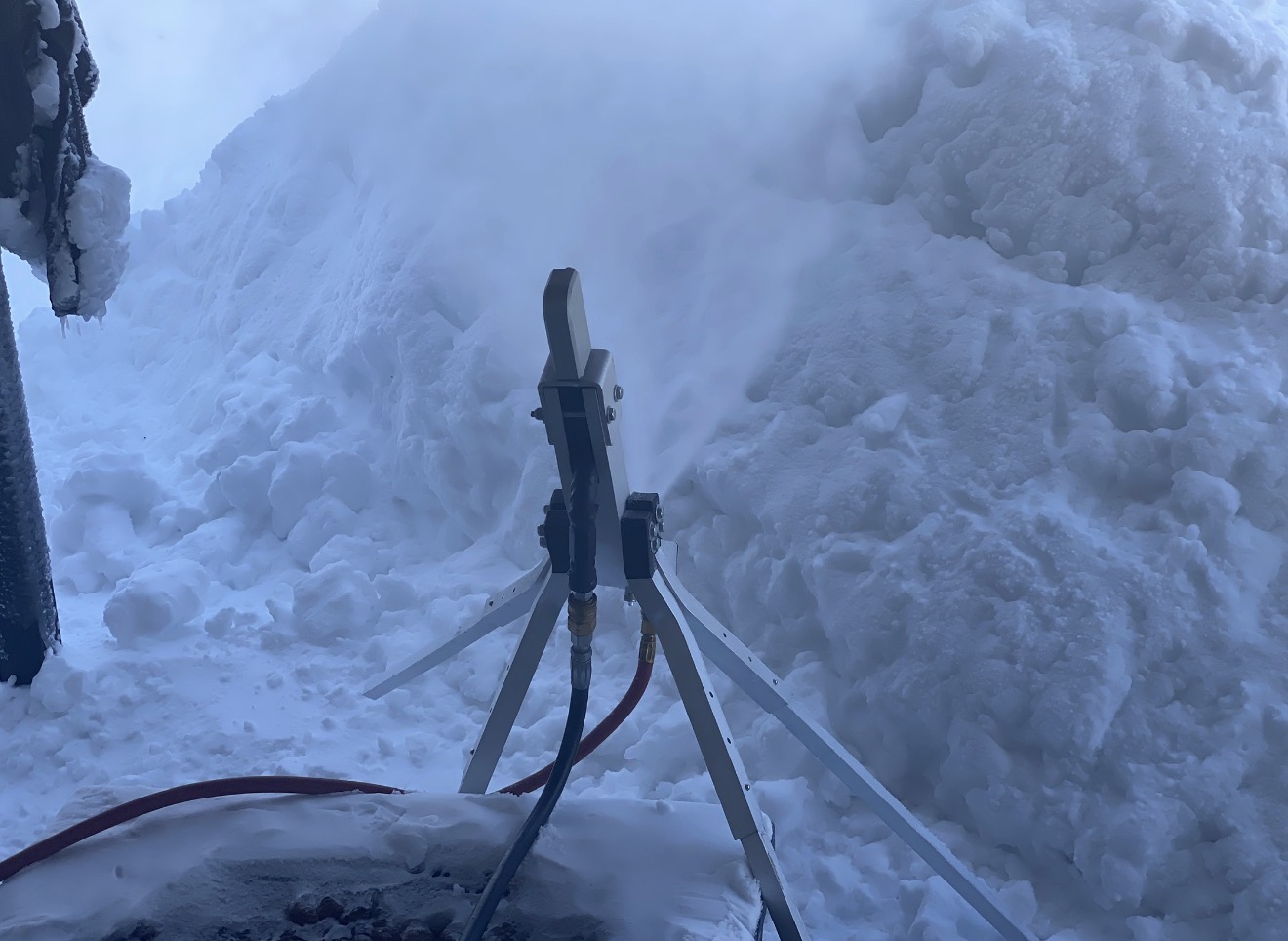
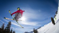
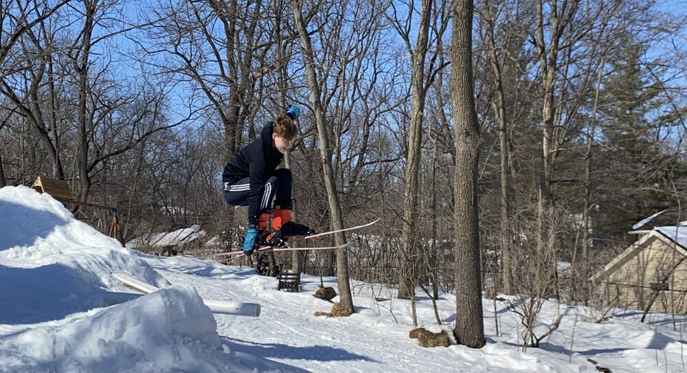
I’ve been building a backyard terrain park for the past 6-7 winters and have a backyard snowmaking setup with two snow guns. I cover about 1/3 acre with a 24” base or so and then build a 10-12’ tall drop in and some big jumps. Have a couple box rails and some jibs and ramps. I usually start in October and then just fight it out with rain and warmups like the past few days trying to keep my base and then I start rebuilding, usually call it a season around March 1. My kids of course love it and it’s a family tradition but also all the neighborhood kids. Not a whole lot of kids learning to ski these days but that is absolutely not the case on my block. Every kid has skis or a snowboard so they can jam in the park all winter. Very proud of my little micro contribution of the next batch of winter lovers.

-
Winter 2025-26 Short Range Discussion
luckyweather replied to SchaumburgStormer's topic in Lakes/Ohio Valley
I'm only going to pay attention to Chicago Storm started threads this season. Have to acknowledge there's an element of magic ✨ in all of this.
-
getting some steady mood flakes at my office in River North
-
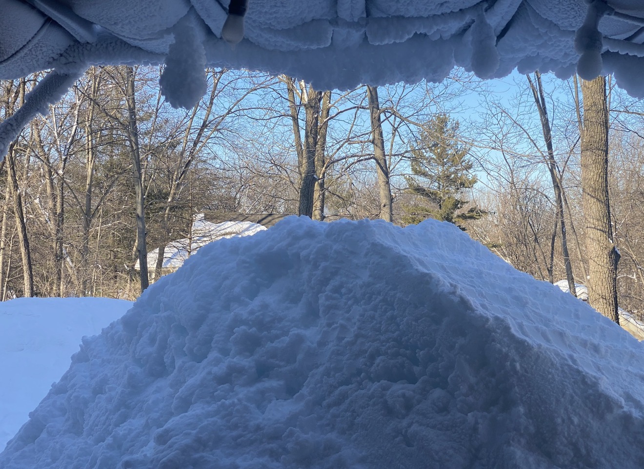
Hard to feel good about the trade off imby coming off a 14.1" snow season (RFD).
-
11/8-11/10 First Snow and Lake Effect Event
luckyweather replied to Geoboy645's topic in Lakes/Ohio Valley
Hey man, I know you and the team are literally doing this unpaid right now, yet you’re still in there grinding. Just wanted to say I appreciate you, sincerely.