It's Always Sunny
-
Posts
1,947 -
Joined
-
Last visited
Content Type
Profiles
Blogs
Forums
American Weather
Media Demo
Store
Gallery
Everything posted by It's Always Sunny
-
Rightfully so. You need to copyrat I mean copyright that!
-
Just checked it out. It's apparently legit lol. I may throw my hat into the ring for Dallas snowfall. I'll set the bar real low so everyone can feel better about their totals.
-
Based on some research I did, early SSWs tend to favor snowfall here in Dallas but I wonder how it fares for you fellow New Englanders. I did some digging and early SSWs appear to correlate with below normal snowfall for KBOS.
-
Yeah Boston and areas just inland are around 11:1 roughly. Here is the chart: http://www.eas.slu.edu/CIPS/SLR/slrmap.htm
-
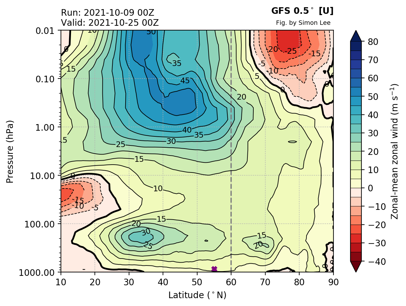
Some activity of interest in the stratosphere...

-
-
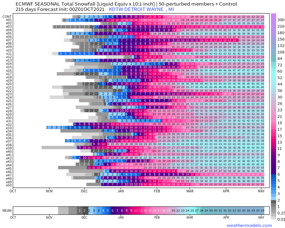
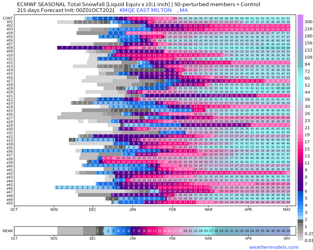
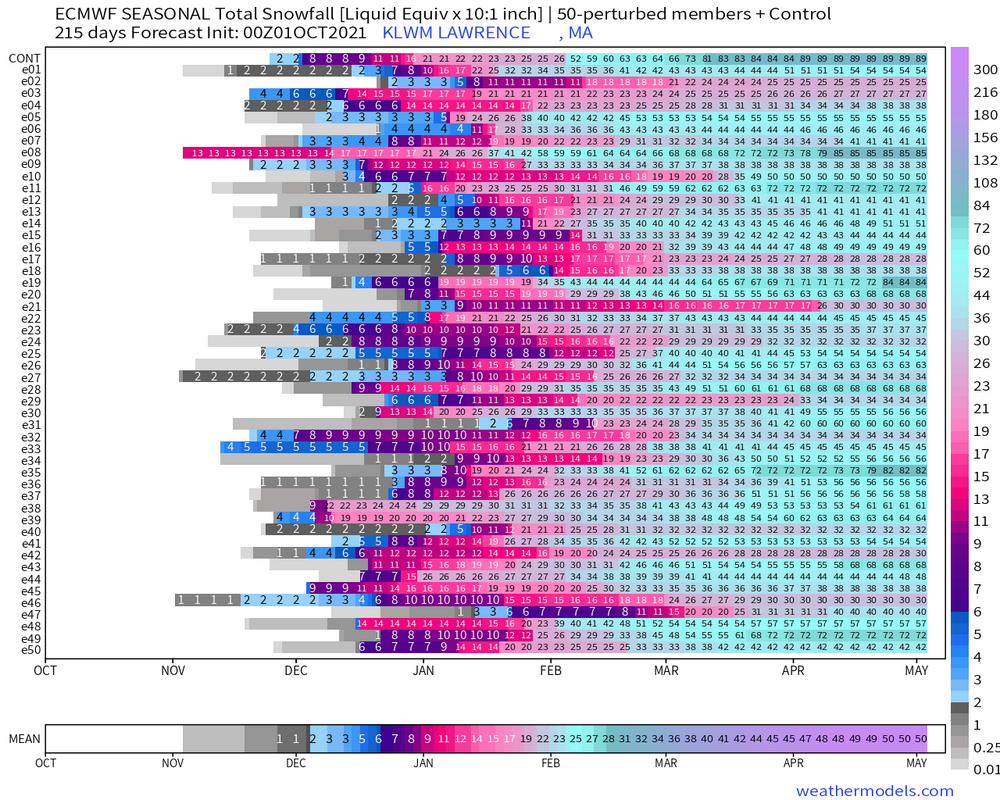
I can't seem to locate this graphic on weathermodels anymore. Anyone else know where to find it? I thought it was in the same place as the city charts in the Lab.
-
Plymouth, NH has 80"
-
I'm offended. I was at Trillium last Saturday you can see BHO right from the brewery is was awesome. Perfect weenie drinking spot.
-
Norwood has 36" Yeah Concord has 70" Nashua with 50" also, same as LWM
-
Toss Blue Hill. Not a rattah but nearly half of their normal seasonal total.
-
-
3" in KPHX is cuter.
-

General severe weather discussion
It's Always Sunny replied to Quincy's topic in Central/Western States
Southerly trend of LP seemingly improves the wind fields across N TX & E OK.
-
I’m in and out on the New England forum and have seen that reference before…what’s a rattah?
-
I disagree. November 2020 500mb height anomalies showed no precursor of what would come in February. If anything, it shows a strong TPV. There's way more to it than just looking at 500mb height anomalies to determine how a seasonal forecast will play out. There are still indications that the PV will be weaker than normal. That hasn't changed despite ECMWF's SEAS-5 recent output.
-
General severe weather discussion
It's Always Sunny replied to Quincy's topic in Central/Western States
Not sure who he/she is...not a good reputation? -
Southern Plains Winter 2021-2022
It's Always Sunny replied to Iceresistance's topic in Central/Western States
Too early to put stock into this but based upon my teleconnection analyses this forecast holds some merit.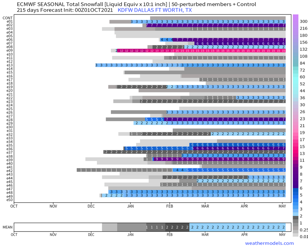
-
General severe weather discussion
It's Always Sunny replied to Quincy's topic in Central/Western States
Your images don't seem to work (at least on my computer), but yeah not too often you see a 30% issued this far in advance during second severe season. 30% contour is a very defined area personally I'm a little surprised they are issuing something that specific this far out. I thought they'd keep the 15% through at least today. -
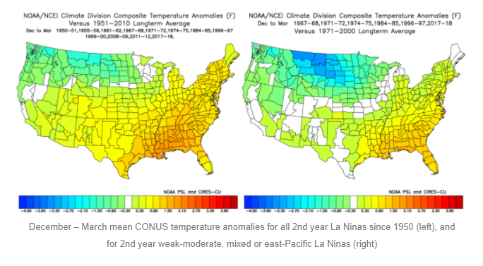
Great write-up, Jim. I haven't analyzed Modoki La Ninas as much as you, Ray and raindance have (I've been looking more into the MJOs influence on us here in TX which generated some interesting findings), but if I am understanding your blog correctly, for us here in TX, a 2nd year, weak-moderate & mixed-east based La Nina could further support the idea of "cooler" temps, correct?
-
Pretty difficult forecast for N TX today. Models haven't been in too much agreement on timing or areal coverage. Morning cap has eroded with a decent cu field on satellite. Dry line off to the west should also serve as a focal point for convection not to mention westward moving outflow boundary over E TX could complicate matters further this evening.
-
Yeah like Ray said that was driven mainly be by persistent -EPO. Didn’t need a -NAO that winter lol. Also before I moved here Dallas got an ice storm & snow out of it too.
-
Looking at 500mb composites over the past 10 years we've done better with a +PNA/-NAO setup. A lot of it isn't textbook but there are a lot of years with near normal to below normal heights. There's obviously other factors/variables that matter but standalone that's what I'm finding at least.
-
Ok yeah I had it backwards then.
-
Temps could still be cold enough for snow obviously but I'm talking pattern wise a +PNA would be better.