It's Always Sunny
-
Posts
1,947 -
Joined
-
Last visited
Content Type
Profiles
Blogs
Forums
American Weather
Media Demo
Store
Gallery
Everything posted by It's Always Sunny
-
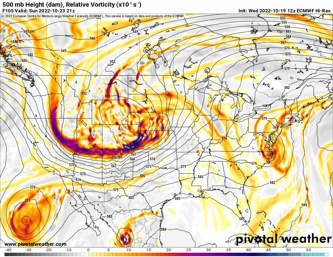
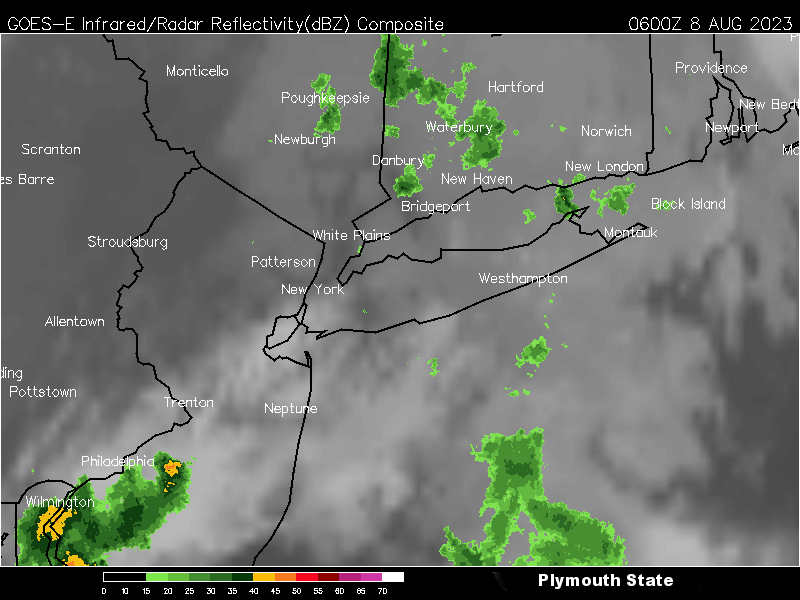
Histogram of dew points YTD for ISP...definitely muggier than normal:
-
Hell of a light show!

-
Yeah it’s an interesting microclimate feature for sure. I’m surprised we got more rain here a few days ago with that little cell compared to this event. On a separate note, just got a good downpour here a short time ago.
-
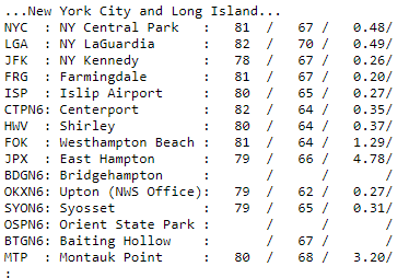
Half of LI upgraded to a Slight tomorrow:
-
Hamptons FTW. A bit overdone by model guidance the day prior, with most spots not eclipsing 0.5".
-
Two out of three ain't bad. Looks like Saturday's chances are a bit better here.
-
Tomorrow's rain will be welcomed, with a lot of guidance giving LI at least 0.5". NAM & ECMWF hinting at some pockets of 2"!
-
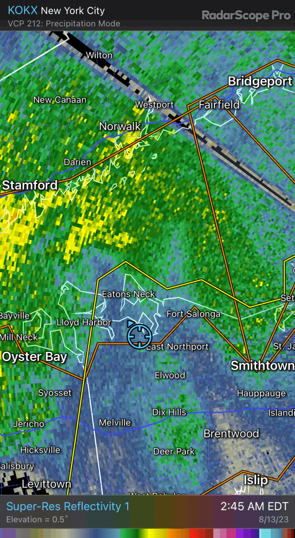
Centerport reported 0.61" with that quick hitting shower last night! Still roughly 3" below normal for the year but that shower alone accounted for nearly 50% of average monthly precip (~1.20"). Next shot at showers coming in on Thursday.
-
-
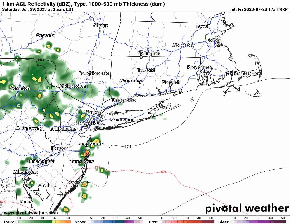
Another shot at rain and maybe a brief thunderstorm late tomorrow afternoon/evening along prefrontal trough:
-
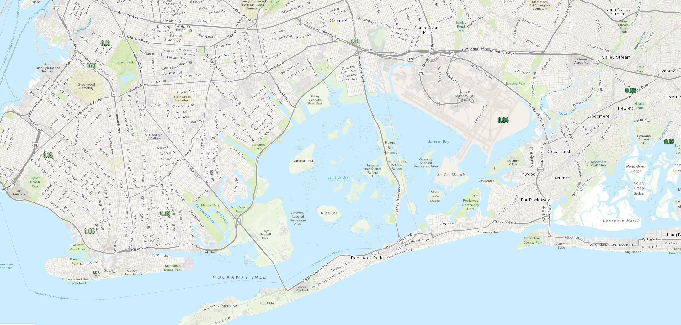
Glen Cove apparently gusted to 65 mph yesterday with that line of thunderstorms last night. KFRG & KISP reported 34 & 35kts respectively. By the time it reached Huntington it was a thin, quick moving line with some some weaker gusts (maybe gusts 25-30 mph) but then the line re-solidified once it pushed east.
-
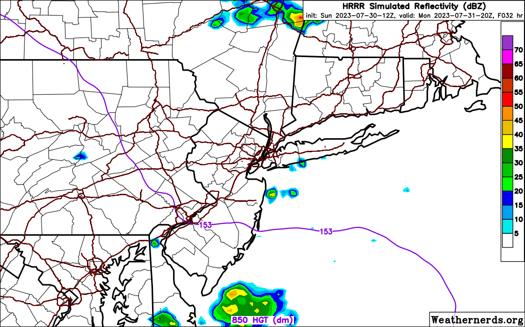
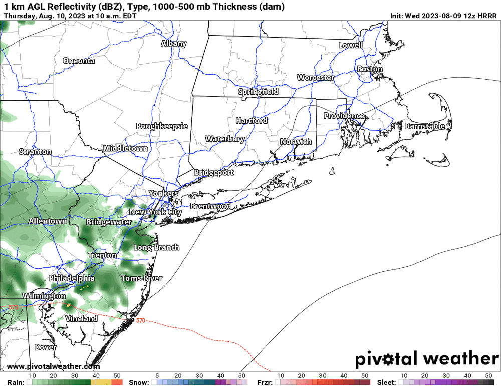
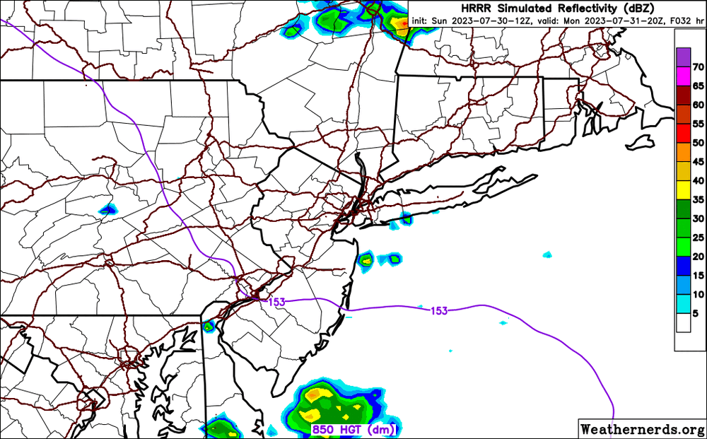
HRRR hinting at a sneaky line of showers and thunderstorms moving through here overnight. Several s/w's traversing the area with some extra help from what will likely be a remnant outflow boundary from the convection over Ohio.

-
Surprised there isn't a thread for Long Island, but now we have one.
-
 That's what she said.
 -
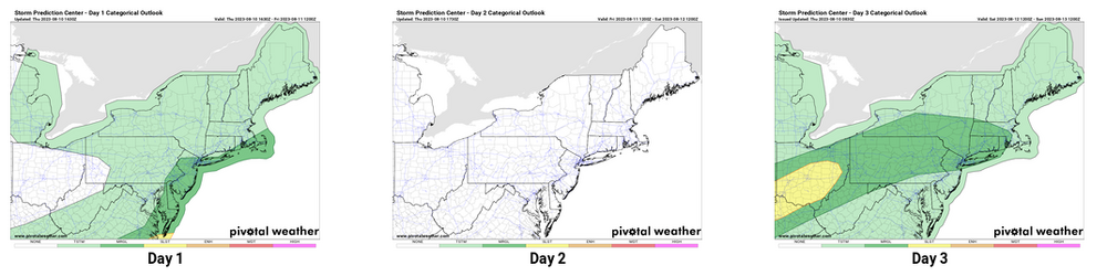
They should've included eastern MA in that area too I think they have a good shot at severe storms.
-
About time they upgraded it.
-
26 inch Fort Lauderdale rainfall
It's Always Sunny replied to bigtenfan's topic in Weather Forecasting and Discussion
I worked that day. Looking back on everything, it was a very rare occurrence (1 in every 200 years). Stationary front was slow to lift north however given vertical wind profile, an embedded supercell was able to develop. During the time of development, storm motion vectors (Bunkers) yielded a fairly stationary cell that anchored to the frontal boundary and just spun like a top over FLL for hours. -
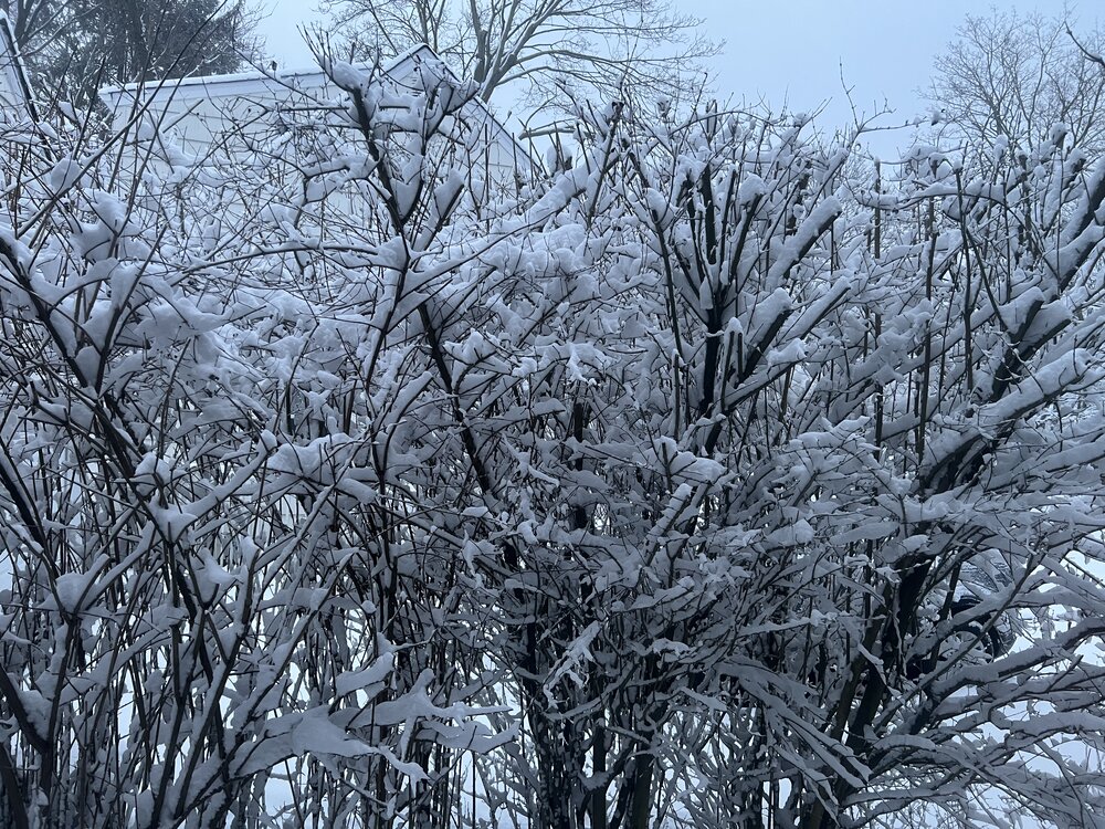
5” here in Huntington, NY.
-
Texas/Oklahoma Discussion & Obs Thread 2022
It's Always Sunny replied to It's Always Sunny's topic in Central/Western States
Possible Slight Risk day for our area Monday/Tuesday. Phasing questions remain regarding Pacific cutoff which could make or break the risk. Something to watch.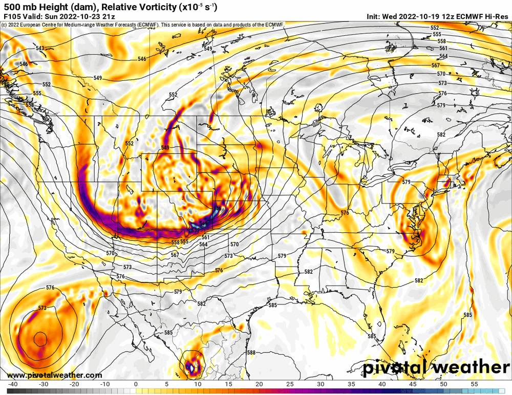
-
I'm aware, thanks.
-
Updated winter outlook now that October SAI is out, with not much change really. Went cooler for Midwest, Great Lakes, with New England & Mid-Atlantic the same. Use whichever link it's the same content but some have had trouble accessing it in the past. It's not nearly as in-depth as some other people's on this forum since we all have varying levels of free time. Either way, enjoy. https://weatherchest.weebly.com/home/updated-winter-weather-outlook-2022-2023 https://baystatewx.blogspot.com/
-
There's some cold signals amongst the models that could usher in cold enough temps to support some snow for parts of northern New England.
-
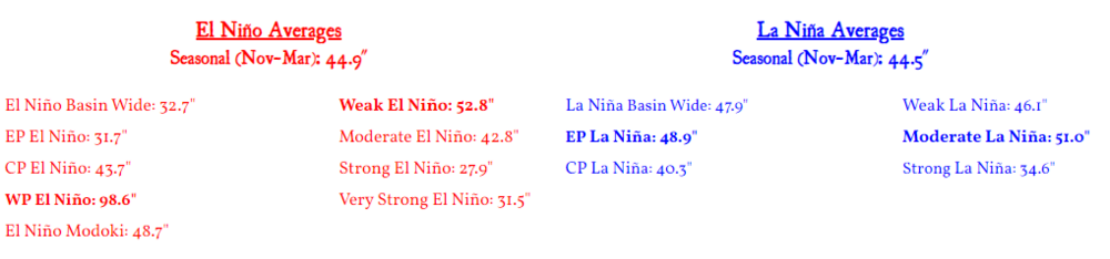
Anything non east based or basin wide is called modoki per research studies i've read, however I've found enough disparity to create a WP el nino, CP el nino & modoki section. For the modoki section, I classified it as where you have cold-neutral anomalies on both sides of warm pool so I made that a thing of it's own. It's my own categorization so there will certainly be some differences on what others had. Also, mine is based in 1991-2020 climo so I'm sure some of these will change once I begin using the appropriate climo periods. Either way, the west and central/modoki ninos correlate the best to higher snowfall like you have i believe.
-
For KBOS:
-
Yeah I've compiled Nino composites and east is most hostile, however basin wide for KBOS is only 1" more between Nov-Mar. Central & west Ninos correlate with most snowfall for KBOS.