Upstate Tiger
-
Posts
984 -
Joined
-
Last visited
Content Type
Profiles
Blogs
Forums
American Weather
Media Demo
Store
Gallery
Everything posted by Upstate Tiger
-
A little happy hour cocktail
-
Merry Christmas you filthy animals…and a happy New Year! May your New Year be filled with banana highs and Miller A’s.
-
Congratulations SE peeps! I think we all willed the 18z into a classic Miller A. Now if we can only will it into actually happening.
-
It looks like we will see more cold intrusions into the SE as we get into January. Maybe we can thread the needle on one but isn't that always the case LOL.
-
Yep next week will be cold. We need that trough axis about 500 miles to the west.
-
-
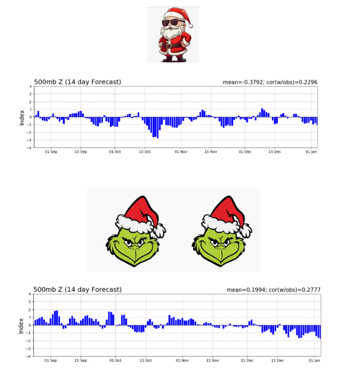
This morning's teleconnections
-
I’m one of the biggest snow on here but yesterday felt awesome on the golf course. I can’t figure out why no one’s on the course today? There’s not a cloud in the sky.
-
Would love to see the Miller B show up again that the GFS was showing on a few earlier runs for the period right after Christmas.
-
That’s what I was noticing yesterday. Hopefully it trends the other way in the next few runs.
-
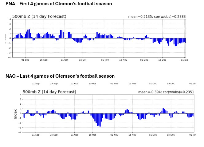
Nothing encouraging looking at the PNA and NAO today. NAO looks to be heading into positive territory while the PNA is heading negative after the 15th. Ops does still show lots of cold in Canada with occasional intrusions into the U.S. and even the SE over the next two weeks followed by warm ups. I see the mountains getting some NWSF with these. One just gets the impression that the models are still having a hard time reflecting the MJO. Honestly, I wouldn't be surprised to see winter stay in this relatively dry rinse and repeat typical in a Nina or turn really cold in the east in January. I am rooting for the latter!
-
I would love to see just one neutral winter. I did read from one of the sites yesterday that the Nina is waning very quickly. If I wasn't too lazy I'd research winters where Nina dissipates after December. Like wncsnow said, there are some things on the 12Z that don't make it all doom and gloom, but the next couple of weeks do not look good for winter in the SE. Way too early to throw in the towel though. Maybe my wife gets me that new Taylormade 5 wood for Christmas I have been wanting and I will get to try it out. Looks like I won't have to be worried either about my Tigers playing in brutal cold in NYC right after Christmas
-
Yeah. It is a different look in the long range from the overnight runs. GFS ops looks to dump the cold more in the west versus locked up in Canada. But teleconnections show the NAO heading negative during that time while the PNA looks like its headed positive. Who knows?
-
Yeah, the overnight models were not good for Christmas week. They seem to indicate next week's moderation will last more than a few days. Still a lot of super cold air in Canada just waiting to dump south.
-
Wouldn’t mind a little stretch of mild myself. Would love to be able to play some golf and get out with the grands.
-
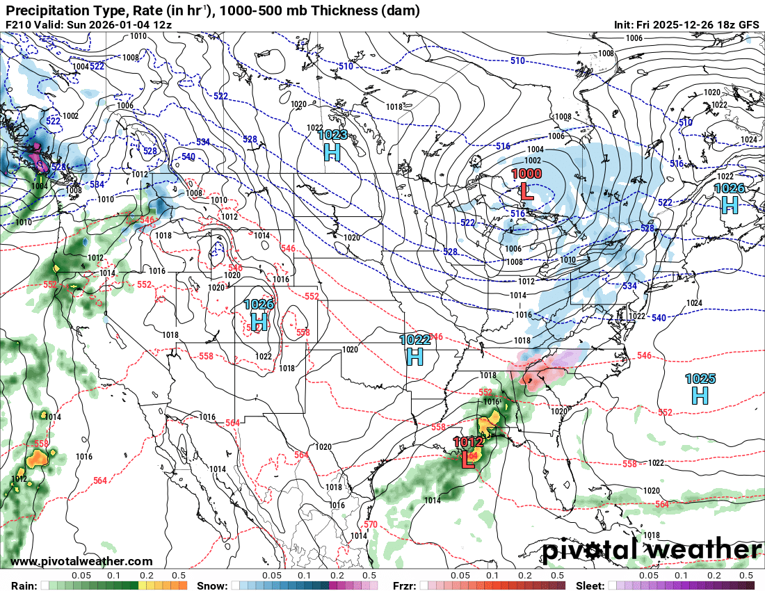
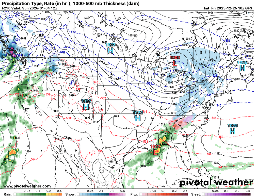
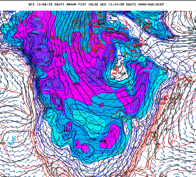
After a slight moderation leading into Christmas weeek, the 06Z GFS drops the arctic hammer across the U.S.
-
18z GFS not far from something good next Sunday/Monday.
-
42/37 here. Needed to be about 5 degrees colder and DP in the 20s and we would have been in business.
-
He ain't lyin.
-
I think that is a good summary. I see the relaxation mid month also showing up on all the models. Kinda stinks as the wife and I will be in the moutains for our annual pre-Christmas trip the 14-18. Of course, this week's warmup never materialized so who knows what will happen in 2 weeks. One thing seems certain, there will some super cold air in the Northern Hemisphere. That's always the first thing I look for...
-
Well I don’t dislike him but I can’t say he makes me excited.
-
Nice to finally have a reason to watch December models. Been awhile.
-
Agree. Haven't had a chance to look at anything but the 12Z GFS today but the last few panels on the long range look pretty good to me.
-
Unless it’s playing the B1G. Hopefully we see a big midwestern OL steamroll that ridge in a couple of weeks.
-
It's always seemed to me looking at the extended that we would cool down briefly after Thankgiving and then warm back up the first week of December then potentially turn much colder by the second week of December. There are some good signals. We shall see...