Upstate Tiger
-
Posts
984 -
Joined
-
Last visited
Content Type
Profiles
Blogs
Forums
American Weather
Media Demo
Store
Gallery
Everything posted by Upstate Tiger
-
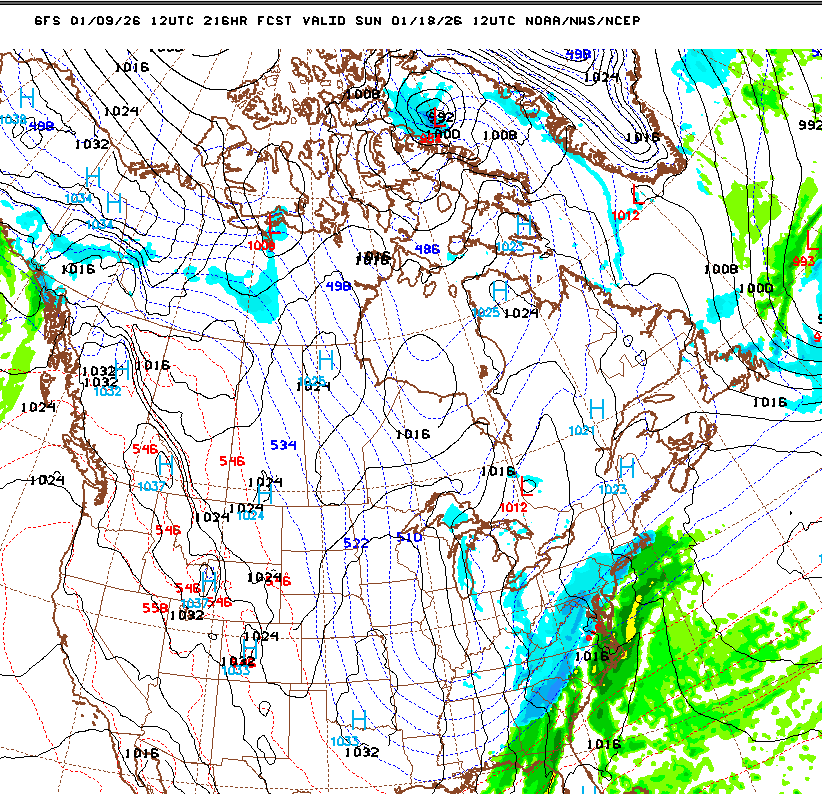
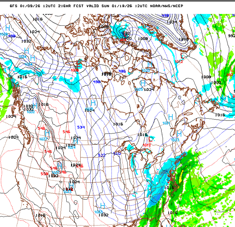
I’ll take that surface setup on the GFS for Sunday.
-
I wouldn’t write anything off yet, especially next weekend. But I also thought the Panthers were going to hang on and upset the Rams so what do I know?
-
Happy hour has the sads for this week. But we have a monster storm only 12 days away.
-
Went through our home a few weeks ago. Stinks.
-
GSP with nice AFD this morning for those interested https://forecast.weather.gov/product.php?site=NWS&issuedby=GSP&product=AFD&format=ci&version=1&glossary=1&highlight=off
-
Yep. Close to an old classic Miller A. we just need the Euro and GFS to keep showIng this SE set up next weekend. I’ll take my chances.
-
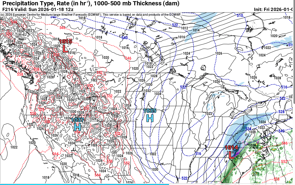
I actually like the potential showing on the Euro better than the GFS. Euro has a bomb just off shore for storm 2.
-
Yep. Certainly not the GFS but definitely better than the 0z.
-
Yep! The chase in on...now prepare for all the ups and downs that come every 6 hours for the next 5-8 days.
-
-
#2
-
-
Euro was a beaut.
-
Still a good signal for next weekend on the 12Zs so far. Agree we see a reload by the end of the month.
-
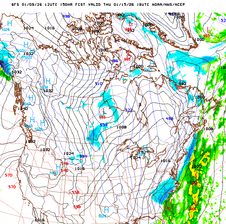
I am still thinking there is potential between the 15-20th this month looking at todays 12Z ops.
-
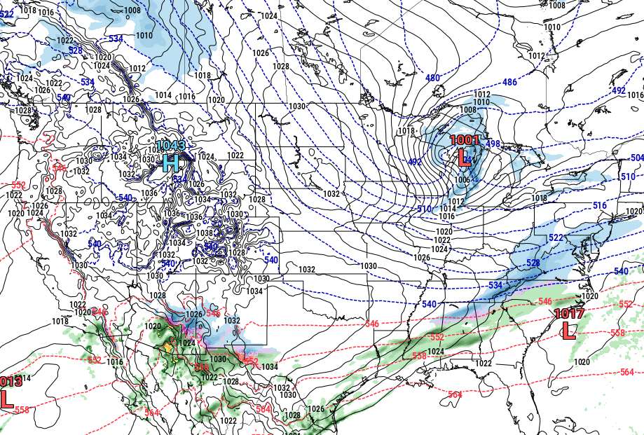
Out to 330 but overall the Euro is much dryer than the GFS up to this point
-
Overnight runs of the ops models were not bad. At least some potential as we get into mid late next week. Cold certainly making a deep run into the US after mid month.
-
12z Euro is a bit more interesting today and certainly colder after next week.
-
Looking a bit stormy in the SE next weekend on the 0z GFS. Euro has also has some convection next weekend. At least we are starting to moisture across the SE after this week.
-
Well the 12Z Goofus gets rid of the ridge at least. Interested to see what the Euro shows after next week.
-
I hope the 18z GFS is wrong because the entire continent was AN until the end when the west went BN. More worrisome is its dry as a bone in the SE.
-
After conducting a thorough quantitative analysis of all model and teleconnections verification scores, I have concluded: The model that predicts AN and no frozen precipitation in the SE verifies almost 100% of the time.
-
Overnight runs remind me of our bowl game. Lots of hope and excitement dashed by the reality that we suck.
-
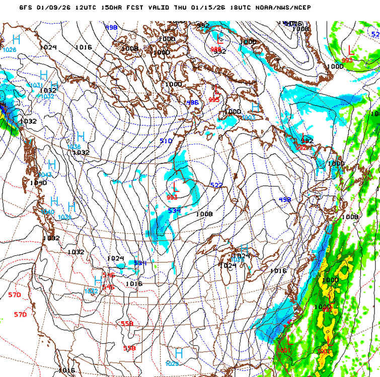
If I smoked I would light one up after the GFS Happy Hour run.
-
Man that is some major league cold spilling into the U.S. at the end of the GFS. Canada is in the freezer.