Upstate Tiger
-
Posts
984 -
Joined
-
Last visited
Content Type
Profiles
Blogs
Forums
American Weather
Media Demo
Store
Gallery
Everything posted by Upstate Tiger
-

January 30th- Feb 1st ULL and coastal storm obs
Upstate Tiger replied to JoshM's topic in Southeastern States
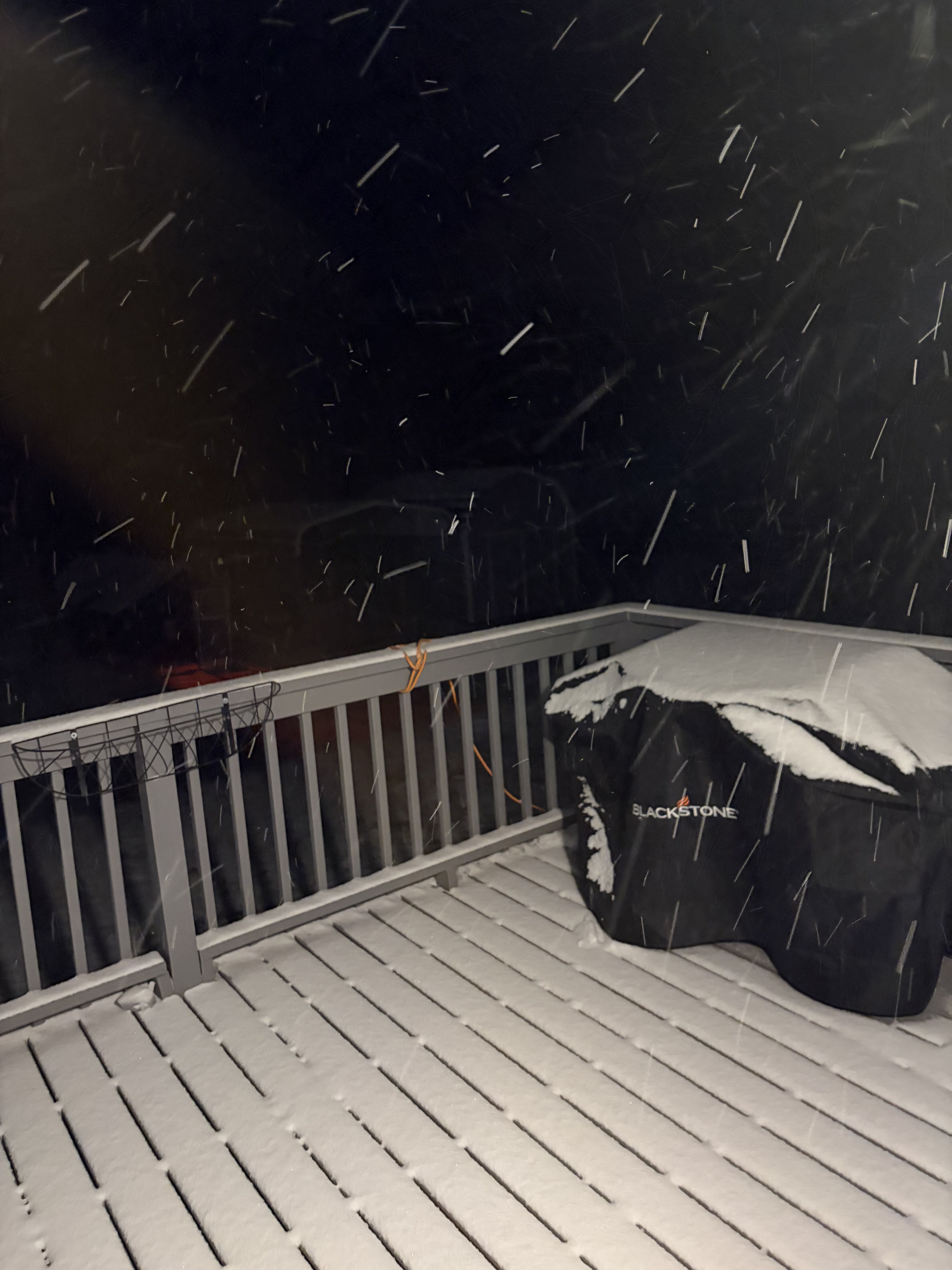
21 degrees and 26 mph winds. Snowing hard and really blowing around. -
January 30th- Feb 1st ULL and coastal storm obs
Upstate Tiger replied to JoshM's topic in Southeastern States
Yeah signal for east coast storm showing up for this range. -
January 30th- Feb 1st ULL and coastal storm obs
Upstate Tiger replied to JoshM's topic in Southeastern States
Little over 2” in West Lincoln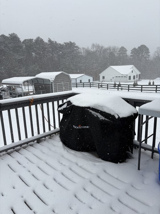
-
January 30th- Feb 1st ULL and coastal storm obs
Upstate Tiger replied to JoshM's topic in Southeastern States
25/22 West Lincoln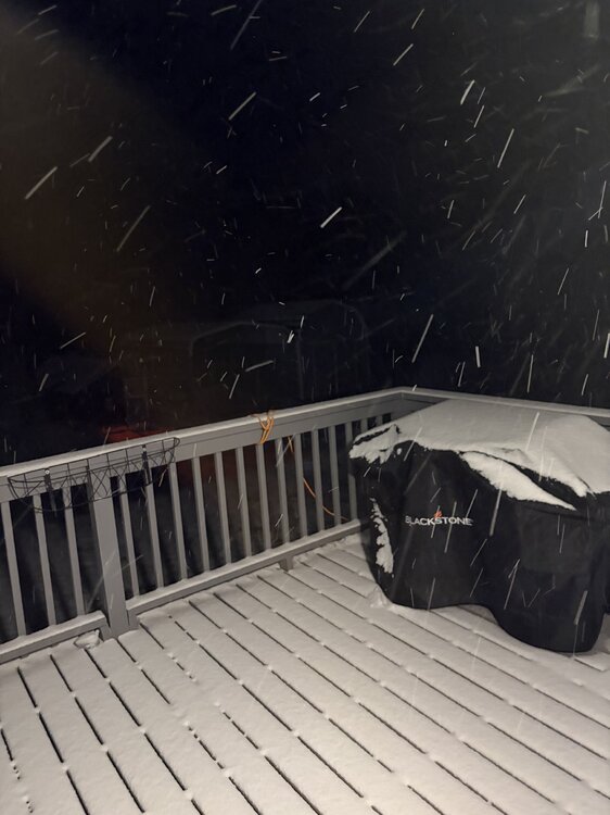
-
The “I bring the mojo” Jan 30-Feb 1 potential winter storm
Upstate Tiger replied to lilj4425's topic in Southeastern States
-

-
The “I bring the mojo” Jan 30-Feb 1 potential winter storm
Upstate Tiger replied to lilj4425's topic in Southeastern States
If he predicts 8”-10” IMBY, he’s the one I’m trusting. -
The “I bring the mojo” Jan 30-Feb 1 potential winter storm
Upstate Tiger replied to lilj4425's topic in Southeastern States
Whichever is best for your backyard. -
The “I bring the mojo” Jan 30-Feb 1 potential winter storm
Upstate Tiger replied to lilj4425's topic in Southeastern States
"ULL's are never as good or as bad as forecast" -
The “I bring the mojo” Jan 30-Feb 1 potential winter storm
Upstate Tiger replied to lilj4425's topic in Southeastern States
-
The “I bring the mojo” Jan 30-Feb 1 potential winter storm
Upstate Tiger replied to lilj4425's topic in Southeastern States
Most of NC and SC still getting snow on the NAM at 39. -
The “I bring the mojo” Jan 30-Feb 1 potential winter storm
Upstate Tiger replied to lilj4425's topic in Southeastern States
Really good run for the western areas... -
The “I bring the mojo” Jan 30-Feb 1 potential winter storm
Upstate Tiger replied to lilj4425's topic in Southeastern States
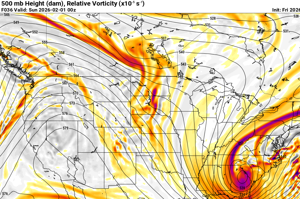
Wonder how the short range models do sniffing out the meso low. GSP still confident this will develop and enhance rates in upstate and NC Piedmont. -
The “I bring the mojo” Jan 30-Feb 1 potential winter storm
Upstate Tiger replied to lilj4425's topic in Southeastern States
Where is everyone? Back in my day, we’d model watch and post all night, then go straight into work without any sleep. -
The “I bring the mojo” Jan 30-Feb 1 potential winter storm
Upstate Tiger replied to lilj4425's topic in Southeastern States
18 hours of snow IMBY in the NC Piedmont. -
The “I bring the mojo” Jan 30-Feb 1 potential winter storm
Upstate Tiger replied to lilj4425's topic in Southeastern States
Even our friend in Savannah getting in on the act 45 -
The “I bring the mojo” Jan 30-Feb 1 potential winter storm
Upstate Tiger replied to lilj4425's topic in Southeastern States
Snow really expanded in Ga at 42. -
The “I bring the mojo” Jan 30-Feb 1 potential winter storm
Upstate Tiger replied to lilj4425's topic in Southeastern States
She’s winding up at 39 -
The “I bring the mojo” Jan 30-Feb 1 potential winter storm
Upstate Tiger replied to lilj4425's topic in Southeastern States
Heavy banding along the NC coastal plain at 33 -
The “I bring the mojo” Jan 30-Feb 1 potential winter storm
Upstate Tiger replied to lilj4425's topic in Southeastern States
Funny seeing the cliff diving for those not getting 10”. I’m 61 and followed winter weather since 1976. The only 10” storms I remember in the upstate were the PD 1 1979, March 1983, and January 1988. Point being, it’s a rare thing to get 10” of snow in the SE. -
The “I bring the mojo” Jan 30-Feb 1 potential winter storm
Upstate Tiger replied to lilj4425's topic in Southeastern States
Would you change to a Tiger? -
The “I bring the mojo” Jan 30-Feb 1 potential winter storm
Upstate Tiger replied to lilj4425's topic in Southeastern States
Snow all across NC at 12z on Saturday. -
The “I bring the mojo” Jan 30-Feb 1 potential winter storm
Upstate Tiger replied to lilj4425's topic in Southeastern States
Good. I was terribly vexed by its existence and will not rue its demise. -
The “I bring the mojo” Jan 30-Feb 1 potential winter storm
Upstate Tiger replied to lilj4425's topic in Southeastern States
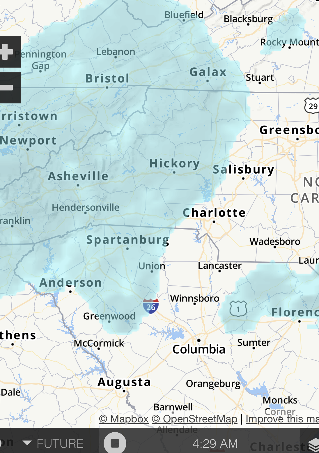
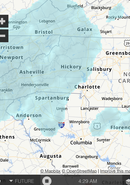
GSP AFD...they are indicating I-85 from GSP to Charlotte to be a potential jackpot zone with all of the western Carolinas and NE GA getting some stout totals. https://forecast.weather.gov/product.php?site=NWS&issuedby=GSP&product=AFD&format=ci&version=1&glossary=1&highlight=off -
The “I bring the mojo” Jan 30-Feb 1 potential winter storm
Upstate Tiger replied to lilj4425's topic in Southeastern States
Charlotte to the coast big winners on that run. SC also gets a lot of qpf.