Upstate Tiger
-
Posts
984 -
Joined
-
Last visited
Content Type
Profiles
Blogs
Forums
American Weather
Media Demo
Store
Gallery
Everything posted by Upstate Tiger
-
I’m confused. Does this mean the skies have not healed?
-
It pains me to say this but thank you Tar Heels. If we win tonight, we’re tied for first. That hasn’t happened much during February for us in basketball. Makes me think we actually get another storm or two because anything is apparently possible this year.
-
Rain and sleet in Gastonia and 47 degrees. Crazy.
-
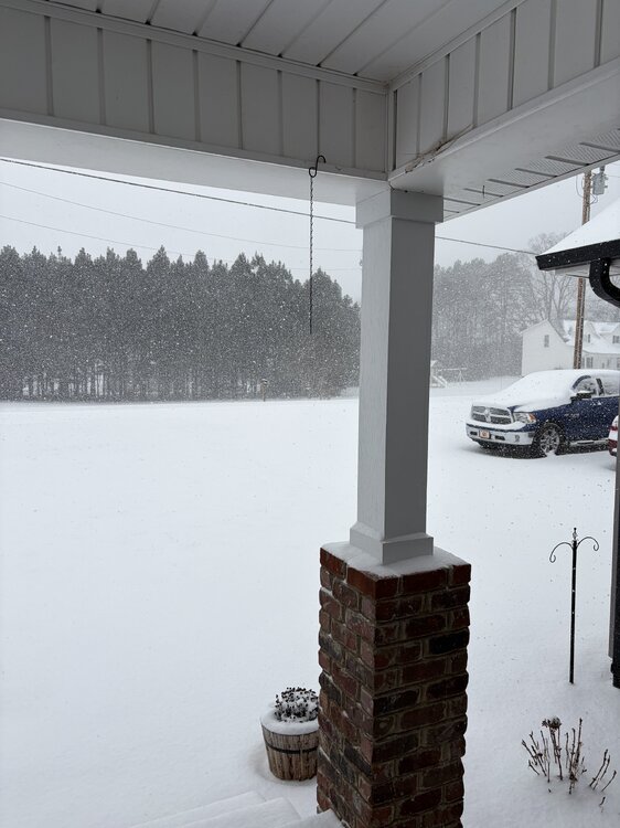
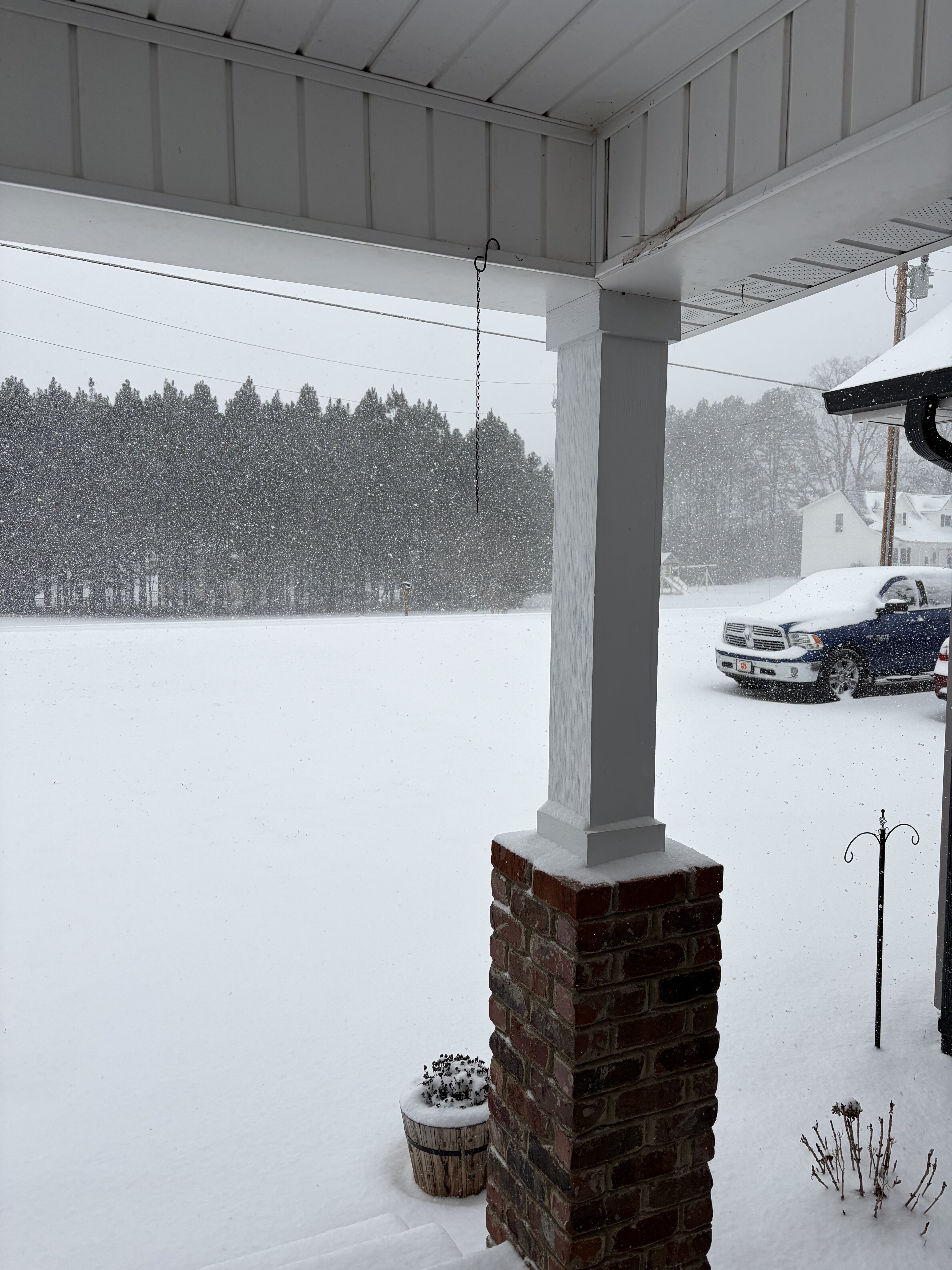
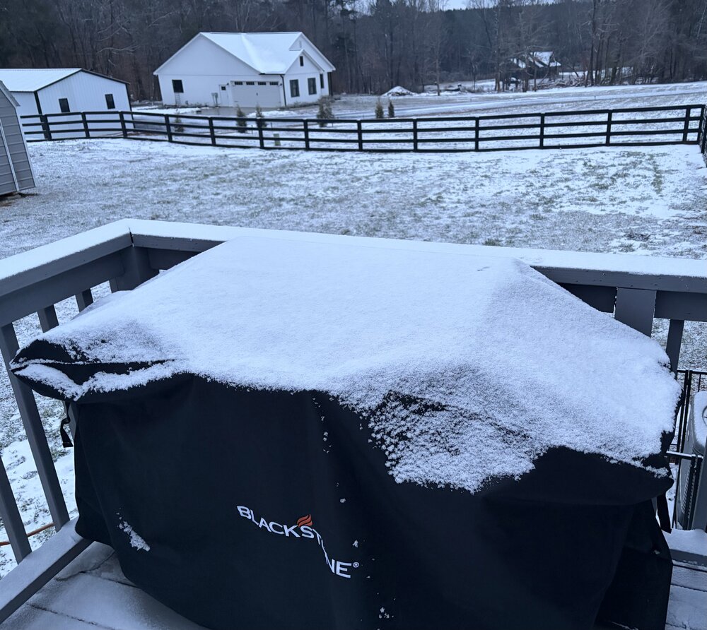
Got a dusting last night. If nothing else it coated the brown and black piles. Sitting right at 11” for the season. Hard to complain.
-
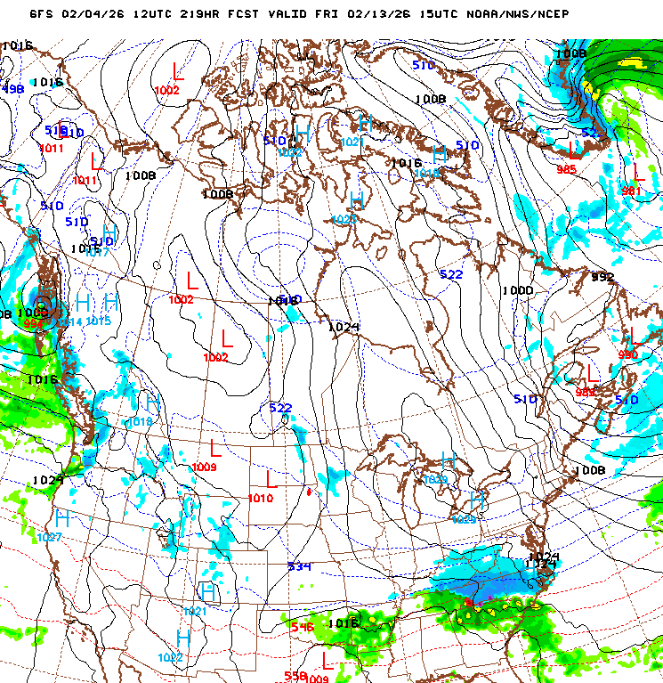
Good data! The NAO looks to be negative for this potential event but you are correct that the PNA is the teleconnection with the largest impact on SE winter weather IMO. This is 10 days out and the teleconnection forecasts can be tricky so maybe it will change. I haven't looked at the MJO forecast.
-


-
CMC has the same general setup but doesn’t have the high placement like GFS so wintry is further north.
-
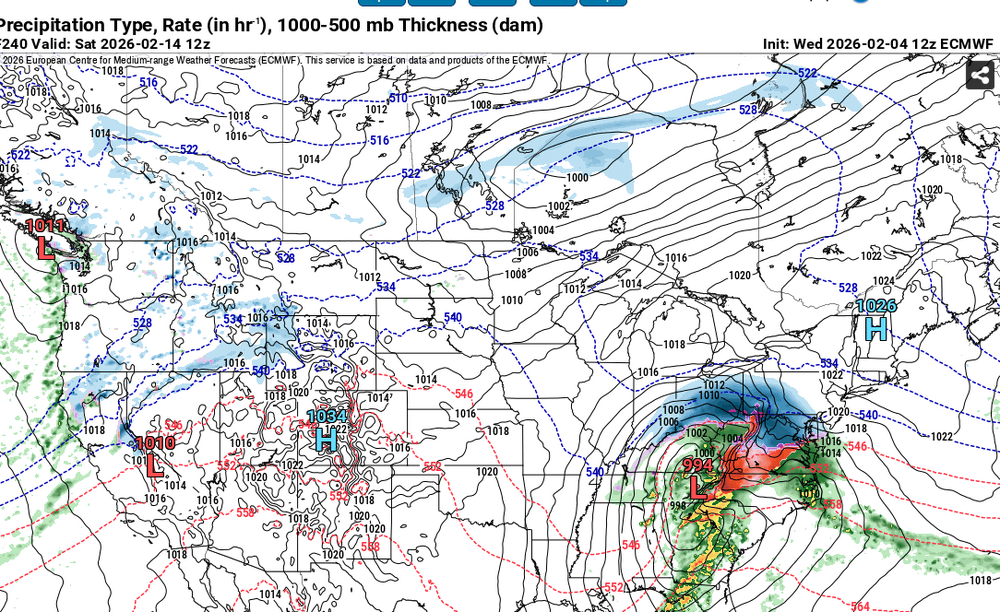
GFS says happy Valentines Day snow lovers.
-
Yep looks like we warm up next week. I will be in Charleston so looking forward to some warmth. Don't sleep on Valentine's weekend, a little blocking and get rid of that upper midwest low and you have a big winter storm in the SE. Looks like a strat split coming up that could make March very cold in the U.S., at least until mid-month.
-
Someone may get NAM’d tomorrow afternoon. It seemed to my faulty memory that secondary lows were common in the 70s and they were always good for a couple of inches.
-
Hopefully we can get one without any screw zone ala President's Day 1 - 1979. Still one of my all time favorites with temps in the teens, howling wind, and 14" in the upstate IMBY. It did warm up rather quickly the following week but still took several days to melt.
-
Yep. Looking like a return to winter in the east around or just after Valentine’s Day for a at least a couple of weeks. Still think this winter holds at least one more SE winter storm.
-

January 30th- Feb 1st ULL and coastal storm obs
Upstate Tiger replied to JoshM's topic in Southeastern States
Yep. The low water content makes it evaporate really quickly. -
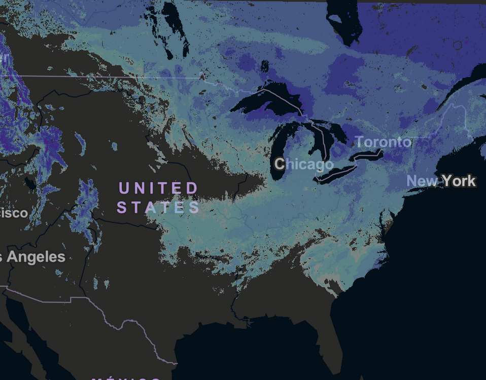
current US snowfall coverage.
-
January 30th- Feb 1st ULL and coastal storm obs
Upstate Tiger replied to JoshM's topic in Southeastern States
Overall for the entire forum, the CMC and GFS seemed to remain the most consistent and verify the best. If I have time, I will try and go back and compare the globals from Monday to Friday. -
January 30th- Feb 1st ULL and coastal storm obs
Upstate Tiger replied to JoshM's topic in Southeastern States
Yeah this winter is going to skew our 10 year average LOL -
January 30th- Feb 1st ULL and coastal storm obs
Upstate Tiger replied to JoshM's topic in Southeastern States
I-85 North in Cabbarus blocked. So is 74/Wilkinson Blvd/Franklin in Gastonia. I drove home from the hospital at 530. I have 4wd truck, AT tires, and 500lb of sand in back and it was dicey. -
The “I bring the mojo” Jan 30-Feb 1 potential winter storm
Upstate Tiger replied to lilj4425's topic in Southeastern States
Raleigh looks like they are about to get slammed. -
January 30th- Feb 1st ULL and coastal storm obs
Upstate Tiger replied to JoshM's topic in Southeastern States
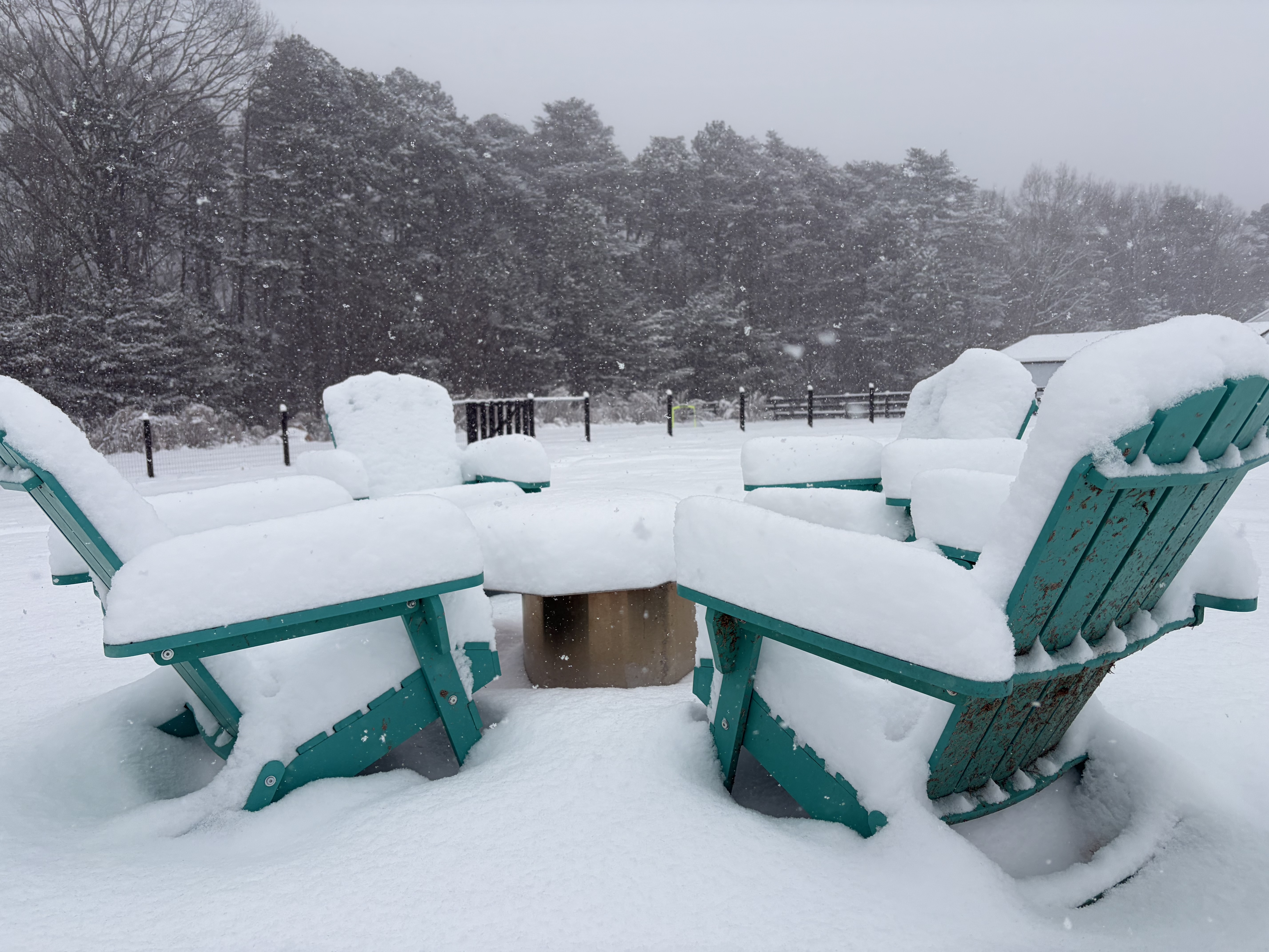
Winding down here. Finished with exactly 9”. That makes it the most snow I’ve witnessed since the January 88 storm when I received 12” in the upstate. 2011, 1996, and 1993 were close but all were 8” or less IMBY. -
Don’t laugh. It showed this storm 2 weeks ago. 4’-5’ of snow is nothing this winter.
-
January 30th- Feb 1st ULL and coastal storm obs
Upstate Tiger replied to JoshM's topic in Southeastern States
Guess we won’t be doing S’mores with the grandkids tonight or next week.
-
The “I bring the mojo” Jan 30-Feb 1 potential winter storm
Upstate Tiger replied to lilj4425's topic in Southeastern States
Hope all of yall get smoked with the same crazy rates we’ve had. -
January 30th- Feb 1st ULL and coastal storm obs
Upstate Tiger replied to JoshM's topic in Southeastern States
7” in West Lincoln. Would love to get to 10” but it will be a stretch. Hoping we get a convective band this afternoon. -
The “I bring the mojo” Jan 30-Feb 1 potential winter storm
Upstate Tiger replied to lilj4425's topic in Southeastern States
Surprised we haven’t had an update from GSP. Guess they’re waiting for the afternoon AFD. -
The “I bring the mojo” Jan 30-Feb 1 potential winter storm
Upstate Tiger replied to lilj4425's topic in Southeastern States
Some of the heaviest rates I’ve ever seen.