Upstate Tiger
-
Posts
984 -
Joined
-
Last visited
Content Type
Profiles
Blogs
Forums
American Weather
Media Demo
Store
Gallery
Everything posted by Upstate Tiger
-
After about 15 minutes of sleet, finally gone over to snow in West Lincoln. Don’t expect it to amount to much but nice seeing it.
-
Early NAM run pops the low further west than the 12z. Edit: Not really different. I must be drunk.
-
Yeah but you are on here reading this thread like me and grasping away
-
Some very interesting solutions on the Euro over the next couple weeks, starting with the end of next week.
-
12Z looks good to me for more opportunities after this week and possibly into February.
-
Me too…so I can wake up at 11 and watch the models like the rest of you.
-
Yep
-
-
While we are waiting on the next epic NAM run, the temp. forecast for today really busted in my area. Was forecast to reach the low 40's at 1PM. Never made it past 35 and is 34 now with winds gusting to 21MPH. Brutal outside today.
-
That's depressing!
-
I can only hope your replacement stirs more excitement than his did. I know I want be starting any threads. The one time I did turned out about like this one is looking.
-
Grew up in the upstate. We had a snow drought from the March 73 storm - 77 record January with no measurable. From 77 on, the late 70’s rocked. Otherwise, you are correct. 80/81, 83/84, 84/85, 85/86 had smaller events but measurable snow. Otherwise, the other years were epic snow years. Really started to decline in regularity after 88 IMO.
-
Nino should resolve this next winter but will we get the cold? Still think we score one before this winter is over.
-
Seems improved to me but I’ve looked at so many on the last 24 hours, not sure. Too lazy to pull the 12z
-
-
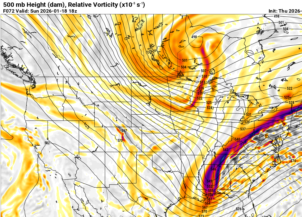
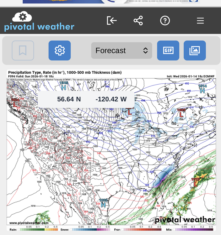
Well the Euro threw us a bone. Much better at 96.
-
Mines stuck at 84. Must be the SE crew.
-
Yep. I actually liked the H5 better on the 12Z but still a good run.
-
Out at the very end of the NAM. Notoriously unreliable at this range but here it is...
-
I haven't been NAM'ed in about 4 years. Would love to see it. On side note, GSP AFD is not out yet. I suspect those guys are bit busy with all that's transpiring over the next several days...mountain snow the next 24 hours, bitter cold, and weekend potential. EDIT: https://forecast.weather.gov/product.php?site=NWS&issuedby=GSP&product=AFD&format=ci&version=1&glossary=1&highlight=off
-
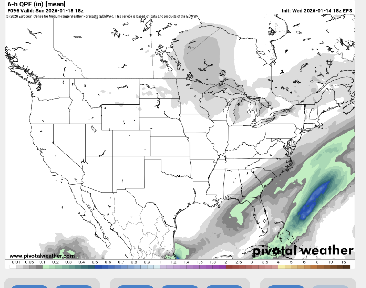
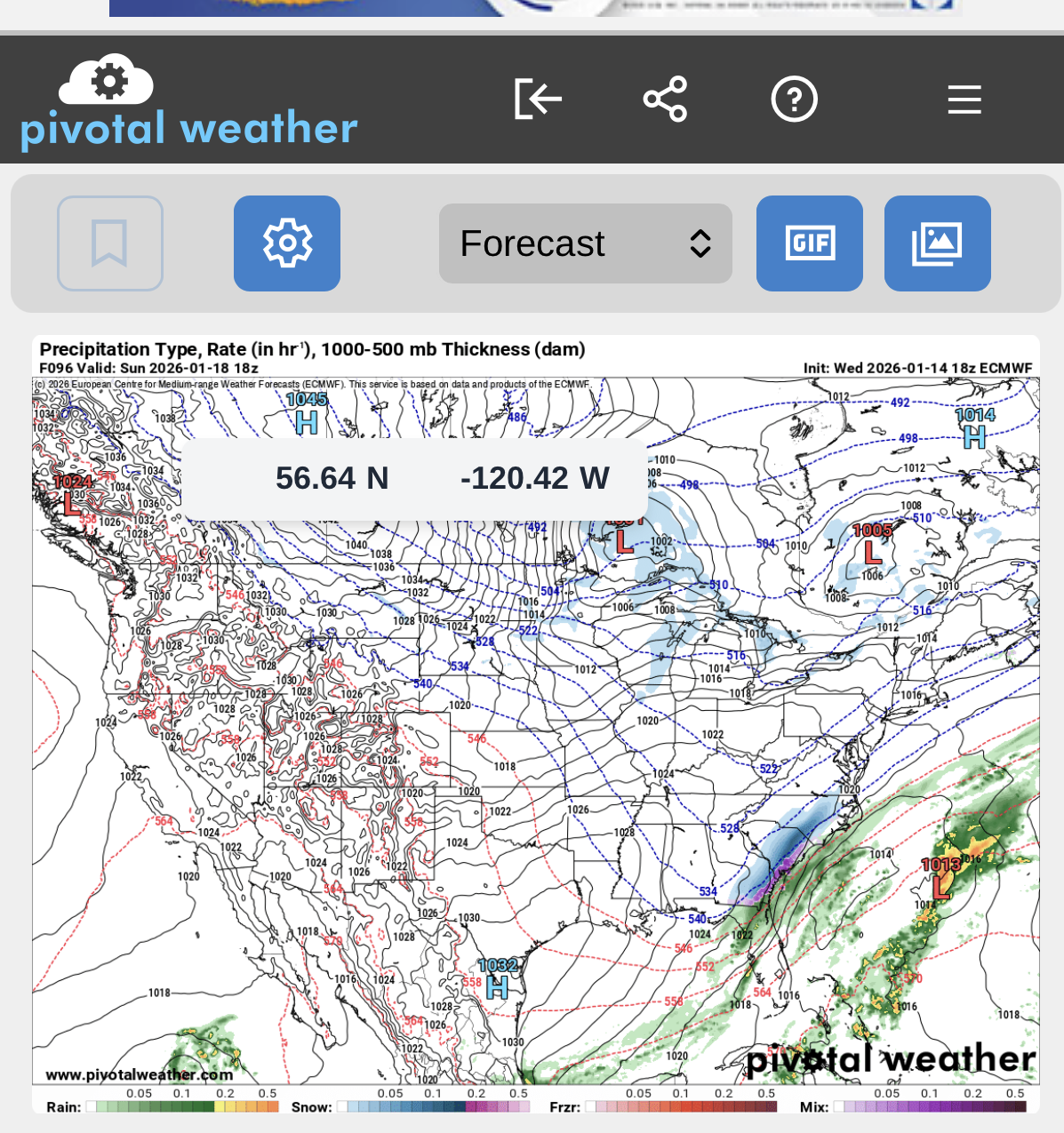
Was hoping for better but this has a ways to go. No sampling and we are mid-day Wednesday and this is a Sunday event.
-
Euro still has the event. Just a little later and further east than the GFS. Let's see the ensembles.
-
12Z GFS = Boom!
-
When I moved from the upstate of SC 10 years ago to the western Piedmont of NC, I thought for sure I’d see more snow. Who knew that if I had taken the job on the coast, I would be in the best spot in the Carolina’s outside the mountains for snow.
-
Little surprised we’re not seeing a better surface reflection on the GFS.