Shades
-
Posts
362 -
Joined
-
Last visited
Content Type
Profiles
Blogs
Forums
American Weather
Media Demo
Store
Gallery
Everything posted by Shades
-
These gradients are impressive and note trajectory of 10m winds in the HV. This air will spill south like a river. Should it catch precip in time for significant icing south of I84 is the unknown, and for a greater population, a very disturbing outcome for impacts.
-
12z GFS 925mb surface temperatures cross-referenced with MSLP+QPF, Friday morning (15Z) at peak of event in metro-area. At 925mb, the 0C/32F line goes south of NYC at 9z, with ongoing light-moderate precip preceding this time frame. At 850mb, 0C/32F is just north of city, bisecting Bronx/Westchester coinciding with this forecast time.
-
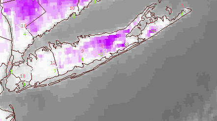
Single digits and below depicted on Long wavelength infrared LWIR this morning via GOES 16 on Long Island, those localized sweet spots where radiational effects are most pronounced. This screen cap image was from 11UTC/6am
-
January 28/29 Blizzard Observations/Discussion/Nowcasting
Shades replied to Northof78's topic in New York City Metro
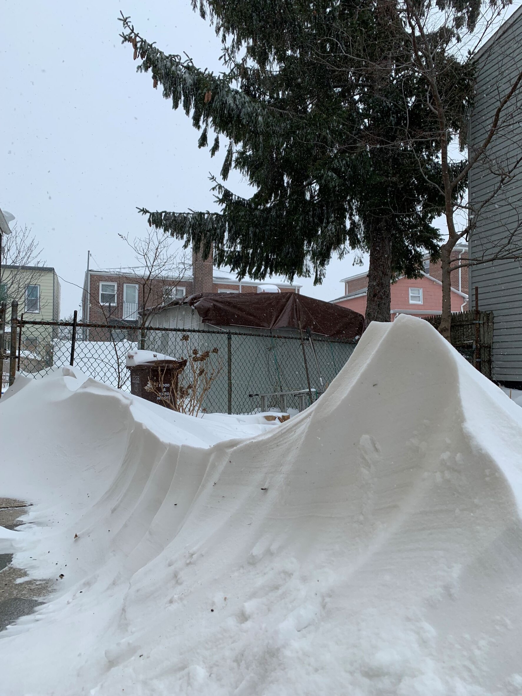
5 foot backyard drifts.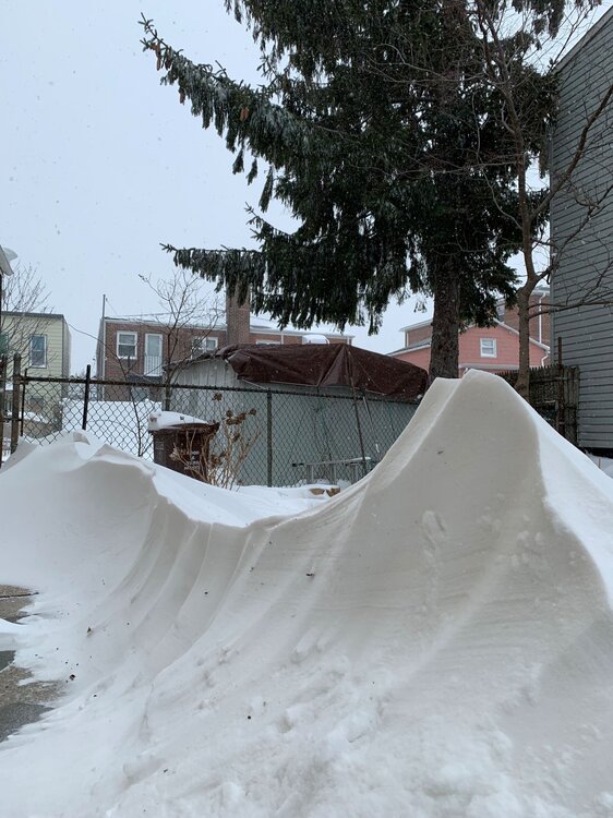
-
January 28/29 Blizzard Observations/Discussion/Nowcasting
Shades replied to Northof78's topic in New York City Metro
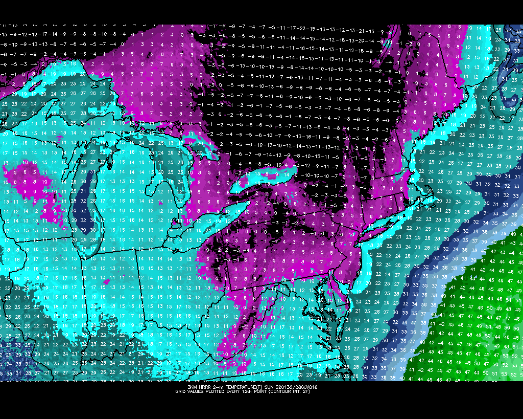
3KM HRRR early morning temperatures for Sunday.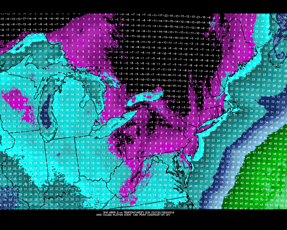
-
January 28/29 Blizzard Observations/Discussion/Nowcasting
Shades replied to Northof78's topic in New York City Metro
I wonder if we go lower than forecast for tonight, it's currently 17 in NYC, forecast low of 13? I can see how we tick up a few degrees if we break into some sunshine later this afternoon, however it's also currently only 5 at Mount Pocono (about a 100 miles northwest from the bird's eye). Lots of talk on snow, but people who may be waiting to shovel snow tonight, or go out and about believing the storm is done for their Saturday night, would be putting themselves at risk; can imagine stranded or immovable vehicles, and with these temperatures, that would be foreboding. Frigid/hypothermia inducing temperatures is less sensible than snowfall. People could be putting their lives at risk. I hope the media and we do well to inform others as needed. -
January 28/29 Blizzard Observations/Discussion/Nowcasting
Shades replied to Northof78's topic in New York City Metro
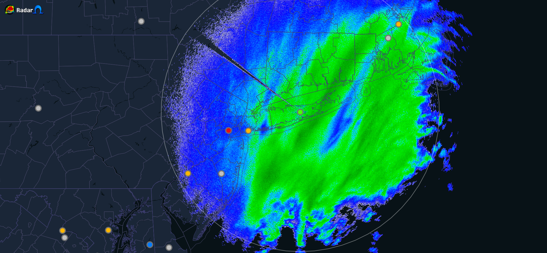
Regional composite/mosaic radar of northeast corridor: https://weather.cod.edu/satrad/?parms=subregional-Mid_Atlantic-comp_radar-24-0-100-1&checked=map&colorbar=undefined Customizable for long animation loops and overlays. -
January 28/29 Blizzard Observations/Discussion/Nowcasting
Shades replied to Northof78's topic in New York City Metro
Not your typical coastal storm in that the low pressure is elongated, less centralized at our latitude, which may be working in our favor for coastal areas. If this system were more consolidated, with a more definitive center (or core if you will - thinking of the tight eye-features many winter coastal nor'easters exhibit), then the precip would also likely be more wrapped-in, and the dynamics more compact. That being said, it's still in its maturing phase, for SNE.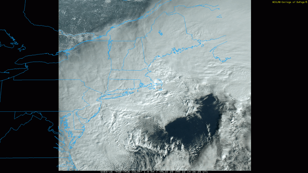
-
January 28/29 Blizzard Observations/Discussion/Nowcasting
Shades replied to Northof78's topic in New York City Metro
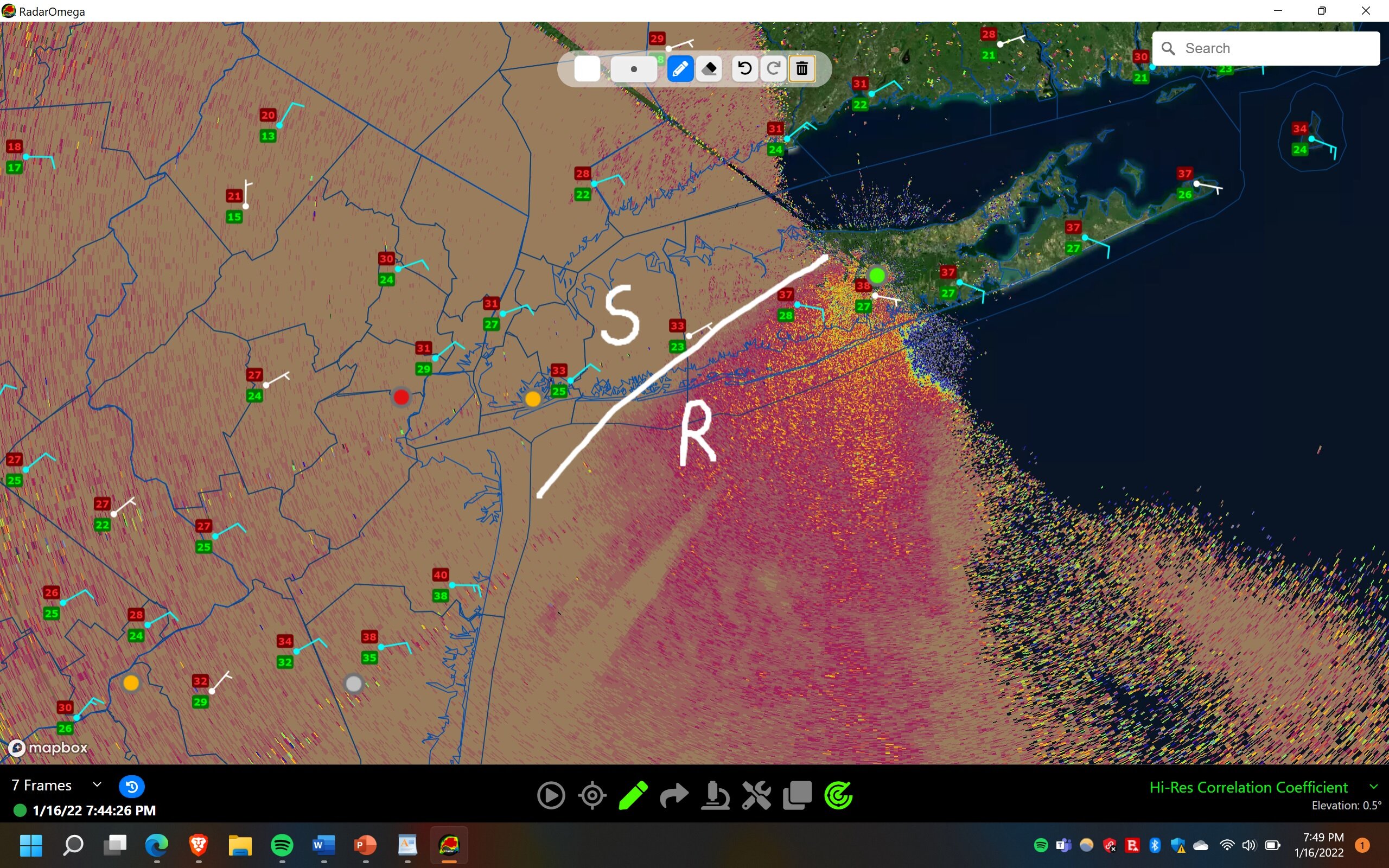
RadarOmega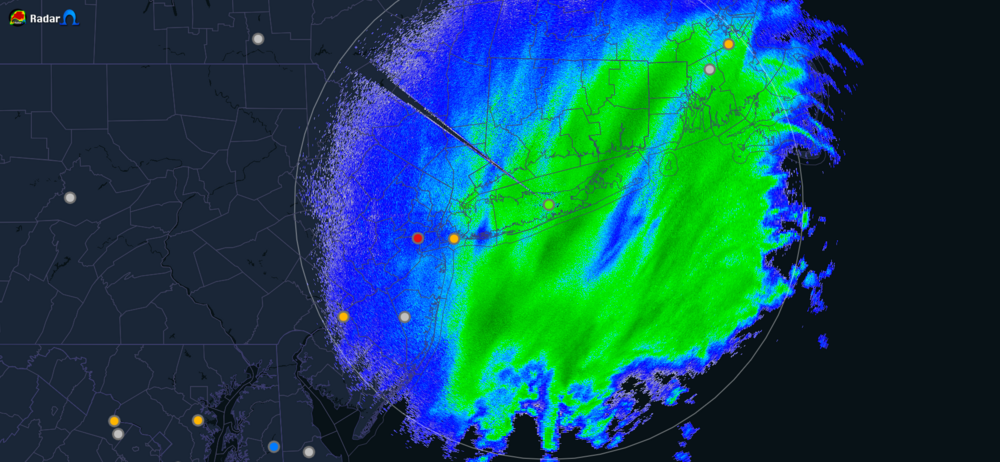
-
January 28/29 Blizzard Observations/Discussion/Nowcasting
Shades replied to Northof78's topic in New York City Metro
I can see how geographic orientation/slope and gradation is a factor in snow drifts and accumulation measurements. Here in Maspeth, Queens, near the embankment of the Ridgewood Plateau, on the north facing steep side, I'm experiencing higher totals than a mere half mile away in locations that are more level. This is very pronounced following the banding this morning which has come in with gustier winds, and wind driven-lateral snowfall. That being said, very hard to measure, 7"-9" in Maspeth, Queens. Still some ways to go... -
A lot of chatter about QPF and not much about ratios, considering that it will be in the teens to maybe 25F (forecasted high in NYC for Saturday), we may be looking at enhanced accumulations based on ratios. Models always struggle with this element with what accumulates on the ground, either overestimating with marginal temperatures, or underestimating. Snow total maps are almost always erroneous in that regard. We're on the favorable side this time around.
-
Height rises in the Canadian Maritimes also now being depicted = less progressive flow out on the Atlantic side; amplitude - let's see if this becomes a trend with future guidance.
-
It's very light, akin to drizzle (snizzle, if you will). I've observed here in central Queens, the dendrites are miniscule and almost float like dust. It's precipitating from a low cloud base, as advection drizzle would.
-
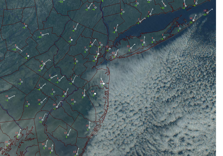
Belmar NJ reporting snow on station OBS: ocean effect. Not picking up well on radar, however.
-
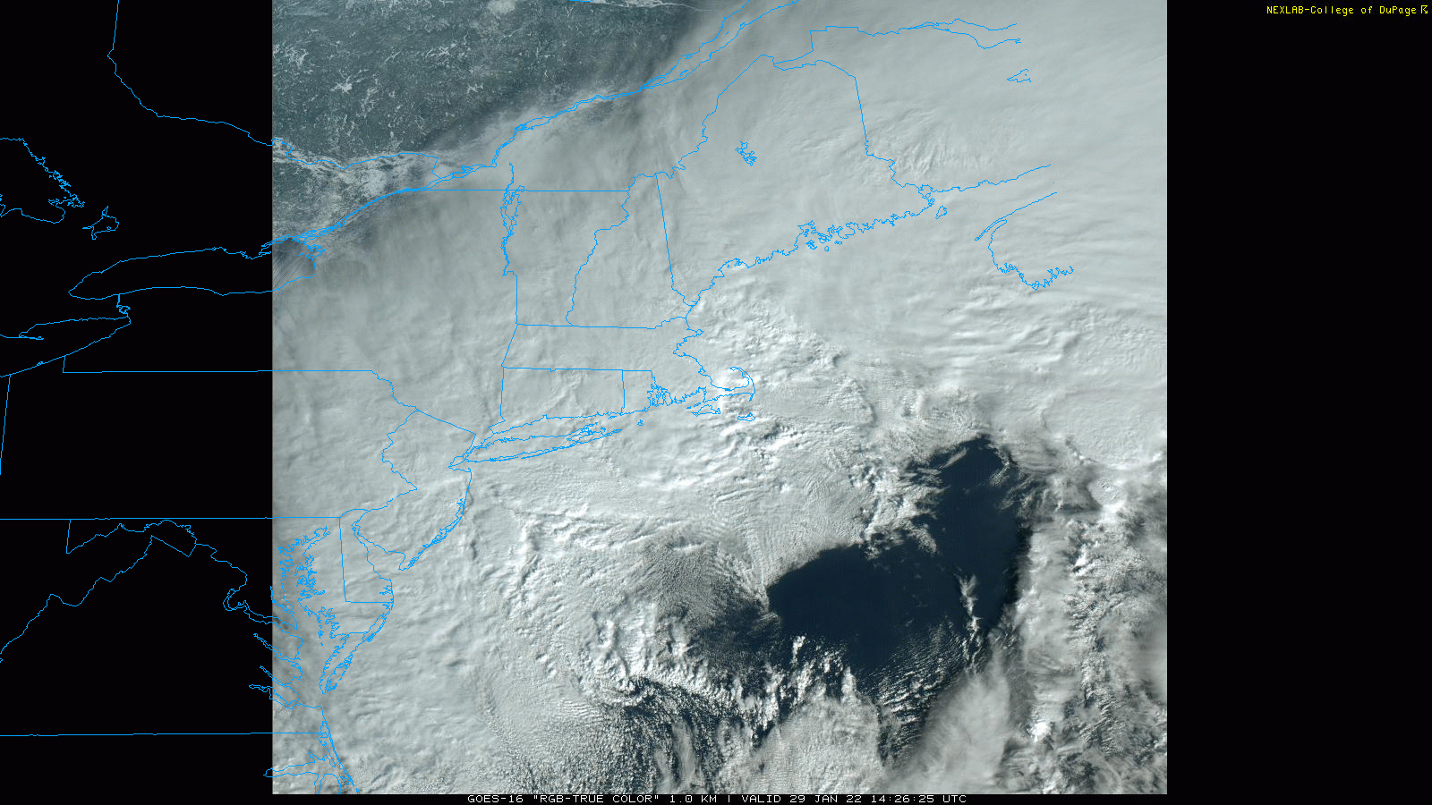
Marine layer beginning to encroach into the area, Jersey shore, Long Island, over top temperatures in the teens/single digits. Very anomalous when looking south and east from a weather observing stand-point. With these temperatures, you usually do not see low level clouds advancing onto the shore and inland, attributing to the outlook of this rapid change in airmasses within the next 12-24 hours.
-
FWIW There's a difference between model watching/prognosticating and tracking a storm. There is no storm atm. We are tracking models and it's important to establish that before making any calls involving absolutes. Just a word to the wise, and I do consider ya'll wise.
-
Chaos theory https://www.sciencedirect.com/topics/earth-and-planetary-sciences/chaos-theory
-
Idk about you guys, but I'd prefer a nickel to dime event that will stay on the untreated surfaces for at least a week, than a double digit snowfall that melts down within a week. Snow with staying-power usurps puddles. I'm so far enjoying Winter 2022 and wouldn't mind this past week to repeat.
-
It matters to city and town municipalities, management and operations. The general public can make their own decisions based on forecasts, however the city and towns follows certain procedures which are based/take guidance and make decisions on operations based on the criteria.
-
Six out of the nine ensembles depict 6-8" totals for parts of Long Island. The orientation of the totals reflects a max heading into southeast New England. If the coastal transfer occurs sooner I can imagine these totals extending into NJ, otherwise as others have stated there will be a gap in max snowfall totals between the primary coming from the Ohio Valley and coastal sections.
-
The TV-mets will have to be more judicious in their weather segments when describing the day as cool, and be more pedantic describing it as an average autumn day.
-
Observed lots of low-topped-surface based drizzle showers in the 5 boros, Long Island, this late afternoon. It's a good to day to calibrate your .pal files of your nexrad color tables on RadarOmega, Radarscope, etc. Lots of microscale boundaries with the sun poking through that are reestablishing the marine layer like a washing machine kept in rinse and spin. Mid-level clouds coming from the southwest with the jet are just adding to the special effects that otherwise would be a glum October day. From the skies, it was a very active day.
-
Emergency response measures to inform the public should not rely solely on media, the internet, for weather-related emergencies. If community-based sirens were utilized in a flash flood emergency, it would be hard to ignore or misinterpret. Many victims of the flooding, particularly in basement apartments were sleeping or otherwise tuned-out from information sources. A siren would elevate response and awareness to the danger and with appropriate guidance from other information sources, inform the public to move to higher ground as needed in life threatening measures.
-
It has to be a park because otherwise there's risk of development like any other location in Manhattan, any thing from a pizzeria to a skyscraper next door, or a subway below, tarnishing decades of records. Maybe they keep the overgrowth as an eco-barrier to better represent the climate prior to urban sprawl, and throw out the idea of a "new norm" *shrugs*