andyhb
-
Posts
20,454 -
Joined
-
Last visited
Content Type
Profiles
Blogs
Forums
American Weather
Media Demo
Store
Gallery
Everything posted by andyhb
-
This thread is a ****ing trainwreck right now.
-
They've been quackier than a duck farm for ages.
- 992 replies
-
- 11
-

-
Crush job incoming.
-
IIRC didn't some of this get fixed in the most recent update of the GEFS? Or is that still associated with the v16 testing?
-
-
Going to be a lot of precip with this thing if the trough has any degree of amplitude upon reaching the OV/Lakes. Gulf is wide open.
-
It's almost as if @RCNYILWX knew what he was talking about or something...
-
I doubt a lot of people want winter to continue into April either.
-
re: Spring tornado chances. 2008/2017 would be more promising though.
-
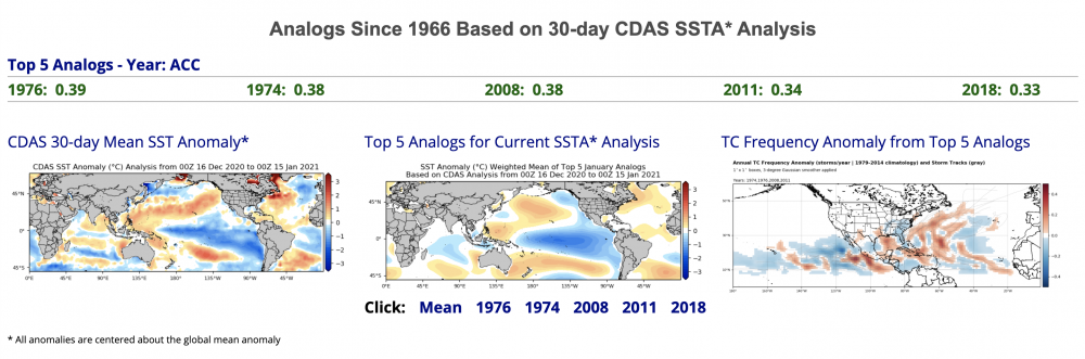
Looks like Tropical Tidbits has their SSTA analogs up and running again. That would certainly be a favorable set for an active severe weather season, especially early season. On the other hand, rapidly decaying Ninas in 3.4 over the past 20 years have been very unfriendly to the Plains in peak season, as such years consist of 2006, 2009, 2012, 2017, and 2018.
-
Difficult to get cutters when you have a strong block over the Davis Strait.
-
Posting/discussing ensemble forecasts in that range is problematic how? That's what they're designed for. Also, you were the one that made a blanket statement about west-based La Ninas, not me. The point is that we haven't exactly been in a "typical" pattern of La Nina (or anything close to what you are claiming) recently. Ongoing -NAO argues against a torch, as does the potential for ridging over the EPAC/AK later in the month.
-
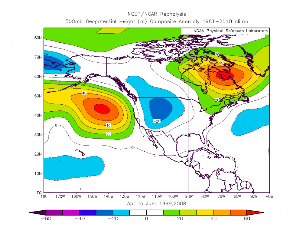
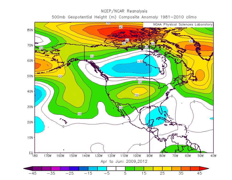
Interestingly the MEI data is tracking right along with 07-08 and 98-99 for the past 4-5 months, despite the SSTAs being quite a bit weaker through most zones. Well behind 2010-11 though, which is the strongest La Nina via MEI in the entire dataset going back to 1979. Also pretty close to 08-09 and 11-12. If we're talking severe weather season strictly looking at these four years, there's quite a divergence between 07-08/98-99 (highly active seasons) and 08-09/11-12 (much quieter ones). The latter two show a poleward retracted jet in AMJ as opposed to the former.
-
This is gibberish. With ridging into AK yielding a Siberian connection (dislodging cold air) and strong -NAO blocking near/over Greenland, an all out torch is highly unlikely ala 2012. Low frequency (ENSO) signal is not the be all/end all. Hell, south/central Texas got a substantial snow event yesterday, that doesn't typically happen in a La Nina year given the suppressed sub-tropical jet. Edit: I should've expanded my post yesterday to mention late January as well, since that looks to be when we will see more of a transition.
-
For lack of a better term, February looks like it could offer the chance for a blockbuster or two for the Lakes as the North American longwave pattern retrogrades plus continuing high latitude blocking (albeit likely relaxed some) and a more Nina-like regime resumes. Should note that with this high latitude blocking comes some degree of suppression to the typical SE ridge, and less likelihood for storms to cut west of the sub-forum. Going to have to watch severe weather chances down south I'd imagine as well.
-
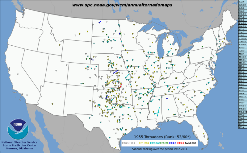
1955 was a very active spring over the Southern Plains severe weather wise, especially for the time.
-
Looks like the two years that had big -NAOs in January out of that composite are 1955 and 1960. The former just seems to be a pretty good analog in general the more I filter.
-
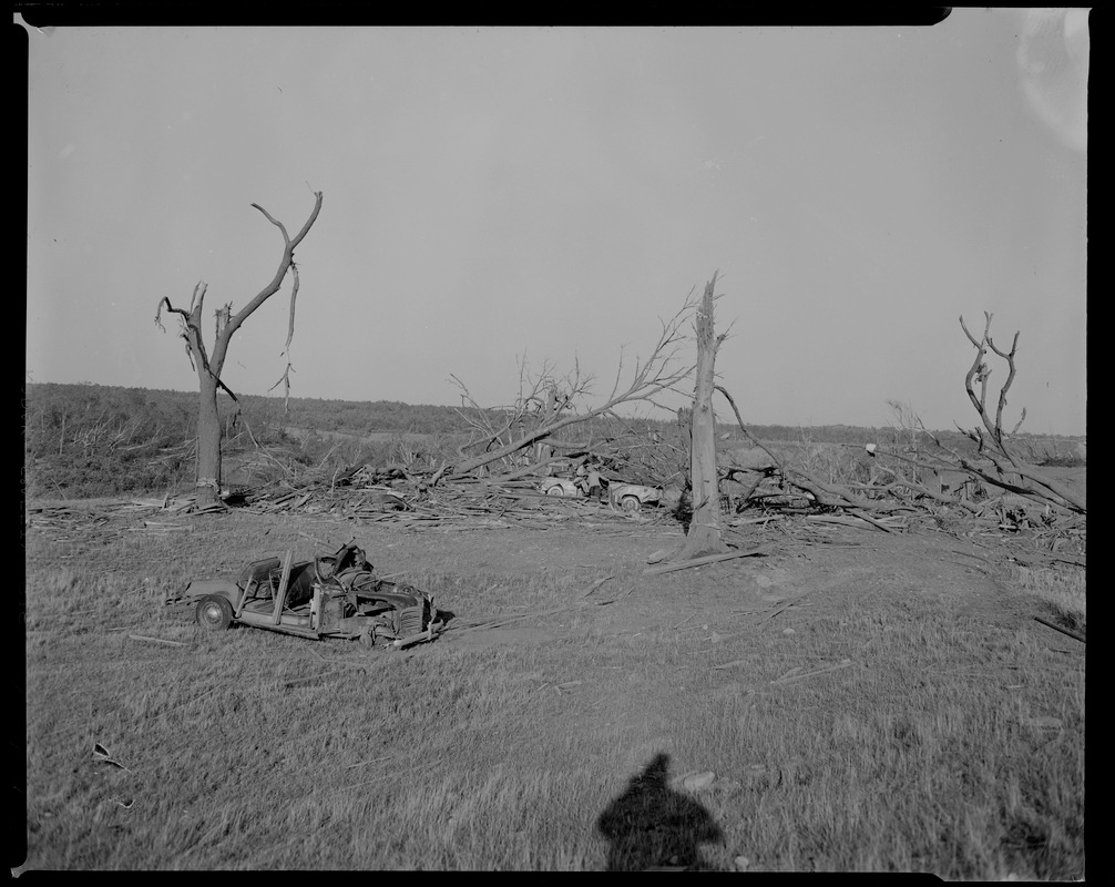
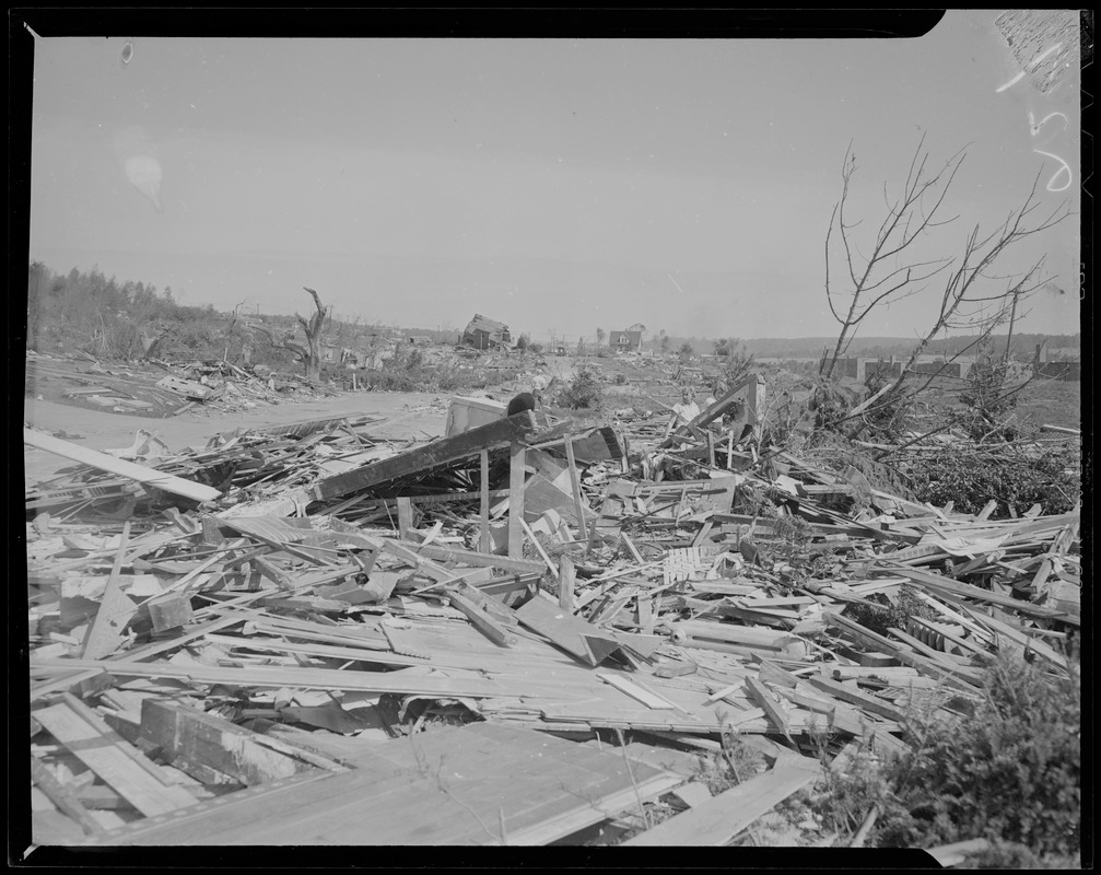
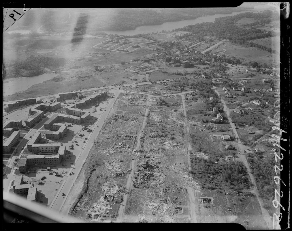
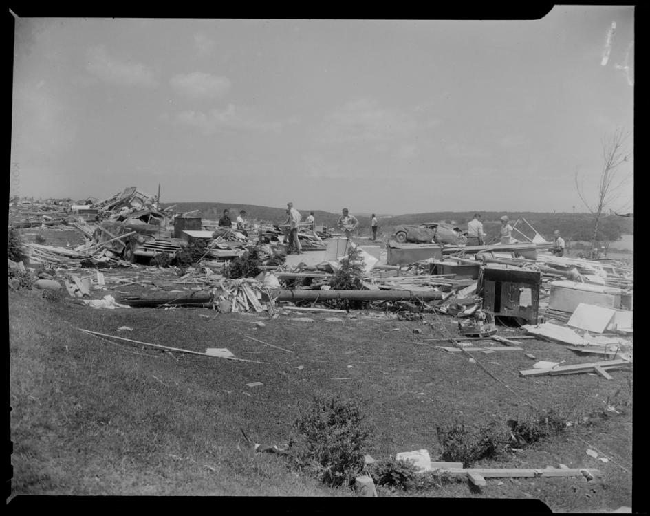
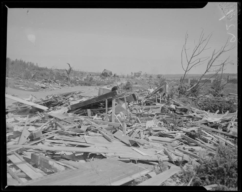
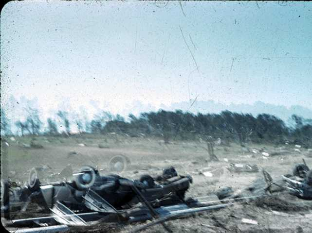
More extreme damage from the Worcester tornado (photos I haven't seen). Idk how this one is not classified as a 5 in the databases.

-
Well the Euro is certainly... fun next week. As in two feet of snow for ICT and >30” for Manhattan fun.
-
It would be nice if you weren't constantly such a d*ck.
-
Active tornado season in Dixie, not necessarily the Plains. That, and weak La Niña (which is what the weeklies have been shifting towards in 3.4) has not been friendly to tornado season as of late (2006, 2009, 2012, 2017, 2018).
-
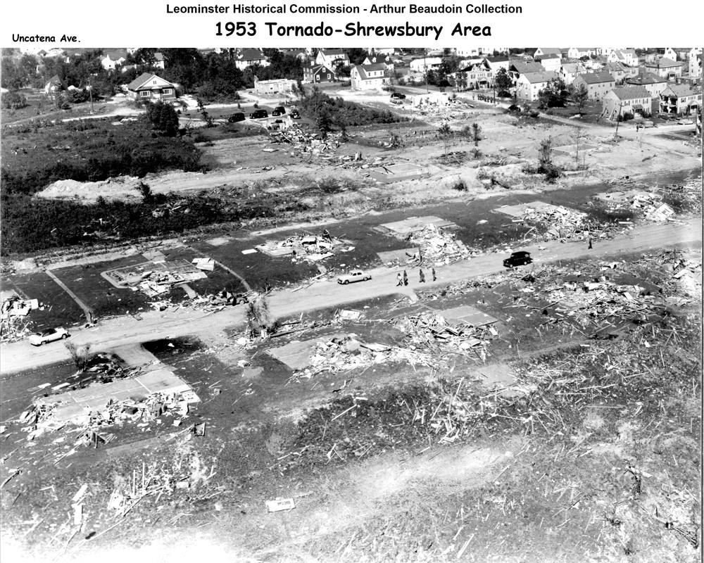
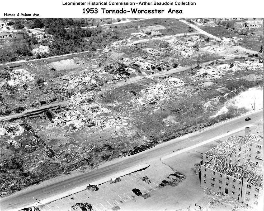
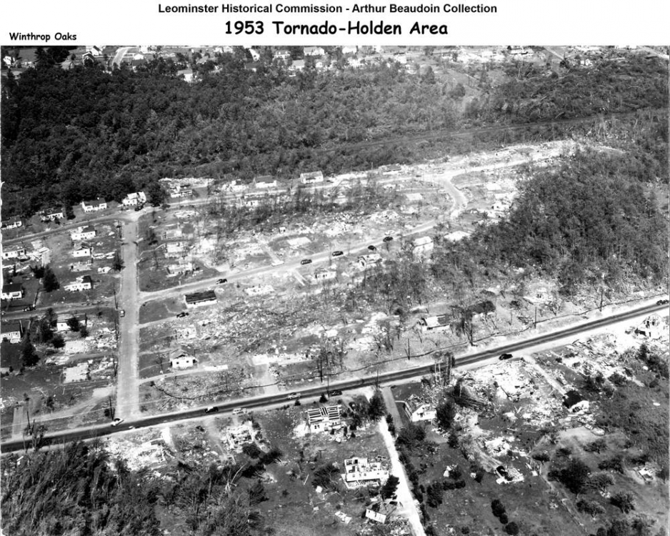
Couldn't find another place to put this (not sure if there's a dedicated thread to the Worcester tornado or not), but these aerial images that I've never seen before of the damage path of the tornado are incredible, and are at multiple locations along the path.


-
Aside from the 8/10 derecho, lol this severe season. Can’t say things are looking up for next year for us out here in the Plains with the raging drought out west and La Niña conditions, but I could certainly see some Midwest shenanigans.
-
Also regarding fairly modest storms (intensity wise via central pressure) producing extreme snowfalls.
-
Looks like a new report of 4 feet came in for NH.