Radtechwxman
-
Posts
2,481 -
Joined
-
Last visited
Content Type
Profiles
Blogs
Forums
American Weather
Media Demo
Store
Gallery
Everything posted by Radtechwxman
-
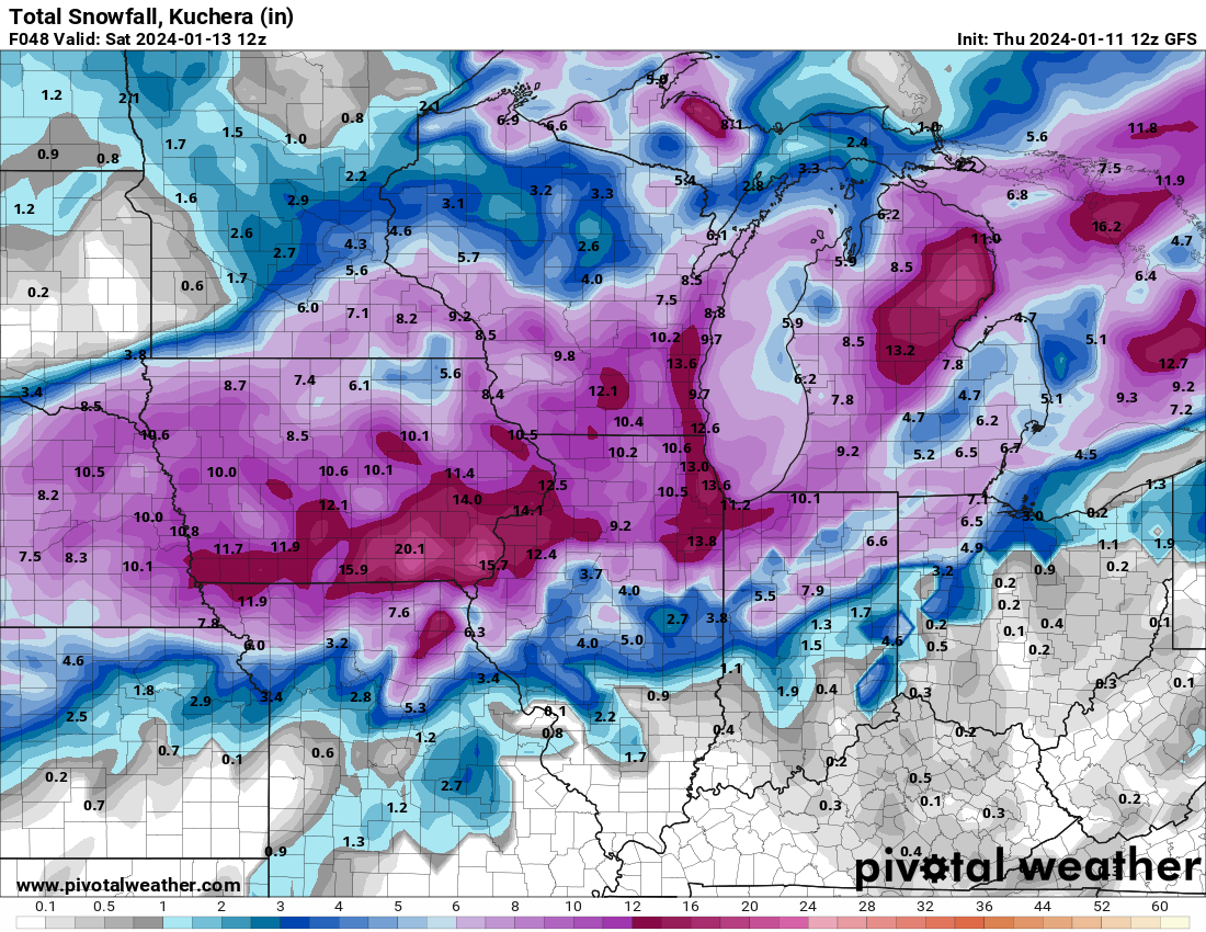
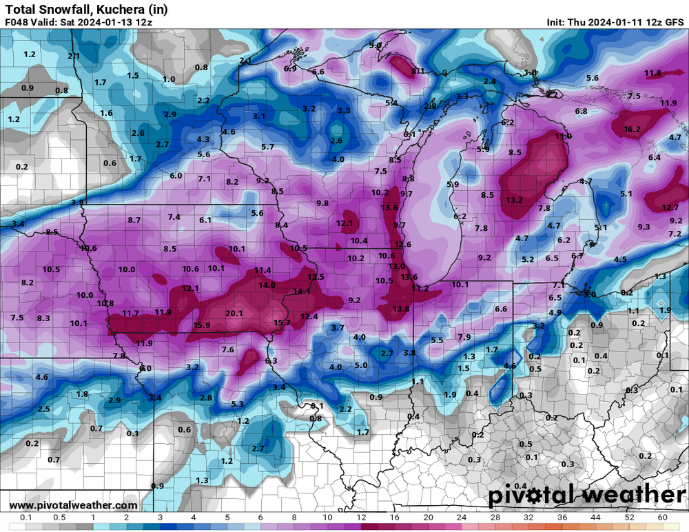
0z hrrr is very odd. Have a double barrel strengthening low. Both low centers strengthening. One tracks basically over me and the other well se. It changes over precip from east to west. Gets me in a waa screw hole between lows. Not sure I buy that evolution. Very strange.
-
Euro is skimpy with back end deformation snow compared to other models esp further south on tail end. Another thing I noticed is that hrrr last few runs has shown the waa precip staying snow here longer before mixing.
-
When was the last time that model was right?
-
Okay real question. It's been pondering me a while. How does this system have so much more warmer air with it vs the last? I get trough geometry is a bit different but I still am baffled with the track similarities between this one and last and how this time it looks mostly liquid here. Stronger llj? Deeper cross section of waa vs last?
-
Gradients and cutoffs are going to be wild with this. I look to be very close to one. My forecast is 0-6in based on latest model runs.
-
I actually felt like it came nw. Has kind of a barrel double low then one takes over further east. Nam/rap/hrrr were hinting at this at times. Maybe they were right. The snow gradient across Peoria County is comical.
-
That is a good point. Noticed spc has toned down severe threat due to poor thermodynamics and limited moisture return. So less convection.
-
I wouldn't trust nam. It did terrible with last storm.
-
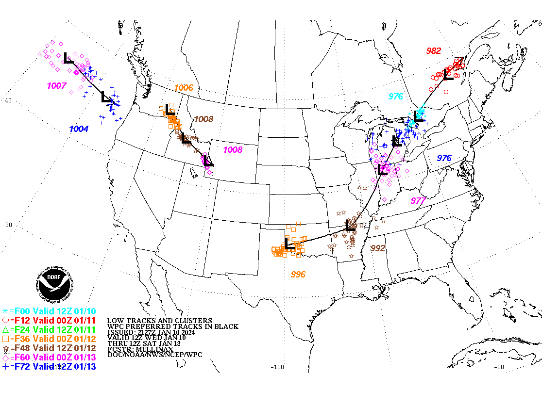
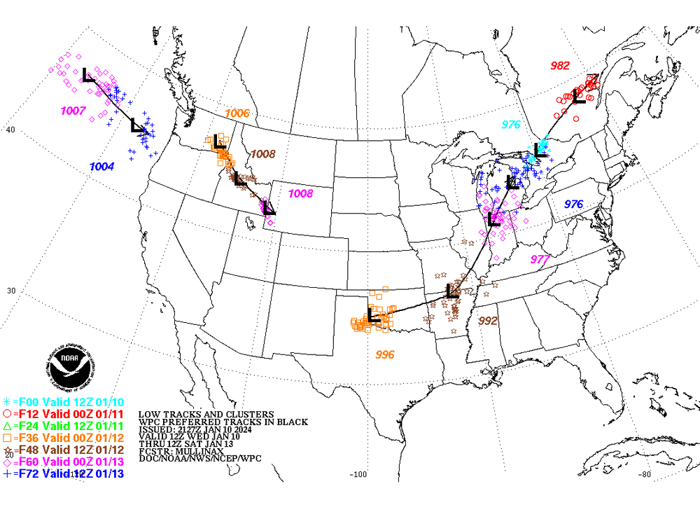
Nam continues to be so nw with the low track
-
Not really. Lol. Screws the parts of IL that also missed out on last storm. And Ohio Valley really getting the shaft.
-
That stings a little. Just love barely missing a massive snowstorm and possible blizzard Hoping hrrr is overdone with that warm surge. Or changes over sooner
-
Lol instead of getting better consensus it's getting worse
-
Minus the void over my county decided to keep rain here longer
-
Comical that gfs hammers areas all over me and has a void over Peoria County where I am #weatherdome
-
This. Not trusting them 100%. Globals actually did better with track on last storm.
-
Nam/rap/hrrr still seem to be on nw side of other guidance. Will make huge difference here.
-
At this point I would start trusting hi res guidance more over globals. 06z hrrr seemed to be finally in line with other models. Rap was still pretty nw.
-
06z euro a little drier. Wonder if it will be like last system where after it occludes deformation zone starts to lose steam.
-
Euro still not wanting to play nice for areas further south like other globals. Crush job for Chicago and N IL of course. Man this one hurts. That track on euro looks so good for here normally. Hoping maybe that warm nose won't get that west.
-
Feel like rap/hrrr will continue to nudge se closer to guidance like last event
-
Gfs is remarkably consistent compared to the other models
-
Team gfs and rgem till the end. Ride or die
-
I certainly had higher hopes for this pattern but should have known the feet of snow was too good to be true. Ha.
-
This track looks very close to what GFS is showing
-
Euro so close to having me in better accumulations. I'm like riding the mixing line. Definitely going to miss the heaviest swath but would be nice to get high end advisory snow or low end warning criteria at least.