

LongBeachSurfFreak
-
Posts
9,524 -
Joined
-
Last visited
Content Type
Profiles
Blogs
Forums
American Weather
Media Demo
Store
Gallery
Everything posted by LongBeachSurfFreak
-

Central & Eastern Pacific Thread
LongBeachSurfFreak replied to Windspeed's topic in Tropical Headquarters
Not happening. Later in the season maybe. Needs to rocketing NE to survive the water tr is around 20c.. -
That complex off the south Jersey coast eould be an epic flooder if it were over land.
-
Yeah they aren’t the plague they were originally billed to be. We actually had more last summer on the uws than this summer. Finally a droughtless summer on the island I’m more interested in that.
-
Best light show in a decade. It’s so rare to get that continuous lighting on the island. Memorable
-
It’s no joke like watching a fire work show finally right now. Nom stop with numerous very intense nearby cloud to ground strikes. Watching from my outdoor covered porch spellbound. guess those supercells over Ohio held together
-
Absolutely epic storm in lynbrook. Best in many many years. Currently continuous lighting. 50ish mph gusts to to start. Soooooo happy I woke up
-
Yeah I think that area is our best best for anything significant. Has been producing tons of supercells. So obviously allot instability/shear with that zone heading east
-
Pretty epic super cells in eastern Ohio right now headed into PA. As per usual I doubt much survives for us later
-
2023 Atlantic Hurricane season
LongBeachSurfFreak replied to Stormchaserchuck1's topic in Tropical Headquarters
I hate to say it but I agree. I think too many people, pros included are warm water drunk so to speak. The Atlantic could be 40c and if there’s a ton of shear and dry air it doesn’t matter. That said, any storm that finds a moist low shear area has the potential to go nuclear. This is basically what long term climate models are forecasting. More cat 5s and less 1/2s relative to climatology. -
Right…. Slow but not forgotten. Though I think some of the major forecast have a high bust potential.
-
Central & Eastern Pacific Thread
LongBeachSurfFreak replied to Windspeed's topic in Tropical Headquarters
Dora looks spectacular this morning. This is going to be one monster ace producer as it has several more days as a major. -
Damn looks like a cold pool aloft type precip shield. We will take the rain on the drought stricken south shore
-
I guess you’re not following forks. Elevated …..
-
That has all the hallmarks of a derecho on radar for south/central Jersey. This might be a memorable event down there
-
Definitely a derecho in progress. Just insane radar as it went through northern MD
-
Storms west of the DC area look like something out the Great Plains. It’s going to be one hell of a day there. we are finally destabilizing here, so I wouldn’t totally write our are off
-
Exactly. Fetch and duration are actually equally important. You can get captured fetch when a storm is moving fast enough to entrain its own swell. So there is likely a large east swell moving with the storm currently, but to the westerly movement it will miss the islands. The best example of captured fetch was hurricane bill of 08 in the north east. The storm was moving north west towards the coast with a large captured swell ejected as the storm eventually turned north. That produced the largest swell I have witnessed on Long Island. With sets in the 15 foot range causing massive wash overs and beach erosion under sunny sky’s.
-
Central & Eastern Pacific Thread
LongBeachSurfFreak replied to Windspeed's topic in Tropical Headquarters
Yeah I was surprised know when was talking about this storm. Very resilient microcane. Contains some annular properties which would explain the resilience. Very long track too -
Zip on the island and the city last night. Always surprises me when a front comes through dry this time of year. Onto Monday/Tuesday
-
Some very nice storms over Pa and upstate currently. We are kind of in the squeeze play between that action and precip down south
-
Yet we can’t crack 100 during the summer. Most likely do to increased DP. Kind of like Florida, Hi capital but also really breaks 100.
-
2023 Atlantic Hurricane season
LongBeachSurfFreak replied to Stormchaserchuck1's topic in Tropical Headquarters
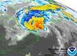
Belle likely would have been a hurricane at landfall on Long Island based on current water temps, keeping all other factors the same. We are loosing our hurricane buffer more and more. This will soon be prime hurricane coastline. -
Hard to tell, but I think that’s an ash, which would be doomed anyway.
-
Wind gust to 48 knots at the 44065 the ny harbor buoy, and .86” at the wantagh meso. Very very rare win for the south shore of the island.
-
Of course I headed north to catch what I thought would be the best of the storm on the north shore. Caught the double rainbow and maybe 40mph gusts while going up the wantagh. Should have stayed at the beach where I’m sure it ended up epic

