wdrag
-
Posts
5,609 -
Joined
-
Last visited
Content Type
Profiles
Blogs
Forums
American Weather
Media Demo
Store
Gallery
Everything posted by wdrag
-
OBS for OKX Flood Watch (attached) into early Saturday 5/10/25
wdrag replied to wdrag's topic in New York City Metro
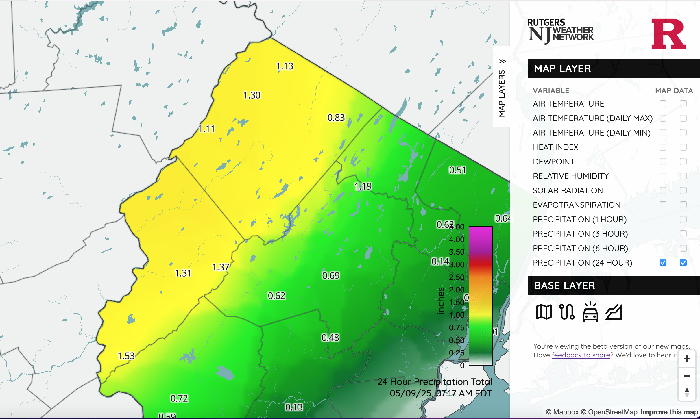
I still dont quite understand the Watch in our area and its expansion but going with it. NYS mesonet all under 1" so far. NJ however, this is legit. Click for clarity. Wantage fits with at least 1.34 so far... needed.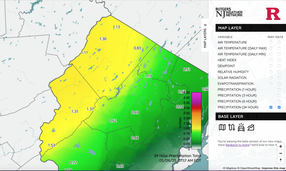
-
Added an OBS thread for the OKX Flood Watch. Am not enthused as I'd like to be, mainly due to antecedent conditions but potential does exist for spot 4" amounts se NYS, W CT... basically within the axis of most modeling heaviest rain northwest of I-95. Seems like the FFG is on the higher side but training - repeat episodes could result in spot flooding within the OKX Flood Watch. CT RVR Flood warning is minor at this time and may not crest til the weekend. Have a good night.
-
OBS for OKX Flood Watch (attached) into early Saturday 5/10/25
wdrag replied to wdrag's topic in New York City Metro
Wantage NJ 0.62 125P-7P. -
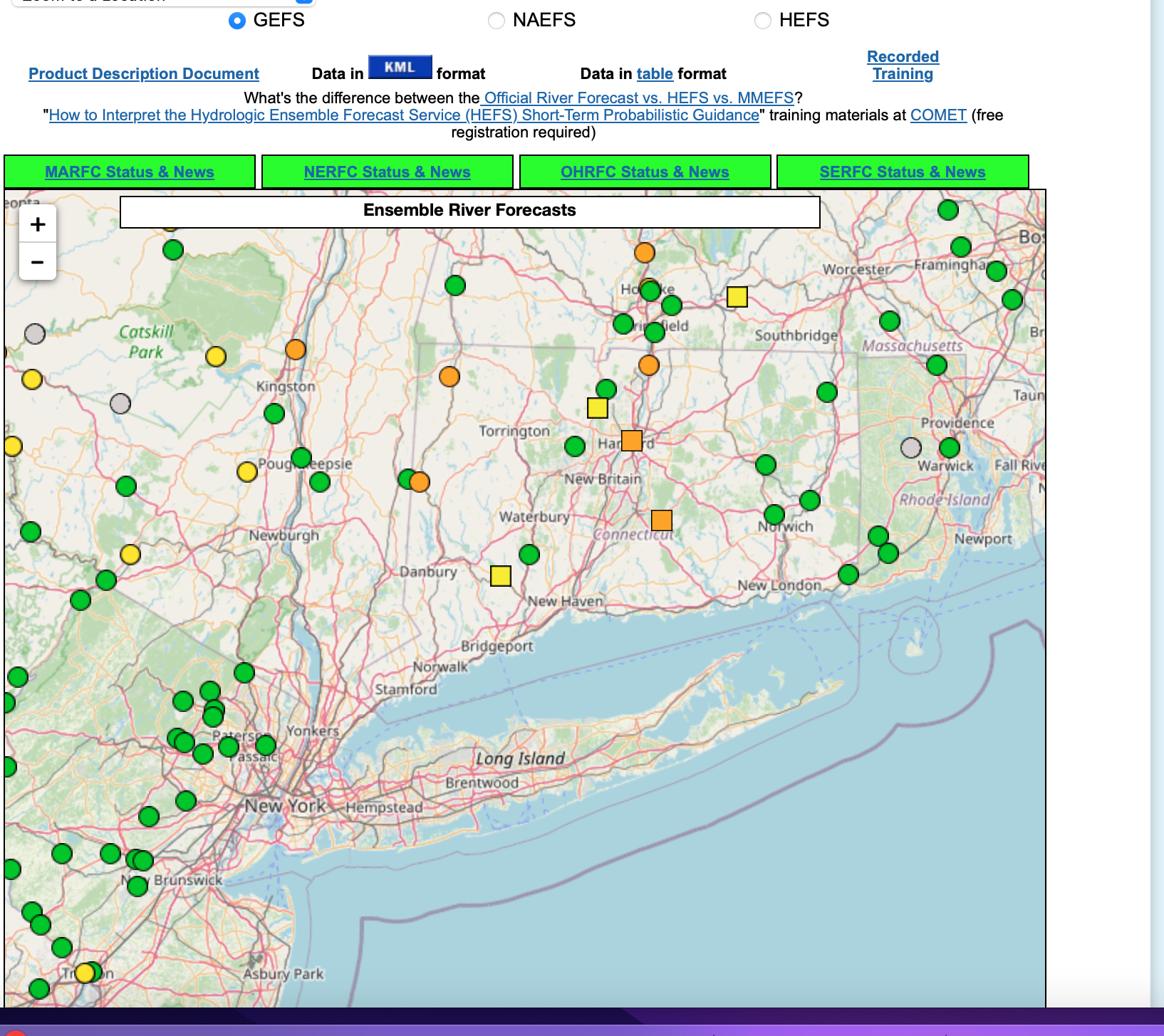
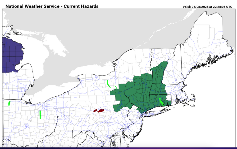
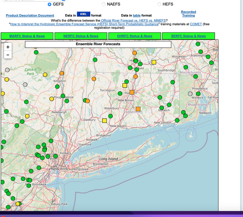
Isolated 4" rainfall possible by daybreak Saturday for w CT, se NYS where OKX has issued a flood watch this Friday afternoon 5/8/25. Most modeling has a needed 1-3" spread out over a 36-42 hour period ending Saturday morning. Flood guidance suggests we'll need 2.5" in a 6 hour period for flooding. Lesser rainfall LI NJ and ne PA under 1.5". A snapshot of ensemble forecasts showing minor flooding anticipated at several gages in the north part of the NYC subforum. Long ways to go. We'll add some CoCoRaHs amounts at 9A Friday and see where we stand.
-
Wantage NJ 8 s High Point. 0.41" 125P-2P in my stratus (0.45 on my AWN). So the .41 matches the OHP,THP,STP seen at 220PM this afternoon off DIX. No thread at this time... if NWS drops a watch on I84 I lmght add a thread...that seems where iso 4" reports should occur between today-12z Sat. Unlikely thread at this time.
-
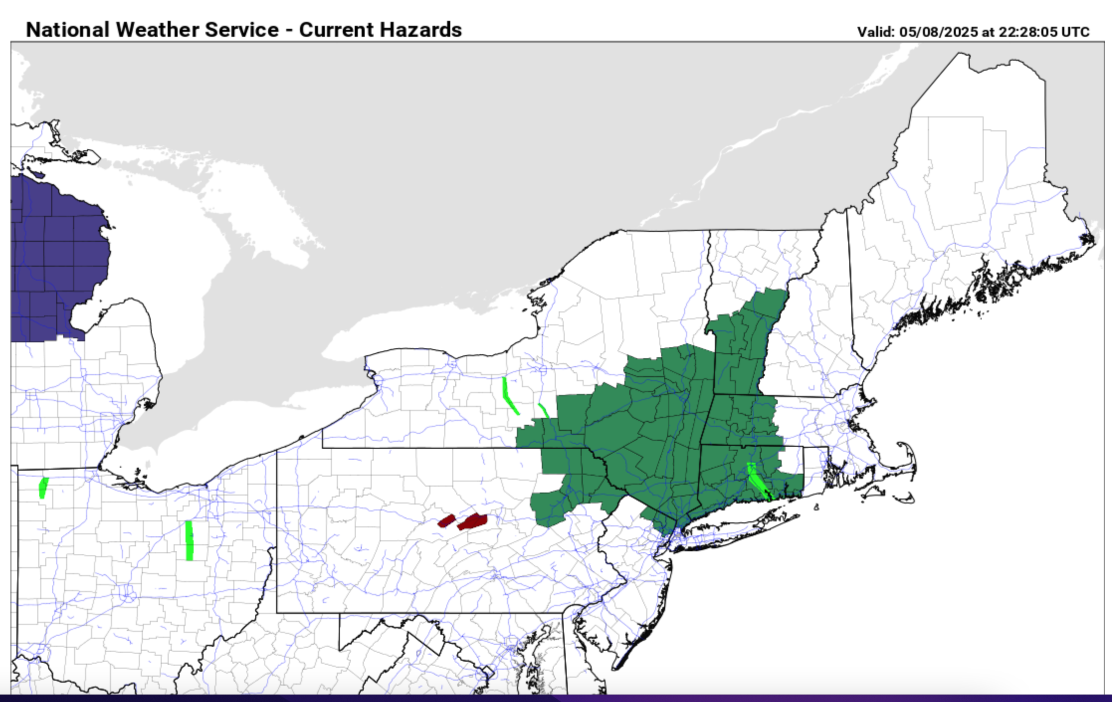
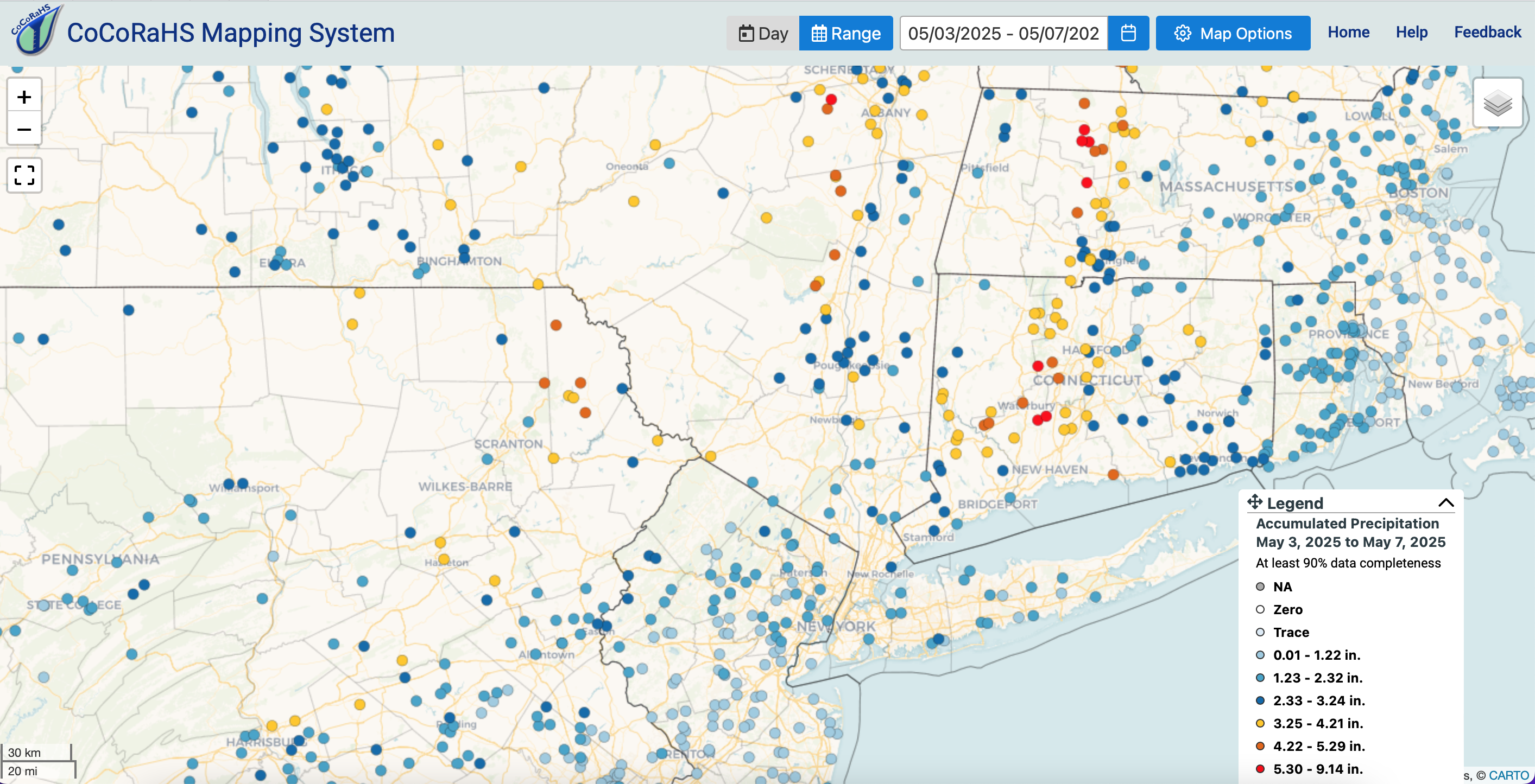
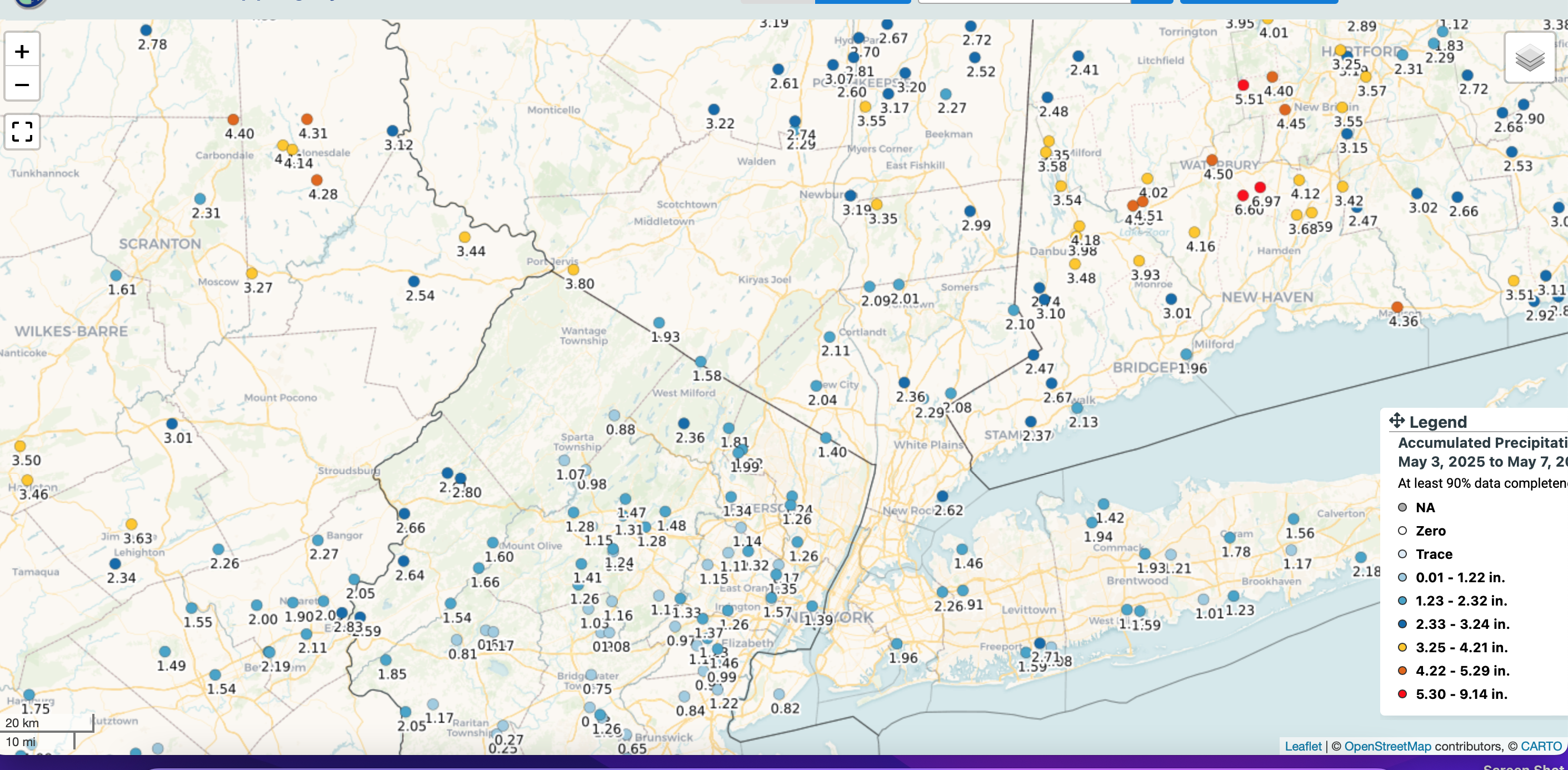
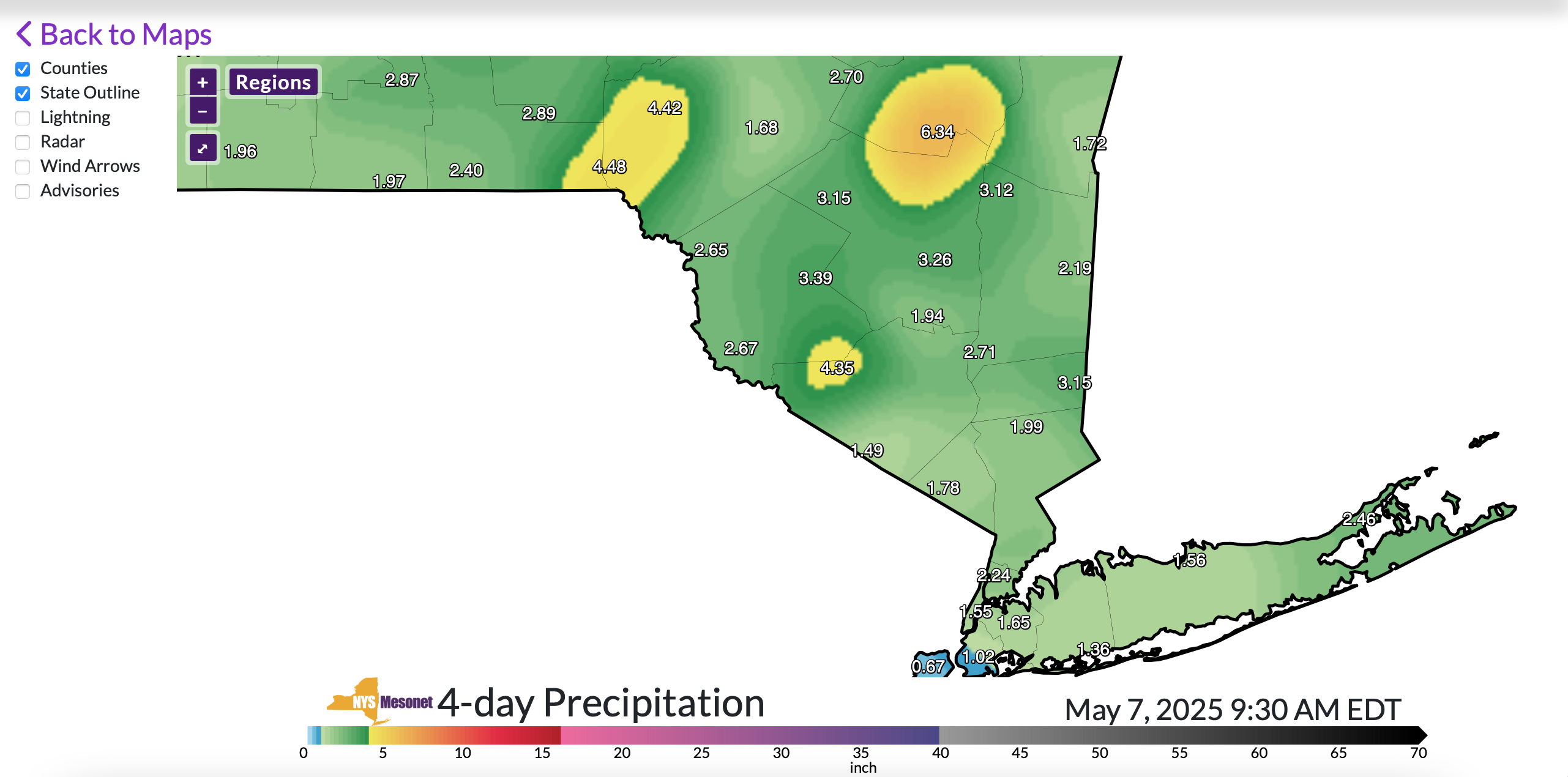
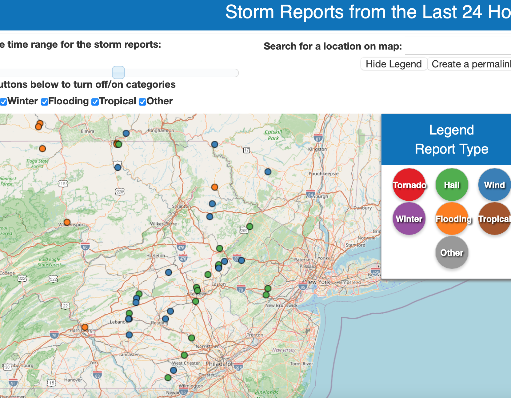
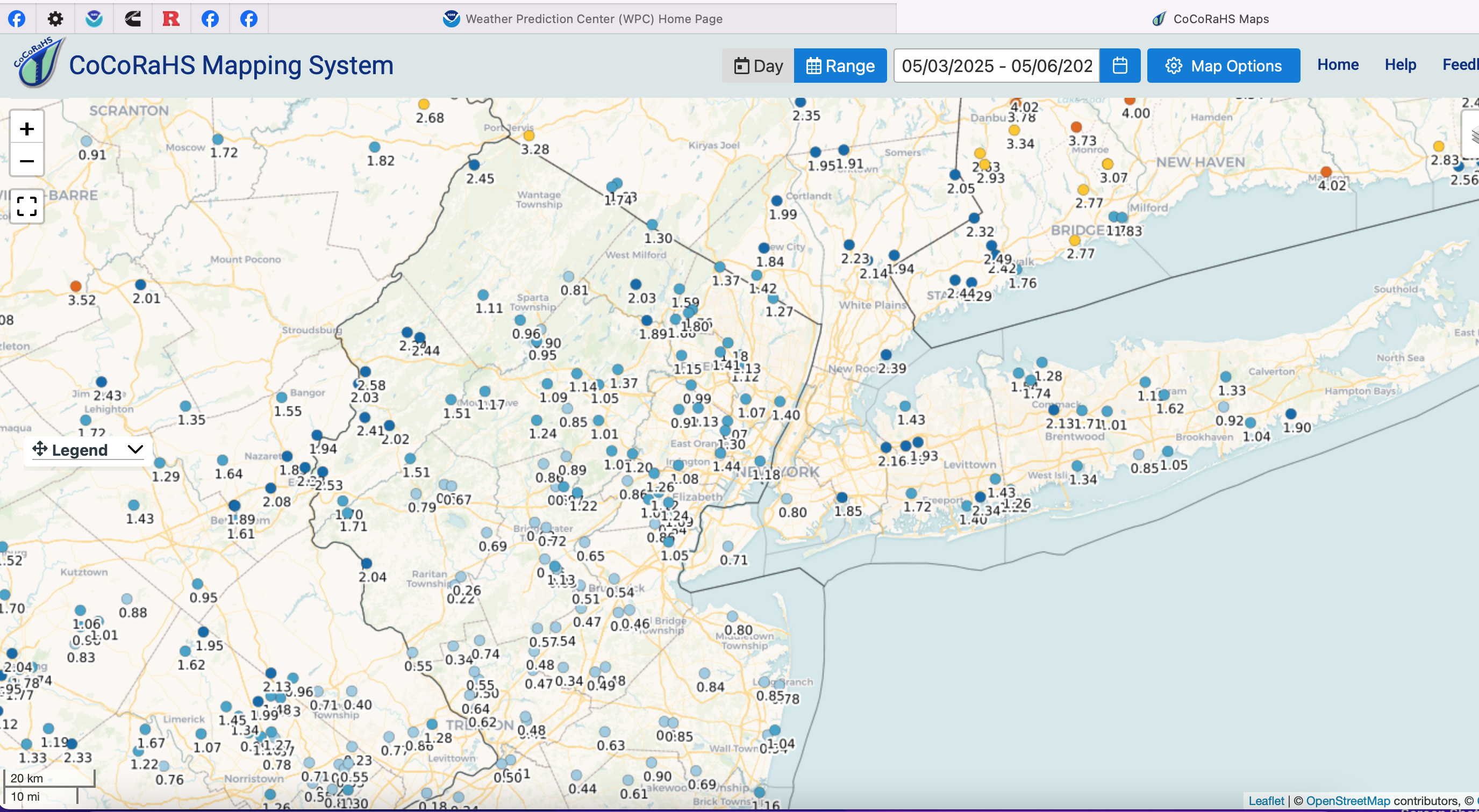
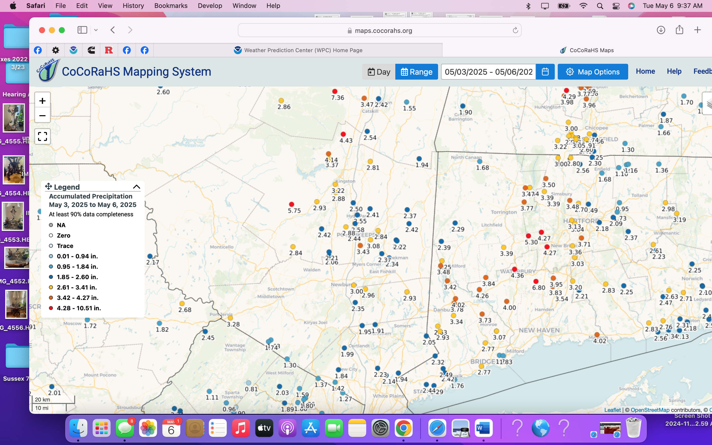
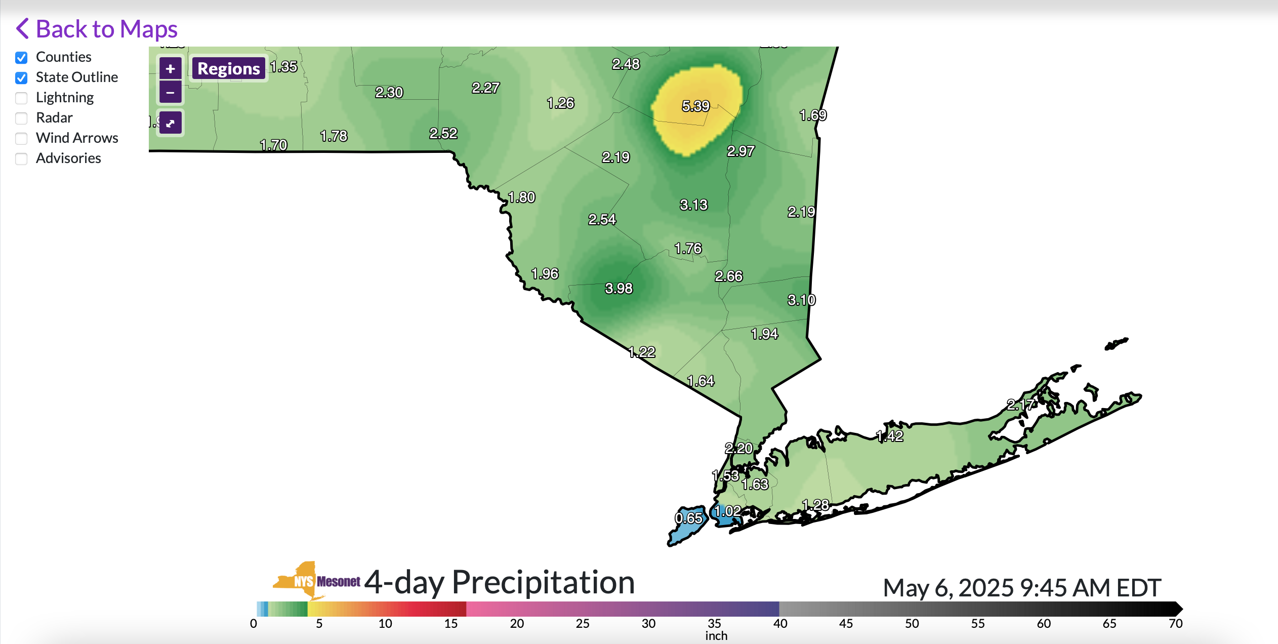
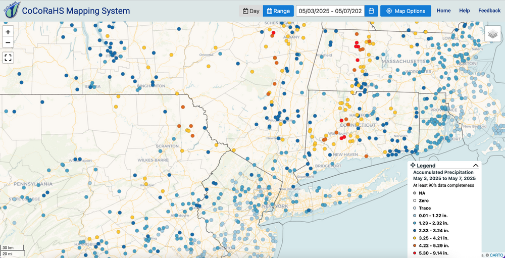
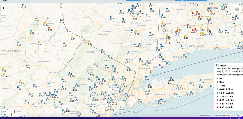
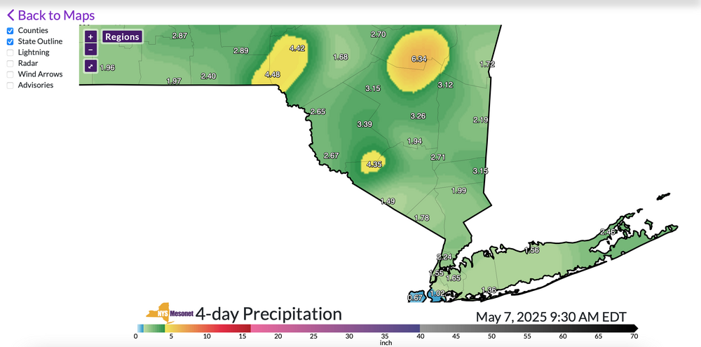
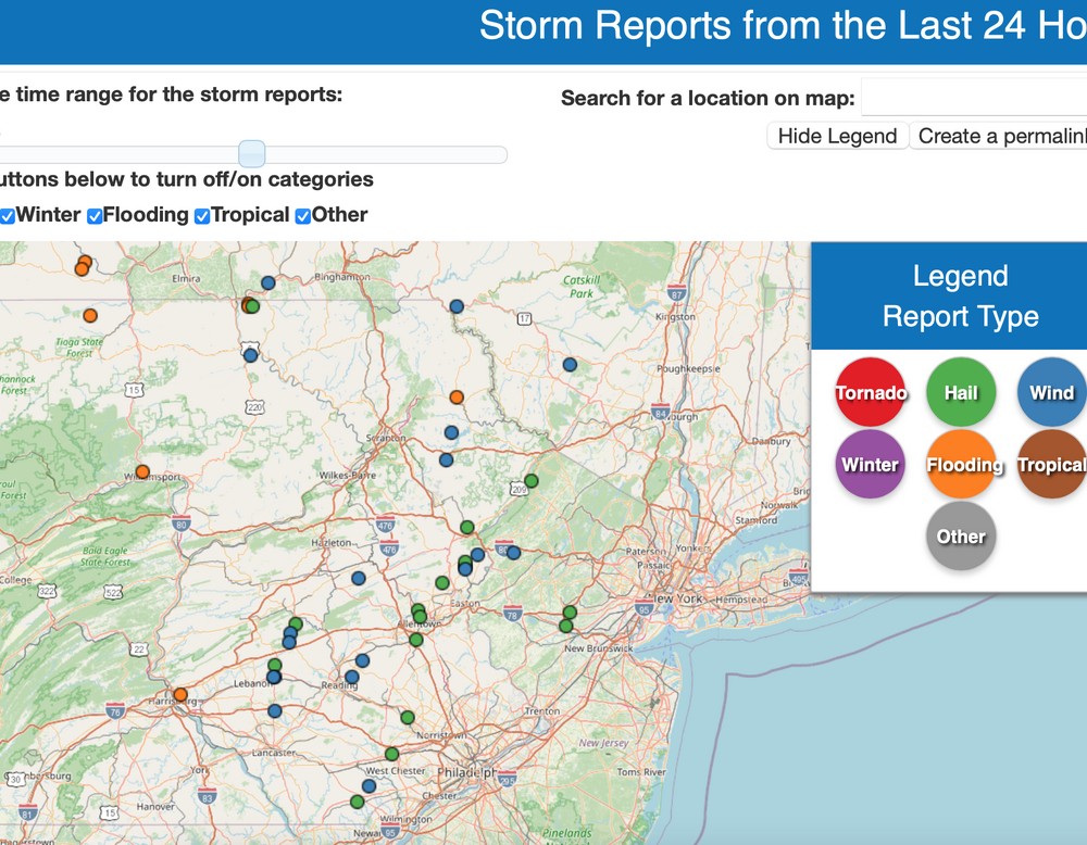
No thread for 1-3" interior late Thu-early Fri. Antecedent not quite high enough. Samples attached of actual rainfall via CoCoRaHs and NYS Mesonet. (Fri-Tue). (click for clarity) Also yesterdays hail reports near our area in green...not necessarily severe hail.
-
Storms late this afternoon might be hailers
-
Kittatinny Ridge-Appalachian Trail in western and northern SC and the Del River on the west side might play a role. I agree w your obs.
-
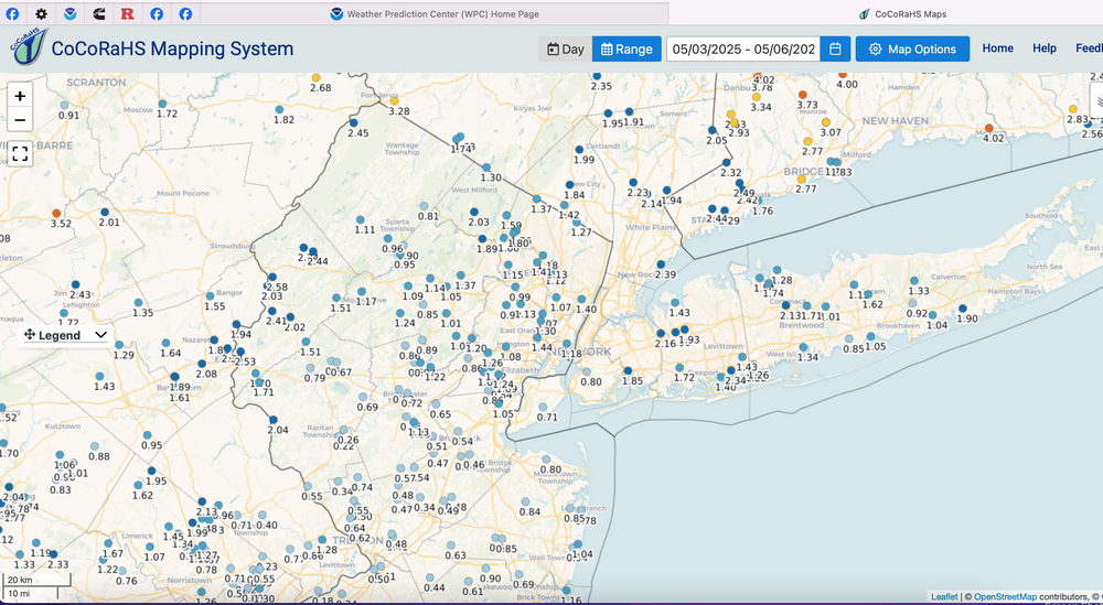
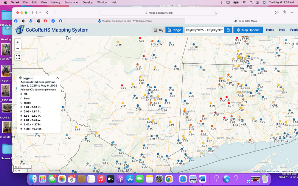
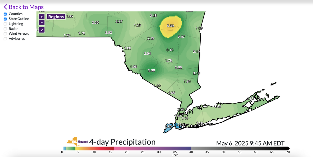
Good Tuesday morning... CoCoRaHs maps attached and NYS MESONET. Depending on how extensive there SVR storm rainfall this afternoon I95 northwestward, I expect much of what was outlooked last week for qpf to verify. Next one Thu night-Friday might need a thread due to antecedent conditions. Still waiting a day to see what this afternoon-evening yields. Click for clarity if you're interested. Heading for spot 8" in the far northern part of the forum.
-
Kittatinny Ridge-Appalachian Trail in western and northern SC and the Del River on the west side might play a role. I agree w your obs.
-
NJ and NYS mesonrtd have about 2.3” near High Point NJ and Port Jervis NY. Am remote so can’t verify but am sure SR23 washout is legit. Don’t know how serious.
-
Report of a road washout in Sussex county NJ where fall rates were nearly 3.5 per hour a couple hours ago. SR23 out of high point state park. Saw other mPING reps of flooding W Sussex county. While my AWN reads high. At VA least 1.3” past 24
-
No changes in my posted amounts yesterday which favors 3-6 I95 Inland iso 8 which is modeling Catskills right now ends Wed eve.
-
No changes in my model thinking above. No thread from myself at this time. Will try and check back tomorrow. 231pm/2
-
Holding off a thread for now... manageable 3-6" event northwest of I95 with isolated 8" possible by Tue night??? NYC-LI-coastal NJ my guess per WPC and modeling is 1.5-3.5". Most of this Sun-Tue but starts inland late Sat. Impacts outdoor activity. Be careful with lightning, slippery embankments. MLB impacts likely with delays-cancels ATL-DCA-PHL-NYY-BOS sometime in this Sat-Tuesday time frame with leftover scattered convection per the upper low departure Wed afternoon. Might be some embedded isolated severe but do check SPC and local WFO's. I didnt want to start a thread based on the beefiest ensembling which is the Euro. GEFS and CMCE lagging. Monitoring remotely on an Iphone. If I get time I may add info this weekend?
-
No rush on any drought denting thread... still looking a 20% coverage 5" but ensembles and WPC below that and definitely I95 inland, at least through Monday. End of whatever happens is probably with the leftover upper low passage Wednesday evening. Most of the rain as per WPC 17z D1-D6. Overall, due to the previous 9 months (or so) drier than normal pattern, most of the area should handle the coming (welcomed) rains. Will rereview at 830A Friday for a possible thread and then probably out of the loop through at least early Sunday afternoon. If a thread posts, it will include OBS. Just waiting it out. For now, not quite there in my mind for a thread. Have a good rest of the day - evening.
-
No thread of 20% coverage 5" areal til this evening... if then. WPC has 4" bullseye over NNJ through 7 days. Helpful rains but spread out over days and dependent on back end bigger rains next Mon-Wed. Streams are low flow but urban problems could result. Major league Baseball games from Atlanta to Boston DC, Phil;ly, NYY likely to see some delays or cancels this weekend-early next week... and outdoor activity definitely impacted. For now through Monday morning... biggest rains ensemble modeled I95 northwestward (inland where widespread 1.5-2" anticipated). Thereafter the focus may shift... and that will be the driver to get us to 5+. That latter still has a fair amount of uncertainty. There has to be a map of rainfall deficits. I took a look back the past 9 months via HPRCC and it looks to me like our area has deficits of 4-9". There probably is better data out there that someone can share. I did look at DEP reservoir levels as of yesterday... unless I'm misinterpretating... we're closer to normal than I thought... did I misread less than 5% below normal?
-
Monitoring for 5-7 Day drought buster Fri May 2-Fri May May 9... no thread from myself as yet but if it looks more likely that there will be 20% areal coverage 5+ in NYC subforum (Poconos-Catskills , to the Ct River and north of I-195, would then thread.
-
imo... human element may need to be removed except first 12 hours. Certainly think that beyond 2 days where I think hazard announcements are not even outlined beyond the AFD. AFD does not count for me as public notice. I wish it did but need to translate to actionable listening via products. Seems to me GFS and AI and EC modeling is VERY good through D6 ish. Many dont care to act on anything, or at least beyond 2 pr 3 days. Toooo many doubters os non reliable resources of info. That's freedom. I can live with it.
-
79 in Wantage NJ at 316PM..been up to 80.4. That's pretty big for us here in the hills. I think you'll see current obs continue and making better use of already available platforms. I've wondered aloud about the future of forecasting since the 20teens. Already modeling is so so good... r/s lines are next to improve. It does not surprise that some of the writing has been on the wall for a while I can think of areas where NWS can minimize and areas where it needs to step up. My minor words of wisdom have not been adopted since my 2018 departure. No problem. I am grateful to be alive etc.
-
Forecasting will probably revert temporarily to whatever model blend you can use, plus NBM with very little change from the downsized offices. Weather forecasting in 2030? Possibly automated-AI. My good times forecasting have come and gone.
-
I hope you all are aware that websites we access are slowly decreasing. RCC's stopped today. This, because of government funding reduction.
-
Wantage NJ at 740' elevation 1" at 4A with moderate snow, all surfaces covered. Going to be some power problems when high terrain above 1000 feet gets to 5 or 6" by 9AM. I added at 439A. Modeling suggests that snow on the grass wont completely melt til late Sunday afternoon in nw NJ...all elevations. Where 6" might not happen to melt til Monday afternoon.
-
No thread at this time but Thunder snow possible for NNJ as previous flash density shows. My guess is that parts of the 5 boroughs will see wet snow, sleet or small hail tomorrow morning. Trace at CP?
-
That is an option..., modeling differs. most favor double or triple the amounts in the Pocs-Catskills Sussex County NJ, whilst the 12z Canadian likes MA/RI. Development of the upper low to me favors e NYS/e PA... not in stone, except am pretty sure most of I84 wakes up to new snow on the ground and/or in progress with the band of snow in CT/MA seeming more progressive to the north with the banding hanging way back of the sfc low.