CoolHandMike
-
Posts
1,652 -
Joined
-
Last visited
Content Type
Profiles
Blogs
Forums
American Weather
Media Demo
Store
Gallery
Everything posted by CoolHandMike
-
That sucks. We majorly overproduced last Feb, was hoping those SE to me would catch up early this year. It's still 72 hours out though so don't give up just yet!
-
Oh, I'm not going to waste any time model-hopping and hoping for huge dumps. This isn't going to be the blockbuster event of the winter for most of us (if any). But it's a good sign this early into January.
-
WU calling for 6" of snow Sunday night. Interesting...
-
This morning was brutal. However I was only mildly uncomfortable thanks to many layers (fleece thermals ftw!), but I still need to figure out something to warm my feet up. Thankfully the site I'm working at put in place a work cycle (similar to what we do in extreme heat) so I spent about half the time outside and half the time warming up in my car. This afternoon was more bearable at least. We got to a low of 14.7°F at my house this morning, and the dusting of snow was a nice little surprise.
-
The cold's fine. It's the wind that sucks. But yeah, no cube, unless you count the sea-box we work out of as one.
-
Same. Gonna put on the heavy Tyvek tomorrow at work. It's the only time of year where it's moderately comfortable. Especially since I'll be working on the waterfront: ...SMALL CRAFT ADVISORY NOW IN EFFECT UNTIL NOON EST TUESDAY... ...FREEZING SPRAY ADVISORY IN EFFECT FROM 7 PM THIS EVENING TO 10 AM EST TUESDAY... * WHAT...For the Small Craft Advisory, northwest winds 10 to 20 kt with gusts up to 30 kt and rough waters. For the Freezing Spray Advisory, moderate accumulation of freezing spray expected. * WHERE...Upper Delaware Bay.
-
I'm sure glad to be a part of this place. Merge shmerge. Feel like we got a pretty good group of people here, for the most part.
-

Sunday Morning Ice Event - January 9th
CoolHandMike replied to ChescoWx's topic in Philadelphia Region
Turns out it doesn't matter as the site boss just texted me to say that work's off tomorrow due to some key personnel calling in sick. Which is good, because everything is still really wet what with all the rain (and melting snow). I have no doubt it'll dry some when the winds pick up, but it's not something I really wanted to investigate at 4:30am. Wife is happy as well. Currently still above freezing here though, and actually the warmest it's been all day.
-
Sunday Morning Ice Event - January 9th
CoolHandMike replied to ChescoWx's topic in Philadelphia Region
Roads look pretty wet. I'm a little concerned about driving to work tomorrow at 4:30am... I guess I'll see how far I can get and if it's worth it to go in at all. Not especially looking forward to working outside all day either. -
Happy Birthday!
-
This is single-handedly the funniest thing I have ever read on this entire forum. Bravo.
-
Thanks for the link! Nothing on there yet. Not sure what it was.
-
So I just caught a strobe of light (like the one you'd see panning over neighborhoods from a police helicopter) pass over my neighbor's house and across the cul-de-sac. Caught it out of the corner of my eye on my front door camera monitor. I do live under a flight approach but did not hear anything taking off or landing. I know this is a long shot, but did anyone else see anything just now? Thinking it might have been a meteor, though I swear it looked like a focused beam. Huh. *shrugs*
-
January 7th First Snow for some N&W folks Discussion
CoolHandMike replied to ChescoWx's topic in Philadelphia Region
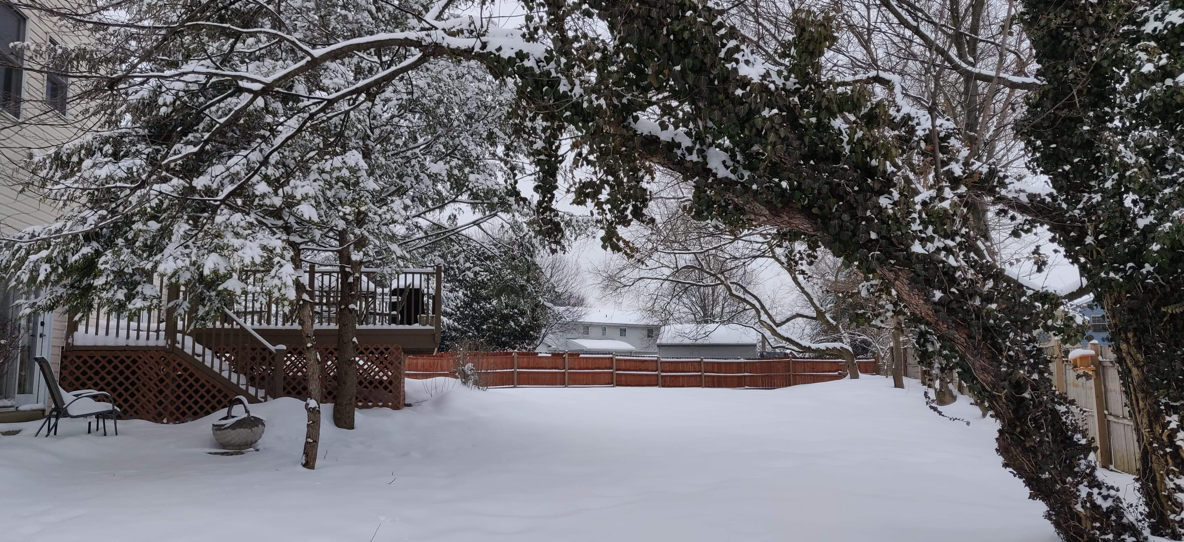
A solid 3.5" here. Shoveling was a breeze. Grass is completely covered, yay! -
January 7th First Snow for some N&W folks Discussion
CoolHandMike replied to ChescoWx's topic in Philadelphia Region
Got about 2" here now. Not currently precipitating, but the "shield" is slowly rotating through so we might wake up to a little bit more. Usually I'm a "give me a foot or give me nothing!" type of weenie, but this is perfectly nice and I'll gladly take it. -
January 7th First Snow for some N&W folks Discussion
CoolHandMike replied to ChescoWx's topic in Philadelphia Region
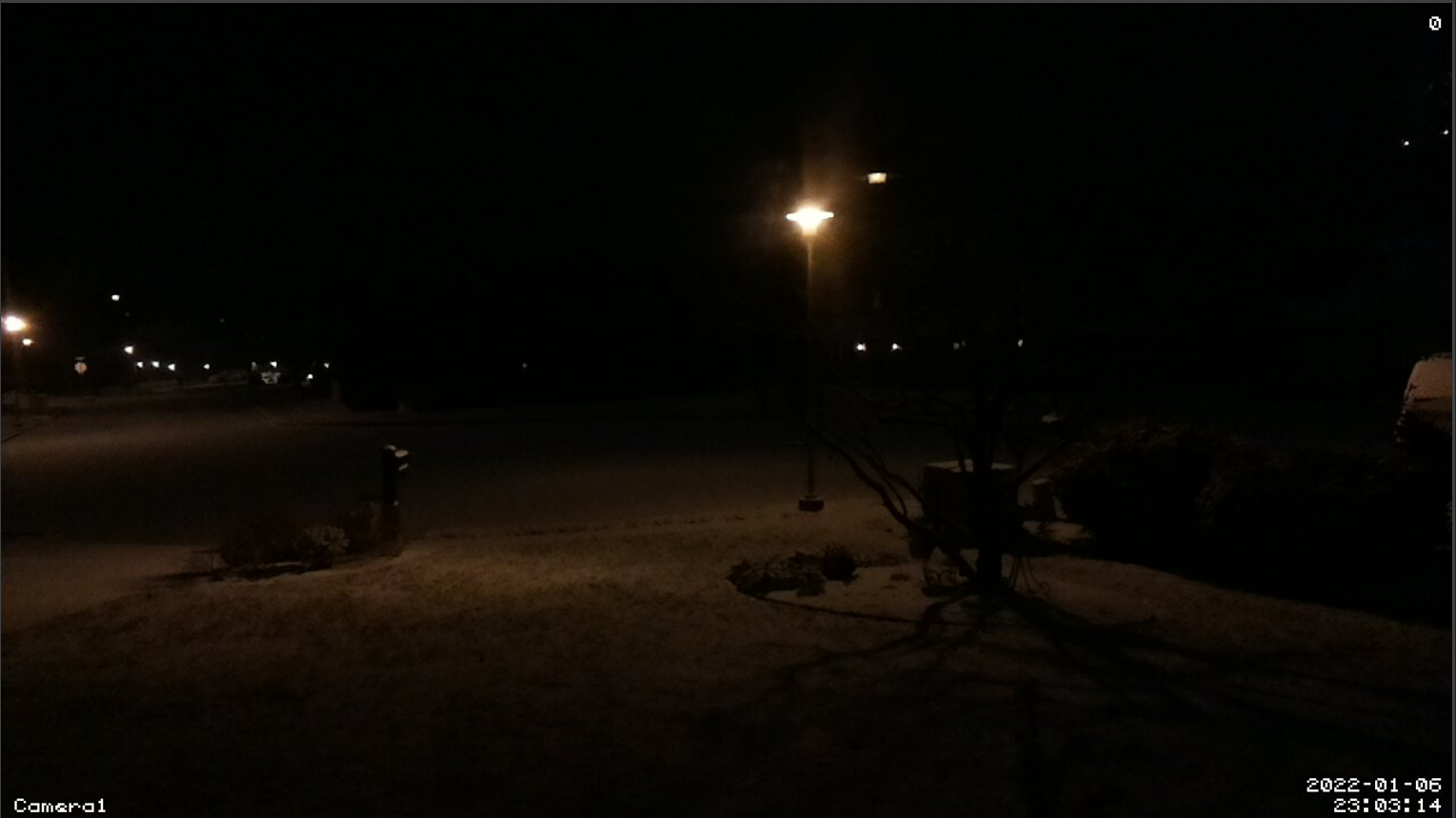
View from my front yard cam.
-
January 7th First Snow for some N&W folks Discussion
CoolHandMike replied to ChescoWx's topic in Philadelphia Region
I think we're around .75". It's so light and airy though. Puppy's first reaction was to try to lick all of it off the back deck. Was not expecting that. She's so food motivated than if even the tiniest thing is perceived as some form of nourishment, it gets 110% of her undivided attention. I guess snow counts. Had to escort her to the back yard, borrowing an unfortunate turn of phrase from my wife, to "show her how to pee". -
January 7th First Snow for some N&W folks Discussion
CoolHandMike replied to ChescoWx's topic in Philadelphia Region
I can report we've officially had a dusting. It's still not really doing anything though, just a few flakes here and there. Must have all come down in the last 20 minutes or so. Hopefully just the start. -
January 7th First Snow for some N&W folks Discussion
CoolHandMike replied to ChescoWx's topic in Philadelphia Region
I just turned that feature on for the desktop version. Very nice, thanks! I wonder how you can submit a report. Off to Google... -
January 7th First Snow for some N&W folks Discussion
CoolHandMike replied to ChescoWx's topic in Philadelphia Region
It's our first real snow of the season, and my wife is kinda losing it. She's worried about the roads tomorrow afternoon, and just now she asked me if the snowblower was working and if I wanted to move it to the garage tonight. I told her it's not a bread and milk type of snow and sent her this. -
January 7th First Snow for some N&W folks Discussion
CoolHandMike replied to ChescoWx's topic in Philadelphia Region
Virga as of yet. -
January 7th First Snow for some N&W folks Discussion
CoolHandMike replied to ChescoWx's topic in Philadelphia Region
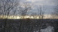
Definitely looked like a snow sky on my way home from work around 4pm. Should be a nice little event. -
January 7th First Snow for some N&W folks Discussion
CoolHandMike replied to ChescoWx's topic in Philadelphia Region
I can't wait. WU is calling for 2-4" for my area; this will be my new puppy's first experience with snow. She's a year old beagle mix but she was a rescue from Louisiana of all places. -
Heck yeah, a day off (Friday) and measurable snow to track. Got to work this morning just before all heck broke loose on the highways. Was just a tiny bit slick at 5:30am when I crossed the DMB.
-
I figured! We're mostly level C but occasionally spend time in B. Not fun, but supplied air has it's benefits on super hot days at least.