CoolHandMike
-
Posts
1,652 -
Joined
-
Last visited
Content Type
Profiles
Blogs
Forums
American Weather
Media Demo
Store
Gallery
Everything posted by CoolHandMike
-

E PA/NJ/DE Spring 2022 OBS Thread
CoolHandMike replied to Hurricane Agnes's topic in Philadelphia Region
Still pretty gusty behind the front. I'm picking up gusts in the mid 20's mph range. I really wish my anemometer was mounted in a more favorable spot though--it's on top of my shed and kind of sheltered from different angles. One of these days I'd like to mount it high up on my roof peak, but that's going to require some serious preparations (and maybe a lift rental). -
E PA/NJ/DE Spring 2022 OBS Thread
CoolHandMike replied to Hurricane Agnes's topic in Philadelphia Region
It just came through. Looked like a washing machine through my NW-facing living room windows. The gauge says we picked up .18" but it sure seemed like a lot more than that. I guess it's harder to measure when it's going sideways (on my little device, anyway). -
E PA/NJ/DE Spring 2022 OBS Thread
CoolHandMike replied to Hurricane Agnes's topic in Philadelphia Region
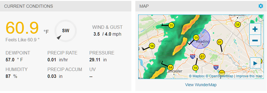
Lightning to my NW and it's starting to get gusty. We had some wild temperature swings today as well. High of 73.5°F around noon, then down to 60 at 6pm, now it's back up to 69. -
E PA/NJ/DE Spring 2022 OBS Thread
CoolHandMike replied to Hurricane Agnes's topic in Philadelphia Region
74.4°F here just north of Reading. ALLLL the neighbors are out washing cars, pressure washing their houses, etc. -
E PA/NJ/DE Spring 2022 OBS Thread
CoolHandMike replied to Hurricane Agnes's topic in Philadelphia Region
24.4°F right now at almost 1:30am. Forecast high for Sunday is 74 and Monday is 75. That's weird, right? I feel like that should be May weather. I mean, at least it's supposed to go back down into the 50s afterwards, but still. Do not like. -
E PA/NJ/DE Spring 2022 OBS Thread
CoolHandMike replied to Hurricane Agnes's topic in Philadelphia Region
Got down to 15.2°F this morning. Hard to believe it's supposed to be 73 just two days from now. -
Feb 24-25th Event -- Generators for some, pre-emerg for others
CoolHandMike replied to JTA66's topic in Philadelphia Region
Currently 34.5°F and raining from the trees. Thank goodness there's no wind. Yeah I've got about 5.5 hours of frozen gauge data lol. Just came back at 11:30. -
Feb 24-25th Event -- Generators for some, pre-emerg for others
CoolHandMike replied to JTA66's topic in Philadelphia Region
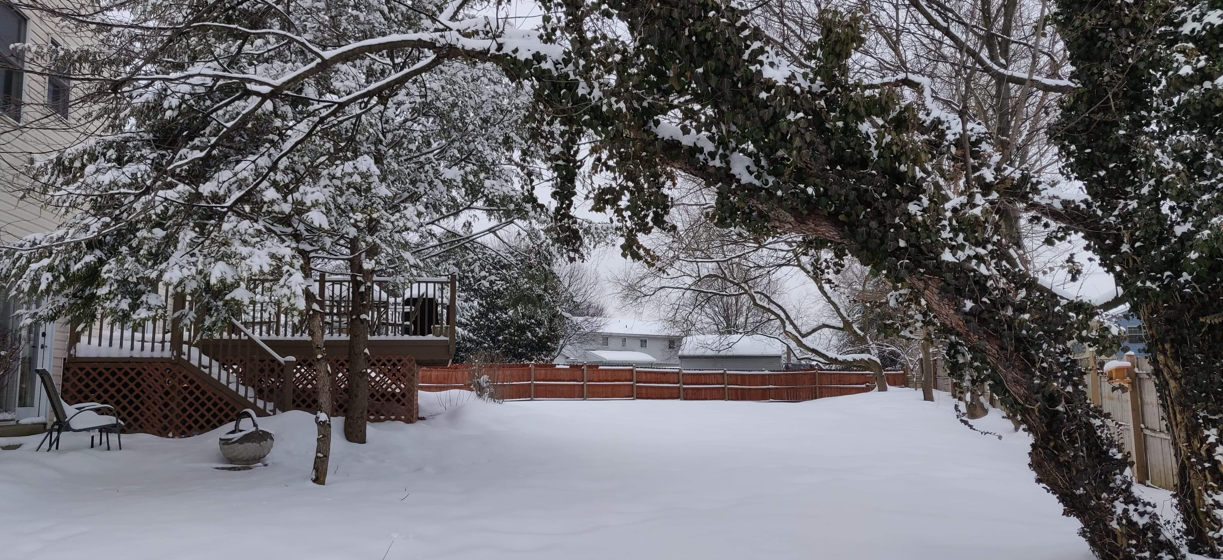
All exterior surfaces are coated in about an eighth to a quarter of an inch of really bumpy ice. It's kind of surreal, sitting here at my computer at the wee hours of the morning knowing the power could just shut off without a moment's notice and everything could just go dark. Thankfully there's no real wind associated with this event, otherwise I'm sure we would have had massive power outages by now. That said, it is icing up pretty bad out there right now. Temps hovering right around 30°F, light freezing rain. -
Feb 24-25th Event -- Generators for some, pre-emerg for others
CoolHandMike replied to JTA66's topic in Philadelphia Region
Sometime in the past hour we had some freezing rain. There is a super thin, icy coating on my deck furniture. -
Feb 24-25th Event -- Generators for some, pre-emerg for others
CoolHandMike replied to JTA66's topic in Philadelphia Region
I noticed Ralph's temps are colder than mine. Check out this weird warm pocket: I'll probably do this again in a couple of hours. -
Feb 24-25th Event -- Generators for some, pre-emerg for others
CoolHandMike replied to JTA66's topic in Philadelphia Region
There's some disconnect between what's being modeled and my local forecasts. The way my local forecasts have trended makes me think it might ZR for maybe a couple of hours after midnight and then everything warms up by sunrise. First it was supposed to start at 7, then the forecast said 9, now it says 11. Looking at the 0Z NAM though makes it look like ZR all the way from midnight until 10am. This strikes me as a very not straightforward weather system (can we even call it a storm? I guess it will be much further north). I don't envy being a met tonight, that's for sure. -
Feb 24-25th Event -- Generators for some, pre-emerg for others
CoolHandMike replied to JTA66's topic in Philadelphia Region
Very light flurries with graupel mixed in up my way, temp just below freezing but looks like it's ticking up from our low of 28°F this morning. No stickage yet. -
Feb 24-25th Event -- Generators for some, pre-emerg for others
CoolHandMike replied to JTA66's topic in Philadelphia Region
Well dang. Stayed up late due to current events, and just now noticed this: Going to be busy tomorrow (today! sad lol). Better get to bed and then figure out what we need to do to prepare. Already have extra gas and propane for the genny, and I'll definitely be test-firing it up tomorrow. Thankfully we have a fully stocked pantry so I won't need to visit the grocery store at least. Might have to make a beer run though.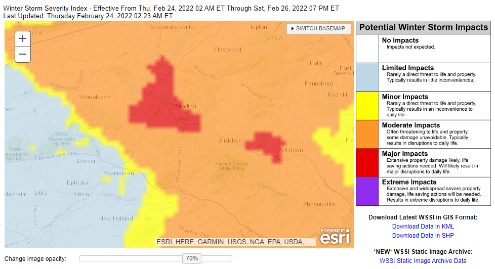
-
Feb 24-25th Event -- Generators for some, pre-emerg for others
CoolHandMike replied to JTA66's topic in Philadelphia Region
Yeesh. Do not want .5 to 1" of frozen rain. Hopefully it's mostly sleet. That said, I've scheduled a couple of different tree services to come out and give us some quotes for take downs, it'd be ironic if this problem solves itself. ish. -
Sun poking through up here. Already up to 62°F. Wife's gonna want me to mow the lawn, I can just feel it.
-
So do you guys want me to finally fire up my antiquated snow blower or not? Getting mixed messages over here. Mind you, I haven't run it in over a year, now.
-
Quite the bold claim, this: (lol) You are currently offline, or your network connection is having trouble, and we are unable to show you the page you requested.
-
Ice fishing, or just regular? Where at? Sorry I'm so full of questions, I've always wanted to go ice fishing for perch but it's yet another hobby I have yet to invest into. I did see some people ice fishing several weeks ago during our super cold snap, so I know it is feasible in our area at least.
-
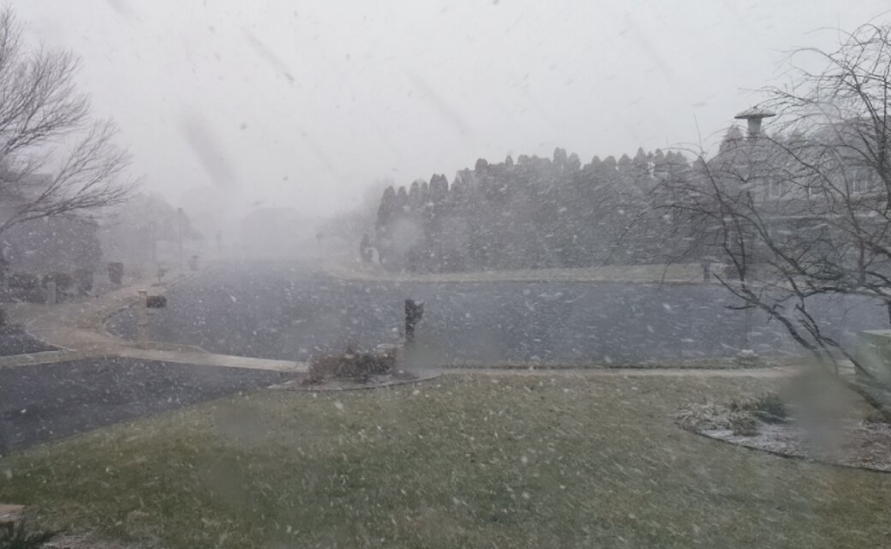
I think I just hit my file size limit. Didn't one of you guys run into this problem a short while ago? What's the fix? Flizzard just about over here. That was pretty cool and unexpected!
-
Temps crashed almost 10° from 41.1 to 32.1 in a matter of minutes. Lawn is covered. Cancelled our class since I don't even want to know what happened to traffic between here and there.
-
Huge flizzard right now. Were just about to leave for our weekly dog training class but I think we'll wait.
-
Eh, seemed kinda underwhelming. Picked up another tenth of an inch. Still, not cool to see a spring-type rain event in the middle of February. Will be glad to return to more seasonal temps (and hopefully precip!) in the days to come.
-
Looks like the front is just about to pass by me. Might as well stay up for it.
-
Oh wow. It's actually roaring out there! Wondering if the neighbor's trampoline will still be there in the morning.
-
1 AM and back above 60°F. Super gusty. Pressure still dropping so the front is still well west of me.


