CoolHandMike
-
Posts
1,652 -
Joined
-
Last visited
Content Type
Profiles
Blogs
Forums
American Weather
Media Demo
Store
Gallery
Everything posted by CoolHandMike
-
That about sums it up. On top of that, the freaking ICE CREAM TRUCK is making the rounds right now!!!
-
Big booming thunder in the distance. Light rain showers. Has not cooled significantly since my last post.
-
Went to the PA Ren Faire today. While there were an incredible amount of cars in the lot by the time we got there at 1pm, it didn't seem super-duper crowded, and wait times for food and drink weren't crazy long like I've seen it in the past. One thing on everyone's mind though was the warmth. It got up to the upper 70s by 2pm and stayed there until we left at 5:30. Off and on clouds, but barely a hint of a breeze most of the afternoon. It was the same story as the rest of our summer has been, with dewpoints in the upper 60's for most of the day.In October. Not completely unbearable (like the Kutztown Folk Festival in July usually is) but uncomfortable all the same. Felt sorry for all the folk in full garb, but we went in civvies this time with just our "Bavarian" fedoras as a nod to the faire's Oktoberfest theme. We are hoping it cools down somewhat for our next visit, towards the end of the month. Hopefully second summer will be over by then. This just needs to stop. It's after 7pm, in October, after the sun has set. Yuck.
-
Loving this. My weather data for May is spotty but it looks like this is the lowest we've seen since early May.
-
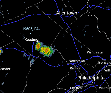
Be that as it may, this belongs in the banter thread. It poured over in Wyomissing, but we got the barest whiff of a shower, didn't even register in the gauge. Cooling down now though.
-
Ehhhh. Maayyybe. I think whatever's forming will scoot by just to my SW. Might get a couple of drops, but that's ok with me. Looking forward, as always, to the cool down.
-
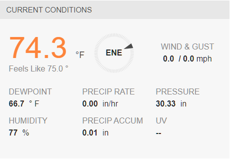
Kinda muggy out here. Overcast with occasional slivers of sunlight. Only got .01" this morning and it doesn't look like we're getting any more, but we shall see if anything else develops.
-
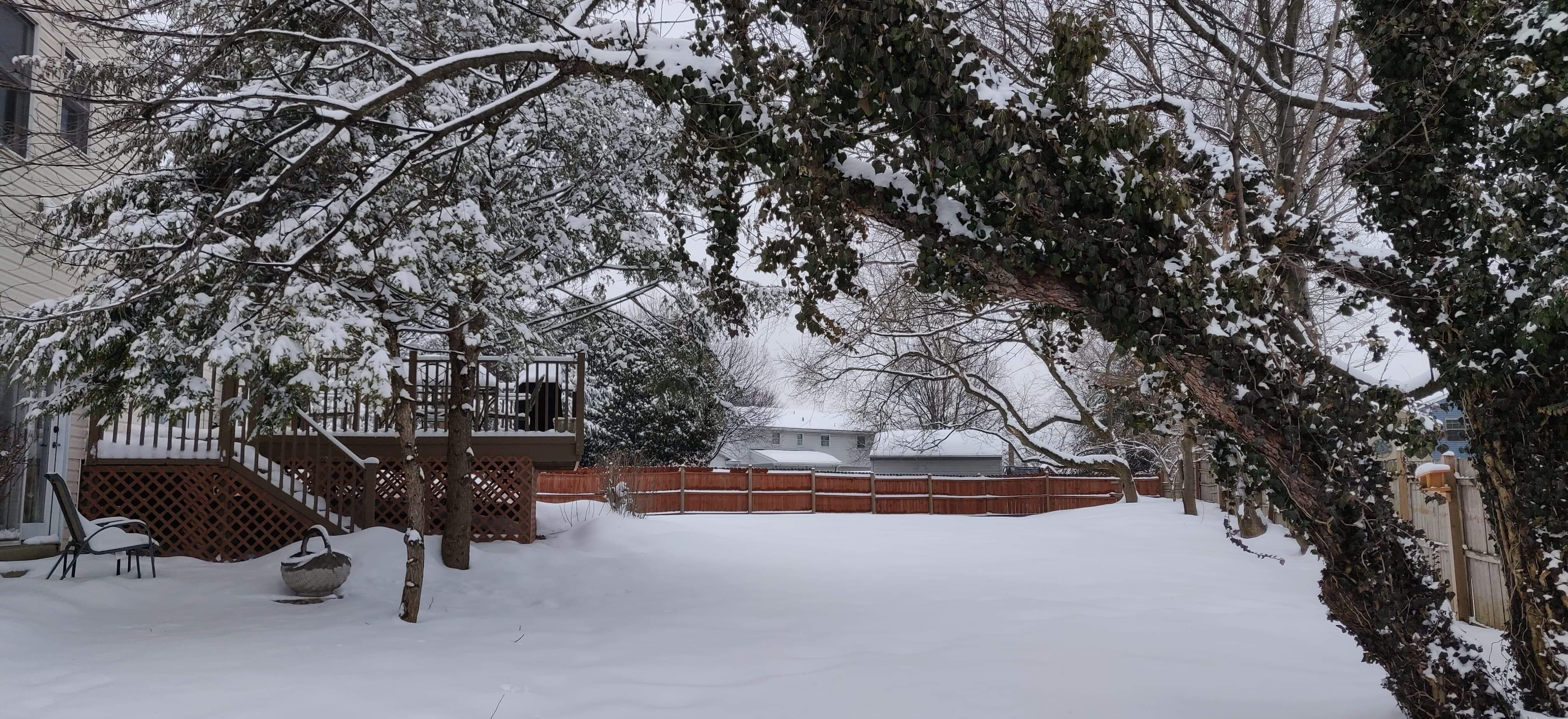
Don't get me wrong, I'm super-enjoying the more hospitable weather, but losing daylight earlier and earlier is putting a serious time crunch on all the outdoor projects I've been deferring all summer. Three nights in a row now I've worked outside until sunset building out a section of fence, finally finished tonight but couldn't really enjoy it because it got dark so early! Looking forward to posting some pics in the OT thread tomorrow. Back tot he news at hand: Forecast has possibility of morning T-storms. Might be interesting!
-
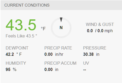
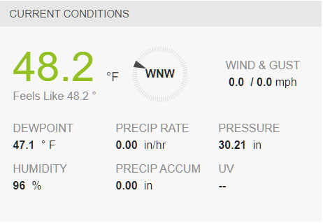
My low last night was 46.9°F; the last time we hit below that was 46.2, also on June 23rd. It has been a minute.
-
Fire me up. Can summer be over now, finally? Or is this just false fall?
-
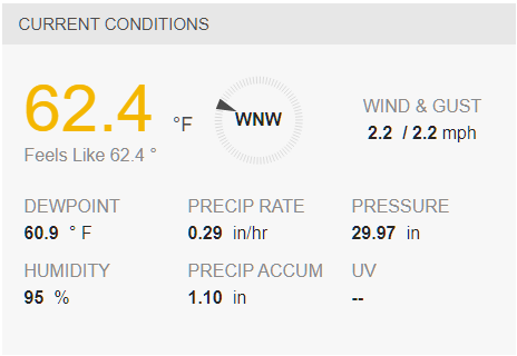
Looks like I ended up with 1.44" here. Currently a nice, cool 63°F with the occasional passing misting/shower.
-
Truth!
-
Still waiting for this warmth to break. Soon.
-
unbelievably warm out. Let's go already, autumn!
-
Pattern change? Please let it be so.
-
Ok, see this tiny, little blob of barely nothingness? My fault. I decided to wash my car for the first time in many months. (mumbled angry coolhandmike noises)
-
I tried seeding a spot in my backyard earlier this year, and it sorta kinda took--the previous owners had held a bonfire in that spot right before we closed, grrrr. Anyhow, if you're familiar with the janitor from Futurama, I always made an effort to use his voice whenever my wife was within earshot: "Mmm hmm, yup. Just a-waterin' muh dirt patch. Mmm hmm, yup." So yeah, I totally get it you guys. What I DON'T get is how stinkin' warm and humid it still is out there. We're about to be in meteorological AND astronomical fall. This has got to break eventually.

-
Looking at those nearly stationary cells just south and along the MD line. That's been the story of this summer, hasn't it? Hope Ellicott City will be ok. Anyway, I don't see this moving north any time soon though. Slightly cooler today in the field, mid-eighties and mostly overcast all day made for a much more pleasant day in the hazmat suit compared to the rest of the week. Still waiting for the humidity to taper off.
-
Got .83" as of now. Nice, gently rolling thunder and the occasional flash in the distance. Looking forward to our mini-cooldown tomorrow to close out my field work for the week.
-
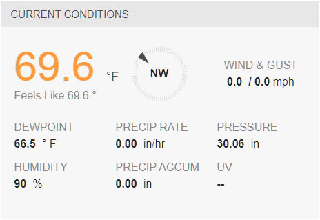
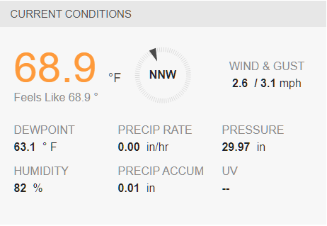
.31" in the gauge. There was a lull so I figured I'd throw open both garage doors and get a breeze while breaking down the trash and recycling. NOPE. Sure, it may be 67°F, but that comes with zero breeze and 95% humidity. I. Am. Soaked.
-
-
Got a nifty little shelf cloud on the storm coming my way. I'll post a pic in a bit.
-
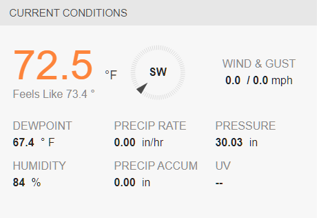
True, but I'm seeing only one day under 80° in the ten-day forecast, with nothing below 60 at night, and that's kind of alarming. Tomorrow it's supposed to be 89 with heat index in the mid 90's. This doesn't feel right, but I don't have any data at the moment to support it... I'll have to do another lunch-time deep-dive one of these days. Growing up though, my dad always pegged this time of year for a pattern change and the pool was closed up right after Labor day. How many people still have their pools open right now these days?
-
 Now that's some interesting data. Surprising to see less (or even not at all) 2000's data in the "warmest" category. I also think it'd be interesting to see each plot graphed separately just for clarification. Looking forward to more data, thanks for taking the time to make this!
 -
No no, it's just this week and then some other random weeks in October (yet to be determined). As soon as my field schedule for October is finalized, I'll let you guys know because those weeks are guaranteed to be hot and miserable. Just like this week. Then I'll have a nice, normal office month in November while it's absolutely gorgeous outside, and then I'll be assigned to do fieldwork again once it cools down to an unacceptable level in December/January.