

donsutherland1
-
Posts
23,780 -
Joined
Content Type
Profiles
Blogs
Forums
American Weather
Media Demo
Store
Gallery
Everything posted by donsutherland1
-
Morning thoughts… Today will be mostly sunny and somewhat cooler than yesterday. High temperatures will reach the lower and middle 80s in most of the region. Likely high temperatures around the region include: New York City (Central Park): 80° Newark: 82° Philadelphia: 84° The coolest air mass so far this season will begin pushing into the region tomorrow. Friday will be much cooler than normal with the temperature topping out in the 60s in parts of the region. Normals: New York City: 30-Year: 74.7°; 15-Year: 75.7° Newark: 30-Year: 76.3°; 15-Year: 77.4° Philadelphia: 30-Year: 77.5°; 15-Year: 78.4°
- 1,529 replies
-
- 1
-

-
- hurricane
- tropical storm
- (and 1 more)
-
Somewhat cooler air will arrive tonight into tomorrow. A sharp cold shot is likely after midweek. Parts of the region will then see their coldest temperatures so far this season. In the 6 past cases when the June AO averaged +0.750 or above (1950-2021), 67% of the following August and September cases featured above normal temperatures. The August ECMWF forecast shows a warmer than normal September in the Northeast. This warmth would be consistent with the ongoing warming that has been occurring in September. On August 18, the SOI fell to -32.90. Since 1991, there were 8 cases when the SOI fell to -30 or below during the August 10-25 period. That outcome has often preceded a wetter than normal September in parts of the Northeast. Mean September rainfall figures for those 8 cases: Boston: 4.38" (normal: 3.55"); New York City: 5.08" (normal: 4.31"); and, Philadelphia: 5.12" (normal: 4.40"). Very wet years outnumbered very dry ones by a 2:1 ratio in Boston and 3:1 ratio in both New York City and Philadelphia. 63% of cases saw at least one day with 1" or more rainfall in Boston. 88% saw at least one day with 1" or more in New York City and Philadelphia. 50% of those cases saw at least one day with 2" or more daily rainfall in Philadelphia. In sum, the SOI may be offering a signal that there will be some drought relief for the northern Mid-Atlantic and southern New England regions in September. On September 7, Philadelphia picked up 1.22" of rain. The ENSO Region 1+2 anomaly was -0.9°C and the Region 3.4 anomaly was -1.0°C for the week centered around September 6. For the past six weeks, the ENSO Region 1+2 anomaly has averaged -0.62°C and the ENSO Region 3.4 anomaly has averaged -1.00°C. La Niña conditions will likely persist through the fall. The SOI was +22.58 today. The preliminary Arctic Oscillation (AO) was -0.659 today. On September 17 the MJO was in Phase 2 at an amplitude of 0.280 (RMM). The September 16-adjusted amplitude was 0.219 (RMM). Based on sensitivity analysis applied to the latest guidance, there is an implied 75% probability that New York City will have a warmer than normal September (1991-2020 normal). September will likely finish with a mean temperature near 70.7° (1.5° above normal).
- 1,529 replies
-
- 1
-
-
- hurricane
- tropical storm
- (and 1 more)
-
Morning thoughts… Today will be variably cloudy and very warm. High temperatures will reach the middle and upper 80s in most of the region. Likely high temperatures around the region include: New York City (Central Park): 85° Newark: 88° Philadelphia: 88° It will turn cooler tomorrow. A sharp cold shot is likely after midweek. Normals: New York City: 30-Year: 75.1°; 15-Year: 76.1° Newark: 30-Year: 76.6°; 15-Year: 77.7° Philadelphia: 30-Year: 77.9°; 15-Year: 78.7°
-
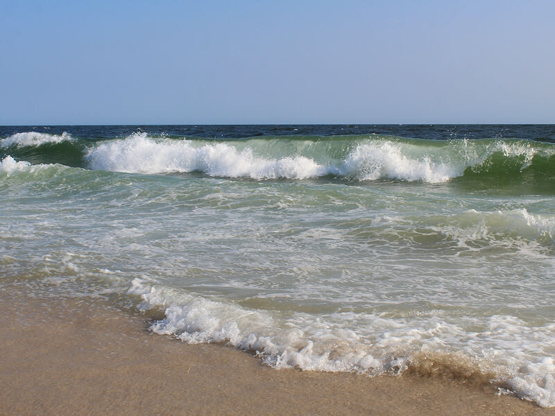
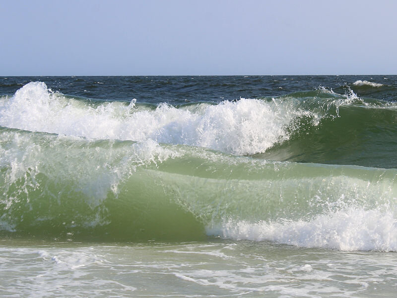
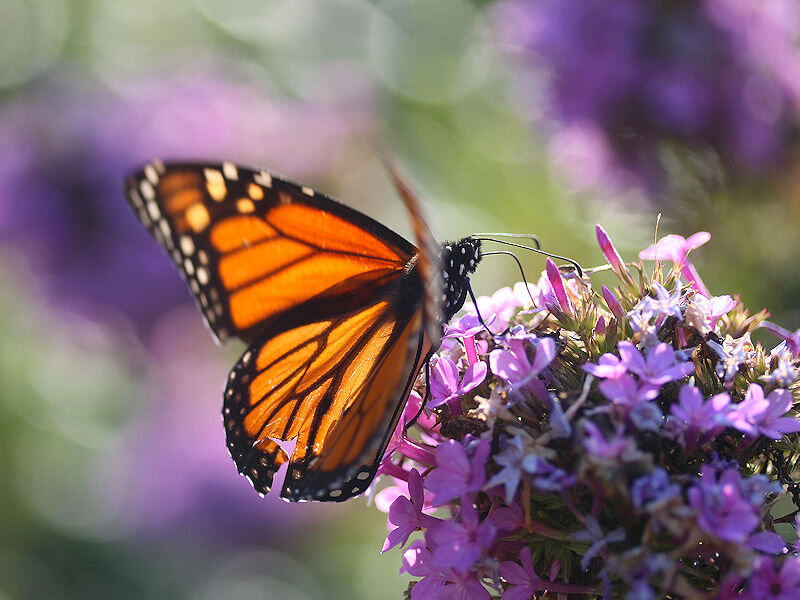
A brisk sea breeze, temperatures in the lower 80s, and abnormally warm ocean temperatures made for a great beach day. Some photos from Robert Moses State Park from this afternoon.
- 1,529 replies
-
- 8
-
-
- hurricane
- tropical storm
- (and 1 more)
-
Tomorrow will be a very warm day with temperatures reaching the middle and upper 80s across the region. A few of the hotter spots could hit 90°. Somewhat cooler air will arrive afterward and then a sharp cold shot is likely after midweek. In the longer range, there remains greater than usual uncertainty, as extratropical Merbok, which pounded the Bering Sea area, could impact the jet stream. Occasionally, such cyclones have set in motion a pattern evolution that has dislodged cold air that pours into the continental U.S. 1-2 weeks later. A classic example from the far more intense Nuri occurred in 2014. Nuri bombed out as it battered the Bering Sea region on November 9. Very cold air moved into the northeastern U.S. starting on November 15. Near record and even some record low temperatures occurred from November 18-22. Merbok will not reach Nuri's intensity, but the scenario of a strong cold shot to close out September and open October is plausible. In the 6 past cases when the June AO averaged +0.750 or above (1950-2021), 67% of the following August and September cases featured above normal temperatures. The August ECMWF forecast shows a warmer than normal September in the Northeast. This warmth would be consistent with the ongoing warming that has been occurring in September. On August 18, the SOI fell to -32.90. Since 1991, there were 8 cases when the SOI fell to -30 or below during the August 10-25 period. That outcome has often preceded a wetter than normal September in parts of the Northeast. Mean September rainfall figures for those 8 cases: Boston: 4.38" (normal: 3.55"); New York City: 5.08" (normal: 4.31"); and, Philadelphia: 5.12" (normal: 4.40"). Very wet years outnumbered very dry ones by a 2:1 ratio in Boston and 3:1 ratio in both New York City and Philadelphia. 63% of cases saw at least one day with 1" or more rainfall in Boston. 88% saw at least one day with 1" or more in New York City and Philadelphia. 50% of those cases saw at least one day with 2" or more daily rainfall in Philadelphia. In sum, the SOI may be offering a signal that there will be some drought relief for the northern Mid-Atlantic and southern New England regions in September. On September 7, Philadelphia picked up 1.22" of rain. The ENSO Region 1+2 anomaly was -0.9°C and the Region 3.4 anomaly was -1.0°C for the week centered around September 6. For the past six weeks, the ENSO Region 1+2 anomaly has averaged -0.62°C and the ENSO Region 3.4 anomaly has averaged -1.00°C. La Niña conditions will likely persist through the fall. The SOI was +31.91 today. That broke the daily record of +28.76, which was set in 2013. The preliminary Arctic Oscillation (AO) was -0.911 today. On September 16 the MJO was in Phase 8 at an amplitude of 0.220 (RMM). The September 15-adjusted amplitude was 0.482 (RMM). Based on sensitivity analysis applied to the latest guidance, there is an implied 76% probability that New York City will have a warmer than normal September (1991-2020 normal). September will likely finish with a mean temperature near 70.9° (1.7° above normal).
- 1,529 replies
-
- 1
-

-
- hurricane
- tropical storm
- (and 1 more)
-
Morning thoughts… Today will be mostly sunny and warm. High temperatures will reach the lower and middle 80s in most of the region. Likely high temperatures around the region include: New York City (Central Park): 85° Newark: 87° Philadelphia: 87° The warmth will peak tomorrow. Normals: New York City: 30-Year: 75.6°; 15-Year: 76.4° Newark: 30-Year: 77.0°; 15-Year: 78.0° Philadelphia: 30-Year: 78.2°; 15-Year: 79.1°
-
Noticeably warmer air will return tomorrow to close out the weekend and continue into early next week. The potential exists for parts of the region to experience 90° or above temperatures at the height of the warmth. Philadelphia and Newark have the best chance at approaching or reaching 90° during the peak of the warmth. New York City will likely top out in the middle or upper 80s. In the longer range, there is greater than usual uncertainty, as extratropical Merbok, which pounded the Bering Sea area, could impact the jet stream. Occasionally, such cyclones have set in motion a pattern evolution that has dislodged cold air that pours into the continental U.S. 1-2 weeks later. A classic example from the far more intense Nuri occurred in 2014. Nuri bombed out as it battered the Bering Sea region on November 9. Very cold air moved into the northeastern U.S. starting on November 15. Near record and even some record low temperatures occurred from November 18-22. Merbok will not reach Nuri's intensity, but the scenario of a strong cold shot to close out September and open October is plausible. In the 6 past cases when the June AO averaged +0.750 or above (1950-2021), 67% of the following August and September cases featured above normal temperatures. The August ECMWF forecast shows a warmer than normal September in the Northeast. This warmth would be consistent with the ongoing warming that has been occurring in September. On August 18, the SOI fell to -32.90. Since 1991, there were 8 cases when the SOI fell to -30 or below during the August 10-25 period. That outcome has often preceded a wetter than normal September in parts of the Northeast. Mean September rainfall figures for those 8 cases: Boston: 4.38" (normal: 3.55"); New York City: 5.08" (normal: 4.31"); and, Philadelphia: 5.12" (normal: 4.40"). Very wet years outnumbered very dry ones by a 2:1 ratio in Boston and 3:1 ratio in both New York City and Philadelphia. 63% of cases saw at least one day with 1" or more rainfall in Boston. 88% saw at least one day with 1" or more in New York City and Philadelphia. 50% of those cases saw at least one day with 2" or more daily rainfall in Philadelphia. In sum, the SOI may be offering a signal that there will be some drought relief for the northern Mid-Atlantic and southern New England regions in September. On September 7, Philadelphia picked up 1.22" of rain. The ENSO Region 1+2 anomaly was -0.9°C and the Region 3.4 anomaly was -1.0°C for the week centered around September 6. For the past six weeks, the ENSO Region 1+2 anomaly has averaged -0.62°C and the ENSO Region 3.4 anomaly has averaged -1.00°C. La Niña conditions will likely persist through the fall. The SOI was +29.42 today. That broke the daily record of +25.38, which was set in 2010. The preliminary Arctic Oscillation (AO) was -1.472 today. On September 15 the MJO was in Phase 8 at an amplitude of 0.483 (RMM). The September 14-adjusted amplitude was 0.447 (RMM). Based on sensitivity analysis applied to the latest guidance, there is an implied 78% probability that New York City will have a warmer than normal September (1991-2020 normal). September will likely finish with a mean temperature near 71.1° (1.9° above normal).
- 1,529 replies
-
- 1
-
-
- hurricane
- tropical storm
- (and 1 more)
-
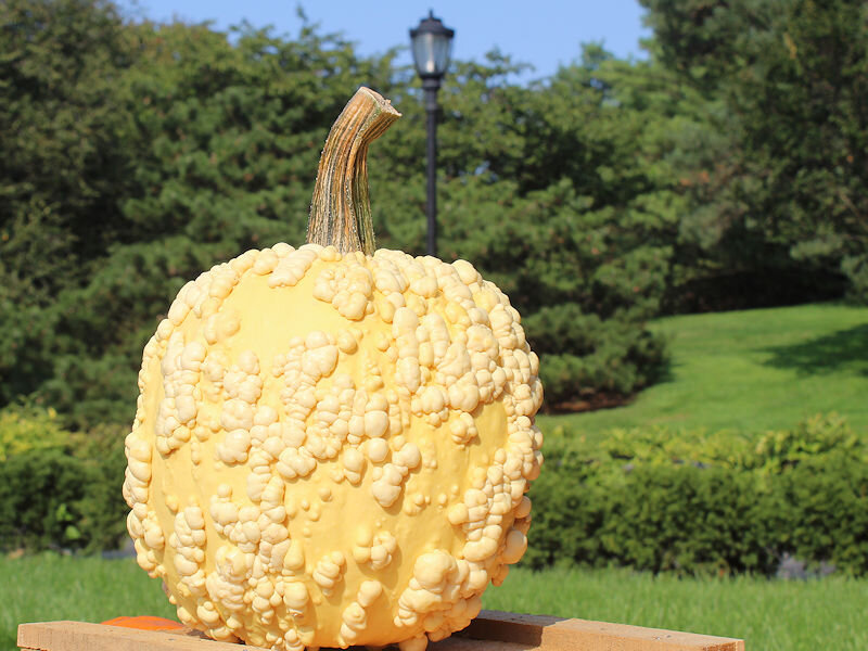
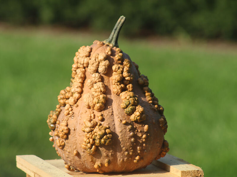
Under bright sunshine, the temperature soared to 75° in New York City. That made for a great opening day for the New York Botanical Garden's fall gourd show. Some photos:


- 1,529 replies
-
- 8
-
-
- hurricane
- tropical storm
- (and 1 more)
-
St. Paul Island recorded sustained winds of 55.2 mph yesterday. That was the highest figure since December 3, 2011 when 56 mph winds were recorded. It was the highest September figure since September 29, 1958 when sustained winds of 63 mph were measured.
- 1,529 replies
-
- 1
-
-
- hurricane
- tropical storm
- (and 1 more)
-
Morning thoughts… Today will be mostly sunny with near normal temperatures. High temperatures will reach the middle and upper 70s in most of the region. Some 80s are possible especially from central New Jersey southward. Likely high temperatures around the region include: New York City (Central Park): 76° Newark: 78° Philadelphia: 83° Much warmer air will arrive tomorrow. Normals: New York City: 30-Year: 75.9°; 15-Year: 76.7° Newark: 30-Year: 77.4°; 15-Year: 78.3° Philadelphia: 30-Year: 78.6°; 15-Year: 79.4°
-
Much of the region saw its coolest morning so far this season. Low temperatures included: Albany: 45° Allentown: 46° Binghamton: 41° Boston: 55° Bridgeport: 50° Danbury: 45° Islip: 50° New York City: 57° Newark: 53° Philadelphia: 58° Poughkeepsie: 43° Providence: 49° Scranton: 46° Westhampton: 40° White Plains: 49° The early autumnal chill will be short-lived. Noticeably warmer air will return to close out the weekend and continue into early next week. The potential exists for parts of the region to experience 90° or above temperatures at the height of the warmth. Philadelphia and Newark have the best chance at approaching or reaching 90° during the peak of the warmth. New York City will likely top out in the middle or upper 80s. In the longer range, there is greater than usual uncertainty, as extratropical Merbok, which will pound the Bering Sea and then Alaska's north shore through tomorrow, could impact the jet stream. Occasionally, such cyclones have set in motion a pattern evolution that has dislodged cold air that pours into the continental U.S. 1-2 weeks later. A classic example from the far more intense Nuri occurred in 2014. Nuri bombed out as it battered the Bering Sea region on November 9. Very cold air moved into the northeastern U.S. starting on November 15. Near record and even some record low temperatures occurred from November 18-22. Merbok will not reach Nuri's intensity, but the scenario of a strong cold shot to close out September and open October is plausible. In the 6 past cases when the June AO averaged +0.750 or above (1950-2021), 67% of the following August and September cases featured above normal temperatures. The August ECMWF forecast shows a warmer than normal September in the Northeast. This warmth would be consistent with the ongoing warming that has been occurring in September. On August 18, the SOI fell to -32.90. Since 1991, there were 8 cases when the SOI fell to -30 or below during the August 10-25 period. That outcome has often preceded a wetter than normal September in parts of the Northeast. Mean September rainfall figures for those 8 cases: Boston: 4.38" (normal: 3.55"); New York City: 5.08" (normal: 4.31"); and, Philadelphia: 5.12" (normal: 4.40"). Very wet years outnumbered very dry ones by a 2:1 ratio in Boston and 3:1 ratio in both New York City and Philadelphia. 63% of cases saw at least one day with 1" or more rainfall in Boston. 88% saw at least one day with 1" or more in New York City and Philadelphia. 50% of those cases saw at least one day with 2" or more daily rainfall in Philadelphia. In sum, the SOI may be offering a signal that there will be some drought relief for the northern Mid-Atlantic and southern New England regions in September. On September 7, Philadelphia picked up 1.22" of rain. The ENSO Region 1+2 anomaly was -0.9°C and the Region 3.4 anomaly was -1.0°C for the week centered around September 6. For the past six weeks, the ENSO Region 1+2 anomaly has averaged -0.62°C and the ENSO Region 3.4 anomaly has averaged -1.00°C. La Niña conditions will likely persist through the fall. The SOI was +20.68 today. The preliminary Arctic Oscillation (AO) was -1.666 today. On September 14 the MJO was in Phase 8 at an amplitude of 0.024 (RMM). The September 13-adjusted amplitude was 0.044 (RMM). Based on sensitivity analysis applied to the latest guidance, there is an implied 79% probability that New York City will have a warmer than normal September (1991-2020 normal). September will likely finish with a mean temperature near 71.2° (2.0° above normal).
- 1,529 replies
-
- 1
-
-
- hurricane
- tropical storm
- (and 1 more)
-
Morning thoughts… After a very cool start, today will be mostly sunny and cool. High temperatures will reach the middle and upper 70s in most of the region. Likely high temperatures around the region include: New York City (Central Park): 76° Newark: 79° Philadelphia: 80° Much warmer air will arrive on Sunday. Normals: New York City: 30-Year: 76.3°; 15-Year: 77.1° Newark: 30-Year: 77.8°; 15-Year: 78.6° Philadelphia: 30-Year: 79.0°; 15-Year: 79.7°
- 1,529 replies
-
- 1
-
-
- hurricane
- tropical storm
- (and 1 more)
-
The coolest air mass so far this season is continuing to overspread the region. The temperature will dip into the 50s for the first time this season at Central Park. Some outlying areas could see the mercury dip below 50°. However, the early autumnal chill will be short-lived. Noticeably warmer air will likely return early next week. The potential exists for parts of the region to experience 90° or above temperatures at the height of the warmth. Philadelphia and Newark have the best chance at approaching or reaching 90° during the peak of the warmth. New York City will likely top out in the middle or upper 80s. In the 6 past cases when the June AO averaged +0.750 or above (1950-2021), 67% of the following August and September cases featured above normal temperatures. The August ECMWF forecast shows a warmer than normal September in the Northeast. This warmth would be consistent with the ongoing warming that has been occurring in September. On August 18, the SOI fell to -32.90. Since 1991, there were 8 cases when the SOI fell to -30 or below during the August 10-25 period. That outcome has often preceded a wetter than normal September in parts of the Northeast. Mean September rainfall figures for those 8 cases: Boston: 4.38" (normal: 3.55"); New York City: 5.08" (normal: 4.31"); and, Philadelphia: 5.12" (normal: 4.40"). Very wet years outnumbered very dry ones by a 2:1 ratio in Boston and 3:1 ratio in both New York City and Philadelphia. 63% of cases saw at least one day with 1" or more rainfall in Boston. 88% saw at least one day with 1" or more in New York City and Philadelphia. 50% of those cases saw at least one day with 2" or more daily rainfall in Philadelphia. In sum, the SOI may be offering a signal that there will be some drought relief for the northern Mid-Atlantic and southern New England regions in September. On September 7, Philadelphia picked up 1.22" of rain. The ENSO Region 1+2 anomaly was -0.9°C and the Region 3.4 anomaly was -1.0°C for the week centered around September 6. For the past six weeks, the ENSO Region 1+2 anomaly has averaged -0.62°C and the ENSO Region 3.4 anomaly has averaged -1.00°C. La Niña conditions will likely persist through the fall. The SOI was +8.50 today. The preliminary Arctic Oscillation (AO) was -1.510 today. On September 13 the MJO was in Phase 2 at an amplitude of 0.030 (RMM). The September 12-adjusted amplitude was 0.229 (RMM). Based on sensitivity analysis applied to the latest guidance, there is an implied 80% probability that New York City will have a warmer than normal September (1991-2020 normal). September will likely finish with a mean temperature near 71.2° (2.0° above normal).
- 1,529 replies
-
- 1
-
-
- hurricane
- tropical storm
- (and 1 more)
-
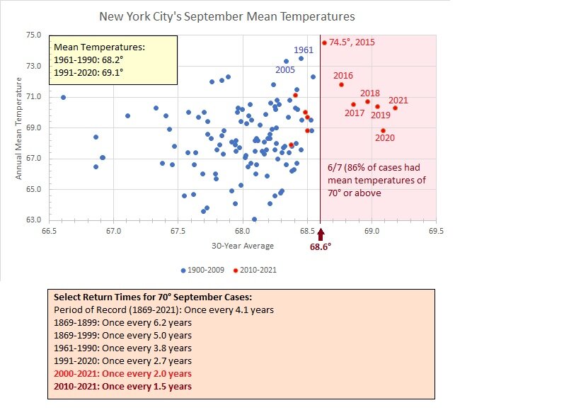
With a warm first half of the month and a period of much above normal temperatures likely later this weekend into next week, it is likely that the monthly mean temperature will average at or above 70°F in New York City this September. Historically, such warmth occurred about once every 4 years (once every 5 years prior to 2000). However, with a warming climate coupled with the City’s urban heat island effect, the return time has been cut by more than 50% since 2000. At current monthly normals, such Septembers may now be the norm.
- 1,529 replies
-
- 3
-
-

-
- hurricane
- tropical storm
- (and 1 more)
-
Morning thoughts… It will be mostly sunny and cooler. High temperatures will reach the middle and upper 70s in most of the region. Likely high temperatures around the region include: New York City (Central Park): 75° Newark: 77° Philadelphia: 78° Much warmer air will arrive on Sunday. Normals: New York City: 30-Year: 76.6°; 15-Year: 77.4° Newark: 30-Year: 78.1°; 15-Year: 78.9° Philadelphia: 30-Year: 79.3°; 15-Year: 80.0°
- 1,529 replies
-
- 3
-
-
- hurricane
- tropical storm
- (and 1 more)
-
Much cooler air will begin to filter into the region tonight. By Friday morning, the coolest air mass so far this season will cover the region. The temperature will likely slip below 60° for the first time this season at Central Park. However, the early autumnal chill will be short-lived. Noticeably warmer air will likely return early next week. The potential exists for parts of the region to experience 90° or above temperatures at the height of the warmth. Philadelphia and Newark have the best chance at approaching or reaching 90° during the peak of the warmth. New York City will likely top out in the middle or perhaps upper 80s. In the 6 past cases when the June AO averaged +0.750 or above (1950-2021), 67% of the following August and September cases featured above normal temperatures. The August ECMWF forecast shows a warmer than normal September in the Northeast. This warmth would be consistent with the ongoing warming that has been occurring in September. On August 18, the SOI fell to -32.90. Since 1991, there were 8 cases when the SOI fell to -30 or below during the August 10-25 period. That outcome has often preceded a wetter than normal September in parts of the Northeast. Mean September rainfall figures for those 8 cases: Boston: 4.38" (normal: 3.55"); New York City: 5.08" (normal: 4.31"); and, Philadelphia: 5.12" (normal: 4.40"). Very wet years outnumbered very dry ones by a 2:1 ratio in Boston and 3:1 ratio in both New York City and Philadelphia. 63% of cases saw at least one day with 1" or more rainfall in Boston. 88% saw at least one day with 1" or more in New York City and Philadelphia. 50% of those cases saw at least one day with 2" or more daily rainfall in Philadelphia. In sum, the SOI may be offering a signal that there will be some drought relief for the northern Mid-Atlantic and southern New England regions in September. On September 7, Philadelphia picked up 1.22" of rain. The ENSO Region 1+2 anomaly was -0.9°C and the Region 3.4 anomaly was -1.0°C for the week centered around September 6. For the past six weeks, the ENSO Region 1+2 anomaly has averaged -0.62°C and the ENSO Region 3.4 anomaly has averaged -1.00°C. La Niña conditions will likely persist through the fall. The SOI was +7.91 today. The preliminary Arctic Oscillation (AO) was -0.930 today. On September 12 the MJO was in Phase 5 at an amplitude of 0.233 (RMM). The September 11-adjusted amplitude was 0.314 (RMM). Based on sensitivity analysis applied to the latest guidance, there is an implied 76% probability that New York City will have a warmer than normal September (1991-2020 normal). September will likely finish with a mean temperature near 71.1° (1.9° above normal).
-
Clouds gave way to afternoon sunshine. In response, the mercury rose into the lower and middle 80s. Tomorrow will be another warm day, but much cooler air will begin to filter into the region afterward. The coolest air mass so far this season will cover the region on Friday. However, the early autumnal chill will be short-lived. Noticeably warmer air will likely return early next week. The potential exists for parts of the region to experience 90° or above temperatures at the height of the warmth. In the 6 past cases when the June AO averaged +0.750 or above (1950-2021), 67% of the following August and September cases featured above normal temperatures. The August ECMWF forecast shows a warmer than normal September in the Northeast. This warmth would be consistent with the ongoing warming that has been occurring in September. On August 18, the SOI fell to -32.90. Since 1991, there were 8 cases when the SOI fell to -30 or below during the August 10-25 period. That outcome has often preceded a wetter than normal September in parts of the Northeast. Mean September rainfall figures for those 8 cases: Boston: 4.38" (normal: 3.55"); New York City: 5.08" (normal: 4.31"); and, Philadelphia: 5.12" (normal: 4.40"). Very wet years outnumbered very dry ones by a 2:1 ratio in Boston and 3:1 ratio in both New York City and Philadelphia. 63% of cases saw at least one day with 1" or more rainfall in Boston. 88% saw at least one day with 1" or more in New York City and Philadelphia. 50% of those cases saw at least one day with 2" or more daily rainfall in Philadelphia. In sum, the SOI may be offering a signal that there will be some drought relief for the northern Mid-Atlantic and southern New England regions in September. On September 7, Philadelphia picked up 1.22" of rain. The ENSO Region 1+2 anomaly was -0.9°C and the Region 3.4 anomaly was -1.0°C for the week centered around September 6. For the past six weeks, the ENSO Region 1+2 anomaly has averaged -0.62°C and the ENSO Region 3.4 anomaly has averaged -1.00°C. La Niña conditions will likely persist through the fall. The SOI was +19.97 today. The preliminary Arctic Oscillation (AO) was -0.603 today. On September 11 the MJO was in Phase 5 at an amplitude of 0.314 (RMM). The September 10-adjusted amplitude was 0.243 (RMM). Based on sensitivity analysis applied to the latest guidance, there is an implied 78% probability that New York City will have a warmer than normal September (1991-2020 normal). September will likely finish with a mean temperature near 71.1° (1.9° above normal).
- 1,529 replies
-
- 1
-
-
- hurricane
- tropical storm
- (and 1 more)
-
Morning thoughts… It will be variably cloudy. Showers and thundershowers are possible. High temperatures will reach the lower and middle 80s in most of the region. Likely high temperatures around the region include: New York City (Central Park): 82° Newark: 84° Philadelphia: 84° Much cooler air will arrive late in the week. Normals: New York City: 30-Year: 77.4°; 15-Year: 77.8° Newark: 30-Year: 78.8°; 15-Year: 79.5° Philadelphia: 30-Year: 80.0°; 15-Year: 80.5°
- 1,529 replies
-
- 1
-
-
- hurricane
- tropical storm
- (and 1 more)
-
Under partly sunny skies, temperatures rose into the 80s across much of the region today. Through midweek, temperatures will average somewhat above normal. Afterward, the coolest air mass so far this season will likely overspread the region. Noticeably warmer air could again return early next week. In the 6 past cases when the June AO averaged +0.750 or above (1950-2021), 67% of the following August and September cases featured above normal temperatures. The August ECMWF forecast shows a warmer than normal September in the Northeast. This warmth would be consistent with the ongoing warming that has been occurring in September. On August 18, the SOI fell to -32.90. Since 1991, there were 8 cases when the SOI fell to -30 or below during the August 10-25 period. That outcome has often preceded a wetter than normal September in parts of the Northeast. Mean September rainfall figures for those 8 cases: Boston: 4.38" (normal: 3.55"); New York City: 5.08" (normal: 4.31"); and, Philadelphia: 5.12" (normal: 4.40"). Very wet years outnumbered very dry ones by a 2:1 ratio in Boston and 3:1 ratio in both New York City and Philadelphia. 63% of cases saw at least one day with 1" or more rainfall in Boston. 88% saw at least one day with 1" or more in New York City and Philadelphia. 50% of those cases saw at least one day with 2" or more daily rainfall in Philadelphia. In sum, the SOI may be offering a signal that there will be some drought relief for the northern Mid-Atlantic and southern New England regions in September. On September 7, Philadelphia picked up 1.22" of rain. The ENSO Region 1+2 anomaly was -0.9°C and the Region 3.4 anomaly was -1.0°C for the week centered around September 6. For the past six weeks, the ENSO Region 1+2 anomaly has averaged -0.62°C and the ENSO Region 3.4 anomaly has averaged -1.00°C. La Niña conditions will likely persist through the fall. The SOI was +19.67 today. The preliminary Arctic Oscillation (AO) was -0.510 today. On September 10 the MJO was in Phase 5 at an amplitude of 0.244 (RMM). The September 9-adjusted amplitude was 0.446 (RMM). Based on sensitivity analysis applied to the latest guidance, there is an implied 68% probability that New York City will have a warmer than normal September (1991-2020 normal). September will likely finish with a mean temperature near 70.8° (1.6° above normal).
-
Morning thoughts… It will be variably cloudy. Showers and thundershowers are possible. High temperatures will reach the lower and middle 80s in most of the region. Likely high temperatures around the region include: New York City (Central Park): 82° Newark: 84° Philadelphia: 85° Much cooler air will arrive late in the week. Normals: New York City: 30-Year: 77.7°; 15-Year: 78.2° Newark: 30-Year: 79.2°; 15-Year: 79.8° Philadelphia: 30-Year: 80.4°; 15-Year: 80.8°
- 1,529 replies
-
- 1
-
-
- hurricane
- tropical storm
- (and 1 more)
-
A system will likely continue to bring light to occasionally moderate rain to the region tomorrow perhaps into Tuesday. The coolest air mass so far this season will likely arrive late in the week. In the 6 past cases when the June AO averaged +0.750 or above (1950-2021), 67% of the following August and September cases featured above normal temperatures. The August ECMWF forecast shows a warmer than normal September in the Northeast. This warmth would be consistent with the ongoing warming that has been occurring in September. On August 18, the SOI fell to -32.90. Since 1991, there were 8 cases when the SOI fell to -30 or below during the August 10-25 period. That outcome has often preceded a wetter than normal September in parts of the Northeast. Mean September rainfall figures for those 8 cases: Boston: 4.38" (normal: 3.55"); New York City: 5.08" (normal: 4.31"); and, Philadelphia: 5.12" (normal: 4.40"). Very wet years outnumbered very dry ones by a 2:1 ratio in Boston and 3:1 ratio in both New York City and Philadelphia. 63% of cases saw at least one day with 1" or more rainfall in Boston. 88% saw at least one day with 1" or more in New York City and Philadelphia. 50% of those cases saw at least one day with 2" or more daily rainfall in Philadelphia. In sum, the SOI may be offering a signal that there will be some drought relief for the northern Mid-Atlantic and southern New England regions in September. On September 7, Philadelphia picked up 1.22" of rain. The ENSO Region 1+2 anomaly was -0.4°C and the Region 3.4 anomaly was -0.8°C for the week centered around August 31. For the past six weeks, the ENSO Region 1+2 anomaly has averaged -0.62°C and the ENSO Region 3.4 anomaly has averaged -0.95°C. La Niña conditions will likely persist through the fall. The SOI was +13.91 today. The preliminary Arctic Oscillation (AO) was -0.755 today. On September 9 the MJO was in Phase 5 at an amplitude of 0.446 (RMM). The September 8-adjusted amplitude was 0.722 (RMM). Based on sensitivity analysis applied to the latest guidance, there is an implied 66% probability that New York City will have a warmer than normal September (1991-2020 normal). September will likely finish with a mean temperature near 70.6° (1.4° above normal).
-
Morning thoughts… It will be mostly cloudy with some periods of rain. High temperatures will reach the middle 70s in most of the region. Likely high temperatures around the region include: New York City (Central Park): 76° Newark: 77° Philadelphia: 76° Clouds will begin to increase tomorrow. Showers are possible. Normals: New York City: 30-Year: 78.0°; 15-Year: 78.5° Newark: 30-Year: 79.5°; 15-Year: 80.0° Philadelphia: 30-Year: 80.7°; 15-Year: 81.0°
-
Occasional Thoughts on Climate Change
donsutherland1 replied to donsutherland1's topic in Climate Change
Summer 2022 was the 3rd hottest summer on record, just behind summers 1936 and 2021.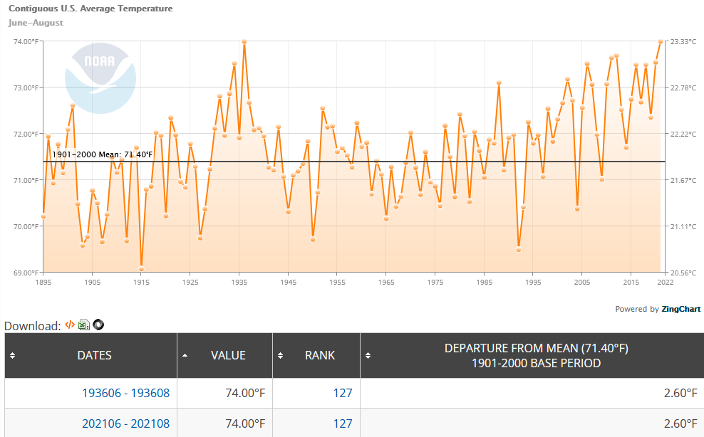
-
Under mainly sunny skies, temperatures rose into the lower and middle 80s across much of the region. Highs included: Allentown: 81° Bridgeport: 82° Islip: 85° New York City: 86° Newark: 87° Philadelphia: 83° Clouds will increase tomorrow and temperatures will be several degrees cooler than they were today. Afterward, a system could bring a light to moderate rainfall to the region early next week. There remains a degree of uncertainty concerning the amount and duration of precipitation. Out West, Seattle reached 90° for the 13th time this year. That surpassed the record of 12 days, which was set in 2015. All three years with 10 or more such days have occurred since 2015. In the 6 past cases when the June AO averaged +0.750 or above (1950-2021), 67% of the following August and September cases featured above normal temperatures. The August ECMWF forecast shows a warmer than normal September in the Northeast. This warmth would be consistent with the ongoing warming that has been occurring in September. On August 18, the SOI fell to -32.90. Since 1991, there were 8 cases when the SOI fell to -30 or below during the August 10-25 period. That outcome has often preceded a wetter than normal September in parts of the Northeast. Mean September rainfall figures for those 8 cases: Boston: 4.38" (normal: 3.55"); New York City: 5.08" (normal: 4.31"); and, Philadelphia: 5.12" (normal: 4.40"). Very wet years outnumbered very dry ones by a 2:1 ratio in Boston and 3:1 ratio in both New York City and Philadelphia. 63% of cases saw at least one day with 1" or more rainfall in Boston. 88% saw at least one day with 1" or more in New York City and Philadelphia. 50% of those cases saw at least one day with 2" or more daily rainfall in Philadelphia. In sum, the SOI may be offering a signal that there will be some drought relief for the northern Mid-Atlantic and southern New England regions in September. On September 7, Philadelphia picked up 1.22" of rain. The ENSO Region 1+2 anomaly was -0.4°C and the Region 3.4 anomaly was -0.8°C for the week centered around August 31. For the past six weeks, the ENSO Region 1+2 anomaly has averaged -0.62°C and the ENSO Region 3.4 anomaly has averaged -0.95°C. La Niña conditions will likely persist through the fall. The SOI was +14.14 today. The preliminary Arctic Oscillation (AO) was -0.566 today. On September 8 the MJO was in Phase 5 at an amplitude of 0.718 (RMM). The September 7-adjusted amplitude was 0.578 (RMM). Based on sensitivity analysis applied to the latest guidance, there is an implied 66% probability that New York City will have a warmer than normal September (1991-2020 normal). September will likely finish with a mean temperature near 70.7° (1.5° above normal).
- 1,529 replies
-
- 2
-
-
- hurricane
- tropical storm
- (and 1 more)
-
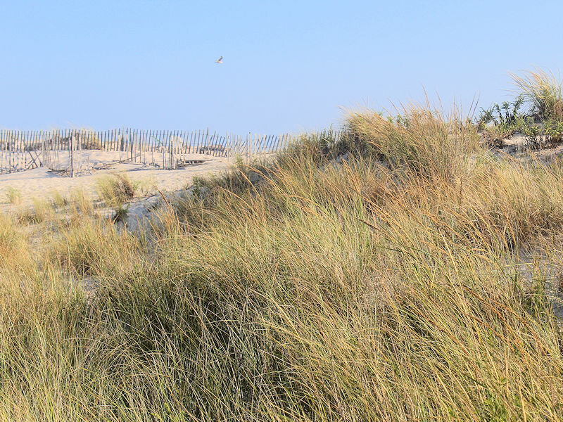
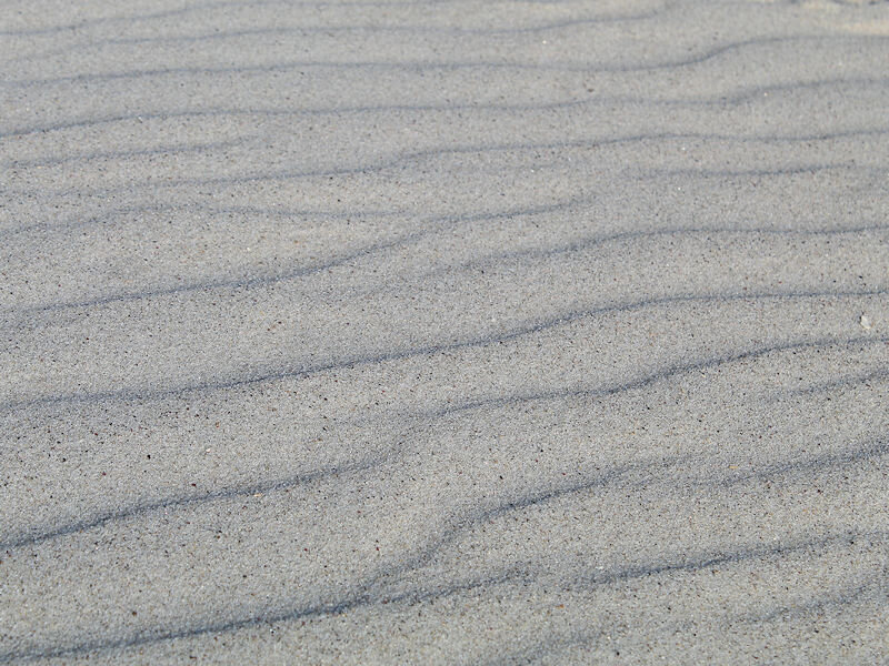
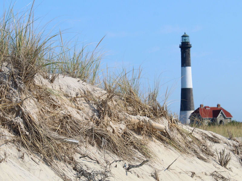
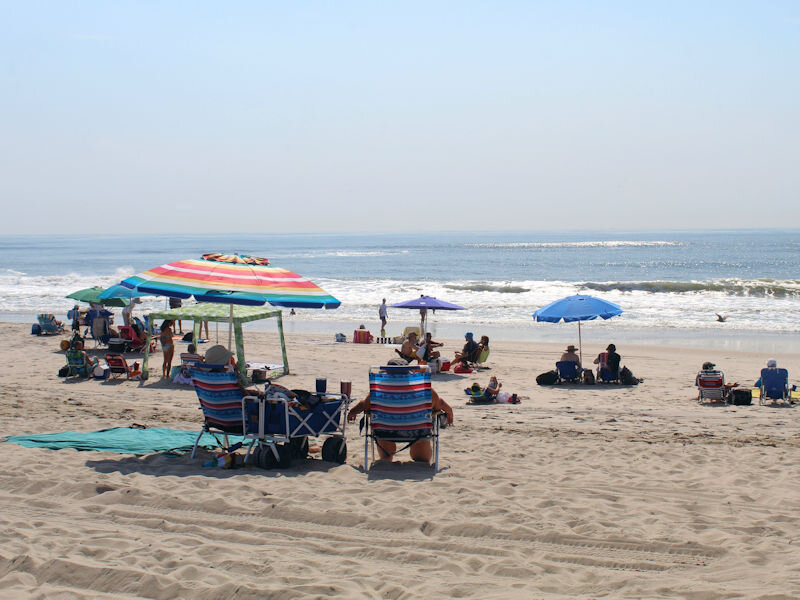
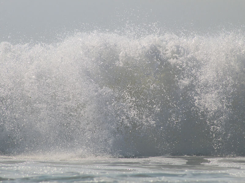
The calendar reads "September," but the thermometer reads more like late August with temperatures pushing toward the middle 80s making for a great beach day. However, rip tides are an issue.
- 1,529 replies
-
- 9
-
-
- hurricane
- tropical storm
- (and 1 more)