

donsutherland1
-
Posts
23,828 -
Joined
Content Type
Profiles
Blogs
Forums
American Weather
Media Demo
Store
Gallery
Everything posted by donsutherland1
-
New York City is experiencing its biggest winter storm in nearly five years. Through 4 pm, 8.8" had fallen in Central Park. 1 W Throgs Neck Bridge in the Bronx has so far had the City's highest amount at 11.3". The last time New York City saw a 6" or greater snowfall was January 28-29, 2022 when 8.3" fell. Its last 10" or above snowfall occurred during January 31-February 3, 2021 when 17.4" accumulated. Arctic air will return to the region as the storm departs tomorrow. Highs will be mainly in the lower 20s through Friday. Tuesday could again see highs top out in the teens in New York City. The last winter with more than one high in the teens was Winter 2018-19 when there were two such days. Moreover, New York City has the potential to see the temperature dip into the single digits for lows on or more days during this period. Some snow flurries or snow showers are possible Thursday night into Friday morning. Overall, January 20th-February 3rd will likely be the coldest and perhaps snowiest two-week period this winter. The forecast WPO-/EPO-/AO-/PNA+ pattern is typically the coldest pattern in January and among the coldest during the first half of February. A persistently positive PNA will have above climatological risk of moderate or significant snowfalls. For perspective, the coldest two-week period this winter prior to January 20th was January 3-16, 2026 and January 4-17, 2026 with a mean temperature of 30.3°. The snowiest two-week period was December 14-27, 2025 when 7.2" of snow fell. The ENSO Region 1+2 anomaly was -0.3°C and the Region 3.4 anomaly was -0.7°C for the week centered around January 14. For the past six weeks, the ENSO Region 1+2 anomaly has averaged -0.48°C and the ENSO Region 3.4 anomaly has averaged -0.68°C. La Niña conditions will likely continue into at least late winter. The SOI was -14.36 today. The preliminary Arctic Oscillation (AO) was -2.614 today. Based on sensitivity analysis applied to the latest guidance, there is an implied near 100% probability that New York City will have a cooler than normal January (1991-2020 normal). January will likely finish with a mean temperature near 30.5° (3.2° below normal). Supplemental Information: The projected mean would be 2.1° below the 1981-2010 normal monthly value.
-
Yes. It is 10.0” from 1905.
-
Extreme Cold, Snow & Sleet: SECS 1/24 - 1/26
donsutherland1 replied to TriPol's topic in New York City Metro
The New York City area and its nearby suburbs has seen a significant snowfall today. Although parts of the region have transitioned to sleet, widespread snowfall amounts of 6" or above have occurred. The outcome is largely the result of the system's dynamics, as the warm air came in aloft as per the consensus of the guidance. From yesterday: Prior to the warming of the mid-levels tomorrow afternoon, soundings showed a strongly saturated dendritic growth zone (DGZ) between –12°C and –17°C. That is almost ideal for producing large, fluffy dendritic flakes. There was also strong lift and high saturation supporting very efficient snow growth and high snow-liquid ratios, especially in areas with stronger banding. In short, for 3-4 hours there could be snowfall rates of 1" per hour and perhaps 2" per hour at times. That's when most of the snow will fall in and around New York City. The visibility could fall under one-quarter mile during the periods of heaviest snow. Thundersnow seems unlikely in most of the area as there isn't a convective signature in the soundings. It is these dynamics, not 10:1 snow-liquid ratio maps that tell the story of what continues to look to be a significant snowfall in and around New York City. During the course of the snowfall, all of New York City's sites (Bridgeport, Central Park, Islip, JFK Airport, LaGuardia Airport, Newark, and White Plains) reported visibilities of 0.25 miles or less. The 1"-2" per hour rates occurred during this period of heavy snow. IMO, the focus on the dynamics, not varying model solutions largely drove what appear in line to be the more accurate forecasts. Chasing the models from run-to-run created the perception that there was greater uncertainty than what actually was present. PNS from 2:06 pm (not final): 764 NOUS41 KOKX 251906 PNSOKX CTZ005>012-NJZ002-004-006-103>108-NYZ067>075-078>081-176>179-260706- Public Information Statement National Weather Service New York NY 206 PM EST Sun Jan 25 2026 ...SNOWFALL REPORTS... Location Amount Time/Date Provider ...Connecticut... ...Fairfield County... 4 S Greenwich 8.2 in 0117 PM 01/25 Public 1 SE Norwalk 7.5 in 1259 PM 01/25 Public 2 ENE New Canaan 7.0 in 0109 PM 01/25 Trained Spotter Bridgeport Airport 6.7 in 0100 PM 01/25 Official NWS Obs Bethel 6.0 in 0111 PM 01/25 Emergency Mngr 4 NNW New Fairfield 5.3 in 1159 AM 01/25 Trained Spotter Bethel 5.0 in 1215 PM 01/25 Emergency Mngr 4 SSE Easton 5.0 in 1249 PM 01/25 3 WSW Shelton 5.0 in 1230 PM 01/25 Trained Spotter Danbury 4.6 in 1130 AM 01/25 Amateur Radio 1 ENE Monroe 3.7 in 1115 AM 01/25 Trained Spotter ...Middlesex County... 1 SW Westbrook 4.0 in 1229 PM 01/25 Public ...New Haven County... Milford 5.0 in 0100 PM 01/25 Trained Spotter North Madison 5.0 in 0106 PM 01/25 Emergency Mngr West Haven 4.0 in 1240 PM 01/25 Trained Spotter Meriden 3.5 in 1200 PM 01/25 Trained Spotter Wallingford 3.2 in 1205 PM 01/25 Trained Spotter ...New London County... 3 SSE Gales Ferry 4.0 in 0144 PM 01/25 Public 2 SSE Ledyard Center 3.2 in 0100 PM 01/25 Trained Spotter 1 SSW New London 2.8 in 1227 PM 01/25 Cocorahs ...New Jersey... ...Bergen County... Leonia 9.2 in 0141 PM 01/25 Public 1 NNW Cliffside Park 9.0 in 0133 PM 01/25 Public 1 N River Vale 9.0 in 0115 PM 01/25 Trained Spotter 2 NNE Franklin Lakes 7.6 in 1219 PM 01/25 Trained Spotter 1 SSW River Edge 7.5 in 1235 PM 01/25 Cocorahs 1 SSE Fair Lawn 7.3 in 0120 PM 01/25 1 NNW Cliffside Park 7.2 in 1231 PM 01/25 Public 1 NE Ridgefield 6.5 in 1250 PM 01/25 Public 1 S Fair Lawn 5.5 in 1215 PM 01/25 Trained Spotter 1 WSW Wallington 5.4 in 1123 AM 01/25 Trained Spotter Fair Lawn 4.0 in 1111 AM 01/25 Trained Spotter ...Essex County... 1 E North Caldwell 9.4 in 0123 PM 01/25 Amateur Radio 1 NE North Caldwell 9.1 in 0150 PM 01/25 Public 1 NW Newark 9.0 in 0147 PM 01/25 Public 1 W North Caldwell 8.5 in 0100 PM 01/25 Cocorahs 1 NW Newark 8.1 in 0102 PM 01/25 Public 1 WNW Bloomfield 8.0 in 0120 PM 01/25 1 NE North Caldwell 8.0 in 1255 PM 01/25 1 SE Millburn 6.8 in 0120 PM 01/25 Public 1 SE Montclair 6.5 in 1153 AM 01/25 Public ...Hudson County... 1 ENE Jersey City 7.1 in 0107 PM 01/25 Public Harrison 6.0 in 1156 AM 01/25 CO-OP Observer 1 W Hoboken 5.1 in 1151 AM 01/25 Trained Spotter ...Passaic County... 1 S Pompton Lakes 9.5 in 0146 PM 01/25 Trained Spotter 2 NE Wayne 8.2 in 1249 PM 01/25 Public Passaic 6.5 in 1205 PM 01/25 Public ...Union County... Newark Airport 8.0 in 0100 PM 01/25 Official NWS Obs 1 SSW Westfield 7.7 in 1232 PM 01/25 Public 1 NE Union 7.5 in 0115 PM 01/25 Trained Spotter 1 WNW Elizabeth 5.2 in 1145 AM 01/25 Public ...New York... ...Kings County... Sheepshead Bay 8.1 in 1248 PM 01/25 Public 2 NNE Bay Ridge 8.0 in 1245 PM 01/25 Public 1 SSE Williamsburg 6.0 in 1209 PM 01/25 Public 3 NW Flatbush 5.6 in 1123 AM 01/25 Public 1 N Bay Ridge 4.0 in 1117 AM 01/25 Public ...Nassau County... Matinecock 9.2 in 1245 PM 01/25 Public East Williston 9.1 in 0153 PM 01/25 Public 1 N Syosset 8.6 in 0130 PM 01/25 Trained Spotter 1 E East Meadow 8.0 in 0139 PM 01/25 Public 1 SW Matinecock 7.0 in 1233 PM 01/25 Public 1 N Syosset 6.6 in 1230 PM 01/25 Trained Spotter 1 ENE Glen Cove 6.0 in 1107 AM 01/25 Public 1 ENE East Meadow 5.8 in 0110 PM 01/25 Emergency Mngr 1 WNW Glen Head 5.7 in 1115 AM 01/25 Public 1 WSW Levittown 5.3 in 1200 PM 01/25 NWS Employee Carle Place 4.9 in 1145 AM 01/25 Amateur Radio 1 E Searingtown 3.5 in 1100 AM 01/25 Trained Spotter Seaford 3.0 in 1234 PM 01/25 Public Roosevelt 2.5 in 1100 AM 01/25 Trained Spotter ...New York (Manhattan) County... Washington Heights 8.3 in 0145 PM 01/25 Public Central Park 7.2 in 0100 PM 01/25 Official NWS Obs ...Orange County... 1 SSW Middletown 8.2 in 1230 PM 01/25 Fire Dept/Rescue 1 NNE Chester 7.0 in 1228 PM 01/25 Public Highland Mills 7.0 in 1200 PM 01/25 Trained Spotter Cornwall on Hudson 6.5 in 1215 PM 01/25 Trained Spotter 3 SSW Pine Bush 6.0 in 1254 PM 01/25 Public Warwick 6.0 in 1100 AM 01/25 NWS Employee Florida 5.5 in 1125 AM 01/25 Trained Spotter Middletown 5.0 in 1130 AM 01/25 Trained Spotter Montgomery 4.0 in 1107 AM 01/25 Trained Spotter Newburgh 4.0 in 1156 AM 01/25 Trained Spotter ...Putnam County... 2 W Putnam Valley 7.3 in 0115 PM 01/25 Trained Spotter Mahopac 7.0 in 0135 PM 01/25 Amateur Radio ...Queens County... 1 W Bellerose 9.0 in 0145 PM 01/25 Trained Spotter 1 ESE Fresh Meadows 7.1 in 0131 PM 01/25 Public NYC/La Guardia 7.1 in 0100 PM 01/25 Official NWS Obs 2 S Elmhurst 6.0 in 1255 PM 01/25 Public NYC/JFK 6.0 in 0100 PM 01/25 Official NWS Obs 2 NNW Greenpoint 4.3 in 1120 AM 01/25 Public ...Richmond County... Dongan Hills 7.8 in 1145 AM 01/25 Public 2 NE Westerleigh 7.0 in 1205 PM 01/25 Public ...Rockland County... Monsey 10.0 in 0130 PM 01/25 Public 1 NW Stony Point 10.0 in 0125 PM 01/25 Public Thiells 9.5 in 1245 PM 01/25 Trained Spotter 1 SE Montebello 8.8 in 0102 PM 01/25 Public Suffern 8.5 in 1229 PM 01/25 Emergency Mngr Pearl River 6.3 in 1130 AM 01/25 Amateur Radio New City 6.1 in 1200 PM 01/25 Trained Spotter ...Suffolk County... 1 W Nesconset 7.9 in 0102 PM 01/25 Public 1 N Setauket-East Seta 7.3 in 0130 PM 01/25 NWS Employee Copiague 7.0 in 0125 PM 01/25 Trained Spotter 1 SW East Northport 7.0 in 0102 PM 01/25 Trained Spotter Huntington Station 7.0 in 0135 PM 01/25 Trained Spotter 1 SSW Miller Place 6.5 in 0100 PM 01/25 Public 1 ENE Commack 6.0 in 0101 PM 01/25 Broadcast Media 1 W Hauppauge 6.0 in 1240 PM 01/25 Trained Spotter South Huntington 6.0 in 0117 PM 01/25 Broadcast Media Islip Airport 5.8 in 0100 PM 01/25 Official NWS Obs Deer Park 5.5 in 1222 PM 01/25 Trained Spotter 1 ENE Commack 5.0 in 1215 PM 01/25 Broadcast Media Mount Sinai 5.0 in 1203 PM 01/25 CO-OP Observer 1 N Smithtown 5.0 in 1207 PM 01/25 Public Saint James 4.9 in 1216 PM 01/25 Public Upton (NWS Office) 4.8 in 0100 PM 01/25 Official NWS Obs 3 WNW Riverhead 4.7 in 1252 PM 01/25 2 E Plainview 4.5 in 1227 PM 01/25 Public Islip Airport 4.0 in 1200 PM 01/25 Official NWS Obs 3 ENE Sag Harbor 3.7 in 1200 PM 01/25 Public 1 WNW Jamesport 2.9 in 1204 PM 01/25 Public 1 SE East Patchogue 2.8 in 1123 AM 01/25 NWS Employee ...Westchester County... 2 ENE Bedford 8.1 in 0128 PM 01/25 Public 2 N Mamaroneck 6.5 in 1217 PM 01/25 Public Mount Vernon 6.5 in 1130 AM 01/25 Amateur Radio 2 ENE Peekskill 6.4 in 1232 PM 01/25 Public White Plains 6.0 in 1130 AM 01/25 Amateur Radio Yorktown Heights 6.0 in 1130 AM 01/25 Amateur Radio Mamaroneck 5.5 in 1130 AM 01/25 Amateur Radio 2 E Ossining 5.2 in 1121 AM 01/25 Public 1 NE North Castle 5.0 in 1120 AM 01/25 Public Hartsdale 4.8 in 1130 AM 01/25 Amateur Radio && -
January 25-26 Winter Storm Potential
donsutherland1 replied to Ralph Wiggum's topic in Philadelphia Region
000 NOUS41 KPHI 251932 PNSPHI DEZ001>004-MDZ012-015-019-020-NJZ001-007>010-012>027-PAZ054-055-060>062-070- 071-101>106-260732- Public Information Statement National Weather Service Mount Holly NJ 232 PM EST Sun Jan 25 2026 ...SNOWFALL REPORTS AS OF 230 PM ON 01/25/2026... Location Amount Time/Date Provider ...Delaware... ...Kent County... Dover 6.5 in 0910 AM 01/25 Public Dover Air Force Base 6.5 in 1155 AM 01/25 AWOS Smyrna 6.0 in 0938 AM 01/25 Trained Spotter Dover 5.5 in 1100 AM 01/25 Public Woodside 5.3 in 0900 AM 01/25 Trained Spotter Magnolia 4.2 in 0900 AM 01/25 Trained Spotter ...New Castle County... Hockessin 6.8 in 1230 PM 01/25 Trained Spotter Hockessin 6.5 in 1020 AM 01/25 Public Wilmington 6.5 in 1120 AM 01/25 Trained Spotter Odessa 6.5 in 1230 PM 01/25 Trained Spotter New Castle County Airport 5.5 in 0100 PM 01/25 ASOS Pike Creek 5.2 in 0955 AM 01/25 Trained Spotter Newark 4.9 in 1000 AM 01/25 Trained Spotter ...Sussex County... Milton 4.0 in 0800 AM 01/25 Broadcast Media Selbyville 4.0 in 0839 AM 01/25 Trained Spotter Milton 3.5 in 1130 AM 01/25 Public ...Maryland... ...Queen Annes County... Barclay 5.5 in 0820 AM 01/25 Broadcast Media Centreville 5.5 in 0912 AM 01/25 Emergency Mngr Sudlersville 5.0 in 0851 AM 01/25 Emergency Mngr Church Hill 3.5 in 0810 AM 01/25 Emergency Mngr Grasonville 3.0 in 0720 AM 01/25 Emergency Mngr ...New Jersey... ...Atlantic County... Buena Vista Twp. 6.7 in 1050 AM 01/25 Trained Spotter Hammonton 6.0 in 1115 AM 01/25 Public Atlantic City International 5.9 in 0100 PM 01/25 ASOS ...Burlington County... Delran 7.0 in 1140 AM 01/25 Public 2 NW South Jersey Regional A 6.6 in 1140 AM 01/25 NWS Employee Mount Holly WFO 6.6 in 0100 PM 01/25 Official NWS Obs Tabernacle 6.5 in 1130 AM 01/25 Trained Spotter 1 NNE Rancocas 6.3 in 1245 PM 01/25 NWS Employee Leisuretowne 4.7 in 0125 PM 01/25 Trained Spotter Fort Dix 4.5 in 1030 AM 01/25 Public ...Camden County... Mt. Ephraim 7.0 in 1140 AM 01/25 Trained Spotter Lindenwold 5.8 in 1115 AM 01/25 Trained Spotter Cherry Hill 5.0 in 1200 PM 01/25 Public Haddon Township 4.7 in 1025 AM 01/25 Trained Spotter ...Cape May County... Ocean City 6.0 in 1130 AM 01/25 Trained Spotter Cape May 5.0 in 0945 AM 01/25 Public ...Gloucester County... Pitman 7.0 in 1125 AM 01/25 Trained Spotter Malaga 7.0 in 0100 PM 01/25 Trained Spotter Woodbury 4.5 in 1030 AM 01/25 Public ...Hunterdon County... Bloomsbury 7.0 in 1241 PM 01/25 Public ...Mercer County... Trenton Mercer Airport 7.2 in 0100 PM 01/25 ASOS ...Middlesex County... 1 SW Browntown 8.3 in 1243 PM 01/25 Public 2 WNW Edison 7.5 in 1206 PM 01/25 Public Edison 7.5 in 1240 PM 01/25 Newspaper South River 7.0 in 1200 PM 01/25 Trained Spotter East Brunswick 6.0 in 1135 AM 01/25 Trained Spotter ...Monmouth County... Keyport 9.0 in 0140 PM 01/25 Trained Spotter Tinton Falls 8.1 in 0154 PM 01/25 Broadcast Media Long Branch 7.0 in 1200 PM 01/25 Public Howell 6.4 in 1130 AM 01/25 Public ...Morris County... Mount Arlington 9.5 in 0100 PM 01/25 Trained Spotter 3 NNE Boonton Twp 9.0 in 1233 PM 01/25 Public Parsippany 6.5 in 1225 PM 01/25 Public Mendham 5.8 in 1108 AM 01/25 Trained Spotter Budd Lake 5.2 in 1015 AM 01/25 Trained Spotter ...Ocean County... Bayville 8.0 in 0130 PM 01/25 Trained Spotter Toms River 6.4 in 1137 AM 01/25 Public Brick 6.0 in 1210 PM 01/25 Trained Spotter Forked River 6.0 in 1240 PM 01/25 Trained Spotter Little Egg Harbor Twp 5.0 in 1250 PM 01/25 Public ...Somerset County... Bridgewater 11.0 in 0100 PM 01/25 Trained Spotter Hillsborough Twp 8.5 in 0100 PM 01/25 Trained Spotter Middlebush 7.5 in 0130 PM 01/25 Trained Spotter Somerville 7.5 in 0130 PM 01/25 Trained Spotter 1 NW Lyons 6.9 in 0115 PM 01/25 Cocorahs ...Sussex County... Sparta 9.6 in 1205 PM 01/25 Trained Spotter Hopatcong 8.3 in 1245 PM 01/25 Trained Spotter 4 WSW Wantage Twp 6.0 in 1110 AM 01/25 Trained Spotter ...Warren County... Blairstown 7.2 in 1200 PM 01/25 Trained Spotter Washington 7.0 in 1125 AM 01/25 Public Washington 6.5 in 1200 PM 01/25 Trained Spotter ...Pennsylvania... ...Berks County... Mertztown 9.9 in 0135 PM 01/25 Trained Spotter Huffs Church 9.5 in 1230 PM 01/25 Trained Spotter Blandon 9.0 in 1220 PM 01/25 Public Reading Regional Airport 8.4 in 0100 PM 01/25 ASOS Boyertown 7.0 in 1034 AM 01/25 Public Reading 7.0 in 1239 PM 01/25 Emergency Mngr ...Bucks County... New Britain 8.0 in 1147 AM 01/25 Public Bensalem 8.0 in 1200 PM 01/25 Trained Spotter Hilltown Twp 8.0 in 0100 PM 01/25 Trained Spotter Warminster 7.5 in 1215 PM 01/25 Trained Spotter Furlong 7.3 in 1230 PM 01/25 Trained Spotter Chalfont 7.1 in 1230 PM 01/25 Trained Spotter Levittown 7.1 in 1253 PM 01/25 Trained Spotter 1 SSE Northampton Twp 6.6 in 1200 PM 01/25 NWS Employee ...Chester County... East Coventry Twp 8.0 in 1210 PM 01/25 Trained Spotter East Nottingham Twp. 6.8 in 1000 AM 01/25 Trained Spotter Berwyn 6.5 in 1015 AM 01/25 Public East Coventry Twp 6.5 in 1230 PM 01/25 Trained Spotter East Whiteland Twp 6.0 in 1117 AM 01/25 Emergency Mngr ...Delaware County... Garnet Valley 7.0 in 1230 PM 01/25 Trained Spotter Morton 5.9 in 1130 AM 01/25 Trained Spotter ...Lehigh County... Center Valley 9.5 in 1245 PM 01/25 Trained Spotter Salisbury Twp 9.4 in 0130 PM 01/25 Trained Spotter Lehigh Valley International 9.2 in 0100 PM 01/25 ASOS Wescosville 8.5 in 1235 PM 01/25 Public ...Monroe County... Stroudsburg 8.7 in 1217 PM 01/25 CO-OP Observer Pocono Pines 6.6 in 1145 AM 01/25 Trained Spotter ...Montgomery County... Pottstown 9.5 in 0100 PM 01/25 Trained Spotter Norristown 8.7 in 1230 PM 01/25 Trained Spotter Stowe 8.5 in 1215 PM 01/25 Public Lower Pottsgrove Twp 8.5 in 0100 PM 01/25 Trained Spotter New Hanover Twp 8.3 in 1220 PM 01/25 Trained Spotter Trappe 8.0 in 1230 PM 01/25 Trained Spotter South Pottstown 7.0 in 1115 AM 01/25 Public King of Prussia 6.9 in 1200 PM 01/25 Trained Spotter Upper Providence Twp 6.5 in 1209 PM 01/25 Emergency Mngr Eagleville 6.2 in 1115 AM 01/25 Public ...Northampton County... 1 SSE Bushkill Twp 6.5 in 1100 AM 01/25 Trained Spotter Nazareth 5.6 in 1000 AM 01/25 Public Martins Creek 5.2 in 1000 AM 01/25 Trained Spotter ...Philadelphia County... Philadelphia International 7.4 in 0100 PM 01/25 ASOS 1 NW Ben Franklin Bridge 6.6 in 0100 PM 01/25 Emergency Mngr 1 S Philadelphia 5.8 in 1145 AM 01/25 Public Rittenhouse Square 5.0 in 1145 AM 01/25 Trained Spotter -
9" in Larchmont with a sleet/snow mixture.
-
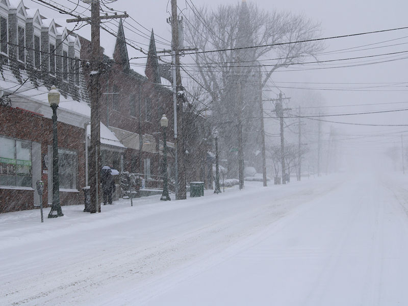
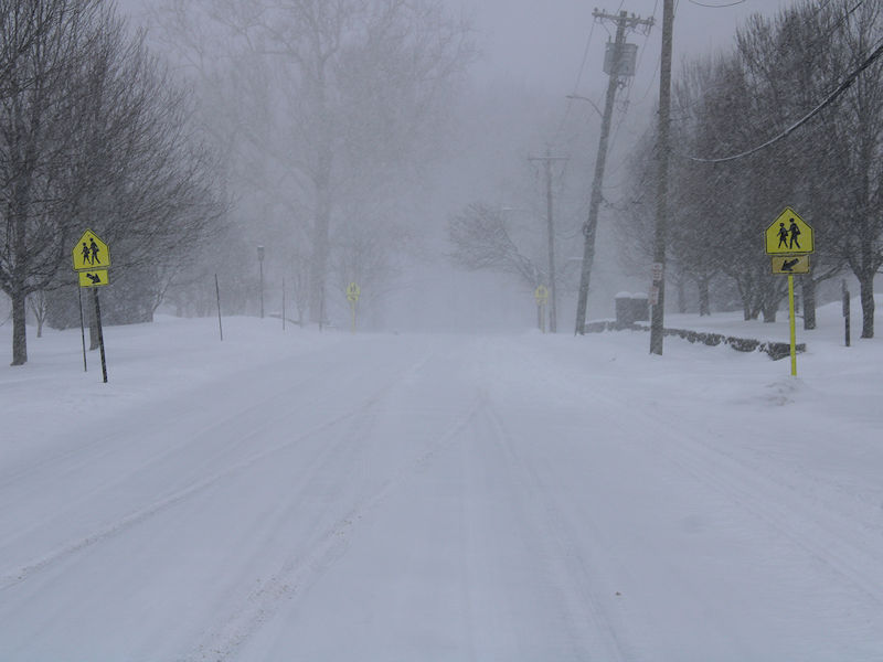
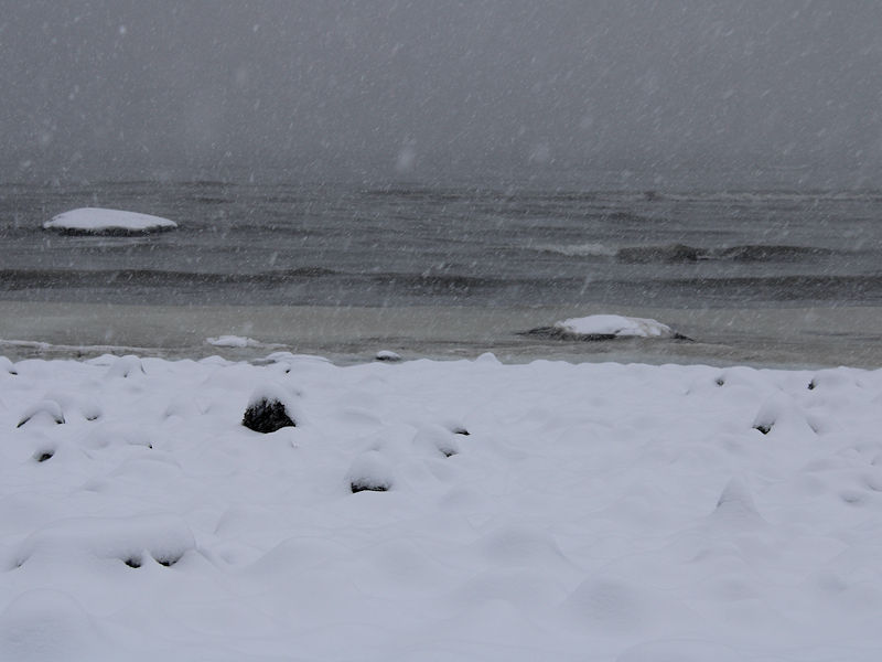
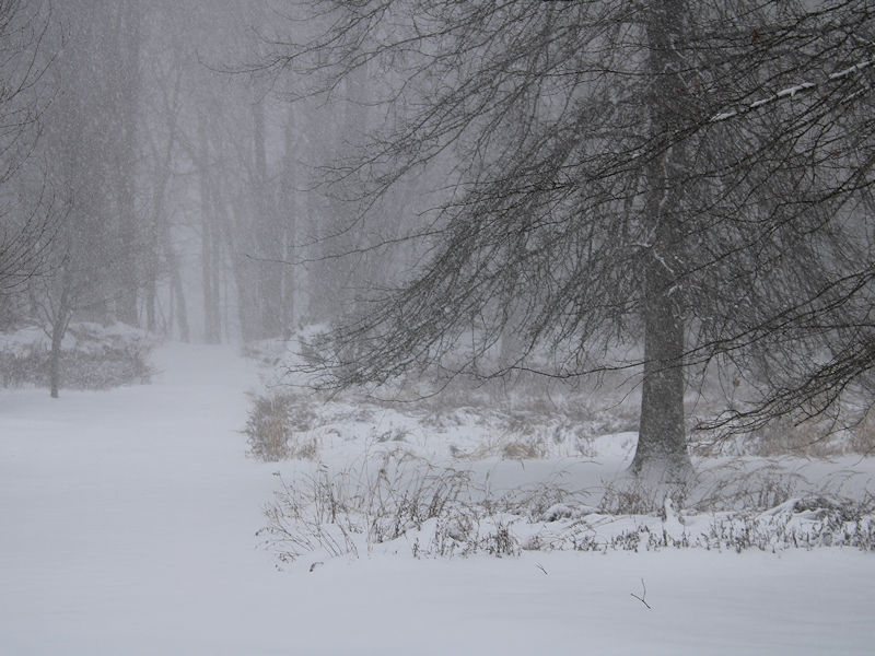
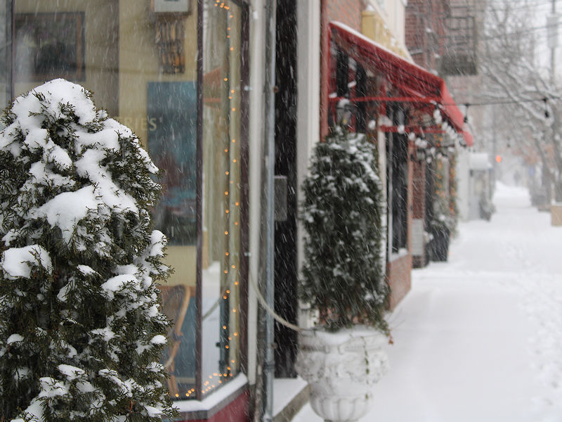
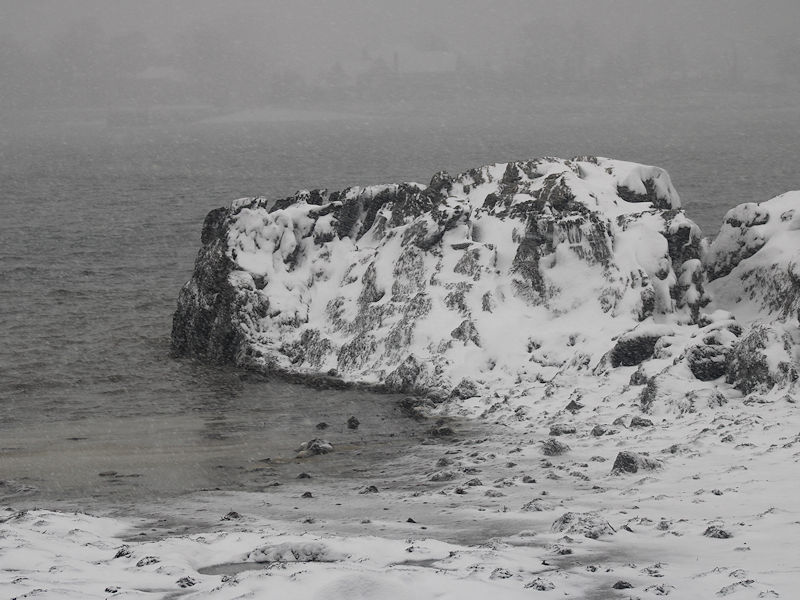
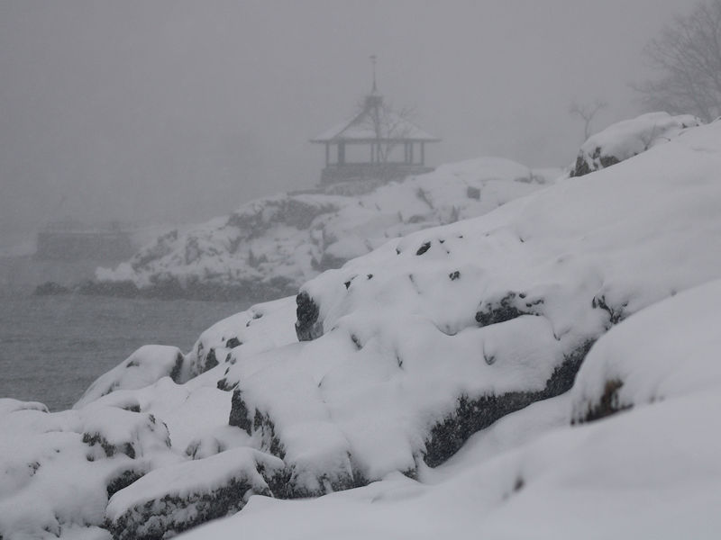
Photos from late this morning and early this afternoon:
-
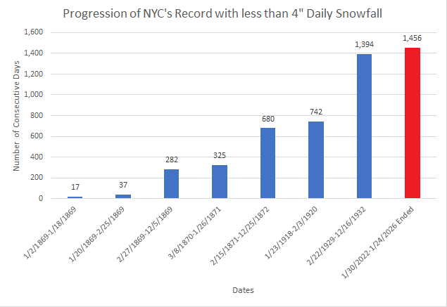
With 7.2" of snow so far today in Central Park, New York City's record drought without a 4" or above daily snowfall has finally ended.
-
January 25-26 Winter Storm Potential
donsutherland1 replied to Ralph Wiggum's topic in Philadelphia Region
Sorry about the delay, as I was away from the site. https://www.weather.gov/wrh/TextProduct?product=pnsphi -
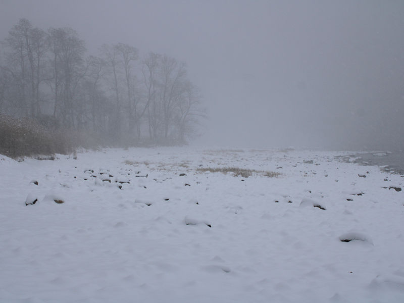
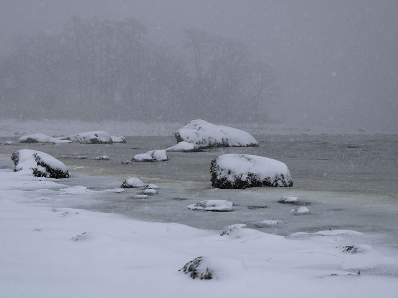
Three photos while keeping a wary eye on the sleet line.
-
January 25-26 Winter Storm Potential
donsutherland1 replied to Ralph Wiggum's topic in Philadelphia Region
160 NOUS41 KPHI 251219 PNSPHI DEZ001>004-MDZ012-015-019-020-NJZ001-007>010-012>027-PAZ054-055-060>062-070- 071-101>106-260019- Public Information Statement National Weather Service Mount Holly NJ 719 AM EST Sun Jan 25 2026 ...SNOWFALL REPORTS AS OF 7 AM 1/25/2026 ... Location Amount Time/Date Provider ...Delaware... ...New Castle County... New Castle County Airport 2.9 in 0700 AM 01/25 ASOS Newark 2.4 in 0700 AM 01/25 Public ...Sussex County... Milton 2.0 in 0520 AM 01/25 Broadcast Media 1 WNW Seaford 1.5 in 0615 AM 01/25 Amateur Radio Georgetown 1.5 in 0615 AM 01/25 Amateur Radio ...Maryland... ...Queen Annes County... 1 SSW Carville 2.5 in 0600 AM 01/25 Emergency Mngr Church Hill 2.0 in 0600 AM 01/25 Fire Dept/Rescue ...New Jersey... ...Atlantic County... Atlantic City International 2.2 in 0700 AM 01/25 ASOS Mays Landing 2.0 in 0650 AM 01/25 Trained Spotter Somers Point 1.7 in 0635 AM 01/25 Trained Spotter ...Burlington County... Mount Holly WFO 1.5 in 0650 AM 01/25 Official NWS Obs ...Camden County... Bellmawr 0.6 in 0640 AM 01/25 Trained Spotter ...Hunterdon County... Flemington 1.5 in 0600 AM 01/25 Trained Spotter ...Mercer County... Trenton Mercer Airport 1.7 in 0700 AM 01/25 ASOS ...Middlesex County... North Brunswick Twp 1.4 in 0700 AM 01/25 Public ...Monmouth County... 1 SW Howell 1.0 in 0600 AM 01/25 Public ...Ocean County... 3 N Ocean Gate 1.7 in 0655 AM 01/25 Trained Spotter Barnegat Twp 1.5 in 0700 AM 01/25 Trained Spotter ...Sussex County... 1 SW Sparta 2.0 in 0700 AM 01/25 Emergency Mngr 4 WSW Wantage Twp 1.0 in 0650 AM 01/25 Trained Spotter 3 SE Montague 1.0 in 0640 AM 01/25 Trained Spotter Wantage Twp 0.5 in 0610 AM 01/25 Trained Spotter ...Pennsylvania... ...Berks County... Spring Twp 3.3 in 0700 AM 01/25 Public Reading Regional Airport 3.0 in 0700 AM 01/25 ASOS ...Bucks County... Fricks 1.5 in 0650 AM 01/25 Trained Spotter ...Chester County... 1 NW East Nantmeal Twp 2.3 in 0700 AM 01/25 Trained Spotter ...Lehigh County... Lehigh Valley International 2.0 in 0700 AM 01/25 ASOS 1 SE North Whitehall Twp 1.6 in 0600 AM 01/25 Public Breinigsville 1.0 in 0600 AM 01/25 Trained Spotter ...Montgomery County... Willow Grove 0.8 in 0600 AM 01/25 Trained Spotter ...Northampton County... 2 E Tatamy 1.8 in 0700 AM 01/25 Trained Spotter ...Philadelphia County... Rittenhouse Square 1.7 in 0710 AM 01/25 Trained Spotter Philadelphia International 1.6 in 0700 AM 01/25 ASOS -
Extreme Cold, Snow & Sleet: SECS 1/24 - 1/26
donsutherland1 replied to TriPol's topic in New York City Metro
It's what the site claims. You raise a fair point. It's plausible that the while the sounding says sleet at a specific point in time, there are embedded periods of heavier precipitation that flip back to snow during parts of the period. Unfortunately, the exact algorithm used isn't published. -
Extreme Cold, Snow & Sleet: SECS 1/24 - 1/26
donsutherland1 replied to TriPol's topic in New York City Metro
A closer look: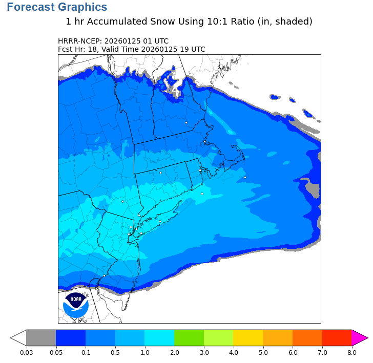
-
Today's high was 17°,
-
Extreme Cold, Snow & Sleet: SECS 1/24 - 1/26
donsutherland1 replied to TriPol's topic in New York City Metro
Source: https://repository.library.noaa.gov/view/noaa/53067/noaa_53067_DS1.pdf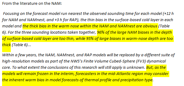
-
It might be low. That was one of the toughest areas. I erred on the side of conservatism. Hopefully, it is low.
-
Snow Contest January 25th-26th
donsutherland1 replied to WeatherGeek2025's topic in New York City Metro
New York City: 9.1" Boston: 17.0" Philadelphia: 7.5" Washington DC: 7.5" Hartford: 15.0" Albany: 18.2" -
Frigid air covered the region today. The low at Central Park was 9°. That was its first single-digit temperature since February 4, 2023 when the low was just 3°. The high temperature in Central Park was 17°. That was its first high temperature below 20° since January 21, 2025 when the high was 19°. It was also the coldest high temperature since December 24, 2022 when the mercury topped out at 15°. The stage is now set for New York City's biggest snowstorm in nearly four or five years. Snow will arrive early tomorrow morning, possibly before sunrise. A significant snowfall is likely in and around the New York City area and surrounding region, even as a transition to sleet is likely. New York City and its nearby suburbs will likely pick up 6"-12" of snow. Areas to the north and west of the City will receive 12"-18" of snow. The central Jersey Shore and eastern Long Island will likely see 4"-8" of snow. Final estimates: Albany: 14"-20" Allentown: 8"-14" Atlantic City: 3"-6" Baltimore: 6"-12" Binghamton: 12"-18" Boston: 14"-20" Bridgeport: 8"-14" Concord: 12"-18" Hartford: 12"-18" Islip: 4"-8" New York City: 6"-12" Newark: 6"-12" Philadelphia: 6"-12" Poughkeepsie: 12"-18" Portland: 12"-18" Providence: 12"-18" Richmond: 3"-6" Scranton: 12"-18" Washington, DC: 6"-12" The last time New York City saw a 6" or greater snowfall was January 28-29, 2022 when 8.3" fell. Its last 10" or above snowfall occurred during January 31-February 3, 2021 when 17.4" accumulated. Arctic air will return to the region as the storm departs. Highs will be mainly in the lower 20s through Friday. Tuesday could again see highs top out in the teens in New York City. the last winter with more than one high in the teens was Winter 2018-19 when there were two such days. Moreover, New York City has the potential to see the temperature dip into the single digits for lows on or more days during this period. Some snow flurries or snow showers are possible Thursday night into Friday morning. Overall, January 20th-February 3rd will likely be the coldest and perhaps snowiest two-week period this winter. The forecast WPO-/EPO-/AO-/PNA+ pattern is typically the coldest pattern in January and among the coldest during the first half of February. A persistently positive PNA will have above climatological risk of moderate or significant snowfalls. For perspective, the coldest two-week period this winter prior to January 20th was January 3-16, 2026 and January 4-17, 2026 with a mean temperature of 30.3°. The snowiest two-week period was December 14-27, 2025 when 7.2" of snow fell. The ENSO Region 1+2 anomaly was -0.3°C and the Region 3.4 anomaly was -0.7°C for the week centered around January 14. For the past six weeks, the ENSO Region 1+2 anomaly has averaged -0.48°C and the ENSO Region 3.4 anomaly has averaged -0.68°C. La Niña conditions will likely continue into at least late winter. The SOI was -18.88 today. The preliminary Arctic Oscillation (AO) was -2.391 today. Based on sensitivity analysis applied to the latest guidance, there is an implied near 100% probability that New York City will have a cooler than normal January (1991-2020 normal). January will likely finish with a mean temperature near 30.6° (3.1° below normal). Supplemental Information: The projected mean would be 2.0° below the 1981-2010 normal monthly value.
-
Extreme Cold, Snow & Sleet: SECS 1/24 - 1/26
donsutherland1 replied to TriPol's topic in New York City Metro
Yes. That's correct. From Pivotal Weather: ECMWF, UKMET, and Environment Canada models keep track of precipitation type in a precise way as the model integrates, so we know how exactly much precipitation falls in the form of snow (at least, based on the model’s internal diagnostics). This eliminates any concern about including sleet, graupel, or rain when we compute snowfall for those models. https://home.pivotalweather.com/guides/snowfall -
Extreme Cold, Snow & Sleet: SECS 1/24 - 1/26
donsutherland1 replied to TriPol's topic in New York City Metro
Prior to the warming of the mid-levels tomorrow afternoon, soundings showed a strongly saturated dendritic growth zone (DGZ) between –12°C and –17°C. That is almost ideal for producing large, fluffy dendritic flakes. There was also strong lift and high saturation supporting very efficient snow growth and high snow-liquid ratios, especially in areas with stronger banding. In short, for 3-4 hours there could be snowfall rates of 1" per hour and perhaps 2" per hour at times. That's when most of the snow will fall in and around New York City. The visibility could fall under one-quarter mile during the periods of heaviest snow. Thundersnow seems unlikely in most of the area as there isn't a convective signature in the soundings. It is these dynamics, not 10:1 snow-liquid ratio maps that tell the story of what continues to look to be a significant snowfall in and around New York City. On account of the system's dynamics ahead of the changeover to sleet and the storm's forecast QPF, I have little reason to deviate from my thinking based on today's 12z and early 18z guidance. Through early portion of the 18z cycle, it appeared that even as differences persisted among the guidance, the models were slowly moving toward a consensus with the exception of the 18z GFS. As 100% of individual EPS ensemble members from the 0z and 12z cycles had 6" or more snow, the 18z GFS's < 4" figure is not within the realistic range of possibilities. The strong dynamics noted earlier also suggest that the GFS's solution is unlikely. Overall, a reasonable low-case snowfall for New York City remains 5". A reasonable high case is 12". New York City and nearby areas remain in line for 6"-12" of snow and sleet. Areas to the south and east of New York City could see 4"-8" amounts (even farther south beyond the New York City area, places like Atlantic City should see 3"-6"). General 12"-18" amounts are likely well north and west of New York City, most likely in parts of northeastern Pennsylvania (Pike County, Lackawanna County), Orange County, Dutchess County, Sussex County into at least the northern half of Connecticut. For perspective, the last time New York City saw a 6" or greater snowfall was January 28-29, 2022 when 8.3" fell from a rapidly deepening blizzard that buried parts of Long Island into southern New England under two feet of snow. Its last 10" or above snowfall occurred during the long-duration January 31-February 3, 2021 snowstorm when 17.4" accumulated. Up in southern New England, Boston appears on track to see 14"-20" of snow. If so, that would be that city's biggest snowsorm since the January 28-29, 2022 blizzard, which dumped 23.8" of snow. -
Extreme Cold, Snow & Sleet: SECS 1/24 - 1/26
donsutherland1 replied to TriPol's topic in New York City Metro
Yes. State College has been suffering from a particularly severe snow drought. -
Extreme Cold, Snow & Sleet: SECS 1/24 - 1/26
donsutherland1 replied to TriPol's topic in New York City Metro
Winter Storm Warning Issued for a winter weather event in which there is more than one of the following: snow, sleet, and ice (freezing rain), and one of the warning criteria is met. The warning criteria for snow is 6 inches expected in a 12 hour period, or 8 inches expected in a 24 hour period. The warning criteria for ice is accumulations meeting or exceeding 1/2 inch. A winter storm warning may also be issued for heavy snow combined with strong winds of 25-34 mph that will cause blowing and drifting of the snow. A warning may still be warranted if the event is expected to exceed advisory criteria, but fall just short of warning criteria and will significantly impact mass transit and/or utilities. https://www.weather.gov/okx/wwa_definitions -
Extreme Cold, Snow & Sleet: SECS 1/24 - 1/26
donsutherland1 replied to TriPol's topic in New York City Metro
There could still be a warm layer below 700 mb and above 850 mb. -
Extreme Cold, Snow & Sleet: SECS 1/24 - 1/26
donsutherland1 replied to TriPol's topic in New York City Metro
From the Bronx: -
Extreme Cold, Snow & Sleet: SECS 1/24 - 1/26
donsutherland1 replied to TriPol's topic in New York City Metro
Here was the initial inquiry: -
Extreme Cold, Snow & Sleet: SECS 1/24 - 1/26
donsutherland1 replied to TriPol's topic in New York City Metro
So, it wasn't that storm. I am not sure what storm was involved.


