WxUSAF
-
Posts
28,778 -
Joined
-
Last visited
Content Type
Profiles
Blogs
Forums
American Weather
Media Demo
Store
Gallery
Everything posted by WxUSAF
-
A 4.35” report from southern Loudon and a 5.57” one near manassas!
-
This is the kind of thing I’ve seen in the orioles
-
Come on, blob. Blob my way
-
It kicked out an outflow. Got windy the last few mins.
-
Build west little storm!
-
Second one issued for the rest of the area including VA
-
WPC meso for heavy rain and flash flood potential out for the Bay and points eastward, including southern MD. (sorry VA)
-
Interesting storm motion. Storms moving east but keep building and redeveloping westward.
-
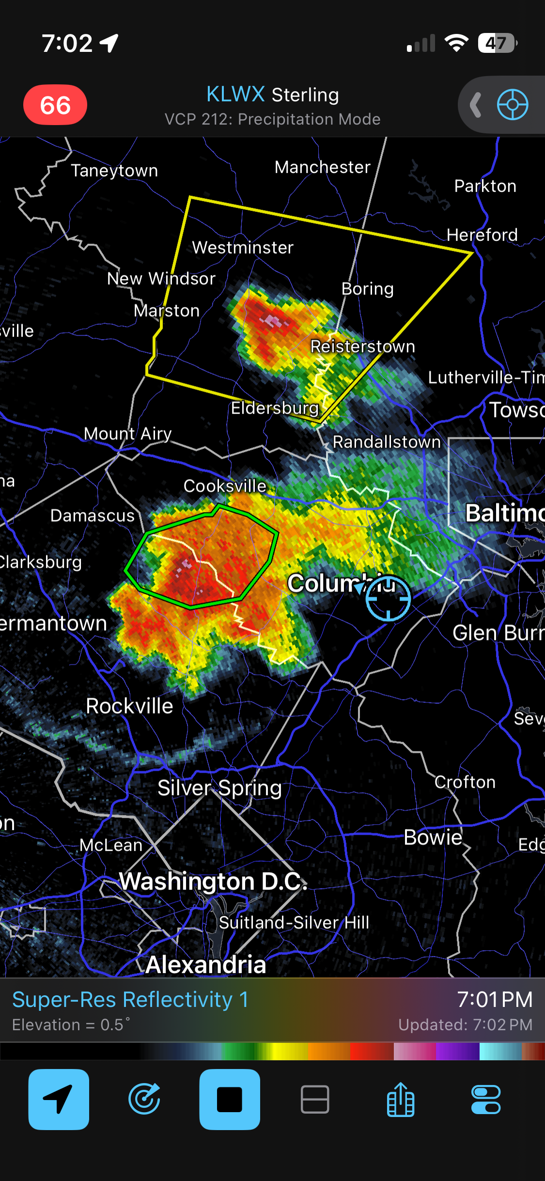
Oh look, cells popping in western HoCo for the third day in a row lol. Maybe a little micro scale feedback going on with wetter ground?
-
495 has been the screw zone so far the last 2 days. Hopefully you all cash in today and tomorrow. That line almost missed me last evening but it extended down just briefly, and damn was that rain intense.
-
Looks like it will, but we'll see when it enters the metro area where all those outflow boundaries have gone every which way
-
That big northern AA cell is still building south. Not sure exactly where you are, but think you're close...
-
About 0.7”. Been thundering almost constantly for nearly 3 hours
-
Two big outflows about to collide near the Potomac north of DC
-
Still very unlucky for MBy rainfall lol
-
If that was happening over downtown Ellicott city it would be testing the new flood mitigation
-
STW posted
-
Severe Storm Watch now issued for most of LWX
-
Constant thunder
-
WPC meso posted for entire LWX zone for flash flood potential
-
Clouds and thunder from that big cell on the HoCo-MoCo line, but it’s building the wrong way eta…same area in HoCo that got the good last evening going to win again
-
19z hrrr more like NAM in that regard. Very nice everyone wins scenario
-
My yard is looking like Texas hardpan so the runoff would be high in any quick downpour
-
18z hrrr most encouraging run of the day for metro area rainfall
-
I’ve seen lots of pinks and purples on QPF maps for awhile and the ground truth has been lacking