weatherwiz
-
Posts
81,082 -
Joined
-
Last visited
Content Type
Profiles
Blogs
Forums
American Weather
Media Demo
Store
Gallery
Everything posted by weatherwiz
-
12z HRRR catching on to the 0z RRFS?
-
What winds can the radomes withstand before worrying about damage risk?
-
This thing is like Pac man, just swallowing whatever is in its path (luckily probably not much). Thing seems to have a nasty RIJ
-
Looks like its about to split
-
It's like a massive supercell MCS Those storm tops may be exceeding 70,000 feet lol
-
Holy shit
-
Pretty much what dendrite said. Also, add in it’s extremely difficult for us to be directly centered under the ridge so more often than not we’re on the periphery so that opens up the door for high cloud/convective debris. Also, it gets difficult to achieve higher end temps when dewpoints start pushing towards and into the 70’s
-
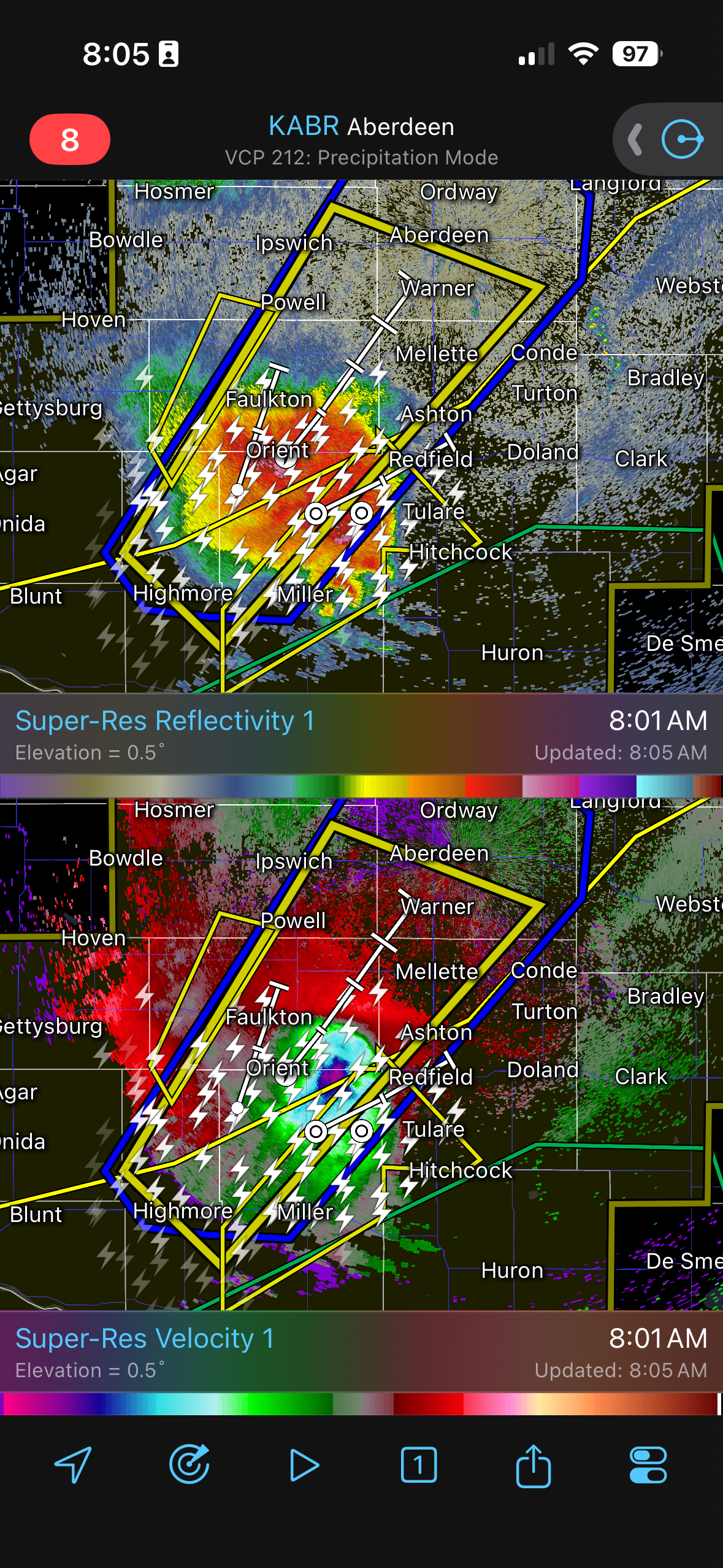
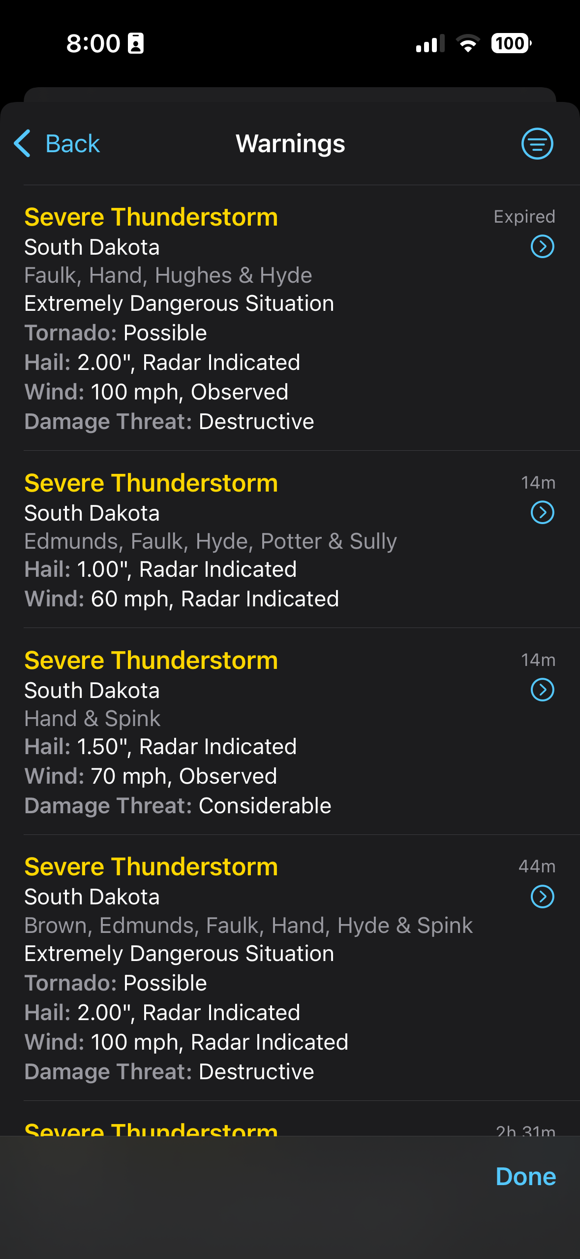
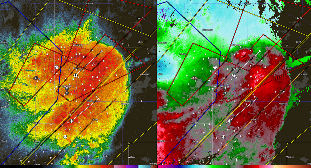
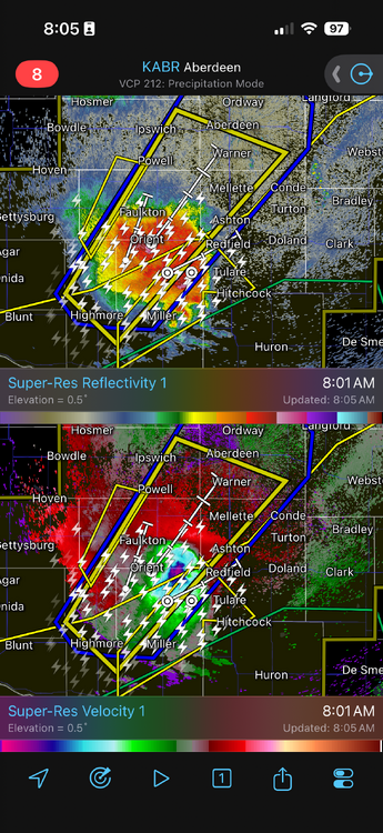
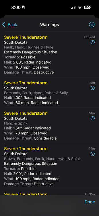
Good morning South Dakota
-
IMO, its much more difficult in these parts versus the PAC NW.
-
Just imagine the masterpiece of a symphony Beethoven could create based on the unison of hums from all of the A/C's that will be cranking full-throttle and non-stop for the next foreseeable future.
-
 We kick off the month of July with a trough digging into the western United States and a large ridge of high pressure building into the midwestern states (I refuse to call this a heat ridge...another stupid, hyped up term) resulting in high heat and humidity building into the eastern third of the country. Here in the Northeast, we will find ourselves on the northern or northeastern periphery of the upper-level ridge. This will place us in a favor position for the advection of higher heat/humidity in the lower-levels while favoring a northwestern flow in the mid-to-upper levels. This pattern can be favorable for MCS propagation into the Northeast region as well as the advection of elevated mixed-layer plumes. In terms of severe weather potential, computer forecast models hint at some shortwave energy rounding the northern periphery of the ridge into the Northeast (uncertainty as to exactly where). With temperatures well into the 90's and dewpoints well into the upper 60's to 70's under the presence of steep mid-level lapse rates, the potential exists for moderate-to-extreme instability to develop with potential for 2500-4000 J/KG of MLCAPE with potential for 30-40+ knots of bulk shear. Should a shortwave work into this environment the potential would exist for numerous thunderstorms, including the potential for some of these to be severe with potential for damaging wind gusts, large hail, and even the potential for tornadoes if enough directional shear is present. The high heat and humidity has finally arrived
 -
Pablo Sandoval ran faster than the board has this week
-
ahh yes...yeah the new site is much better. Wish it was available mobile (unless it is now)
-
Do you use it on pc or mobile? cod is definitely not user friendly mobile
-
Really? I use it all the time and haven't had any issues...outside of some instances where the NAM gets "stuck"
-
tickle me elmo
-
I do think region wide we'll be upper 80's to lower 90's and maybe even closer to 95 in the torch spots, but the most interesting aspect about the pattern is we could end up in a favorable position with respect to the ridge axis for EML advection and MCS propagation from the Great Lakes/southeast Canada!
-
Thank God. Its been a while day since we've had rain. Another day without rain and we'd be crying drought again
-
Pretty interesting/weird how the GFS blossoms QPF in the Tennessee Valley region mid-week directly under the heart of the ridge
-
speaking of GFS...lets hope it verifies next week. We ride the MCS train
-
Something to watch for sure. This setup, if verified, could argue for some flooding potential across southern CT. southern CT right on the edge of the stronger llvl jet and more robust elevated CAPE with the boundary just south. Perfect scenario for training
-
Stalls that cold front just to our south tomorrow evening and then either slowly lifts it back north as a warm front or just remains a stationary front with a wave developing along it. GFS has it too. Wonder if alot of this depends on MCS developing and evolution tomorrow within the midwest
-
Should see a few strong storms tomorrow, particularly north of the Pike. Dries out quite a bit aloft which tapers down potential aerial coverage. Too bad because shear is pretty solid for late June
-
Is it even possible to mix to 700mb around these parts?
-
Tuesday (with a high of 88) is described as "nice" while Thursday (with a high of 86) is described as hot (granted it says humid) but still lol.