

weatherwiz
-
Posts
81,082 -
Joined
-
Last visited
Content Type
Profiles
Blogs
Forums
American Weather
Media Demo
Store
Gallery
Everything posted by weatherwiz
-
 Today is COC
 -
I would have to think something pops too. At least in the case of tomorrow, we have pretty decent height falls into the evening and overnight and lapse rates are pretty respectable for these parts. Shear is pretty solid too, although llvl flow being more westerly may limit convergence? Instability will be there. This is hitting a nice area for wind potential tomorrow and this corridor lines up well with where the best ingredients overlap
-
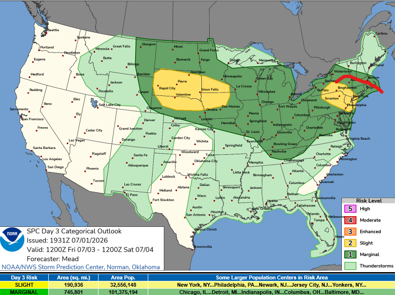
Got the slight to nudge east into SNE a bit...probably will see another nudge tonight. Maybe even a 30% area added up to the CT/MA border tomorrow morning
-
Have to see exactly where the boundary ends up but the RRFS with some nasty storms rolling through later Saturday afternoon. I strongly recommend securing the grill unless you want it going airborne and it starts raining burgers and hot dogs all over.
-
that is wild for JFK
-
Tomorrow night could be really fun, could even be more fun if that EML wasn't shunting to our southwest
-
A lot of evaporation going on too with the rain that moved through. When I went outside with the dog earlier it was like a sauna with the steam rising.
-
Should be another loud night for some tomorrow night
-
Big lightning spike to my west!!
-
Falling apart down this way, figures.
-
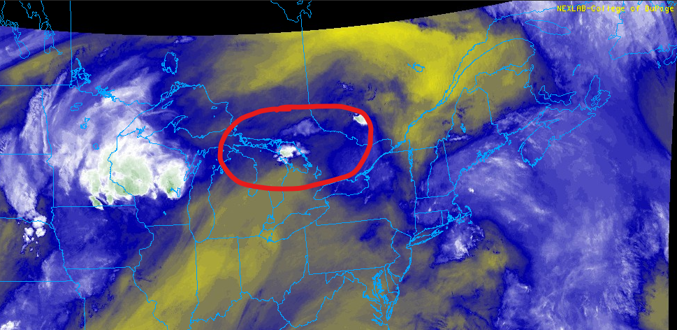
Nice outflow on radar
-
Come to daddy
-
I don’t know. Not feeling too confident about it. Was really hopeful earlier but nothing really indicating. I do think we will at least see some isolated activity during the night.
-
The NAM has been kicking ass this week with convection (not just these parts). NAM doing what it was designed to do! Going to be a big loss when it’s gone when it comes to convective forecasting (and CAD)
-
meh that's a lot of money to look at clouds and put things out on auto
-
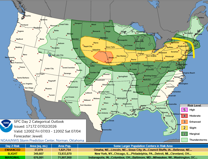
tsk tsk, sight should have been larger to include SNE
-
May be seeing lots of solar panels becoming airborne on Friday.
-
Friday may even deserve its own thread. May fire one up a little later.
-
Weak llvl flow but Friday has my attention on the NAM...
-
I am really curious to see how it unfolds. I totally agree the rising heights are a big negative in this, on the other hand, if we are pushing MLCAPE values >2500-3000 J and get any sort of subtle energy rotating through aloft, is even subtle energy enough to set things off? I think that's why I'm intrigued in this. If we were dealing with MLCAPE that was only like 1500 I probably wouldn't be as intrigued.
-
It's going to be an interesting afternoon I think in terms of convective development. Have to watch this area here. Not a ton going on right now but the NAM seems to blossom from this.
-
MOS/NBM are 76/77. But I'll say they get to 78
-
BDL will probably get down to 77-78
-
NBM has EWR got to 84 tomorrow night BOS may get get below 80 either
-
Just had thunder now


