yoda
-
Posts
62,015 -
Joined
Content Type
Profiles
Blogs
Forums
American Weather
Media Demo
Store
Gallery
Everything posted by yoda
-
Wow... very sad
-
I know it's in the SE forum... but parts of GA and AL got hit hard today... reports of at least 22 dead in Lee County Alabama from two tornadoes
- 2,802 replies
-
- 1
-

-
- severe
- thunderstorms
- (and 4 more)
-
Lol The 850 0c line clearly moved SE along with the snow line
-
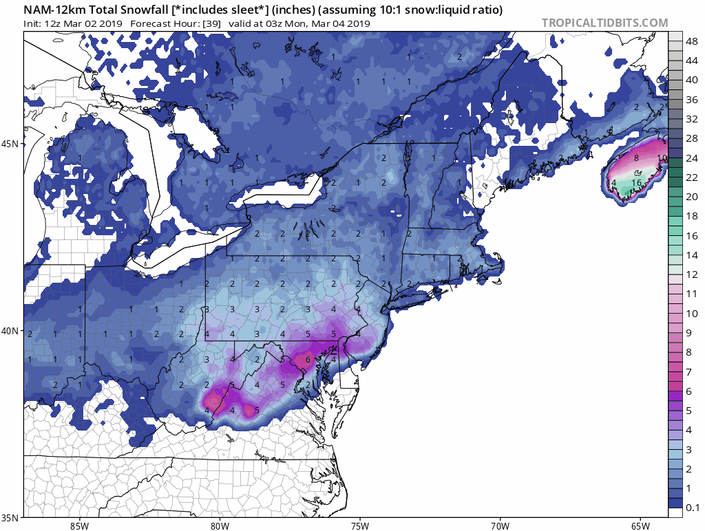
3km NAM is real close to all snow for DCA
-
Hmmm

-
A bit better for the region this run... you can see it at the 850 level
-
18z NAM a bit slower than 12z fwiw
-
-
06z NAM looks slightly better than 00z... keeps up the slow push south ETA: I guess it depends on where you live tbh on if the run was slightly better or worse
-
FWIW, 06z NAM has snow starting around 16z SUN at DCA... looks like some mod snow at 17z and 18z
-
WSWs came to about the BR... and across N MD
-
URGENT - WINTER WEATHER MESSAGE National Weather Service Baltimore MD/Washington DC 255 AM EST Sat Mar 2 2019 VAZ026-027-029>031-040-501-503>505-507-WVZ506-021600- /O.EXA.KLWX.WS.A.0006.190303T1200Z-190304T1200Z/ Rockingham-Shenandoah-Page-Warren-Clarke-Rappahannock- Northern Fauquier-Western Highland-Eastern Highland- Western Loudoun-Northern Virginia Blue Ridge-Eastern Pendleton- 255 AM EST Sat Mar 2 2019 ...WINTER STORM WATCH IN EFFECT FROM SUNDAY MORNING THROUGH MONDAY MORNING... * WHAT...Heavy snow possible Sunday and Sunday night. Total snow accumulations of 5 or more inches are possible Sunday and Sunday night. * WHERE...Portions of northern and western Virginia and eastern West Virginia. * WHEN...From Sunday morning through Sunday night. * ADDITIONAL DETAILS...Travel could be very difficult Sunday and Sunday night. PRECAUTIONARY/PREPAREDNESS ACTIONS... A Winter Storm Watch means there is potential for significant snow, sleet or ice accumulations that may impact travel. Continue to monitor the latest forecasts.
-
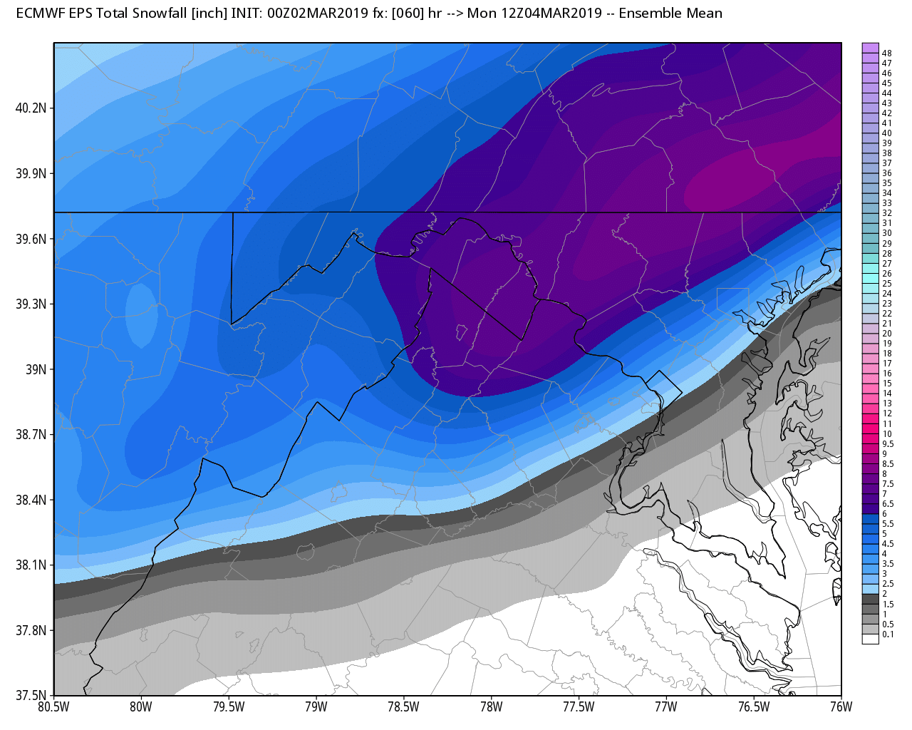
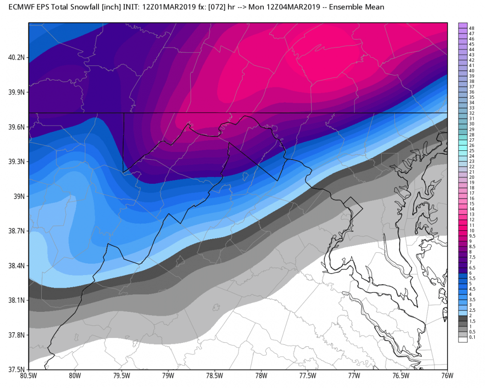
12z EPS from earlier today at 72 00z EPS at 60 from tonights run

-
FWIW, EPS mean shifted SE by a good margin. Around 32 of the 50 members get the 2" marker through DCA. There are about 8 or so that get the 6" marker nearby
-
Surprised @Ji isn't all over tonights euro
-
FV3 is probably more in the other camp... its snow to light rain at the end
-
Looks like 0c 850 line gets near DCA at 48 and 54... but stays just SE on 00z UKMET
-
Will know in about 5 minutes
-
00z CMC made a SE move

-
But its snow
-
Hr 54 Ji... ending as light rain. 48 is snowing hard
-
Sounding at DCA at 48 and 54 on TT are entirely below zero except for last 50m or so... so I would assume it's likely going to be snow
-
1004mb SLP E NC at 51 1000mb SLP just offshore VA/NC border at 54 996mb SLP about 150 miles east of Ocean City at 57
-
1008mb SLP near ATL at 45
-