

yoda
-
Posts
62,102 -
Joined
Content Type
Profiles
Blogs
Forums
American Weather
Media Demo
Store
Gallery
Everything posted by yoda
-
-
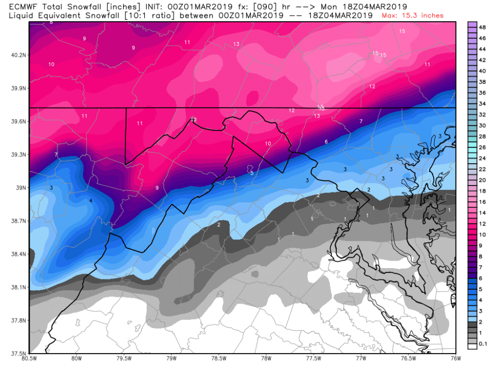
Western MD to about HGR is crushed though this run
-
Not sure it will be enough looking at SLP placement at 72 on IWM this run
-
Ukie is cold rain for most at 78 unfortunately... 850 0c line is out west by i81 corridor at that time even though 2mT are hovering around 32 degrees
-
The mean is flatter or the ensembles themselves then?
-
It's only out to 36 on WB... where you seeing it that fast?
-
Extrapolate goodness?
-
12z run at 84 had it in around the same place 00z at 72 has it... so well see what the precip and 850 maps show ahortly
-
00z UKMET at 72 has SLP in NW GA
-
Meh, 72 and 78 need work on the fv3. 850 0c line are out towards i81 corridor tbh
-
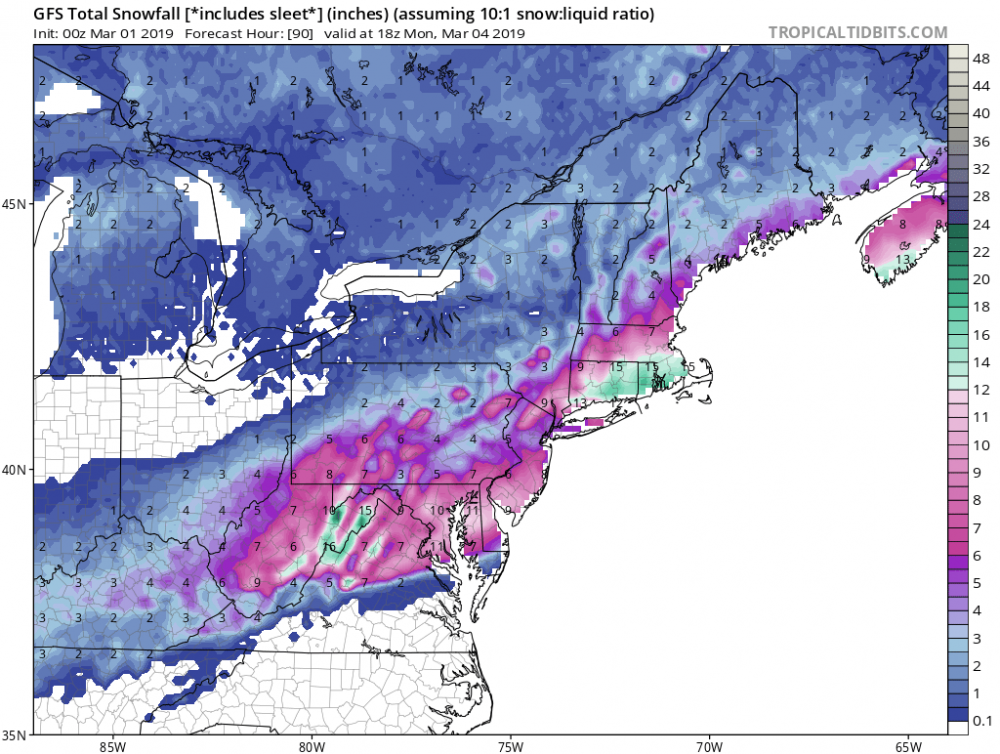
Through 90 hours
-
Still snow at DCA at 78... and looks like snow at EZF too
-
Lol the SLP is so far south that everyone gets hit
-
Looks like SLP is in S AL at 72 on IWM
-
Pretty nice hit at that too
-
No go for the NAM tonight... rain for all as SLP crosses through our region
-
84 near or right over ORF at 1002mb
-
Hmmm IWM at 81 has SLP in NC...
-
12z FV3 looks close to what the GFS says
-
Cold rain for most... perhaps snow for W MD into parts of C MD and for those along M/D line per 12z GFS
-
Looks slightly more amped than 6z
-
I'm guessing that this is the story http://www.mininggazette.com/news/2019/02/rescuers-win-race-against-time-in-storm/
-
Opal is in Fauquier county for those who don't know reading the AFD posted above
-
LWX morning AFD as of 3:50am:
-
Yet he says he is in Chevy Chase MD


