yoda
-
Posts
62,102 -
Joined
Content Type
Profiles
Blogs
Forums
American Weather
Media Demo
Store
Gallery
Everything posted by yoda
-
Short Term Forecast National Weather Service Baltimore MD/Washington DC 1211 PM EST Sun Jan 13 2019 DCZ001-MDZ504-VAZ052>054-506-131900- District of Columbia-Central and Southeast Montgomery- Prince William/Manassas/Manassas Park-Fairfax- Arlington/Falls Church/Alexandria-Eastern Loudoun- Including the cities of Washington, Bethesda, Rockville, Gaithersburg, Silver Spring, Dale City, Manassas, Woodbridge, Lake Ridge, Montclair, Reston, Herndon, Annandale, Centreville, Chantilly, McLean, Franconia, Arlington, Alexandria, Falls Church, Leesburg, Ashburn, and Sterling 1211 PM EST Sun Jan 13 2019 .NOW... A band of moderate to heavy snow is developing and moving into Washington DC and its southwestern suburbs. Visibility may be reduced to a quarter mile. Snowfall rates of a half to one inch per hour are possible. A Winter Storm Warning remains in effect until midnight.
-
Same here... giant flakes
-
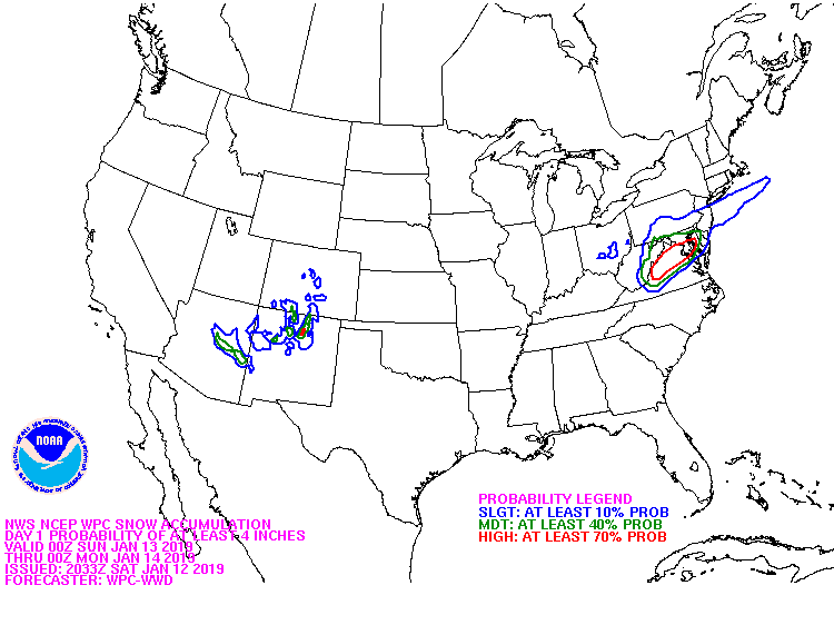
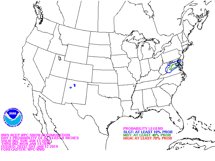
Am I reading the 12z models right? Showing an additional 2 to 4 along i95 corridor possible?
-
I hope we do that this afternoon and evening
-
I don't see the sun here...
-
3km NAM tries for around 0.75 to DCA as well lol
-
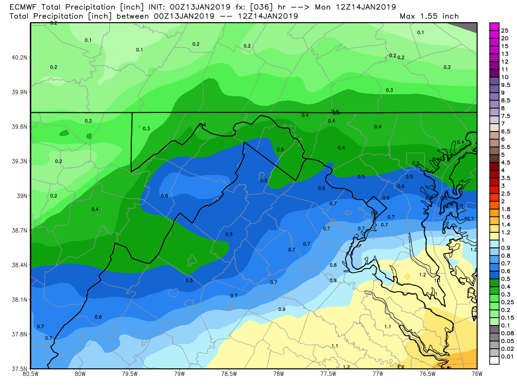
Looks like another 0.8" or so QPF over next 24 hours?
-
Snow finally winds down around 07z or 08z lol
-
I like the mod to heavy snow over us at 21z continuing still at 02z MON lol
-
IAD reports 3.8" at 2:25am per latest PNS BWI was 1.8" and DCA 1.9" both at 12:00am
-
-
0.4 to 0.5
-
Another 0.7 or so QPF at DCA
-
For our DCA snow report watchers: DCA reported 1.9" at 12:00am per the latest PNS
-
Nice. What was your call for DC again? I believe you called for around 6? Or am I wrong?
-
04z HRRR does look nice at the end of its run...
-
3 inches in West Springfield... anyone still up confirm that or around that? Sending it in as a spotter report to LWX... so want some conformity
-
FWIW, 00z UKIE also has it snowing until 6z MON
-
3km NAM has an intense band in S MD at 05z MON
-
00z NAM finishes 1.4" QPF at DCA
-
1.25" QPF DCA at hour 27 on 00z NAM and still snowing
-
00z NAM mod snow along i95 corridor at 05z MON lol
-
You mean the massive lull
-
00z NAM looks really nice around midnight and after looking at the radar forecast
-