yoda
-
Posts
62,102 -
Joined
Content Type
Profiles
Blogs
Forums
American Weather
Media Demo
Store
Gallery
Everything posted by yoda
-
18z NAM a bit slower than 12z fwiw
-
-
06z NAM looks slightly better than 00z... keeps up the slow push south ETA: I guess it depends on where you live tbh on if the run was slightly better or worse
-
FWIW, 06z NAM has snow starting around 16z SUN at DCA... looks like some mod snow at 17z and 18z
-
WSWs came to about the BR... and across N MD
-
URGENT - WINTER WEATHER MESSAGE National Weather Service Baltimore MD/Washington DC 255 AM EST Sat Mar 2 2019 VAZ026-027-029>031-040-501-503>505-507-WVZ506-021600- /O.EXA.KLWX.WS.A.0006.190303T1200Z-190304T1200Z/ Rockingham-Shenandoah-Page-Warren-Clarke-Rappahannock- Northern Fauquier-Western Highland-Eastern Highland- Western Loudoun-Northern Virginia Blue Ridge-Eastern Pendleton- 255 AM EST Sat Mar 2 2019 ...WINTER STORM WATCH IN EFFECT FROM SUNDAY MORNING THROUGH MONDAY MORNING... * WHAT...Heavy snow possible Sunday and Sunday night. Total snow accumulations of 5 or more inches are possible Sunday and Sunday night. * WHERE...Portions of northern and western Virginia and eastern West Virginia. * WHEN...From Sunday morning through Sunday night. * ADDITIONAL DETAILS...Travel could be very difficult Sunday and Sunday night. PRECAUTIONARY/PREPAREDNESS ACTIONS... A Winter Storm Watch means there is potential for significant snow, sleet or ice accumulations that may impact travel. Continue to monitor the latest forecasts.
-
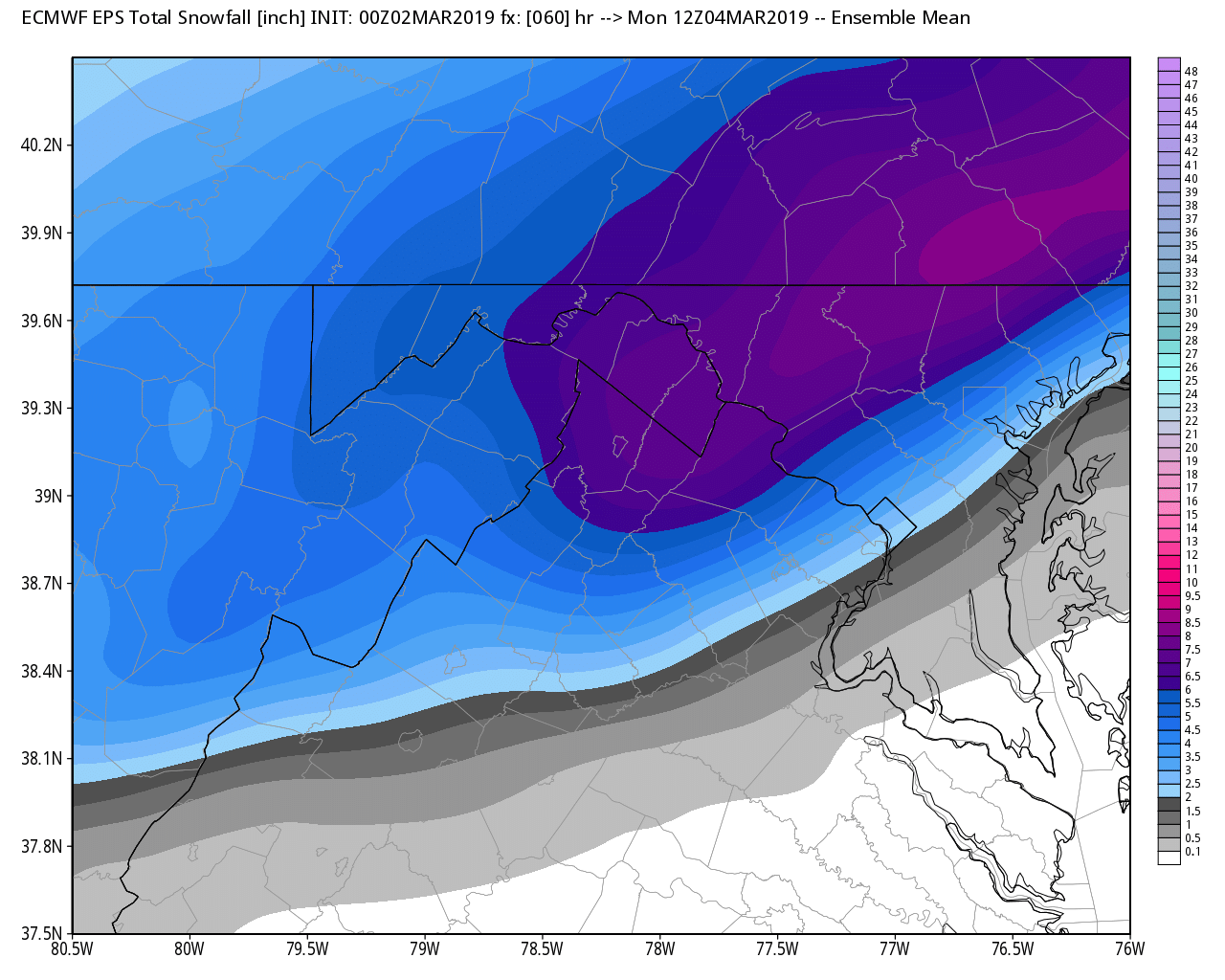
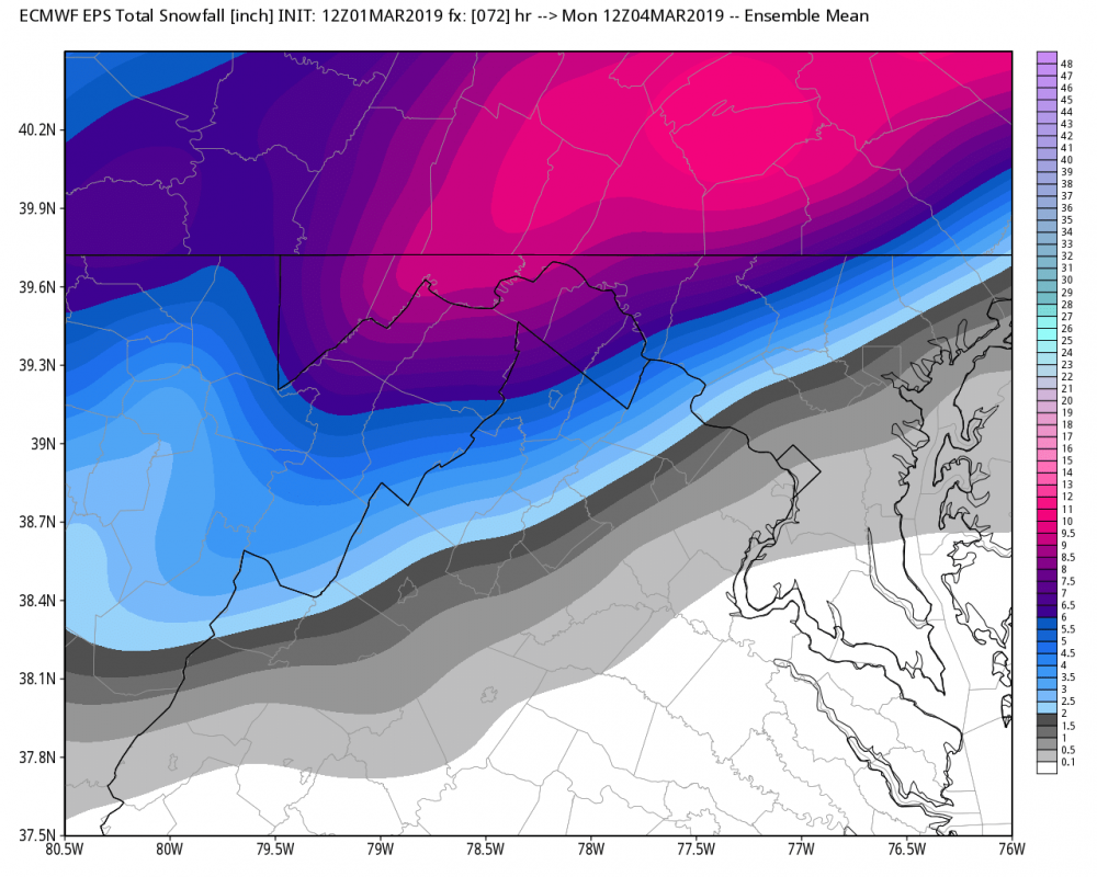
12z EPS from earlier today at 72 00z EPS at 60 from tonights run

-
FWIW, EPS mean shifted SE by a good margin. Around 32 of the 50 members get the 2" marker through DCA. There are about 8 or so that get the 6" marker nearby
-
Surprised @Ji isn't all over tonights euro
-
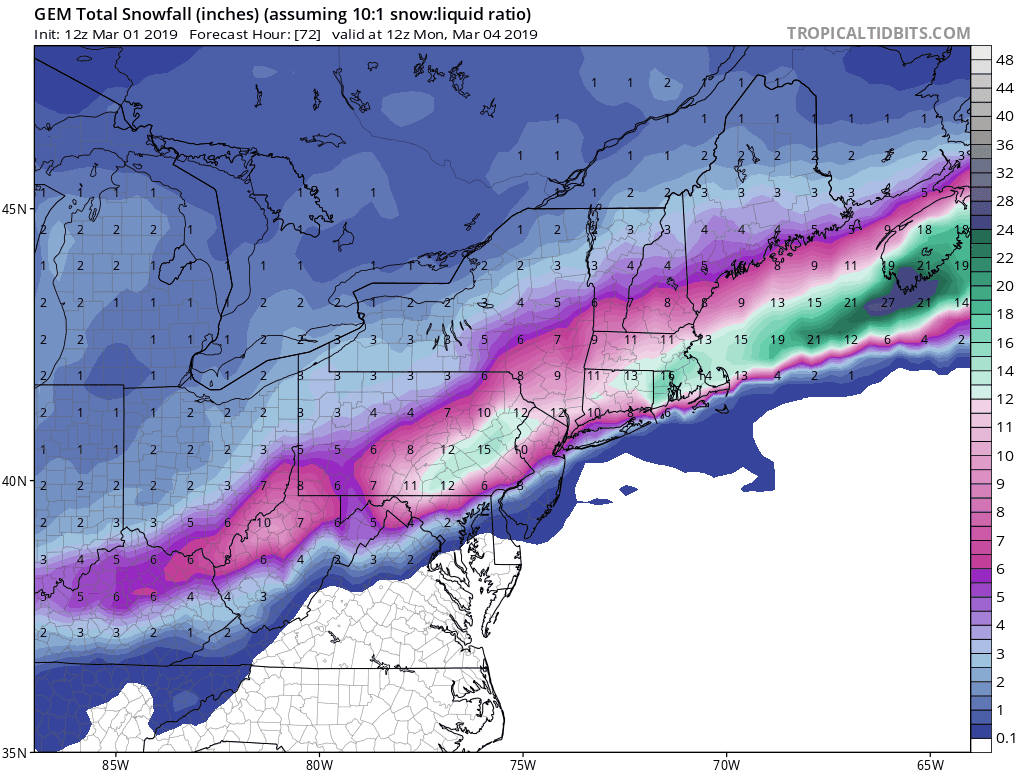
FV3 is probably more in the other camp... its snow to light rain at the end
-
Looks like 0c 850 line gets near DCA at 48 and 54... but stays just SE on 00z UKMET
-
Will know in about 5 minutes
-
00z CMC made a SE move

-
But its snow
-
Hr 54 Ji... ending as light rain. 48 is snowing hard
-
Sounding at DCA at 48 and 54 on TT are entirely below zero except for last 50m or so... so I would assume it's likely going to be snow
-
1004mb SLP E NC at 51 1000mb SLP just offshore VA/NC border at 54 996mb SLP about 150 miles east of Ocean City at 57
-
1008mb SLP near ATL at 45
-
-
5" at DCA at 48 on the 10:1 maps on pivotal and still snowing
-
DCA sneaks barely into all snow on 00z ICON
-
Ya that ain't sticking Um okay... why not?
-
Starts snowing in DCA at around 16z SUN on 00z RGEM Mod snow (perhaps heavy) starts in DCA at 20z SUN and continues until the end of the run at 00z MON
-
Back to so much whining and complaining in here
-
Zoom in to like super extreme NW Loudoun and there is like a speck of blue lol