OSUmetstud
-
Posts
16,521 -
Joined
-
Last visited
Content Type
Profiles
Blogs
Forums
American Weather
Media Demo
Store
Gallery
Everything posted by OSUmetstud
-
People kinda forgot that strengthening is proportional to strength. (much easier for a stronger storm to strengthen quickly)
-
That's fair. Recon looks like it missed the center, so some of that might be because they didn't come in perpendicular.
-
I'm not seeing that. The max wind band was about .2 degrees of the lowest pressure they found. It is a large storm with decent-sized eye and that might limit strengthening, but it's where it "should be."
-
There's a large seeding operation in southern and central Alberta that's meant to decrease hail size. Even though I'm not sure it works, at least it gives me an out if my forecast for Calgary or Red Deer doesn't work out.
-
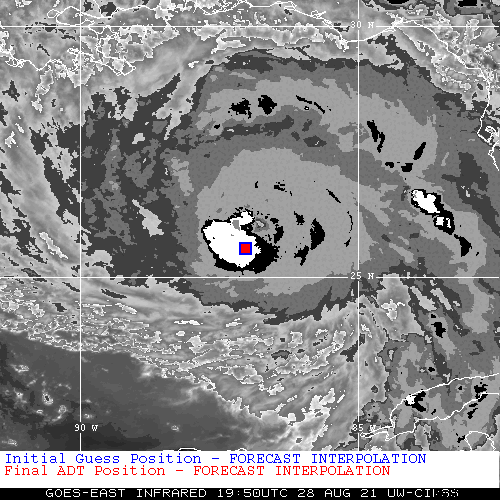
That's what it's showing. The forecast interpolation is SW of the actual position, therefore its intensity estimation is crap.
-
Advanced Dvorak Technique doesn't always best describe it... On a serious note, that's a nice demonstration of the NW of track deviation that has been observed of late.
-
It is, it may not be a cat 1 anymore.
-
raw Advanced Dvorak Technique is up to T5.6. It's clearly strengthening. Just have to confirm how much via next recon.
-
Hurricane Ida Forecasting Contest
OSUmetstud replied to WxWatcher007's topic in Tropical Headquarters
125 mph 125 mph 950 mb S of Morgan City -
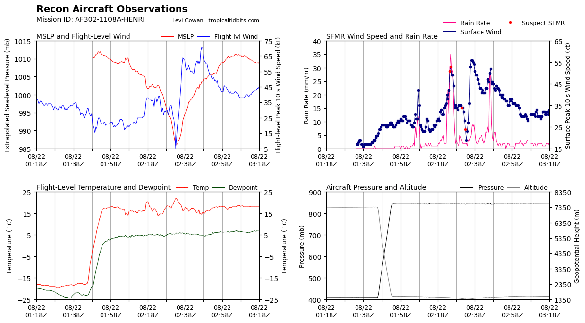
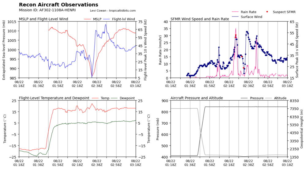
It looks like mission 8 is getting more impressive readings overall for whatever reason. They had 983 mb with a 16 kt wind at splashdown along with flight level winds of 82 knots and SFMR of 67 knots.
-
Hurricane Whiskey and X-Ray seem fun.
-
If the NHC didn't want regular folks calling storms "he" or "she" then they probably shouldn't use a list of names that clearly alternates between male and female sounding names. I know its more properly an "It" but I understand why people would call it a "she" or a "he."
-
Most of the guidance just seems a bit too far away to give New Orleans the worst. The bend left near the coast helps them a good deal. It looks like Morgan City and Lafayette is in the cross-hairs.
-
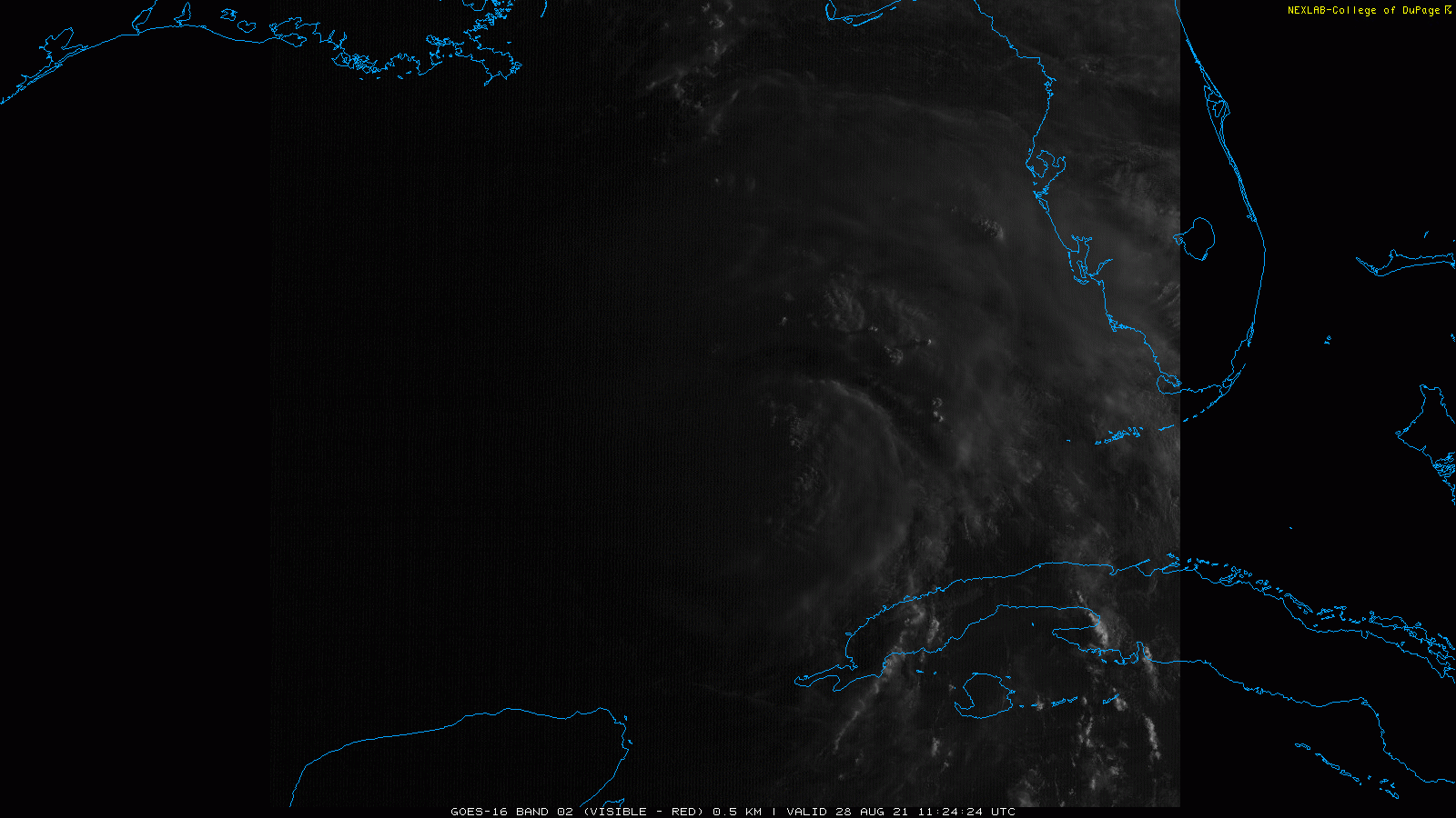
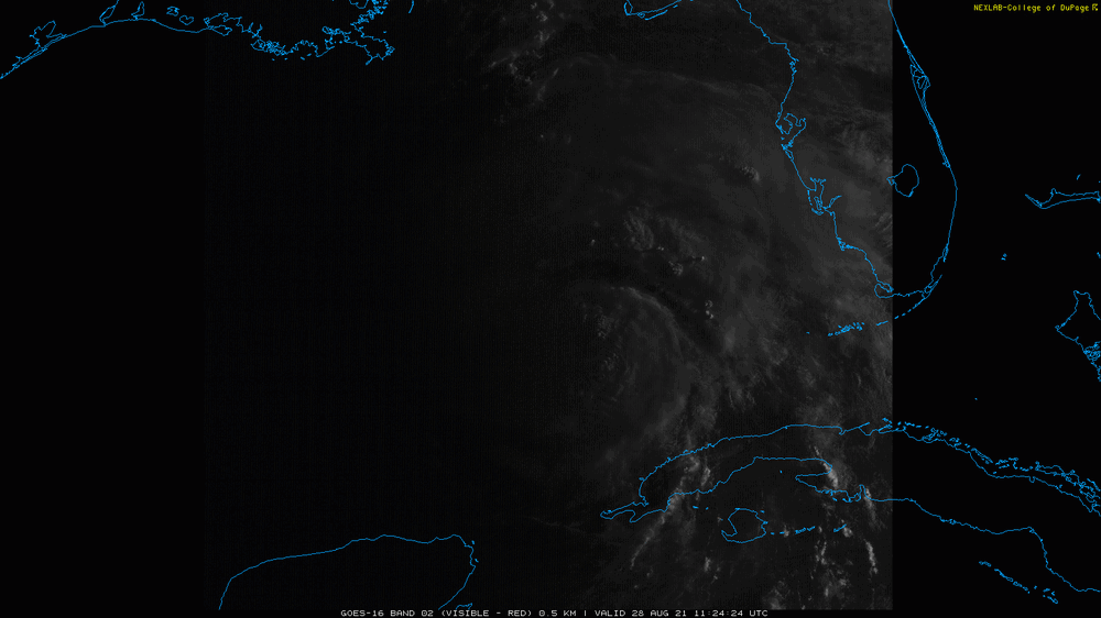
First light
-
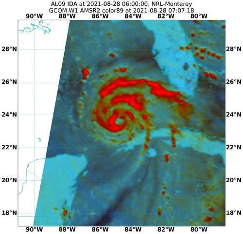
It does seem right on the edge of taking off, there was a cyan ring in the 37 Ghz at 07z.
-
7 URNT12 KWBC 281019 VORTEX DATA MESSAGE AL092021 A. 28/09:44:45Z B. 24.06 deg N 085.26 deg W C. 700 MB 3035 m D. 987 mb E. 195 deg 08 kt F. OPEN SE G. E03/35/10 H. 53 kt I. 307 deg 16 nm 09:40:49Z J. 052 deg 52 kt K. 307 deg 22 nm 09:39:16Z L. 63 kt M. 133 deg 14 nm 09:51:04Z N. 225 deg 66 kt O. 132 deg 15 nm 09:51:11Z P. 10 C / 3067 m Q. 14 C / 3053 m R. 10 C / NA S. 12345 / 7 T. 0.01 / 0.5 nm U. NOAA3 0809A IDA OB 07 MAX FL WIND 66 KT 132 / 15 NM 09:51:11Z Weird eye shape there, elliptical with a 30-210 degree axis, 10 NM by 35 NM.
-
-
The probably with Rita if I remember correctly is how massive the stated evacuation was and some bad communication where far too many people from Houston on high ground evacuated who shouldn't have.
-
Right, I guess I wasn't sure how much the shorter term jogs to the right would affect the final landfall location, given that the forcing latter should be left.
-
The synoptic pattern to me suggests that stronger=west. I think a stronger Ida ends up diabatically building that ridge to the northwest of it.
-
There's a double wind max on recon.
-
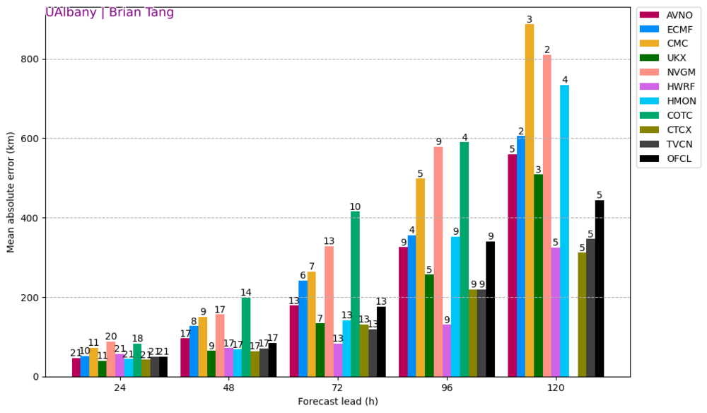
Brian Tang's MAE analysis is showing HWRF having the best performance with this storm so far, at basically all lead times.
-
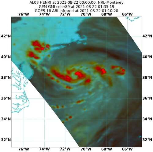
a bit over an hour ago. Symmetrical, with banding, but no proper CDO or bonafide eyewall.
-
An accordion plays, gently
-
That's the first time it's had hurricane-force SFMR