OSUmetstud
-
Posts
16,521 -
Joined
-
Last visited
Content Type
Profiles
Blogs
Forums
American Weather
Media Demo
Store
Gallery
Everything posted by OSUmetstud
-
I don't think those equivalent to Laura in insured losses calls are looking good right now either...
-
the shrimp industry will be decimated for sure
-
Oh sure. I'm just saying that from what we've seen today, I think they'll be alright. Am I not allowed to give an opinion on it?
-
Katrina was a semi-man made disaster. This will actually be worse for a lot of areas in SE LA than Katrina was, meteorological speaking. The surge in NOLA will actually probably end up similar. The thing that's different is the levees.
-
Laura hit the least populated area in LA. This is no Katrina, but this is worse than Laura in terms of population affected.
-
The surge at Shell Beach, LA is just above 7 ft.
-
This place is like somebody's memory of a town, and the memory is fading. It's like there was never anything here but jungle
-
Apparently the surge in New Orleans with Betsy was 10 ft or so. I think this might out-do that in New Orleans. For SE Louisiana, I'm definitely expecting over 15 ft. It's a much larger hurricane than Michael was.
-
Laura was about 17-18 ft apparently.
-
Overweighted childhood memories became dogma.
-
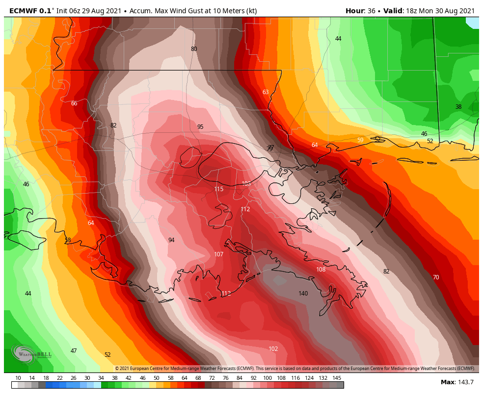
06z ecmwf is not ideal, another adjustment to the right.

-
It's probably more like 931mb because the extrap and dropsonde pressure are off by about 4mb.
-
I think that's fairly normal in the strongest, right? The flight level winds and surface winds are close with the big max in between.
-
Yeah, you're probably talking about a surge approaching 20 ft at the mouth of the Mississippi here as opposed to 28 ft observed in Katrina in Mississippi.
-
The article I read suggested they were built for a 1 in 100 year storm in 2057. So they were assuming some sea level rise too.
-
Do you have a webcam link?
-
In terms of track comparisons, you'd have to think Betsy (1965) is somewhat comparable here.
-
IKE is pretty impressive here. Large storm. Katrina was just over 120. This is 95 TJ.

-
It's probably fine but I wouldn't want to bet my life on it.
-
It was designed for a 1 in 100 year storm and 15 ft of surge.
-
We're so used to rapid intensification the last decade or two that steady strengthening of like 2mb an hour all day seems disappointing.
-
If you don't know why a storm is not rapidly intensifying, best to blame dry air...because why not?
-
More likely that the rich have left and the poor have stayed
-
You've been solid on catching that. Where is our diabatic ridge coupling???
-