

wxsniss
-
Posts
5,812 -
Joined
-
Last visited
Content Type
Profiles
Blogs
Forums
American Weather
Media Demo
Store
Gallery
Everything posted by wxsniss
-
Earthquake? definite shaking in Fenway area
-
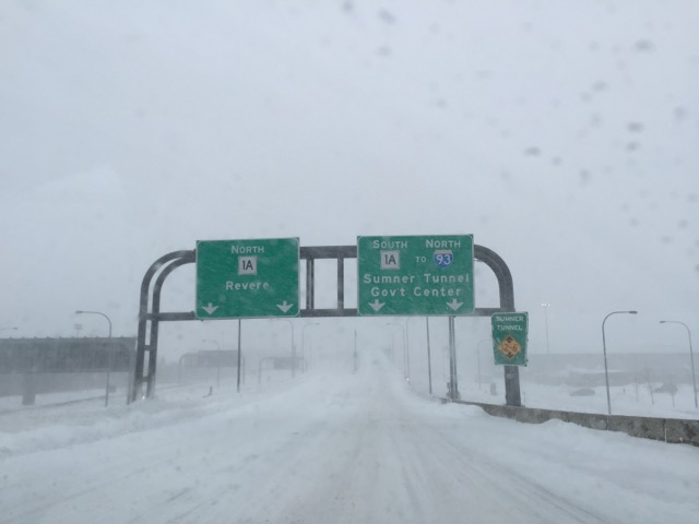
Wow... KBTR 211653Z AUTO 02010G19KT 1/4SM +SN FZFG VV004 M03/M06 A3063 RMK AO2 SLP370 P0010 T10331056 RVRNO
-
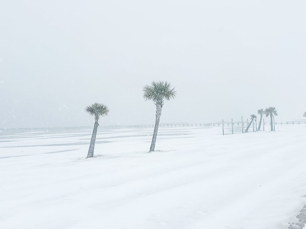
Beautiful night (photos below before deform band came through...) Looks like a beautiful white against bluebird sky now.... rushing to get kids out to sled, rare opportunity with no school or official work day! Congrats to South Shore folks who badly needed this. Looks like Boston reports made it to 5-5.5". We nickel our way back to yore, still a long way but we'll take it!
-
Happy for the South Shore folks, spreading the season wins Be careful out there, it's slippery AF, flash frozen layer underneath I'll make another measurement around 12-1am
-
2.1" at 10:15pm Beautiful winter scene outside, heavy snow... baby steps back to yore
-
Increasingly confident of 5"+ for Boston metro 33F, roads covered completely, should see 1"+/hr rates next 3 hours
-
34F (down 5F in 30 min) We're beating the 8pm mark for good snowgrowth and accumulation Looking upstream, if 850 fronto is any prognostic, Boston metro into northeast MA will crank 9-11pm
-
35F, moderate snow (Coolidge Corner Brookline) Roads starting to whiten Temp dropped 4F in ~20 min
-
37F, snow Ground whitening, that was quick! KOKX / KDIX radar not anemic
-
Rain -> White rain in Coolidge Corner Brookline 39F Let's see how quickly we can drop... per HREF ≥1" /hr rates across eastern MA 8-11pm
-
somehow this post was even more true the following night 0z Euro seems an outlier relative to NAM/GFS / AIFS... not even consistent with it's own 12z run
-
Watches just extended to Suffolk, Norfolk counties for 4-8”
-
Was leaning 70/30 GFS/Euro for days, the JV models produce a lot of noise Expecting Watches into Boston by tonight if Euro/GFS hold
-
Enough support for watches to be extended east at this point
-
Almost identical to 12z GFS
-
Box (and neighboring offices) seem to be favoring GFS/Canadian blend:
-
NAM lost the lead piece of energy that was preventing better tilting of trough in its prior runs... that is one of the main reasons NAM has been further southeast compared to other guidance. 2 players shown below Euro / NAM weaker solutions than other guidance because (i) lead energy #2 (circled green below) was preventing better tilting of trough on NAM up to 12z run, and (ii) subsequent energy #1 is weaker on Euro compared to other guidance. Now that 18z NAM lost that lead energy #2, all guidance is very similar except for strength of followup energy #1. Canadians have energy #1 on roids and not sure I believe it compared to rest of guidance... all energy is sampled pretty well. I'm leaning 70/30 GFS/Euro at this point, which would be a great hit for most of SNE. 12z NAM top / 18z NAM bottom:
-
0z Euro a tick more NW and more juiced than 12z, towards GFS Euro and GFS actually not too far off straddling high-end advisory / low-end warning RGEM / NAM seem to be the outlier extremes, and opposite at that... lends more credence to globals
-
Great vertical lift and banding signature sweeping through SNE on 0z GFS... has had something like this several cycles
-
Logan 1.8" at 7:05pm Measured ~2" Coolidge Corner but lots of compaction I was happy to see those in South Shore that missed out on the Dec 20 event do well today!
-
Loving this discussion all. Tip, the bolded above seems like something you can objectively quantify and then show an association that supports this attribution... do we have data on "basal flow rate" in the past 5 years vs. other years and how that relates to cyclogenesis / snowfall? (Asking not out of skepticism, I've always found this a compelling theory)
-
Fortunately, whether because of limitations in input data +/- inadequate computing, my hunch is AI forecasting has a very long way to go before it can nail these highly impactful nuances. Which I'm ok with... this hobby would lose much of its suspense and thrill if we had perfect deterministic models.
-
x [probability of a goal-line interception to win a SB] = 1:100,000,000 ?
-
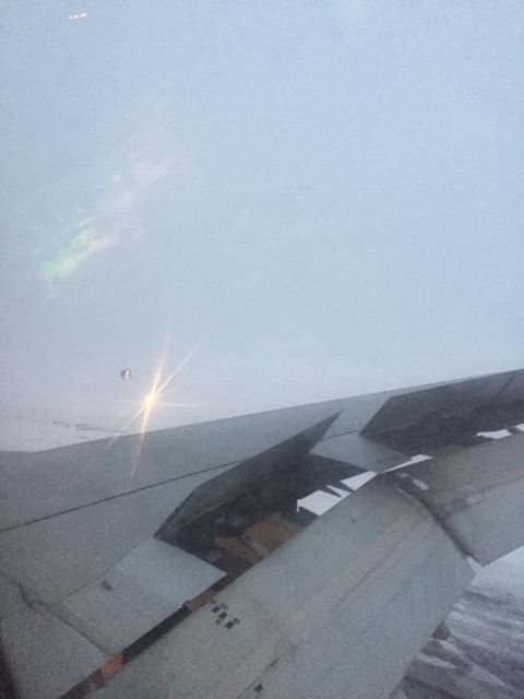
While we're reminiscing... That 2015 period always reminds me of that made-up term Dwight uses in The Office... "perfektenschlag" for when absolutely everything just goes right. I flew back from a certain football game played in Glendale AZ... and land to this at Logan:
-
The assumption is always better sampling -> better result lol

