

jaxjagman
-
Posts
9,045 -
Joined
-
Last visited
Content Type
Profiles
Blogs
Forums
American Weather
Media Demo
Store
Gallery
Everything posted by jaxjagman
-
Dont see much difference through 96
-
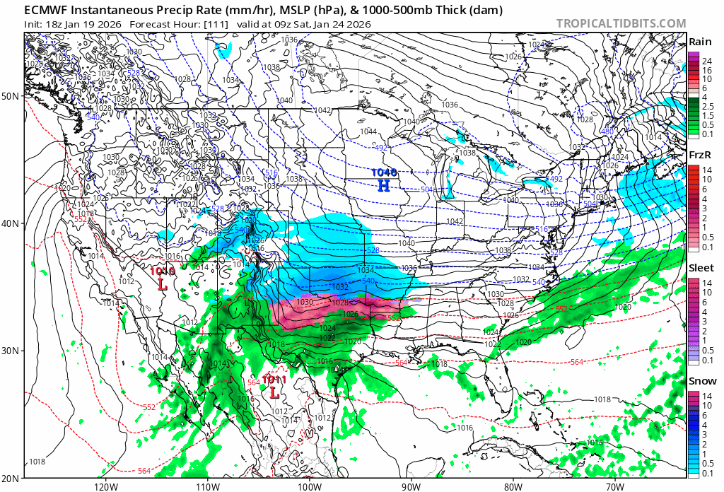
I didnt think the GEFS was that bad,most QPFS Its shown in TN that run
-
Seems like a outlier,it reels in the BAJA Low,only model showing this
-
Its not weatherbell but tropical,its not bad
-
The Euro has a less pronounced warm nose,it even looks better on the 18z,lets hope this dont change
.thumb.gif.c8ff39d8a492a4f6479a44ac6a882806.gif)
-
This is what BAM was talking about earlier in which to be some sorta inverted trough,he said the Euro was going to follow this.guess he will be disappointed,it seem the opposite is happening,good signs for us in our forum
-
NashSevere never goes against OHX,you practically never have any discrepancy between the two
-
=
-
Reckon Nashville is gaining confidence
-
He agrees with what the Euro is showing ...FWIW
-
https://www.weather.gov/erh/ghwo?wfo=mrx
-
Guess Morristown is all in now like MEM
-
MEM,seems to be gaining confidence
-
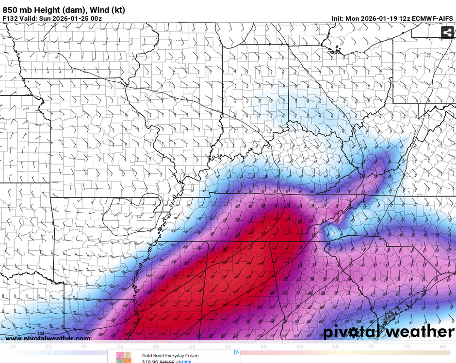
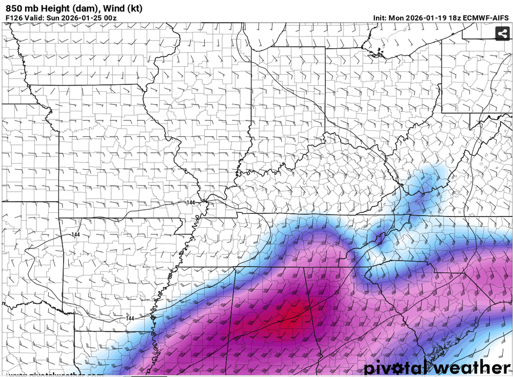
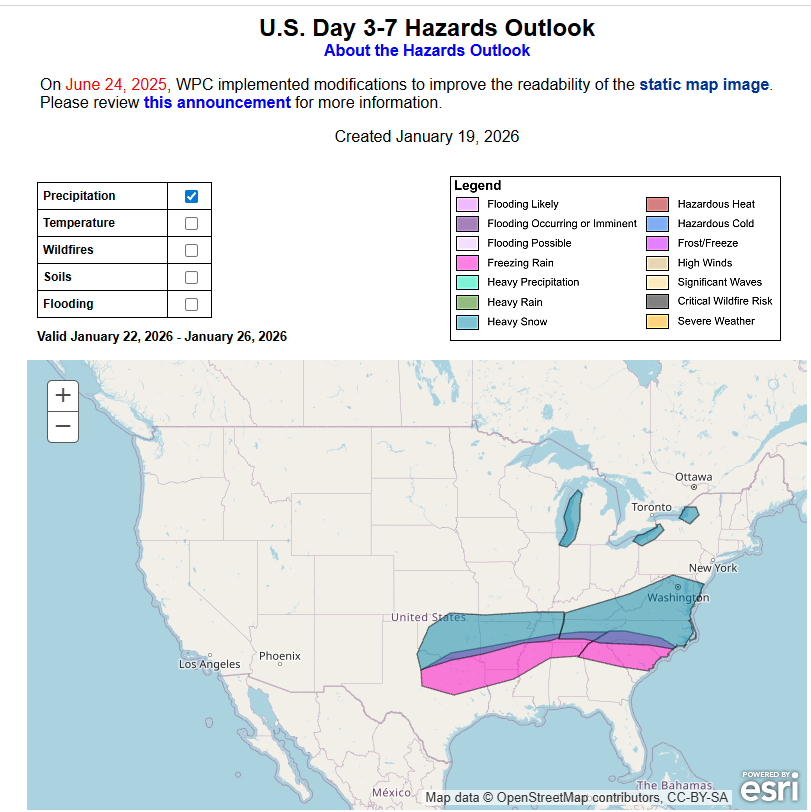
Nice,top anolog is 2024 https://www.weather.gov/ohx/20240114
-
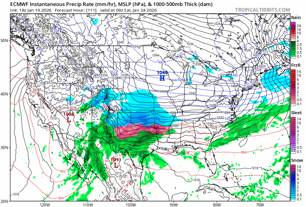
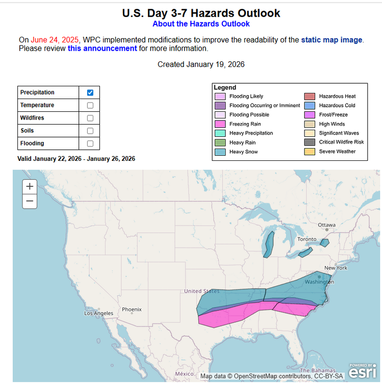
The Euro would be a devastating ice storm from Ark to SC
-
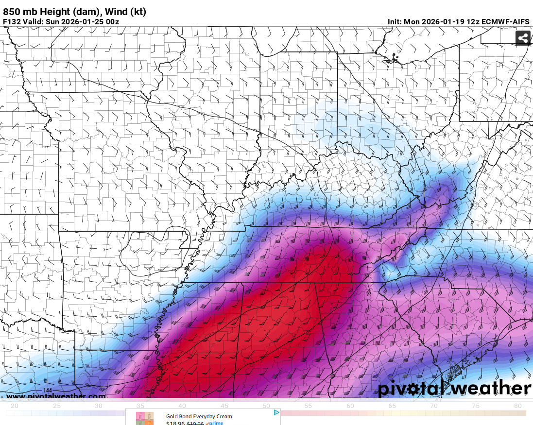
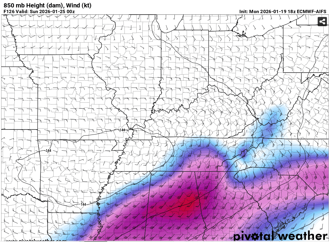
Theres no signs of a inverted trough other than mainly into Alabama,these are at times missed by modeling,reflect back into 2014 in our parts
.thumb.png.cd48b4ebc42c25c3a04d1a01fd997f0a.png)
-
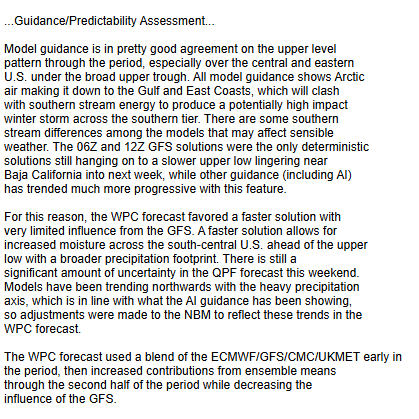
Maybe its a good thing the GFS is suppressed,storms always trend northwards to an extent,qustion would be will the Euro do the same..lol
-
That would be the storm of all storms in Tn
-
Do you have the JAXA?,i know you like to look at sat.images https://sharaku.eorc.jaxa.jp/GSMaP_NOW/index.htm
-
Right,so use to calling it the BIG 10 its the Big 12
-
Problem with the SEC is we beat up with each other,not sure we are the best conference,the big 10 is fairly solid compared to the SEC.NIL always plays a part in all sports now Im not bashing Indiana,but when you have a alumni like Mark Cuban who invest millions of dollars into that program which is pennies to us,they will always be relevant now, you wouldn't think that in football in the past. Bout sick of college sports now myself.NCAA is much to blame in part,the writing was on the wall with there greed and major conferences sucking up into them in the last couple decades,now its out of control.its broken with little hope of getting fixed


.gif.5edc149a983c69f95edb8dc6619c43d9.gif)


.png.782e794d11e8899cf1410e9721bad2bc.png)

