-
Posts
9,079 -
Joined
-
Last visited
Content Type
Profiles
Blogs
Forums
American Weather
Media Demo
Store
Gallery
Everything posted by jaxjagman
-
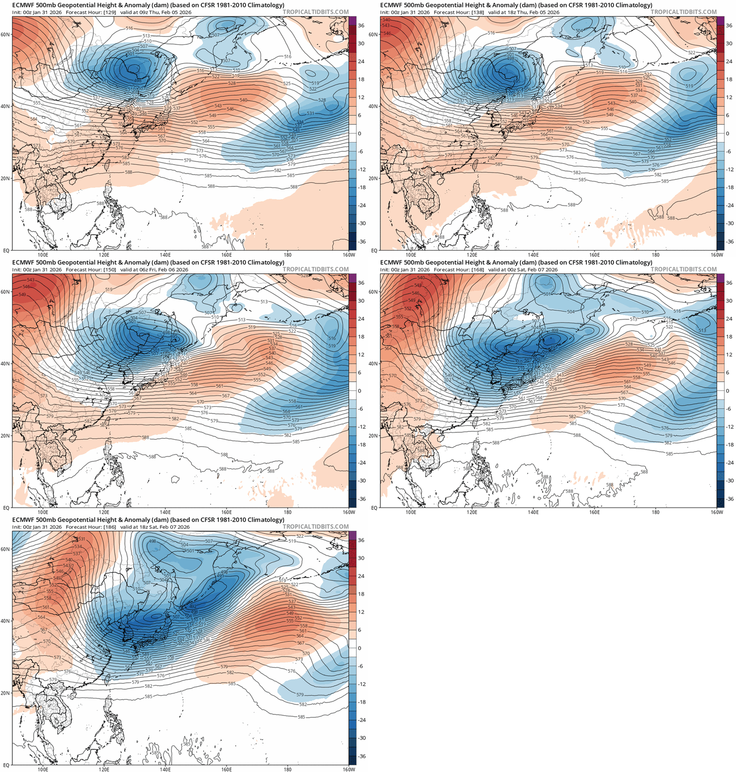
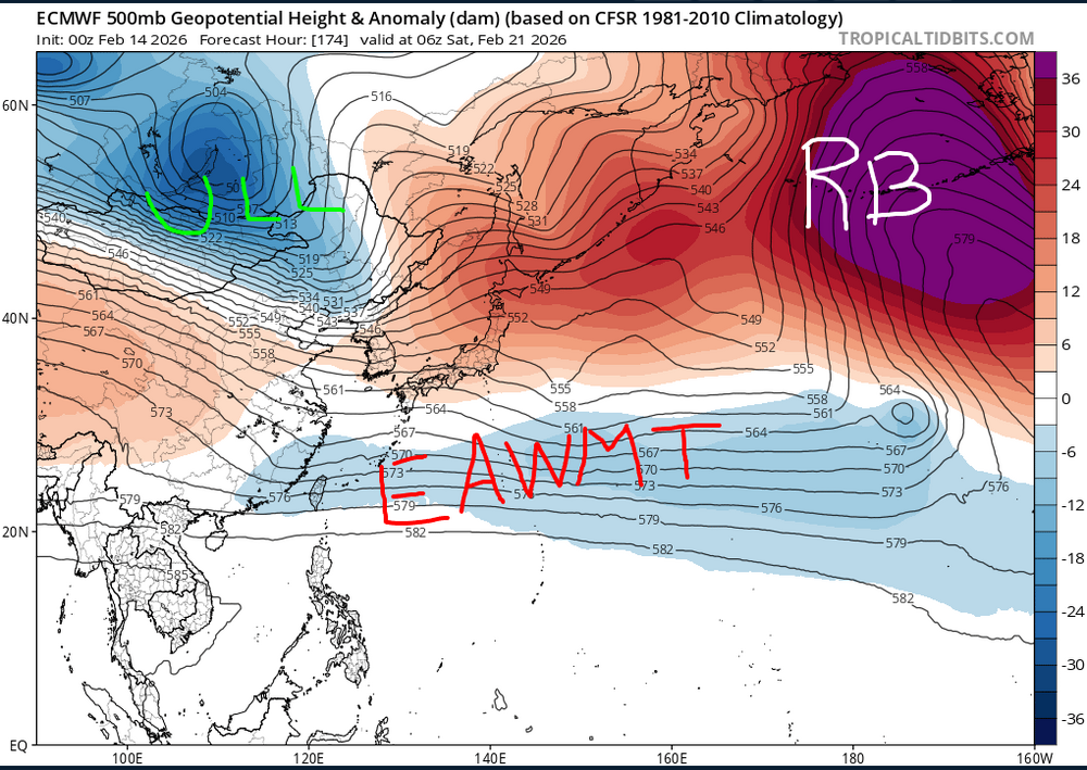
Looks severe towards the end of the month.Looks more like a East Asia winter monsoonal trough,Upper Level LOW into Russia/Mongolia and THE PIG like Flash calls it(Rex Block)in the Aleutians/Bearing Sea Euro and GFS both show this right now,surprisingly right now
-
Oh yeah,enjoy every moment of it.Kids love it !! I have to call my lawn people out,i havent even picked up my yard yet. Like @Mathew was saying earlier we dont need to have any severe right now here,the trees are still stressed and damaged,we had some gust of just winds last Sat morning and knocked our power out for about 6 hrs
-
Headed to Jacksonville in the morning to visit,not sure ill make it there in time for severe.Wife has to do something in the morning before we can leave Next week if we can get moisture we could possibly get some strong storms towards the end of the work week,much depends on where the subtropical ridge is at
-
Dads on a sled never works out very well...lol
-
Lake Erie is 96% frozen over today,that hasnt happened the last 2 decades
-
This really has been a strange winter https://spectrumlocalnews.com/nys/buffalo/news/2026/02/06/lake-erie-almost-completely-ice-covered-for-first-time-in-2-decades
-
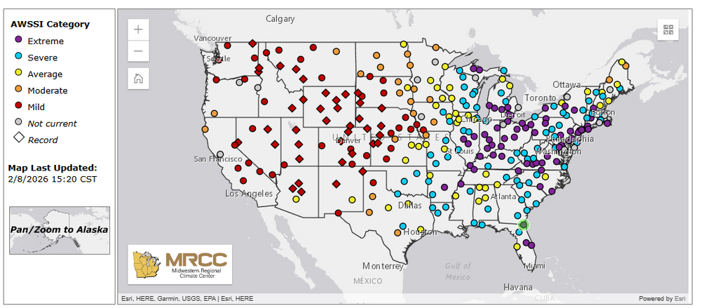
You guys have a awesome winter,its really odd from Johnnson City to Memphis to be so cold and the rest of basically seeing a average winter.Even more odd to see Jacksonville to Orlando https://mrcc.purdue.edu/research/awssi
-
-
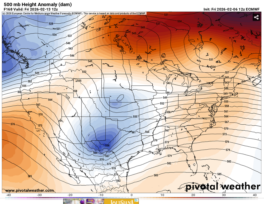
Euro has a great track for us this afternoon for V-Day,just no cold to work with and the CF dont even look very impressive with cold behind it,,looks like another swing and a miss for us here this winter,still 7 days out so it could very well change.
-
BAM does the same shit,its all click bait,give me your money
-
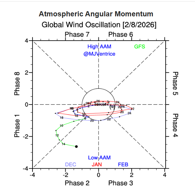
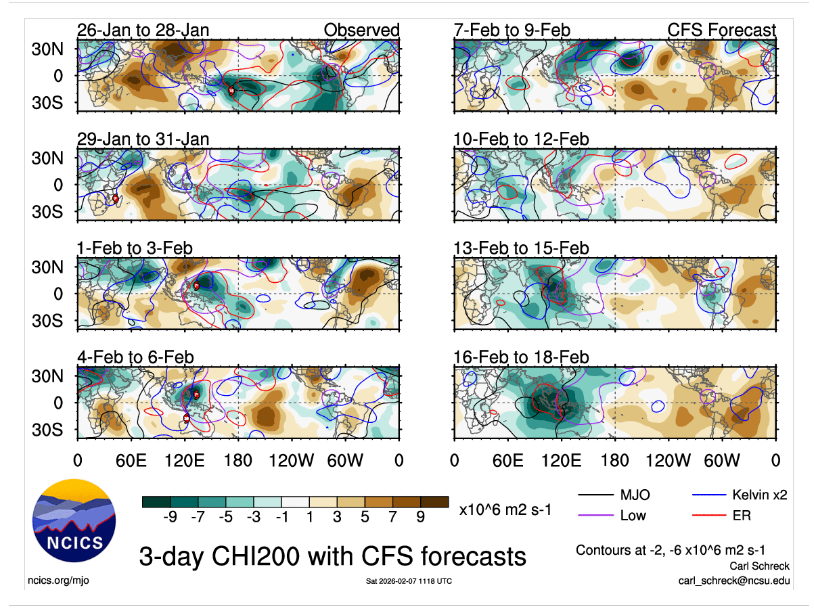
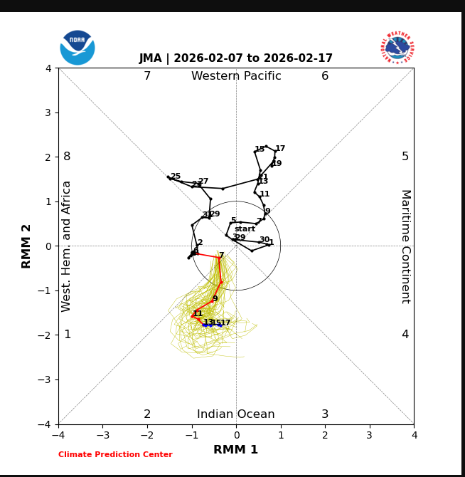
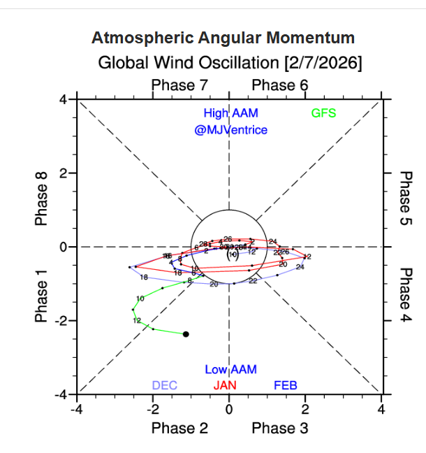
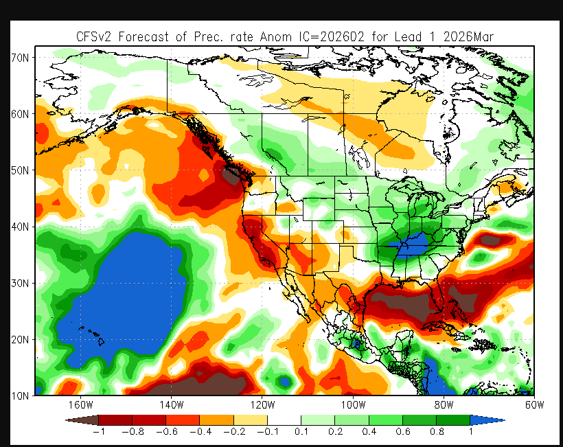
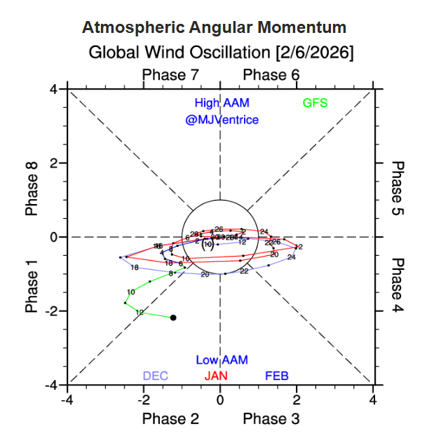
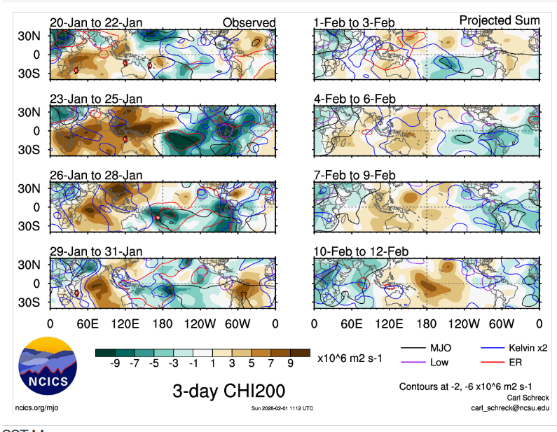
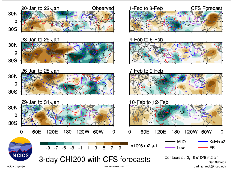
This looks warm in the East upcoming For what ever reason,the CFS shows this tropical forcing with Rossby/Kelvin Waves into the WP/MC,but its been over amplifying this since fall,but its still a warm look, Seems like to me this is fixing to become a active severe threat up past as we get further alonginto,FEB,with the MJO,GAAM,they both seem to be coupled rather well right now
-
I agree,i'm glad CPC switched from the ONI to the RONI.This changes somewhat how you look at analogs. I.E in 2024 and 2005 the ONI showed into OND a more neutral ENSO,while the RONI both years mentioned showed it was actually a moderate NINA https://www.cpc.ncep.noaa.gov/products/analysis_monitoring/enso/roni/ https://www.cpc.ncep.noaa.gov/products/analysis_monitoring/ensostuff/ONI_v5.php
-
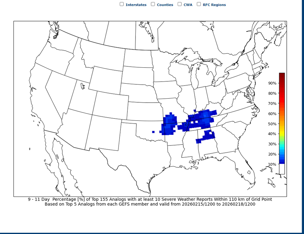
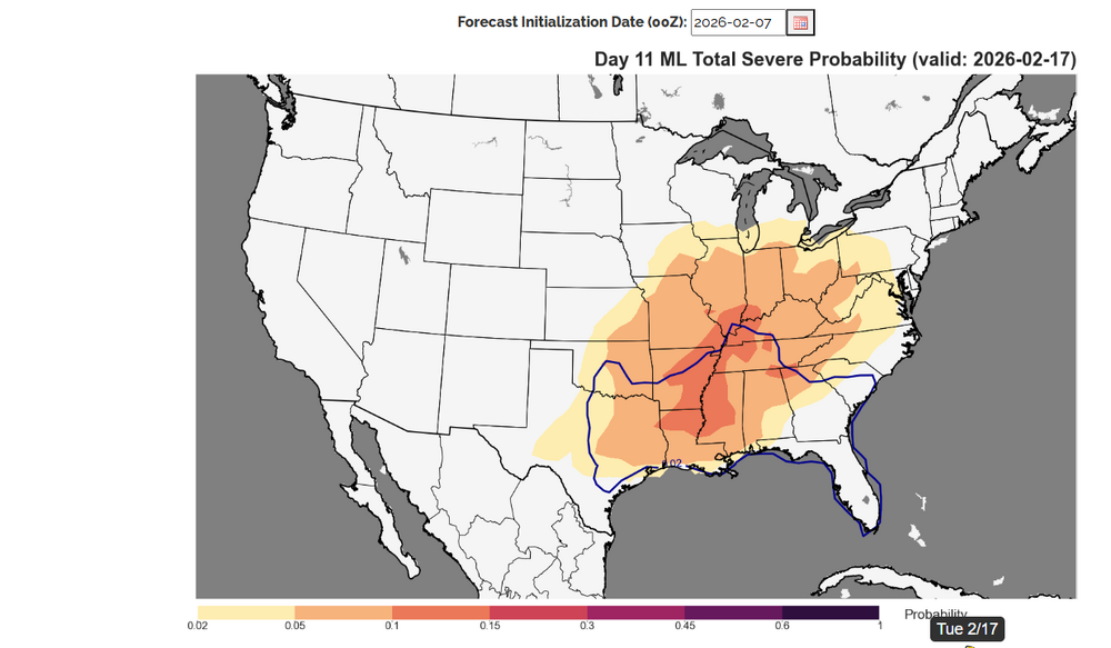
Getting into Climo each day,right now it looks possibly like a active period coming up past the mid month.
-
-
If somehow the GAAM can stay coupled with the MJO,it could get interesting even in Feb,tho you'd like to still see this in March
-
-
Yes,its been like that for whatever reasons North of 1-40 seemingly the last couple decades,its the battle ground and we 90% of the time,lose
-
Been a crappie winter win here thus far for us,unless you get into ice storms. Per Nashville in Jan.1.4" SN,that was before the ice storm and then a dusting after the ZR finally ended,that was the extent to our snow this winter other than token flakes at times which didnt add up to anything Temps were 2.4 BN.Last Jan we was 6.3 BN
-
Not trying to discount you,but when you have decent warm nose advecion with a STJ 30-50 kts into Tn,it really seems impossible to get snow into Tn,it really dont matter what side of the mountain you look at,this is a weak LP it forms where ever it forms,even the WAA looks worse into East Tn
-
Maybe your right,but even the NAM is showing a inverted trough with LP into the lower OV with the STJ around 30-40 kts,good luck with this for snow in Tn,sorry no model shows this will happen
-
-
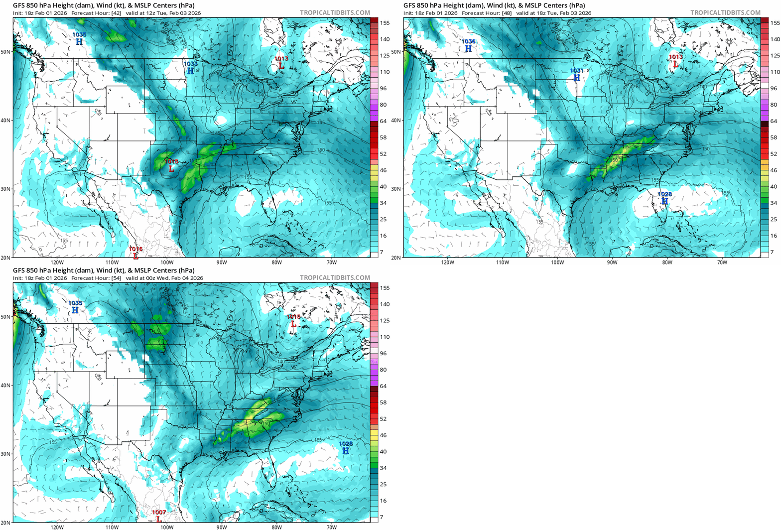
Looks to warm to me,if you really looks at the isobars this is an inverted trough and warm nose,you can then look at what the 850 shows,its definite a warm nose
-
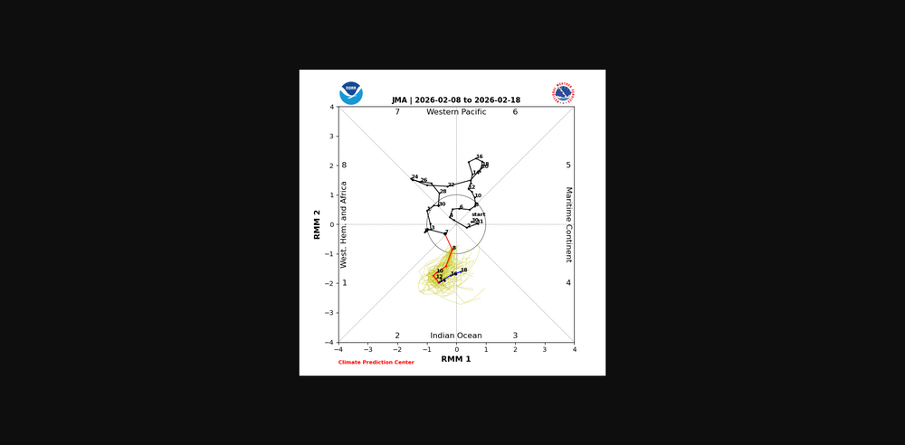
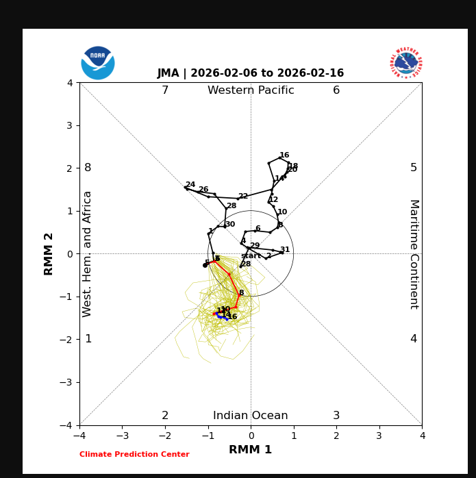
In the long range i'd stick with what the JMA is showing with the MJO.The CFS has some bias with the tropical convection into the WP/MC from Rossby and Kelvin Waves,you can clearly see this once again,this causes contructive/destructive interference with the MJO signal
-

Jan 30th-February 1st 2026 Arctic Blast/ULL Snow OBS Thread.
jaxjagman replied to John1122's topic in Tennessee Valley
We got a unexpected dusting this morning




.thumb.png.e9bded3ee70ed2898bff3228600721cd.png)


