tstate21
-
Posts
87 -
Joined
-
Last visited
About tstate21

Recent Profile Visitors
2,945 profile views


-
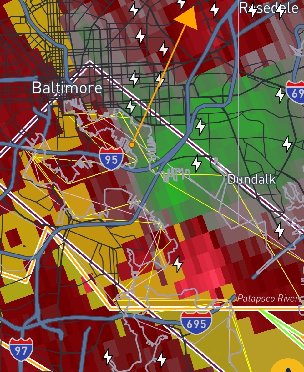
Rotation keeps backing to the SW. Main area of rotation now showing up near Crofton. May need to shift the TW south.
-
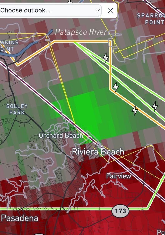
Some rotation enhancement with the line coming through down near Riviera Beach. Curious to see the next few scans. Edit: Now tornado warned, but seems to have fallen apart now. Seems to be a recurring theme today.
-
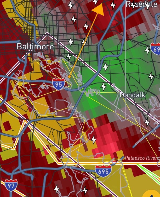
GTG ramping up on the Baltimore City cell. Wont be surprised to see it TW soon.
-
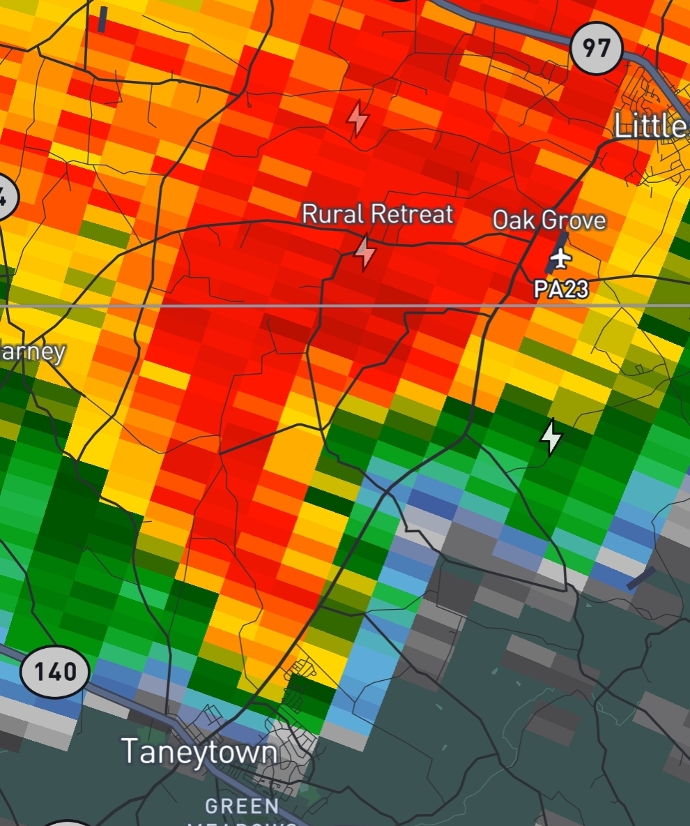
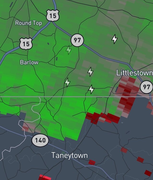
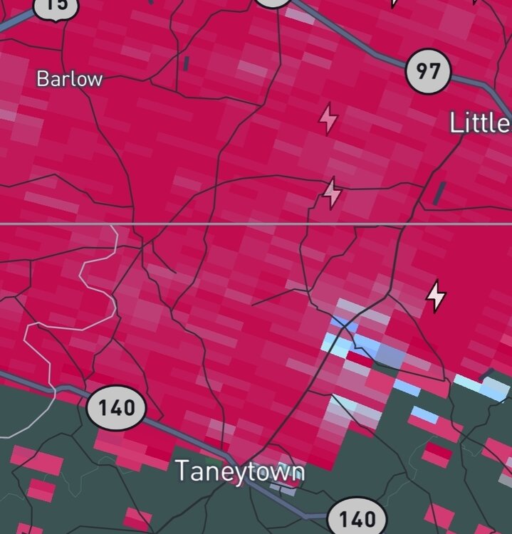
Would not be surprised if there was a small spin up tornado NE of Taneytown about 15-20 minutes ago. Certainly a velocity couplet there for a few frames.

-
https://x.com/i/status/2024564778669395990 Think this answers your question and to be fair the majority of us thought the GFS op runs from those timeframes were BS too.
-
So wait, has no one mentioned the wright weather boards yet? I joined those the 2002-2003 winter leading up to PD2. Maybe its an omen for this winter? Fun times.
-
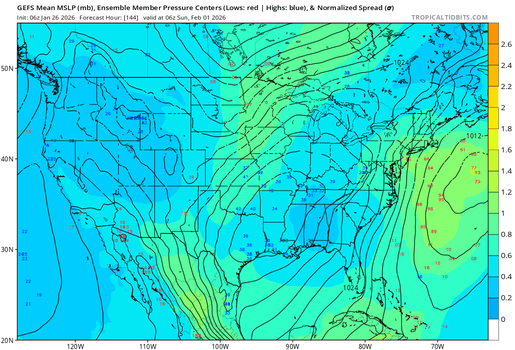
00z GEFS has some large changes from the prior runs, even showing some inland members and the majority of the members are inside the ensemble mean.

-
Even looks to be a little bit of weak rotation just NW of Owings Mills. Doubt it produces but provides something to watch at least.

-
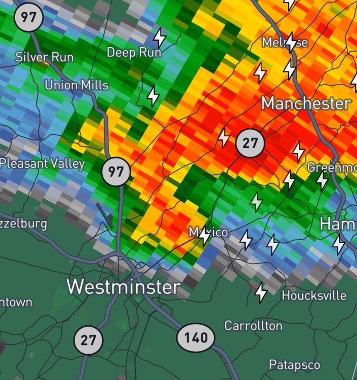
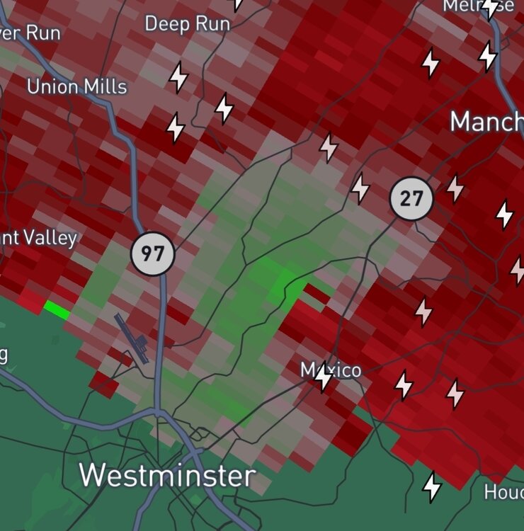
298 WFUS51 KLWX 170026 TORLWX MDC005-013-170100- /O.NEW.KLWX.TO.W.0033.250717T0026Z-250717T0100Z/ BULLETIN - EAS ACTIVATION REQUESTED Tornado Warning National Weather Service Baltimore MD/Washington DC 826 PM EDT Wed Jul 16 2025 The National Weather Service in Sterling Virginia has issued a * Tornado Warning for... Northeastern Carroll County in north central Maryland... Northwestern Baltimore County in northern Maryland... * Until 900 PM EDT. * At 826 PM EDT, a severe thunderstorm capable of producing a tornado was located near Hampstead, or near Westminster, moving east at 10 mph. HAZARD...Tornado and golf ball size hail. SOURCE...Radar indicated rotation. IMPACT...For those in the direct path of a tornado touchdown, flying debris will be dangerous to those caught without shelter. Damage to roofs, siding, and windows may occur. Mobile homes may be damaged or destroyed. Tree damage is likely. * Locations impacted include... Hampstead, Manchester, Millers, Greenmount, and Upperco. PRECAUTIONARY/PREPAREDNESS ACTIONS... Tornadoes are extremely difficult to see and confirm at night. Do not wait to see or hear the tornado. TAKE COVER NOW! Torrential rainfall is occurring with this storm, and may lead to flash flooding. Do not drive your vehicle through flooded roadways. && LAT...LON 3958 7697 3965 7698 3970 7676 3955 7674 TIME...MOT...LOC 0026Z 269DEG 10KT 3961 7691 TORNADO...RADAR INDICATED MAX HAIL SIZE...1.75 IN
-
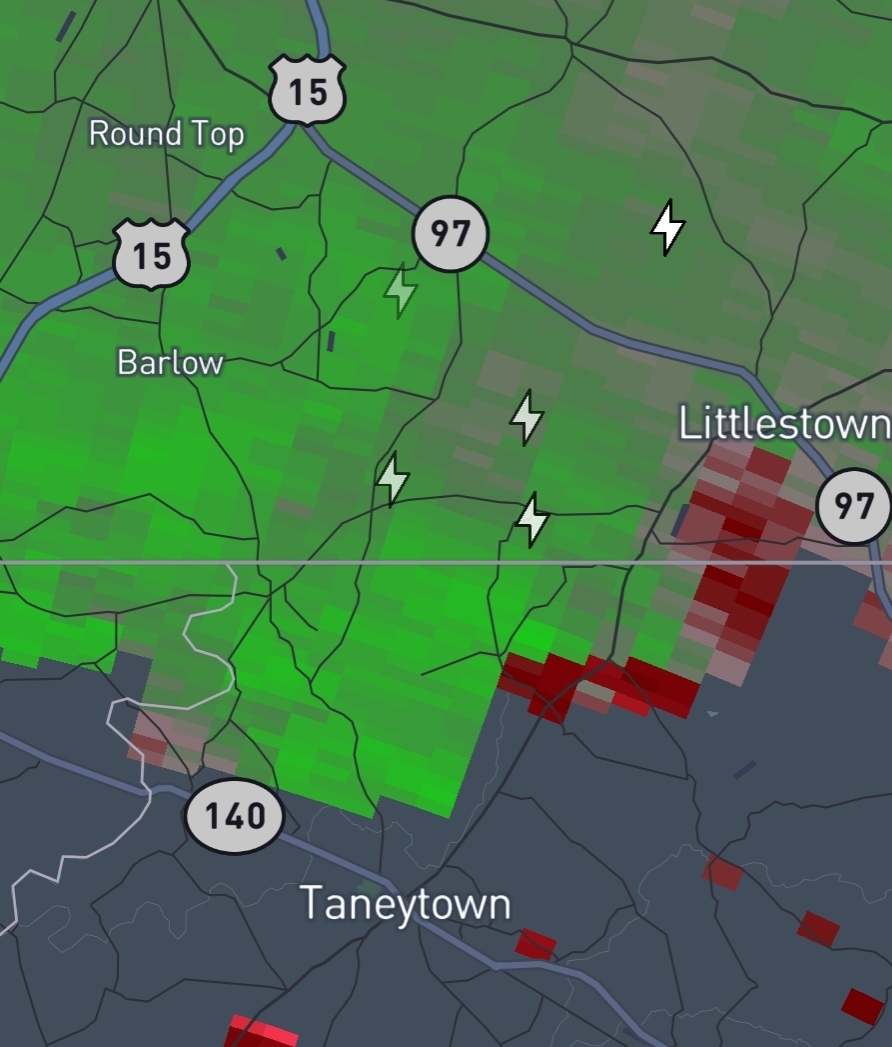
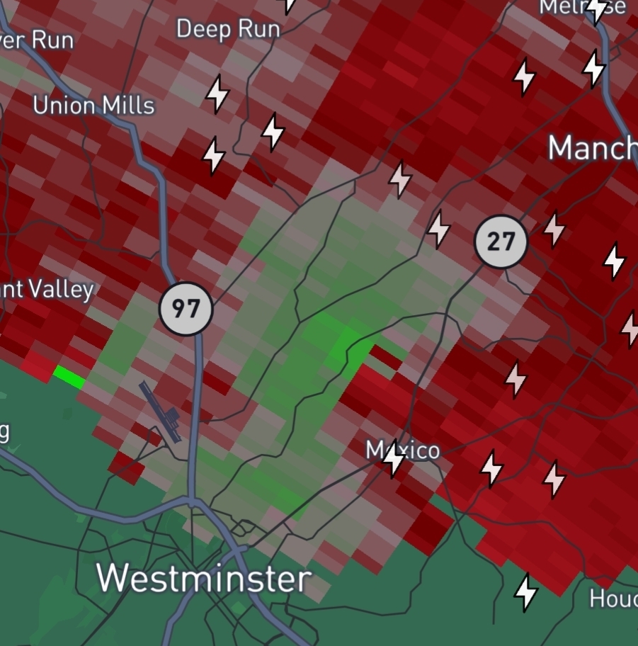
Big time rotation on the storm just northeast of Westminster. Surprised there's no tornado warning on it yet.
-
Now tornado warned. Figured it would be.
-
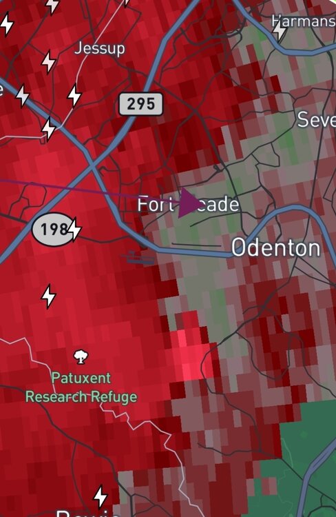
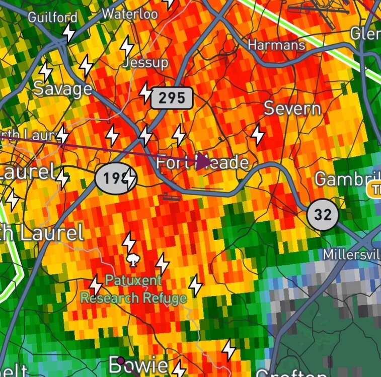
May have been a brief touchdown just south of Ft Meade. Anyone there confirm?
-
Even if Milton simply maintains intensity, I would expect this to be the case given we are approaching diurnal max. Now if he strengthens further tonight... get ready for some even more impressive colors to show themselves soon.
-
There was a definitive hook as that complex crossed into Maryland. I would not be surprised if we see a report of a brief touchdown in Southern PA tomorrow morning. Seems to have developed into a more of a squall line at this juncture.
-
Debris being lofted over 1500 feet in the MoCo cell apparently.