

dendrite
-
Posts
74,437 -
Joined
Content Type
Profiles
Blogs
Forums
American Weather
Media Demo
Store
Gallery
Everything posted by dendrite
-
Nada here Over an inch for Gene
-
He’s moving in mysterious ways
-
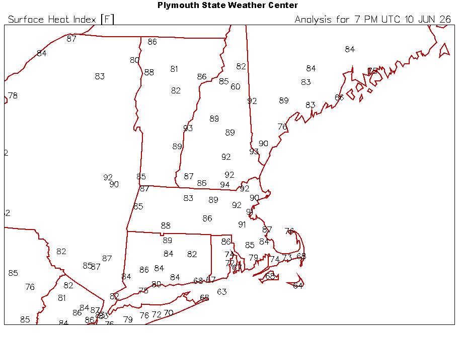
Deep summer with the heat and dews. 87.0/68
-
“Hoodies for days”
-
Saving this one for winter
-
GFS looks seasonably warm much of next week now…lower dews though.
-
The truth is usually a blend between INS and DIT.
-
lol gjge
-
Good luck
-
Made me look. Mostly 300+ hr nonsense
-
It will be great when AI takes every job and we can just tan the nape and troll Kevin all day.
-
Real nice of you to call out wx2fish like that
-
I thought for sure someone would enjoy the image of Judah with cornrows

-
Ray would like this storm even though he only got 15” to Kevin’s 40” since you had an inch of glop.
-
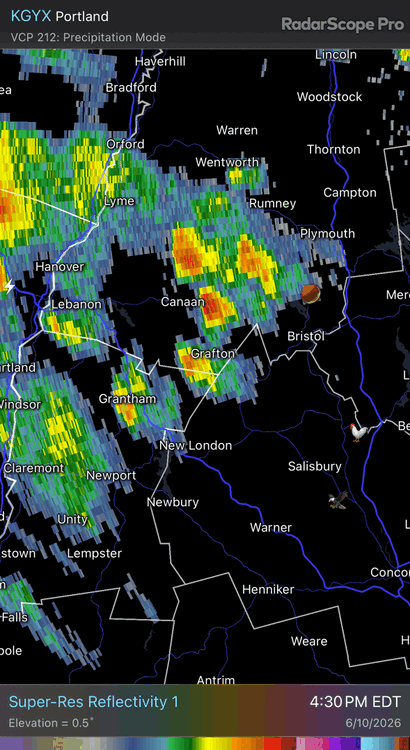
Rufus looked a little better in E MA/NH…a little trigger along the theta-e grad and outflow enhanced seabreeze pushing westward. I’m just interested in rain though.
-
-
What in the sam hell am I trying to interpret here
-
Wish we could get one of the universities to run it...at least the 3k. But it would be a bad look for NCEP if everyone started flocking to Ewall or SUNY to see every NAM run while Rufus has more tumbleweeds than views. I think they've made their bed and they'll have to lie in it either way. At least they were smart enough to wait until the end of met summer/severe wx season before ending it. I wish more free models sites had the RRFS data. I like COD and Tidbits for quick and easy viewing. I get a little lost on what I'm clicking at Pivotal sometimes.
-
Min 48.8°…sucks but it’s still early June. Still looks cooler next week…maybe more like mild downs in SNE. EC tries to sneak a low under NNE which would make for a mank day. Keep the mean trough in the midwest and we’ll be okay most days.
-
-
Def cooler next week.
-
33° at Estcourt Station. Some mid 30s in N NH and W ME too.
-
Min 47.7° Hopefully some rain midweek
-
People scalp their lawns to 1” high weekly, pile on weed killer, and wonder why cold season grasses struggle after 5 days without significant rain.
-
We’re only a week in. I ended May with the 2”+ event so we’re good for now. But yeah, dry 80s for a week will have his webbed hands around my throat.


