dendrite
-
Posts
75,091 -
Joined
Content Type
Profiles
Blogs
Forums
American Weather
Media Demo
Store
Gallery
Everything posted by dendrite
-
 Convection can F off
 -
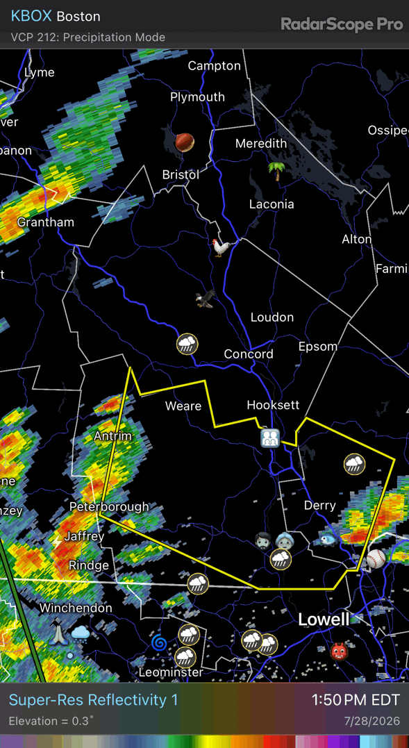
Holy hell what a screwjob 0.02”
-
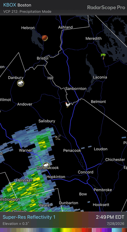
Looks like anything substantial may miss just east. lol We shall see
-
It took 20 years here, but we finally got some VT bears


-
Oh I agree. Although if we’re going to lump dewpoint into it you could argue that the normal max “feels like” temp at MLS isn’t much different than places in SNE. But I was just making a quick quip about some random person making that move to MT to get away from everything and getting surprised at how freakin hot it can be up there. As for the 90° being hot thing…I can see it both ways. Sure, “it’s sooo hot in Dallas today at 95°” is ridiculous, but sensibly to humans, 90° is just plain hot whether it’s normal for the season or whether it’s a record for the date. We had family friends that lived in S AZ and even though they got used to, and averaged, 100+ she said no one went outside there until after 6pm. Fairbanks could have a +20F January and it’s still dangerously cold for us. I know you know all of this, but my point is just that 90s can be hot for humans and not hot for a location at the same time. But I agree, the media does twist and play with weather events that aren’t climatologically significant while trying to portray them that way. But it’s that way with everything on “social” media now. Gotta keep those likes and clicks coming.
-
Mowed most of the backyard today. 3rd time of the season. Was putting it off because of the lack of rain…so it better pour midweek now.
-
Dews weren’t bad up here. 50s.
-

-
Sneaky warm today. 87F at CON and MHT.
-
Euro is pretty wet for most. Kind of a convective TROWAL look swinging through on Wed…then the ULL meanders east and we self destruct with enhanced daytime convection. Looks pretty wet for most of the region outside of the Canadian border.
-
It’s possible. Cutoff is 8am tomorrow for the next map.
-
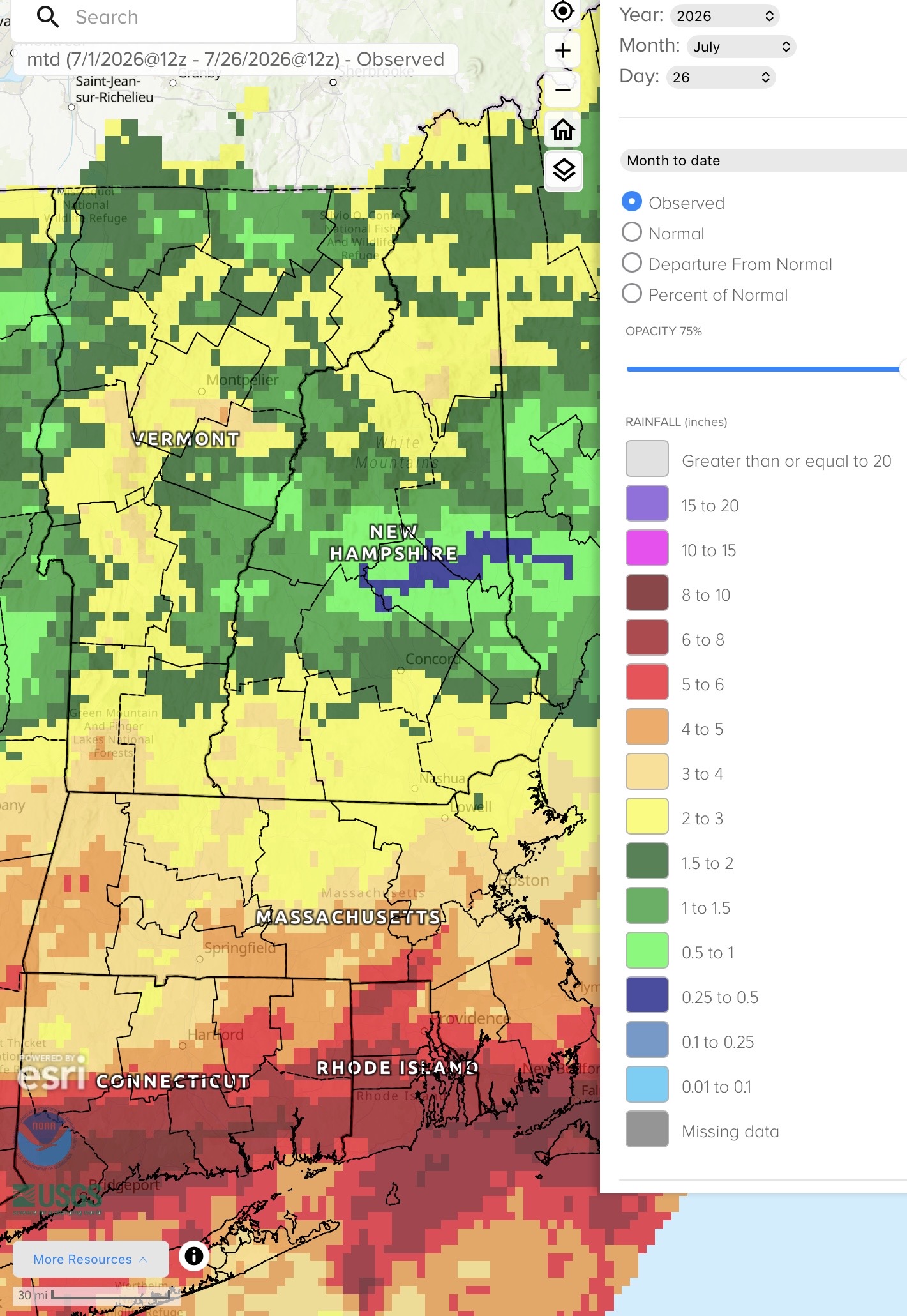
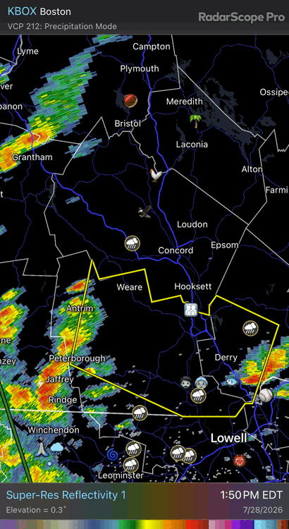
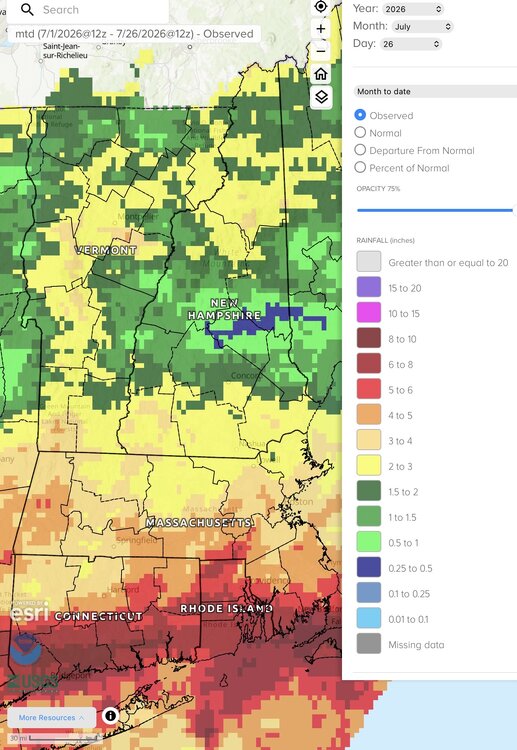
Gotta love flood watches in areas with D1 drought
-
12k nam…what could go wrong?
-
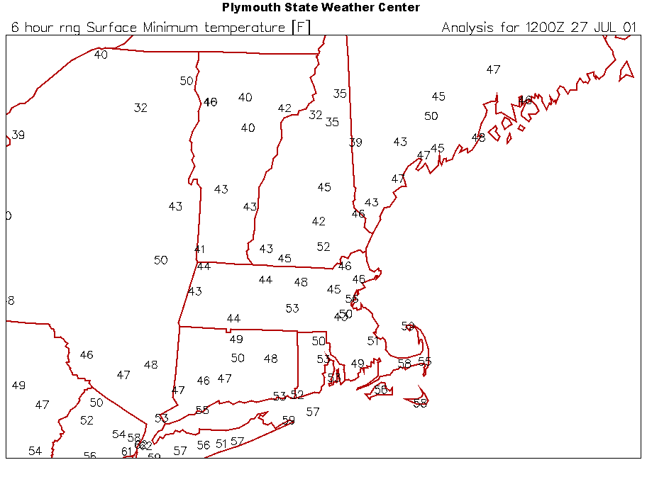
Yup…even pulled a 31° there on the 28th. BED probably would’ve been around 46° that morning, but we’ll probably get another “coldest 7/28 of our lives” tomorrow.
-
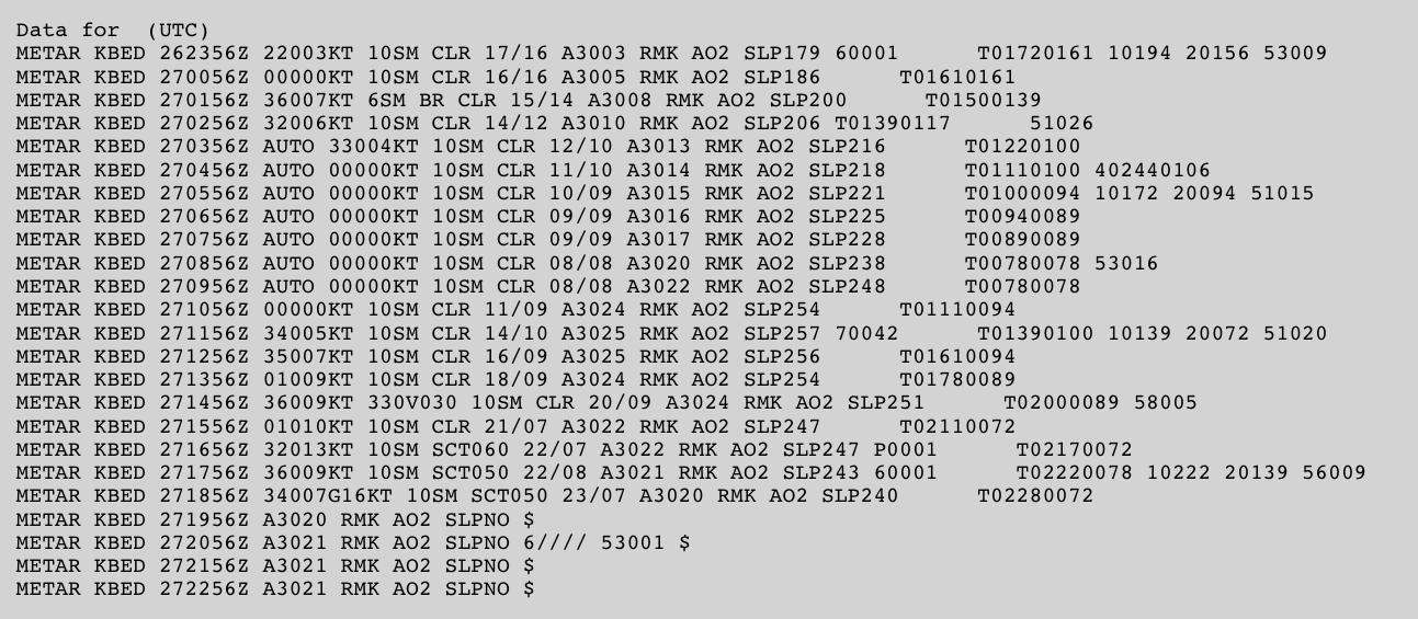
Looks like the ASOS crapped the bed in the late afternoon and they just placed a bunch of M’s for “missing” to finish that month before it was fixed.

-
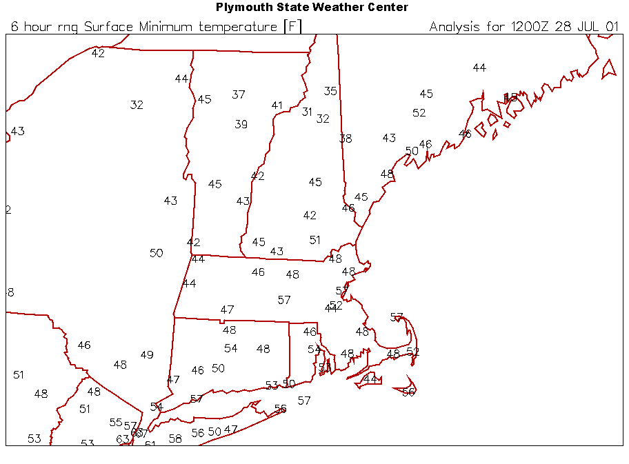
Mins on this day in 2001. Yes that’s a 45° at BED. Someone get grandpa off the internet.
-
Frustrating month
-
I appreciate Scoot reaching a hand out to me while I dangle off the Tobin.
-
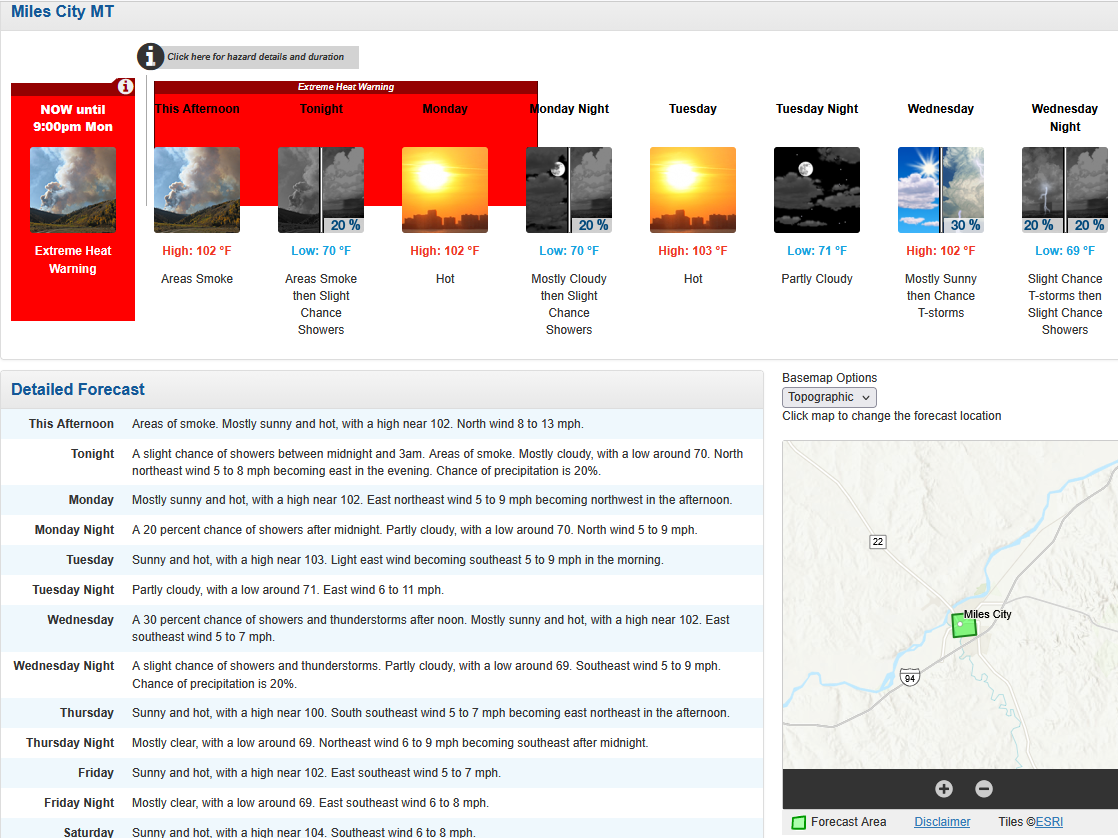
I doubt you’d find a resident there that said 102° is not hot. The record for yesterday is 104° in 1931 and 1933. They’re also now +7.0F for the month where the std devs are at their lowest. Looks like that 80.8F mean will place this July at the 4th warmest all time with 8 of the top 9 warmest Julys occurring since 2000. I won’t pretend to claim I know the history of the MLS ASOS siting though. Maybe pre-ASOS was a “cooler” siting.
-
It wasn’t done at 84hr on the models, but I don’t like the system getting shunted southward as it gets toward this longitude either. Rain will pinwheel around and pivot in, but we’re flirting with mid level dry air in some of these runs. The 18z euro suite is pretty wet up into NNE.
-
Canada should tariff us or make us the 11th province
-
Oh trust me, I know. That area can torch right into the western Dakotas. But they did another record yesterday with 107F. They were +6.9F MTD before today and they put up another 100+ today. The 9th 100+ of the month.
-
Some of these maps have my blood pressure rising. Trying to remain calm.

-
Imagine moving to MT and thinking you're getting away from the heat