dendrite
-
Posts
75,073 -
Joined
Content Type
Profiles
Blogs
Forums
American Weather
Media Demo
Store
Gallery
Everything posted by dendrite
-
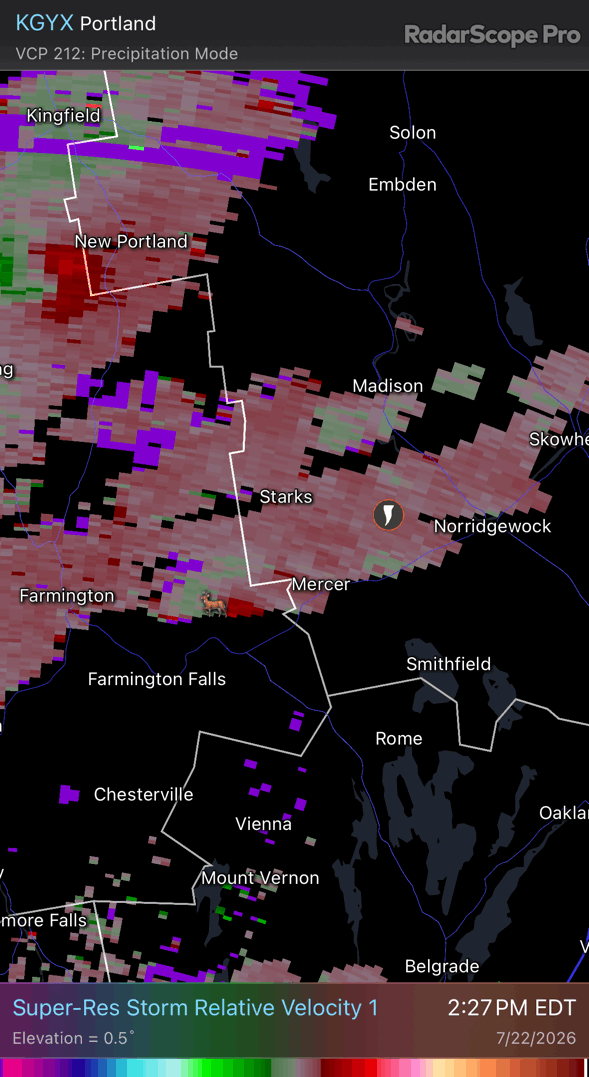
 Ok ok ok The ratio of weather:political posts is taking a nosedive. Let’s at least sorta get back on track. 79.7/50.6 on the day here. Yore New England summer day.
 -
A nice plate of liver to fill you up before you head home too. Can you imagine winter in here with everyone having high T? Not sure I want to be here for that.
-
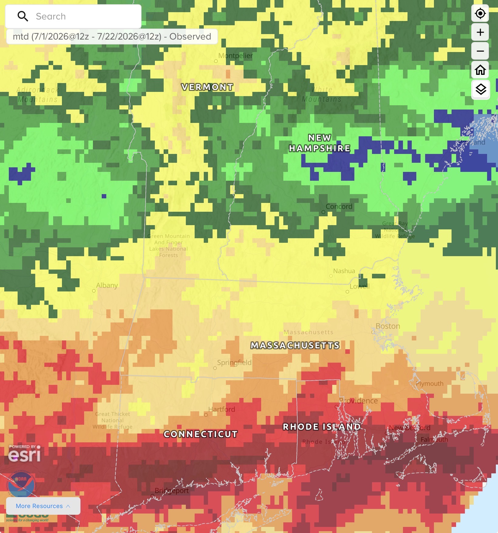
The thing to do would be compare the BOS max and min departures with the other sites going back to spring 2025 and seeing if they start deviating last fall.
-
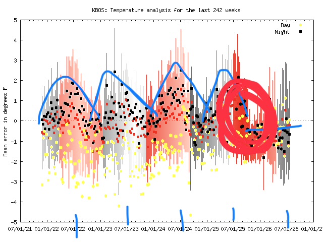
With the MADIS charts you look for step changes or changes in trends. There’s a step change in there around the beginning of October last year. Positive error means the station is running cooler than expected; negative error means it’s running warmer than expected. Traditionally BOS has run positive error (cooler than MADIS “expects”) during the warm season. I marked in blue curves above the nighttime temps centered over the 7/1 plots. This warm season you don’t see that…it’s flatlined in the negative error (warmer than expected). The funny thing is that the max temps are running cooler than expected. The net is a little warmer in the means. I’m not sure what’s going on, but it’s almost like when you mount your sensor on the north side of your house…you’re keeping it in permanent shade during the day, but you’re getting radiative heat from the house at night.
-
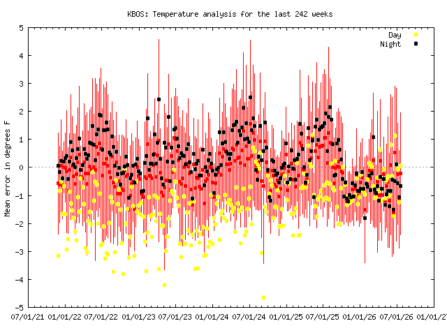
Definitely running warm again. Looks like maybe a step change last fall, but it’s a lot more noticeable this summer.
-
Longtime inside joke here
-
Changing my name to Drought in Northfield
-
The leaves are getting that leathery look
-
Yeah probably not a lot of swampazz this summer. Just a lot of 50s and 60s dews from now through Jan.
-
AVP hasn’t had their final 90° occur before this date since 2009. They’ve done 90+ in September in 10 of the last 21 years. Good luck to him though.
-
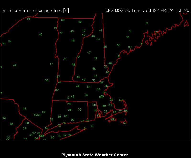
00z MAV for tomorrow morn
-
Min 52.0° Maybe cooler tonight
-
Coldest of our lifetime according to some
-
Feels like another late summer night Breezy and 63/53
-
Top is ISU auto data plotter app. Bottom is from the NWS climo sections…NOWdata I believe.
-
Congrats @tamarack
-
I want my precip in summer.
-
Giant balloon? https://inflatable24.com/products/ufo-flying-saucer-balloon-inflatable?srsltid=AfmBOopf7G8rvNTarlRbG21WnOWwmZa2gIfgHzzuLd2DOnV4deqjitQl
-
I may have to leave the board

-
Nah I’m just building up resistance now

-
Lol f off
-
2 straight summers of webbed fists punching my nuts. Can’t wait for my 0.01”
-
Got muggy overnight. Some rain would be nice.
-
All falling apart as it gets up here. 0.70” month to date here and 1/3 of that was to start the month.