wxeyeNH
-
Posts
9,809 -
Joined
-
Last visited
Content Type
Profiles
Blogs
Forums
American Weather
Media Demo
Store
Gallery
Everything posted by wxeyeNH
-
24.2F Light snow. Vis est 3/4 mile. About 2" new
-
20.2F Light snow vis 1 mile. Poor snow growth. Expecting maybe 7 or 8?
-
30.2F Light snow 1" Vis est 1.5 miles
-
28.2F Light snow. Maybe 1/3" of dry snow
-

November 2025 general discussions and probable topic derailings ...
wxeyeNH replied to Typhoon Tip's topic in New England
31.9F Light snow vis 1.5 miles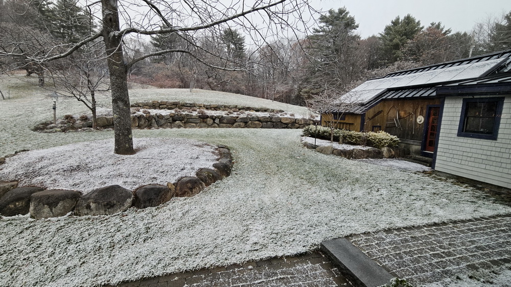
-
November 2025 general discussions and probable topic derailings ...
wxeyeNH replied to Typhoon Tip's topic in New England
33.9F Light snow. Vis about 1 mile -
November 2025 general discussions and probable topic derailings ...
wxeyeNH replied to Typhoon Tip's topic in New England
31.9F sleet -
November 2025 general discussions and probable topic derailings ...
wxeyeNH replied to Typhoon Tip's topic in New England
31.5/23F With these temperatures, I don't see any rain for the vast majority of this system. Maybe lots of sleet or freezing rain but CAD at the surface almost always wins. Snow at the begining, IDK? -
Brian, I just saw this post. Sorry. I would have not been able to have helped you anyhow, as i don't know any rehab people. I hate to see animals suffer. Last month I had to drive to PA and on the interstate a hawk flew right in front of the car into the grill. I still think about that.
-
Mood flakes yesterday and light snow the past 3 hours around 33F. Still waiting for our first trace. We did have a dusting in shaded areas for about an hour yesterday before sublimation. Does that count?
-
Clouds will be the problem over the next 48 hours especially in Central and NNE.
-
November 2025 general discussions and probable topic derailings ...
wxeyeNH replied to Typhoon Tip's topic in New England
33.9F Moderate catpaws -
November 2025 general discussions and probable topic derailings ...
wxeyeNH replied to Typhoon Tip's topic in New England
33.6F Light rain mixed with mangled flakes. No sleet just rain and a few parachutes. -
November 2025 general discussions and probable topic derailings ...
wxeyeNH replied to Typhoon Tip's topic in New England
Well it was definitely pretty large ice pellets. I didn't see any lightning or hear thunder and really didn't look at radar closely so I wasn't sure but now that I see Alex had a thunderstorm it was definitely convective -
November 2025 general discussions and probable topic derailings ...
wxeyeNH replied to Typhoon Tip's topic in New England
47F Just had a quick heavy shower with lots of sleet. -
Major Hurricane Melissa - 892mb - 185mph Jamaica landfall
wxeyeNH replied to GaWx's topic in Tropical Headquarters
The video with all the trees stripped was from Bluefields organic blueberry farm. They are 1/2 mile inland on a hill. The towns around them must be wiped off the map.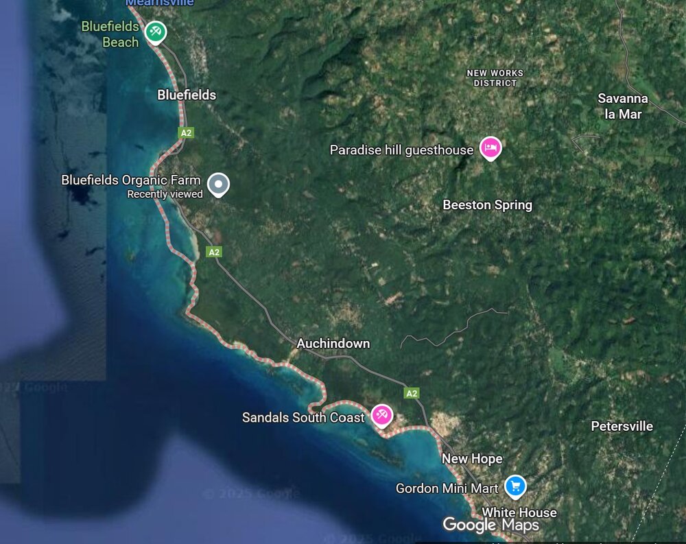
-
Major Hurricane Melissa - 892mb - 185mph Jamaica landfall
wxeyeNH replied to GaWx's topic in Tropical Headquarters
Long time no see.... Yup, that would be a drone video that has never been done and it would go viral. -
Spooky Season (October Disco Thread)
wxeyeNH replied to Prismshine Productions's topic in New England
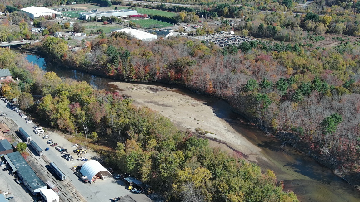
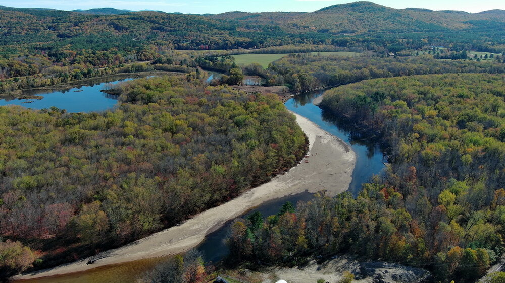
I was in Plymouth, NH today which is one town north of where I live. I decided to fly the drone over the Pemigewasset River. The river is basically just stagnant bodies of water. I could not see any flow. The first picture is where the river normally floods. Amazing drought. Finally, things look to change. I'm glad we will get some water into the system before the surface freezes. Also, there has been no real foliage season to speak of.
-
About .15" from the past storm brings me up to about the same as you. 4.09" since 8/1
-
Enjoyed my .13" last night. Just windy and raw. Streams are basically dry. Drought continues on and on....
-
Spooky Season (October Disco Thread)
wxeyeNH replied to Prismshine Productions's topic in New England
I agree. A couple of days ago I had to drive down to PA. I went west and down I 91. Very little color. Franconia Notch had some good color the weekend before this past one. Meanwhile, your heading to the Outer Banks this weekend. GFS now has a 988mb low sitting just off the coast. Could be some tough going down there with flooding. More houses into the ocean? -
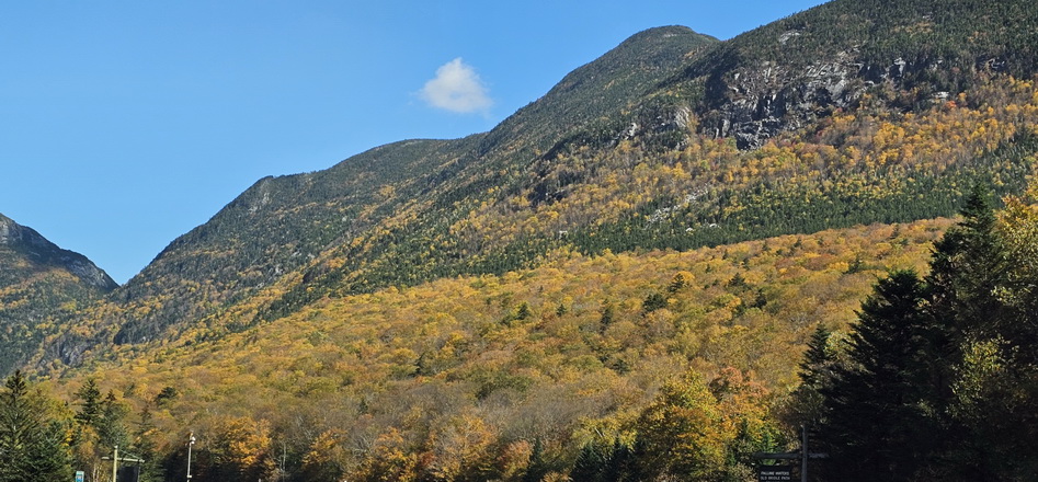
83.2F today! Foliage update: We had pretty good color coming on before our big rain event the other day. Now for whatever reason the colors are very muted. We drove up to Franconia Notch and there was not much color until we got into the Lincoln/ North Woodstock area. Once in the notch, it seemed to be around peak. Not vibrant colors but definitely pretty darn good. There was very little traffic and the parking lots at Cannon did have cars but not near full. It was a spectacular day. Of course, by Columbus Day weekend when the crowds arrive there will mostly just be sticks. Here is a picture from my phone without any post-processing.
-
Another beautiful day. The foliage is weird or maybe it's just me being weird. The colors were coming on strong just before the rain 2 days ago. We did have some leaf fall during the storm but not very much. Now the tree leaves seem more green. I don't think that is possible but perhaps it's just what was turning colors did fall off the trees.
-
Looks like things are about over here. I'll double check tomorrow but I believe we're at 2.78 in. That's more rain than has fallen in the last 3 months. I wonder if they'll be time for the brown grass to Green up a little bit before the heavy Frosts set in
-
Rainstorm is over. .08" That brings me to .28" for September after .35" in August. I wonder if I got 1" on Thursday, if that would even get any flow going in the streams?