wxeyeNH
-
Posts
9,806 -
Joined
-
Last visited
Content Type
Profiles
Blogs
Forums
American Weather
Media Demo
Store
Gallery
Everything posted by wxeyeNH
-
No flakes anymore up here. Mostly ZR 28.4F
-
29.4F IP with mixed in parachutes Snow started at around 3am and totally flipped to IP with some ZR by 6am. Trees have slight ice accretion. Was totally IP up until now but currently lots of parachutes. Ground is white but didn't measure 1.5"?
-
Yeah, I get that. I think the black asphalt roads will be okay except places like your hill facing north. It will be an interesting weather day for sure!
-
Except my county (Grafton) in NH. Just a winter weather advisory here. Personally, I would have included it. It seems Gray goes conservative much of the time
-
I'm sure parts of New England will go under a freezing rain advisory but what are the chances of putting out an Ice Storm Warning? That calls for .5" of ice or more. Looking at the models that does look possible for parts of Central NE. Thoughts?
-
Since I'm 17 miles north of you and my elevation is 1100 feet I am getting worried about ZR. I hope that for the most part it's a sleetfest. I don't need a birch bender nor power issues but I bought a little more wood yesterday just in case I need to keep the stove running. It could be a fun weather day around here.
-
Brian, I have a question about solar insolation this time of year. Although the models show the potential for a lot of ZR with temps around 29-30F here wouldn't solar insolation still play a big factor? I would guess it is pretty hard to get an ice storm in the last days of March but maybe I'm wrong??
-
28.6F Few flakes in the air. 5.6"

-
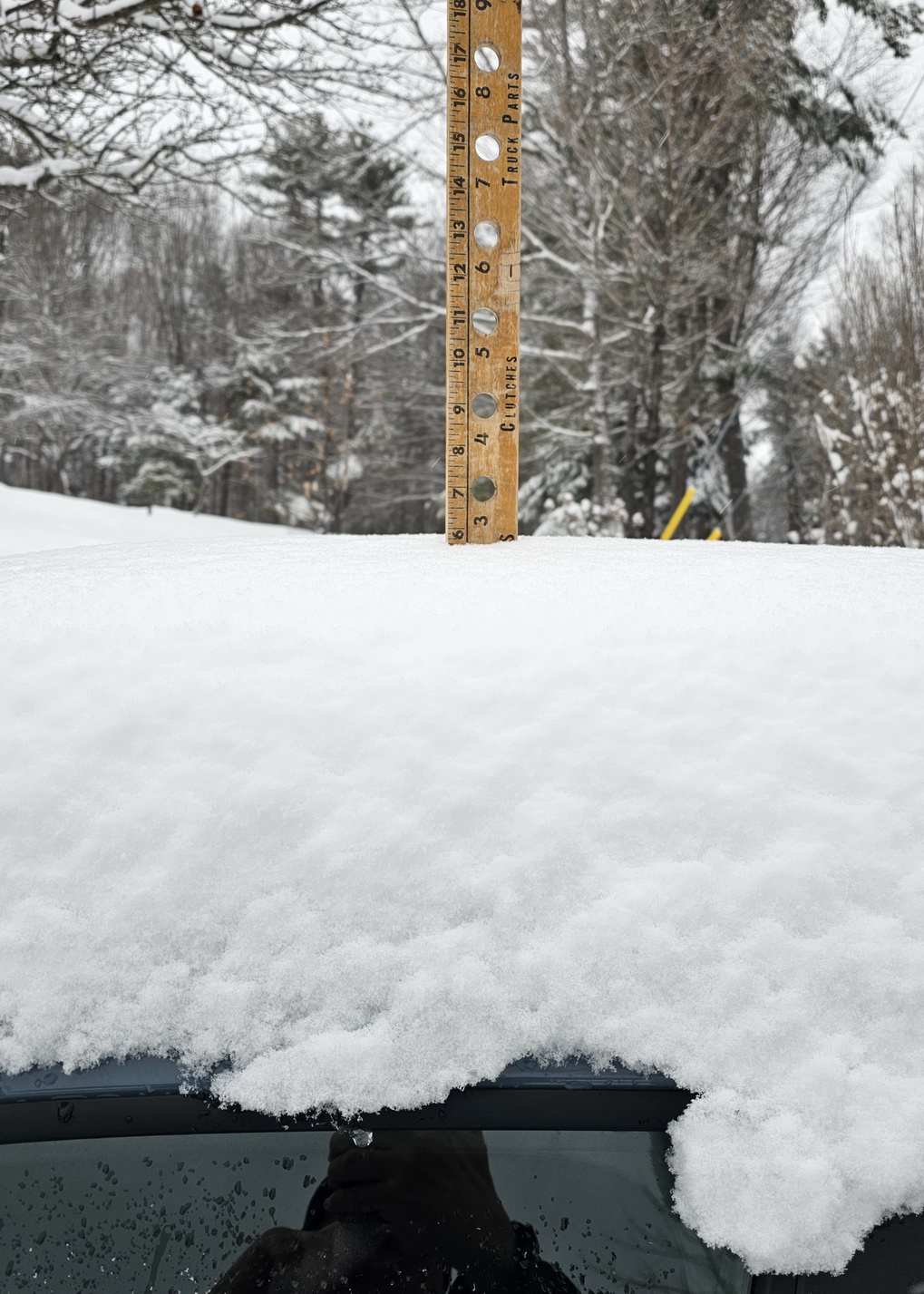
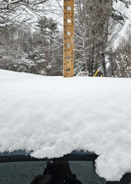
27.9F Light snow. Visibility about 3/4 4" on the nose!
-
Moderate snow. 26.5" Eyeballing around 2"
-
25.8F Heavy snow. Vis 1/8
-
The good stuff finally got here. Moderate snow and 26.4F
-
Hum, no bites from Gray yet but if the trend is our friend then I'm going to have some accumulating snow tomorrow.
-
Midday, not a cloud in the sky. 29F
-
Meanwhile up north 34.7F Light snow
-
54/53 South breeze is increasing. Big snow melt day yesterday through right now. Snowpack remains in the woods but my south facing pastures are almost clear of snow.
-
1pm 51.3F and rising rapidly. Go snow, Go! Down to 7" at the snowstake
-
24F Heavy snow squall just ended. 1". I wasn't expecting that.
-
No power up here. Our provider is New Hampshire Electric Co-op. 88000 customers. 25% no power right now. My Jackery generator attached to our solar panel is generating enough power for our needs. Snow depth down to 8 in
-
34.7F Fog, some light rain. CAD always wins. Snow stake 12". The pack has a lot of sleet in it and is very durable. This rain will definitely not wipe out any pack. I don't expect to see any grass showing on even south facing pastures.
-
42.2F Wind roaring. Rain/snow shower. High was 48F It's very cool to look out my view and see the snow falling into rain at lower elevations
-
31.2F Light snow. It did change to light sleet awhile ago but back to snow
-
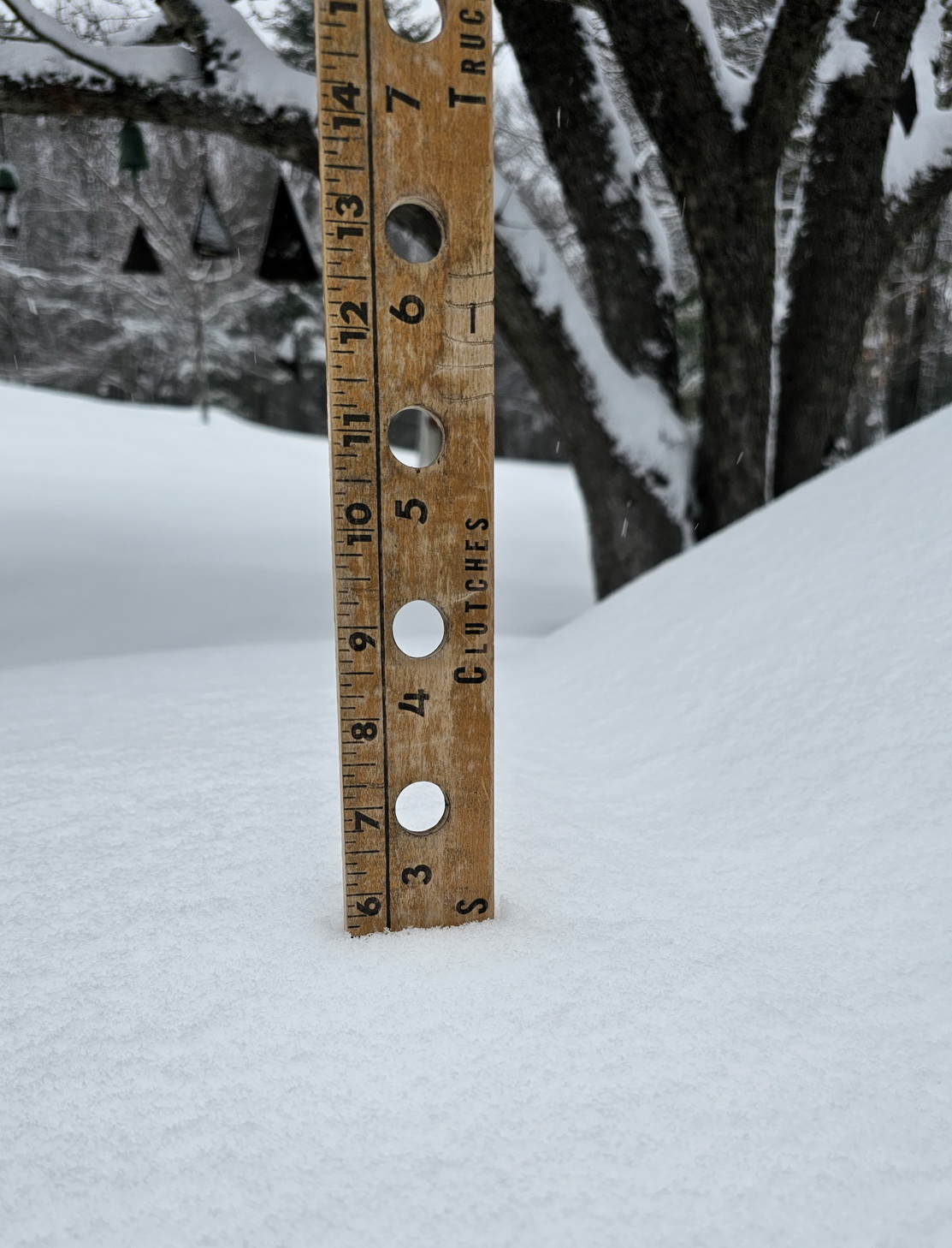
31" Light snow. 4.25" With temperatures starting in the mid to upper 20s and just in the past hour getting above 30F this is another easy powdery snow to snow blow. This will put me over 70" on the season. Snow stake is just below 14"
-
29.8F Light to moderate snow. Thanks, that means its time to snowblow before any possible flip.
-
29.4F Moderate snow. Approaching 3"