-
Posts
6,649 -
Joined
-
Last visited
Content Type
Profiles
Blogs
Forums
American Weather
Media Demo
Store
Gallery
Everything posted by Terpeast
-
We’re just coming off an 80 degree week. If anything this fall has been above normal so far. I think we will have plenty of opportunities
-
Isnt the cansips supposed to be out by now?
-
Was stuck at 52 all day for the high, and now dropped down to 43. Finally radiating well as my area should edit: falling like a rock now. 39
-
Nice. That will help the PDO
- 1,295 replies
-
- 5
-

-
- wishcasting
- almost winter
-
(and 1 more)
Tagged with:
-
Yeah, the PDO took a step back into the negative range, but I think it's only temporary. After a warming trend, the Okhotsk Sea is cooling again (circled below): And a broad N Pac trough with a healthy aleutian low is on the way (and it's no longer October): Still out in the fantasy range after the back and forth battle between Aleutian troughing and ridging, but we may see the troughing reinforced by a new trough moving off NE Asia into the pac. Going to be interesting to see how this plays out. PDO is likely to bounce in the -1.3 to -0.3 range before stagnating towards neutral as the nino takes hold.
-
Right, if I remember correctly 18-19 wasn’t that warm up here. So its bit of a mixed signal and kind of a wash. If I adjusted 63-64 a few degrees warmer, though, it’s a weak mild signal here.
-
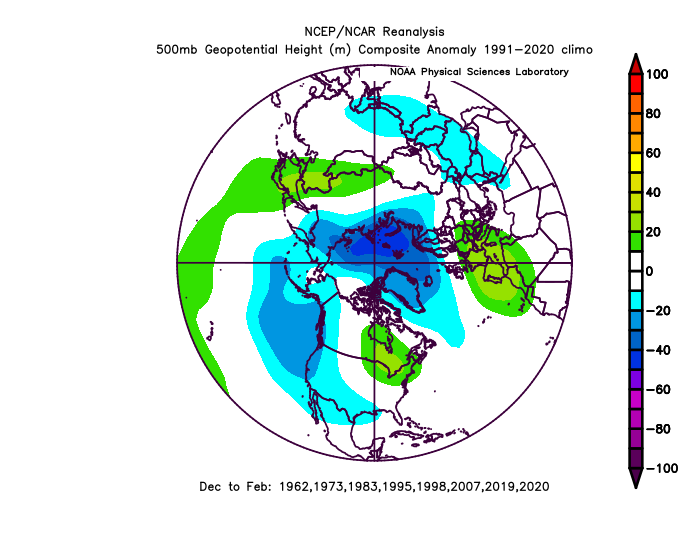
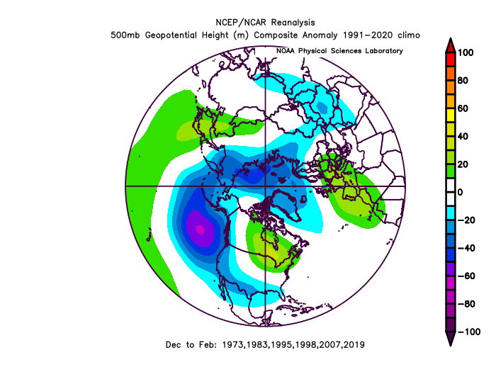
Strong +IOD shows a signal for an east-displaced GOA trough for all years regardless of ENSO, and a stronger east-based aleutian low for nino years. Cold anomalies would be tilted to the SW than SE. But for the record, I don't think the IOD is a big factor this year. Many of these seasons in both composites are El Ninos much stronger than this one, and I don't think we can separate out the IOD signal from strong ninos.
-
So you can see how rare this is. I haven't gone back further than the 1950s, but 1986-87 and 2006-07 are also on my analog short list.
-
Yeah, maybe it was different in PA. DCA had 32” and IAD 53” in 13-14
-
Surprised the 1950s had plenty of -NAO and yet the winters were awful. As if it were the flip side of 2013-14 and 14-15
-
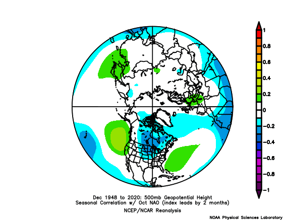
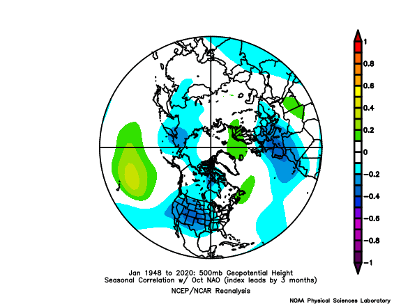
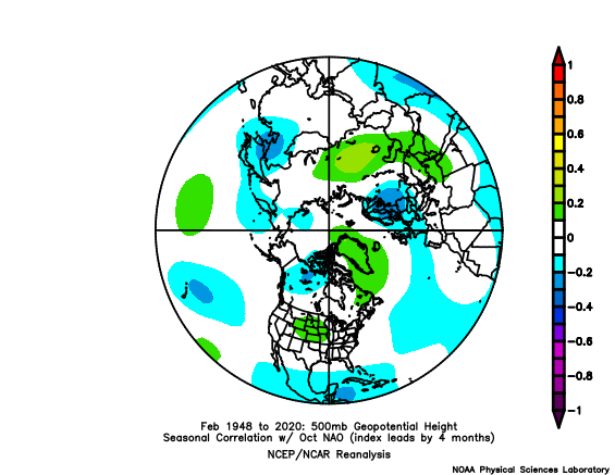
What I've found doesn't really support this. If anything, there's a weak persistence signal into Dec, meaning if we have a -NAO in Oct, we are just a little more likely to also have a -NAO in Dec as well. But after that, it's mostly noise. Really 50/50 by Feb.
-
Got tied up at work and then going to my kids halloween activity. Outlook gonna have to wait a bit. Sorry, didn’t intend to leave you guys hanging like TV mets do all the time…
- 1,295 replies
-
- 6
-

-

-

-
- wishcasting
- almost winter
-
(and 1 more)
Tagged with:
-
Made it to 78 before fropa. 69 now
-
Mantra of the forum! I’ll look over it tomorrow with fresh eyes then post
- 1,295 replies
-
- 1
-

-
- wishcasting
- almost winter
-
(and 1 more)
Tagged with:
-
Fell short of 70 today. 69 for the high
-
Spent the whole day writing the meat of my outlook. Made a preliminary forecast, too. Might just go ahead and post it soon without waiting for new data. Let the chips fall where they may
- 1,295 replies
-
- 12
-

-
- wishcasting
- almost winter
-
(and 1 more)
Tagged with:
-
I'm not sure it matters much anymore. If there's a playbook that needs to be thrown out with CC, I think this would be in it. Of course I could be wrong. For tripole related stuff, I would listen to what Chuck has to say. He has this special method that served him well, and he's predicting the NAO to average neutral this winter.
-
Yeah, it's a slight correction due to slight ridging W and NW of Hawaii: But broad troughing will quickly return to that area within 3 days: And will continue into the next week: So yeah, the PDO might bounce in the 0 to -1 range for a while with some back and forth as nino influence starts to establish itself over the next couple of months. It may even dip to -1.5 on the dailies but I don't expect it to go that much lower.
-
Well crap. I may have to release my outlook sooner than planned
- 1,295 replies
-
- 7
-

-
- wishcasting
- almost winter
-
(and 1 more)
Tagged with:
-
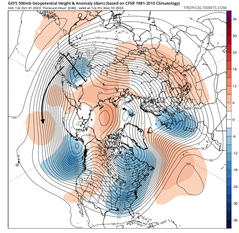
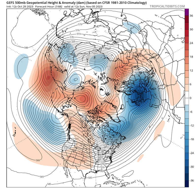
I’ve found that +AMO also promotes blocking and posted about this last week or so. The mismatch between AO and NAO, as @GaWx alluded to just means we need to look at the whole hemisphere to see the position & orientation of blocking, not just look at the numerical indices. In my opinion In fact, even though I'm still waiting for the November model runs, I'm more confident about this winter that I'm starting to write my oulook now.
-
Pretty cool we came to a similar conclusion.
-
I think we will have some favorable 2-week periods interpersed throughout, though definitely not wall to wall.
-
That’s probably more likely given all the mixed signals we have now. But all it takes is one to go ka-boom, and as ckskinsfan would say, we get obliterated.
- 1,295 replies
-
- wishcasting
- almost winter
-
(and 1 more)
Tagged with:


.png.460543c6b05a74868b8dfea3e5e22a2f.png)
.thumb.png.514a7882a4d2d391ecb30536d0098daa.png)
