Terpeast
-
Posts
6,687 -
Joined
-
Last visited
Content Type
Profiles
Blogs
Forums
American Weather
Media Demo
Store
Gallery
Everything posted by Terpeast
-
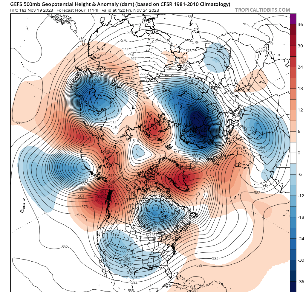
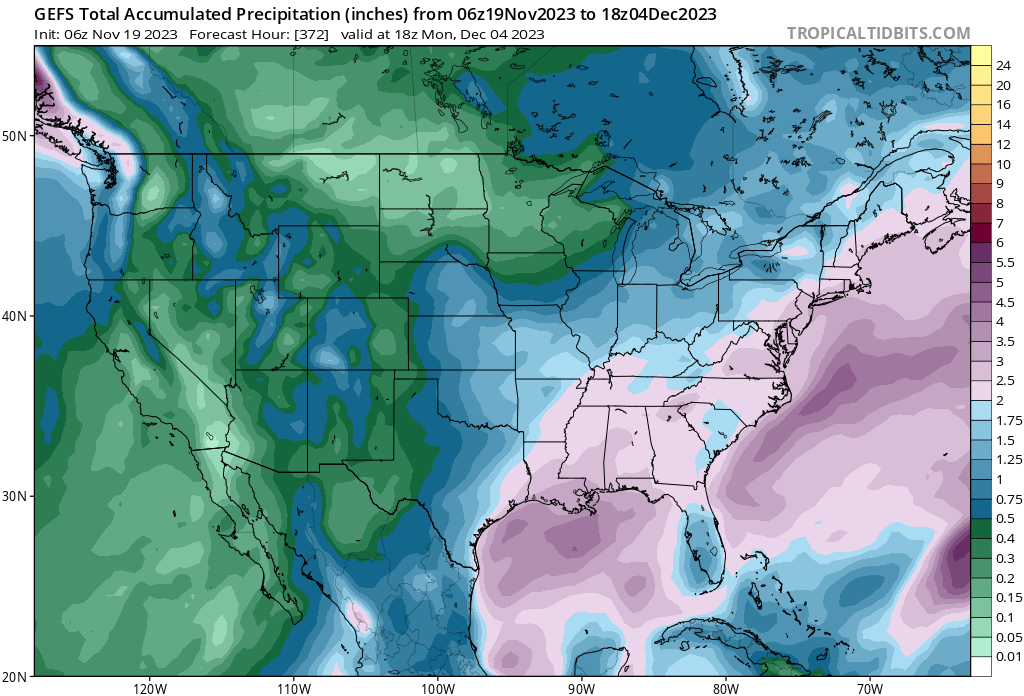
Its been dry in the MA/SE lately, but that’s about to change.

-
I wouldn’t worry about the -PDO because I think it has bottomed out at only -1.3 instead of -2 to -2.5 troughs we’ve seen in the last 2 years. Besides we’ll see more troughing N of hawaii in the next two weeks as supported by most ensembles. To me that’s a sign that the PDO will rise, or at least decouple. The NOAA value is likely lagging.

-
Really??? I’m glad they still call it “experimental”, or they’re looking at a major credibility hit. (yeah, no I’m not buying what they’re selling)
-
I stand corrected on the exact amounts in your backyard, but my point is that had those storms not occurred at all, I’d be a lot more concerned.
- 1,295 replies
-
- 1
-

-
- wishcasting
- almost winter
- (and 1 more)
-
I have to agree with this. How we miss is important information. If we get multiple great tracks, but end up getting almost all rain (Feb 1987 adjusted to today’s climate, or full 97-98 seasons on repeat) - then that’s very bad news. Keep in mind I’m not just talking about one storm, but multiple (4-6x) storms in a single winter. Otoh, if NC gets crushed and we get a near miss (2018)… or @CAPE gets hit with 20” while we smoke cirrus (multiple times in the last 5-7 years), then we probably will need another nino to get our answer.
- 1,295 replies
-
- 4
-
-
- wishcasting
- almost winter
- (and 1 more)
-
32 low
-
I’m not even looking for a snow threat at this point. It’s November. What I AM looking for is STJ activity, which is an important prerequisite for snow when it eventually gets colder. All Op runs and ensembles support busy STJ:

- 1,295 replies
-
- 22
-
-
- wishcasting
- almost winter
- (and 1 more)
-
54. Haven’t exceeded the midnight high so far
-
Lets hope for the GEM solution for Central-SW Virginia’s sake. Euro would be decent too
-
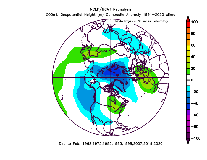
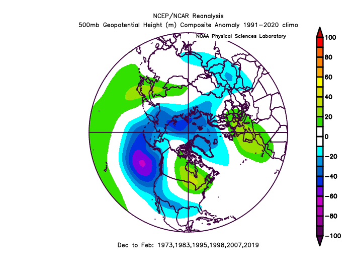
To counterbalance with the other side of this, I find that analog winters with an Aleutian low often have upstream ridging over Japan and just off their coast. I thought to myself that it’s not a bad thing to have if we want cold and snow in the east, as long we have a downstream trough off the aleutians.
-
We're already in mid-winter form. Canceling winter before it even starts. In a -PDO/+ENSO battle like this season, there's going to be a lot more of this. At least it won't be boring like last winter. Just look at the models... STJ is becoming more and more active.
- 1,295 replies
-
- 8
-
-
- wishcasting
- almost winter
- (and 1 more)
-
So I can book a family trip out west next winter without fear of missing a HECS
- 1,295 replies
-
- 2
-

-

-
- wishcasting
- almost winter
- (and 1 more)
-
If anything, the recent spike (was it really a spike, or some aberration with data?) will help shift us to an El Nino base state. Anything to wipe out the residual nina effects - and I think that will happen.
-
Actually, I’m thinking the peak was Oct-Nov. Either SON or OND on the trimonthlies. ^ @GaWx beat me to it.
-
I’m calling it. This nino has already peaked. It’s time to start tracking h5 and individual waves!
-
Haven’t noticed any smoke here. Bottomed out at 32, but already up to 54 now
-
Anyone have a clue why OISST hasn’t updated on cyclonicwx?
-
That EPO spire is really going to give a -PDO a kick in the rear
- 1,295 replies
-
- 6
-
-
- wishcasting
- almost winter
- (and 1 more)
-
Yeah I get that, but you kinda walked into it
-
Yep, and lets get psuhoffman on the board so we can have a blockbuster this year
-
I hope you're right @psuhoffman! You're a bit more bullish than I am, tbh. I hedged a bit downward because I think we'll see some SW troughing episodes (pac base state) that'll "steal" a couple of our chances. Also, one thing I did differently was to include 57-58 and 65-66 (as well as 76-77) but by warming them up a few degrees and thus reducing their snowfall totals, and that dragged down my overall snowfall prediction for the area. But I understand your trepidation and I have the same thing, especially after the recent MEI value came in way low. Agreed that it's good we're not going super nino, though.
-
I asked him that yesterday and he said it was too warm to amount more than maybe a trace
- 1,295 replies
-
- 1
-

-
- wishcasting
- almost winter
- (and 1 more)
-
Following is +0.5 IOD on a 4 month lag before DJF for all years since 1960 regardless of ENSO. Same, but only for El Nino winters (only eliminated a couple of enso neutral years): BTW, this uses the DMI index. Not sure if that makes a difference.
-
Got access? Or still experimental?
-
Yeah if that new wwb holds east of the dateline we MAY get to 1.7 trimonthly